Drone Show Technologies by SPH empower creators to design, animate, and control breathtaking drone light shows.
More than 12 record-breaking shows recognized by Guinness World Records were operated using Drone Show Software.


.jpg)


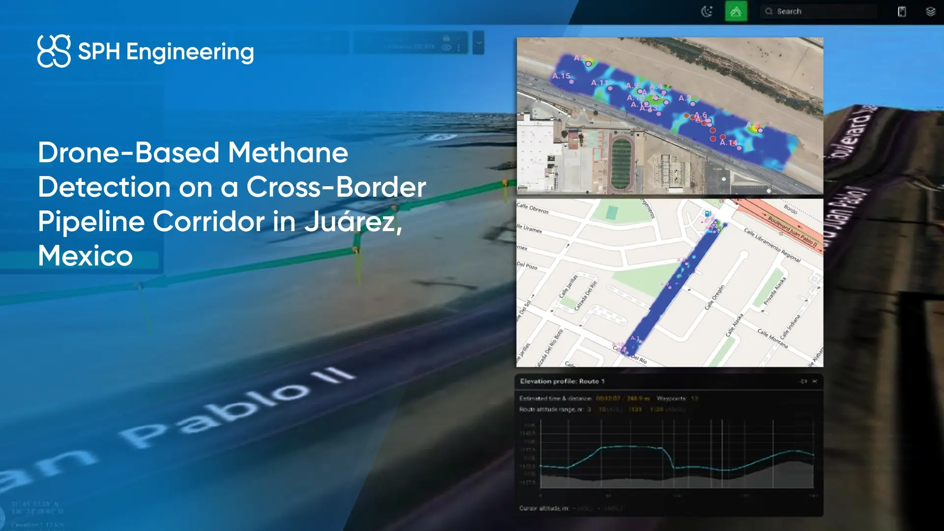
.webp)
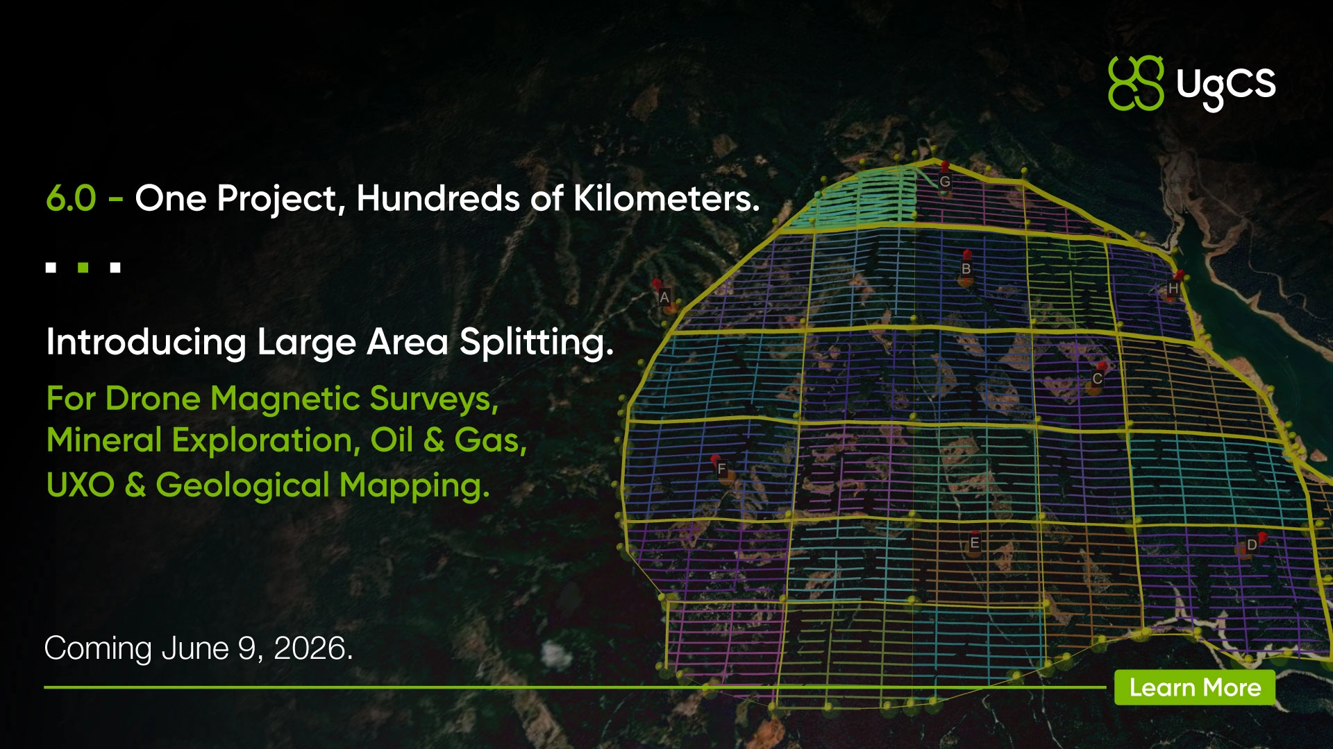
.jpg)
.webp)

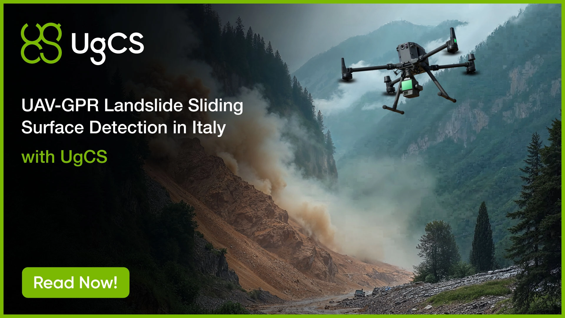
.webp)
.jpg)


.webp)


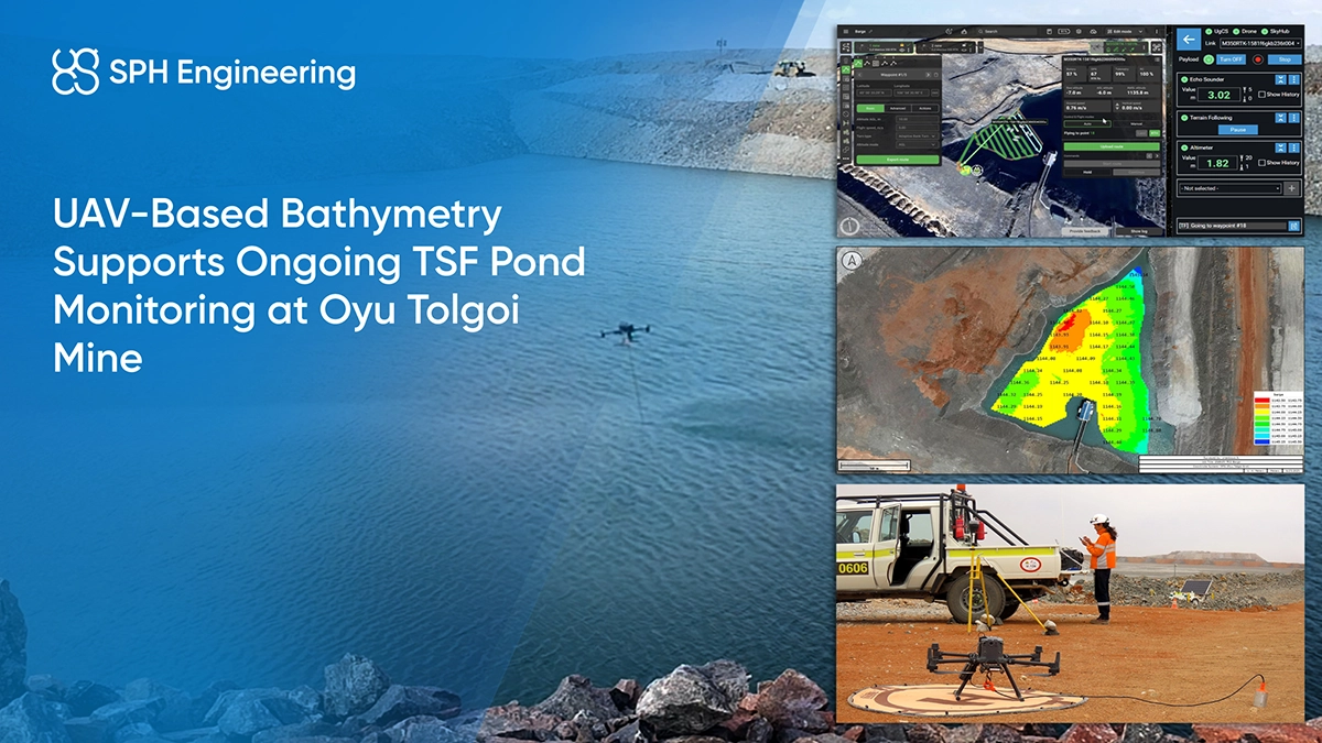


.webp)

.webp)


.webp)

.webp)
.webp)
.webp)
.webp)


%20(1).webp)


.webp)