
Why North Carolina Is A Significant Market for Drone Surveying
North Carolina represents a substantial professional market for UAS technology:
- 8th largest population state in the U.S.
- 8th largest engineering population nationally
- 4th largest surveying population in the U.S. (behind CA, TX, and FL)
Current licensure from the North Carolina Board:
- Professional Engineers (PE): 34,307 total
- Professional Land Surveyors (PLS): 2,358 total
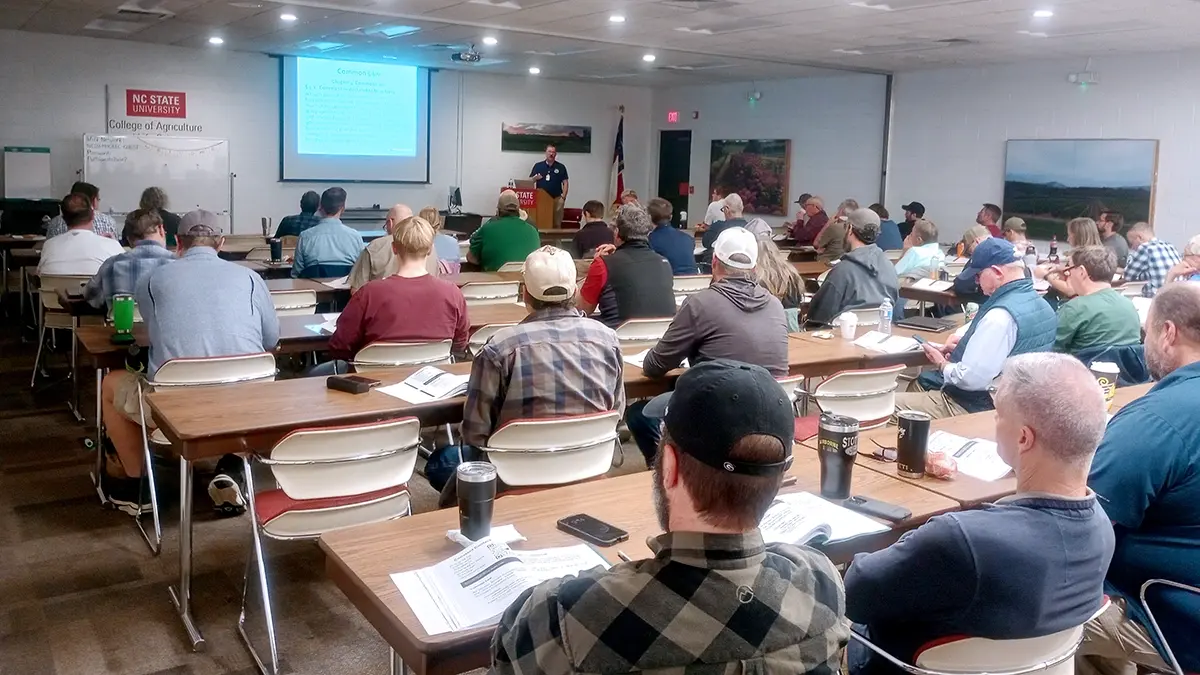
The seminars focused on surveying workflows, with several licensed Professional Engineers also attending. These were particularly those in land development and infrastructure work, where UAS-derived data plays an increasingly relevant role.
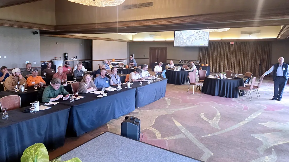
Four Chapters, 272 Licensed Professionals
From September through December, the seminars ran across four North Carolina Society of Surveyors (NCSS) chapters:
- Foothills
- South Brunswick
- Yadkin Valley
- SW Piedmont
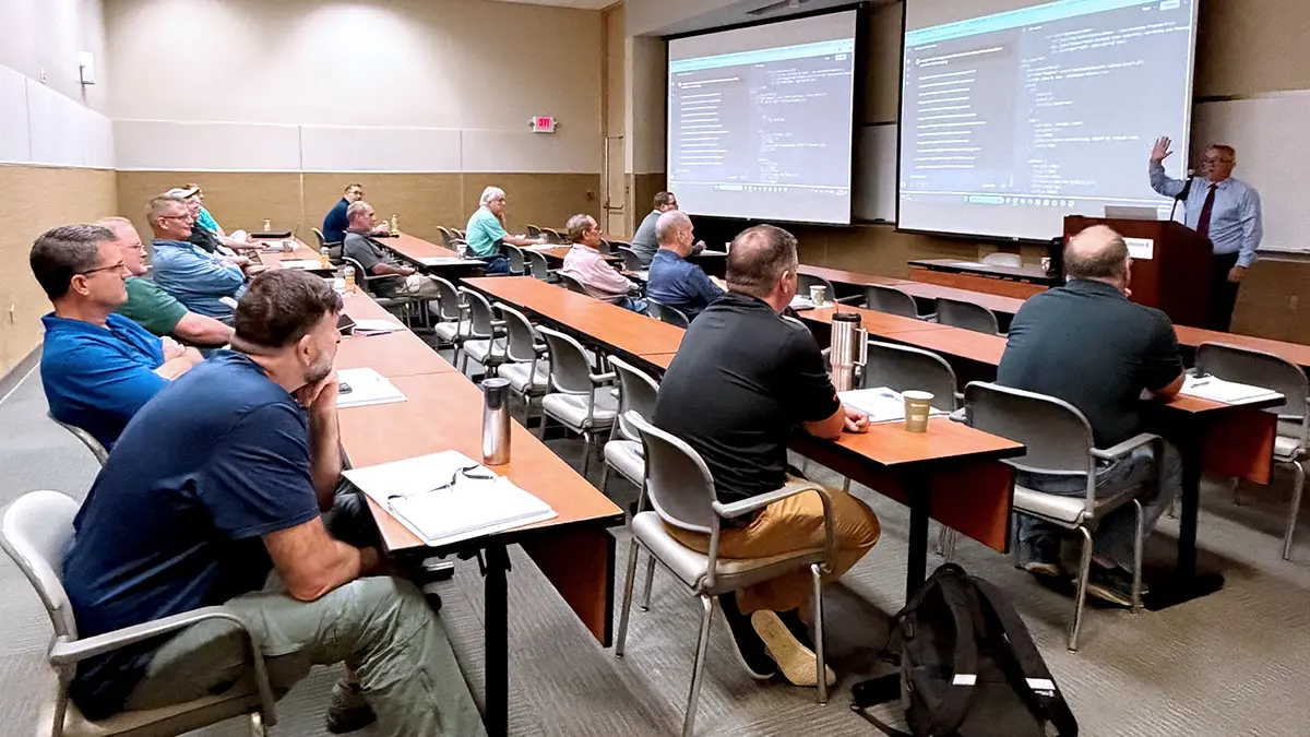
Total attendance: 272 licensed professional surveyors evaluating professional drone mission planning workflows.
How Licensed Surveyors Evaluate Drone Technology in Regulated Practice
Adoption of any new technology occurs across multiple timelines: learning, certification, integration, and eventual proficiency. When that adoption involves venturing into another discipline, caution is intentional and appropriate.
Most licensed surveyors in the U.S. are terrestrial surveyors, with careers built around total stations, GNSS, and direct field observation. When a firm adopts UAS, it's not simply learning to fly. It requires demonstrated competency in photogrammetry or LiDAR acquisition (disciplines that are regulated in many states) before that data can be used in professional deliverables.
Every UAS mission requires an FAA Part 107-certified pilot. That may be the licensee, an employee, or a contractor. Before a firm can begin flying, it must address state licensing standards, FAA certification requirements, internal credentialing decisions, and liability exposure tied to signed work products.
This is consistent with how the profession has historically evaluated new technology.
Early EDM measurements were routinely checked with steel tapes. GPS adoption was slow until repeatability, redundancy, and error models were well understood. In each case, the question was never "does this work?" but rather, "can I defend this drone data and workflow under my seal?"
Once that threshold was met, those technologies became indispensable.
The same dynamic is now at work with UAS. The professionals in these seminars were experienced practitioners evaluating whether a fundamentally different workflow could fit into their daily practice in a way that remained professionally defensible.
How UgCS Supports Defensible, Professional Drone Mission Planning
What generated strong interest was a core realization: UgCS allows the licensed professional of record to directly define and control survey-grade drone mission parameters before the aircraft ever leaves the ground.
Flight geometry. Ground sampling distance. Altitude. Overlap. Terrain following.
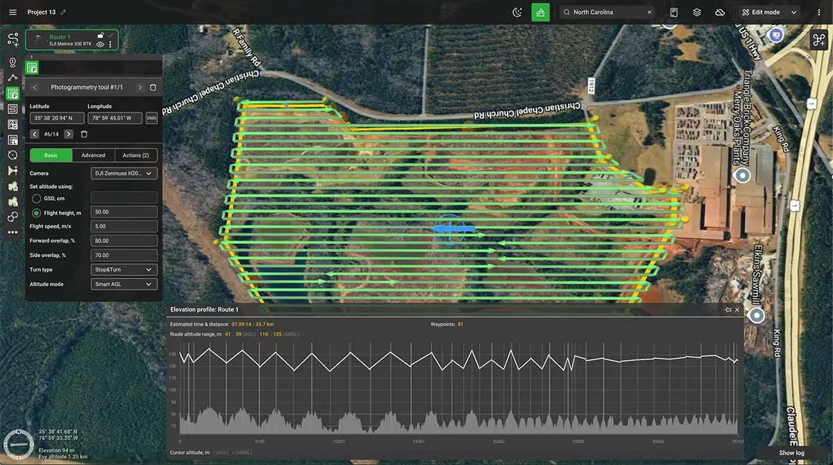
The planning itself is professional work. Execution follows the plan, enabling repeatable drone surveying missions. This aligns with U.S. licensing board expectations around responsible charge.
A licensed professional retains responsibility not just for mission planning, but also for data evaluation and the use of UAS-derived data in any sealed work product.
The Reality of Controller-Based Drone Software in Surveying
Many attendees were using software that came with their equipment's controller. This isn't a limitation on their part. It's how surveying technology works.
Surveyors rely on the software provided with their equipment because surveying technology is overwhelmingly proprietary and vertically integrated. Professionals are trained on, invest in, and build workflows around tightly coupled systems: total stations, GNSS receivers, controllers, and office software.
Because of this structure, many surveyors simply don't realize that a third-party, manufacturer-agnostic drone mission planning platform can interface with an aircraft controller.
The idea that independent software could define professional-grade mission geometry while still executing through the manufacturer's controller isn't intuitive in a profession where nearly every other tool is vendor-locked.
A Real Example: From Manual Drone Flights to Repeatable Surveying Missions
One attendee was already using a UAS to inspect a municipal water tank. Their firm was flying the inspection entirely manually, relying on pilot skill to maintain spacing, overlap, and coverage.
When the presenter demonstrated how UgCS could automate that same inspection using a controlled Point of Interest mission (flying the identical orbit every time), there was an immediate shift in understanding.
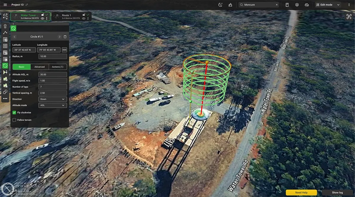
This wasn't about flying better. It was about planning once and executing consistently.
That distinction resonated strongly because it directly addresses repeatability, documentation, and professional defensibility. These are areas where manual flight falls short.
This lack of awareness wasn't limited to surveyors new to UAS. Even individuals already operating drones professionally (including those performing inspections and mapping) were often unaware of the full scope of what UgCS enables.
When pilots and firms work primarily inside default mission tools, they naturally assume those tools represent the limits of what is possible.
Seeing UgCS demonstrated in a professional planning context revealed capabilities that many experienced UAS users had simply never been exposed to.
UgCS fills a unique and largely unseen niche. For many attendees, these seminars were the first exposure to the idea that such a platform even exists.
Professional Training Through The UgCS Expert Teaching Licenses
SPH Engineering granted a temporary UgCS Expert teaching license so the presenter could demonstrate full functionality in live instructional settings. He explained this to each class at the outset.
This partnership:
- Showed UgCS trusted a licensed professional they had not previously partnered with
- Demonstrated a commitment to proper education rather than limited demos
- Enabled meaningful, practitioner-level feedback
The Ground Floor of Broader Adoption
These seminars represented the ground floor of broader UAS adoption in professional surveying practice. Many attendees left saying some version of the same thing:
"I didn't know how to plan a mission before today. Now I can see this being part of my future."
That insight captures what happened across these four chapters. Licensed professionals who had never been exposed to third-party mission planning software now understood how it could integrate into their regulated practice.
UAS-derived data is evaluated under existing surveying standards of practice, with the determination resting with the professional exercising responsible charge.
They saw how professional judgment could be embedded into flight plans before data collection begins. They saw how mission repeatability supports defensible work products. They saw a tool built for the kind of control their licenses require them to maintain.
The seminars introduced UgCS to 272 professionals in one of the largest surveying markets in the U.S. For many, it was the first time they'd seen what professional mission planning could do.
Key Takeaways for Licensed Surveyors
- UgCS enables licensed professionals to define survey-grade drone missions before flight.
- Repeatable mission planning improves defensibility under professional seals.
- Manufacturer-agnostic workflows integrate with existing surveying technology.
See how UgCS supports professional drone mission planning for surveying and mapping workflows.