
.webp)
A three-person crew, 120 days on site, 1,000 total flight hours. About 3000 magnetic anomalies identified, most buried, most scrap metal but with genuine UXO underneath: 75 to 150 millimeter artillery shells, mortar grenades, small arms ammunition.
The site had been classified as low UXO risk.
The survey site: Northern Poland’s WW2 contamination legacy
The location is covered by NDA. The site lies in northern Poland, a region that saw some of the most concentrated artillery fighting of the Second World War. The East Pomeranian Offensive and East Prussian Offensive ran across this coastline through early 1945. The Pomeranian Wall, a German defensive line running through what is now northern Poland, was contested town by town. Postwar military activity under the People's Republic of Poland left another layer of training-ground contamination on top of the wartime legacy.
The site was classified low-risk on a narrow reading of documented operations in its footprint. What Explosive.pl found, and the patterns already documented in neighboring areas, made clear the assessment was off.
Why drone magnetometry, not foot survey
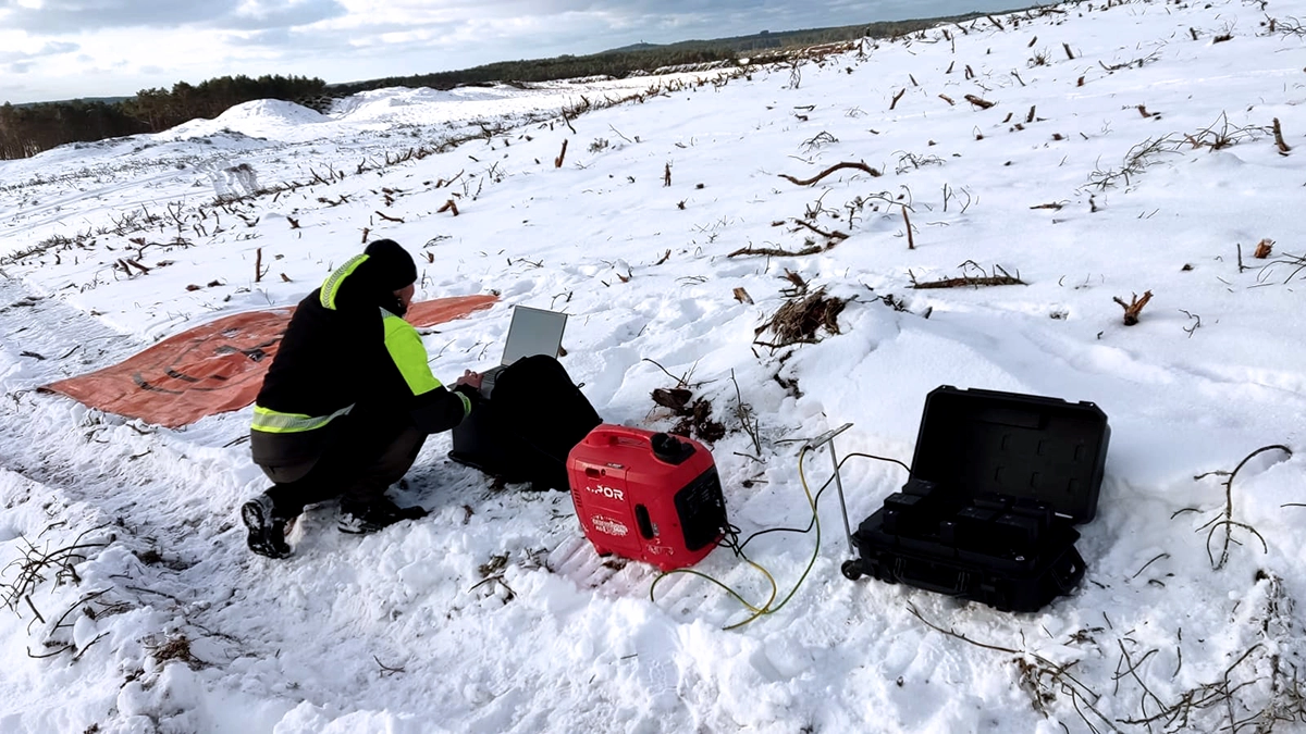
A 302-hectare UXO survey site covered by handheld magnetometers is a multi-season project. One team covers one to two hectares per day in decent conditions. Less in bad ones. The terrain here was hard: coastal slopes, beach sections, inland scrub, vegetation that had to be cleared before any survey could start.
With one drone in the air and a three-person crew handling setup, obstacle removal, flight operations, transport between zones, and post-processing, Explosive.pl moved faster than handheld survey can match. In winter on difficult ground, the crew hit 17 hectares in a single day. Not a sustained average across the project, but it shows what the method permits when conditions allow.The other consequence is endurance. The survey did not exhaust the crew, they stayed sharp for what the drone cannot do, which is the excavation.

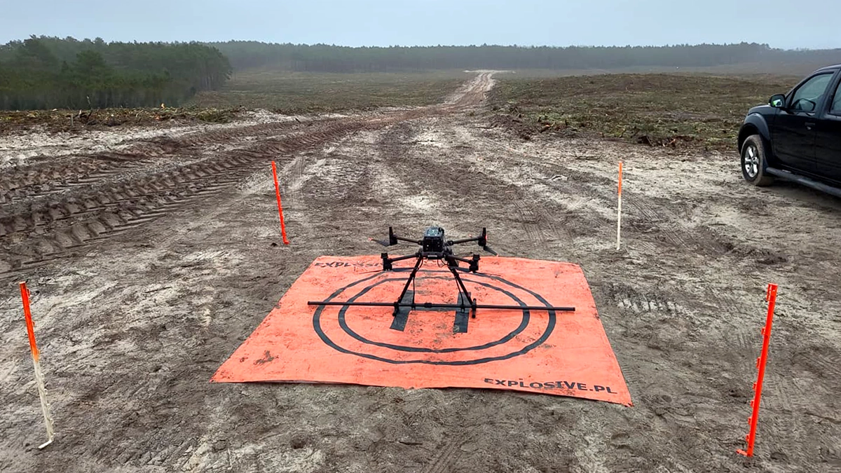
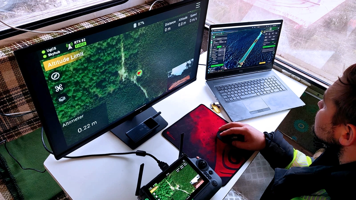
How Explosive.pl flew the drone UXO survey
Flight altitudes varied with terrain: 1.0 meter over beach, 1.7 meters over slopes. Profile width 2.5 meters throughout. Speed ranged from 0.5 m/s on steep ground up to 4 m/s on open beach.
At those altitudes, sensor height is the dominant variable. Magnetic anomaly signal from a buried ferrous object decays as the cube of distance from the sensor. Drift up by 20 centimeters at 1 meter altitude and signal strength on a small target falls by close to half. True Terrain Following kept the sensor at the planned height in real time, regardless of the surface beneath.
Each survey day produced a dense magnetic dataset: 200 Hz per channel, RTK GPS on every point. Post-flight processing in MagDrone DataTool and SENSYS MAGNETO converted the raw readings into an anomaly map and a target list, with estimated burial depth and magnetic mass per detection.
That target list is the deliverable. Field crews walked to each coordinate with handheld detectors to pinpoint the UXO target before any excavation.
What the survey found: 3000 anomalies, live ordnance
About 3000 anomalies in total. Most were buried. As in any long-contaminated site, most turned out to be scrap metal. The genuine UXO finds were artillery shells and mortar grenades in the 75 to 150 millimeter caliber range, plus small arms ammunition. All ferrous. All consistent with the Second World War contamination of this coastline.
Two finds stand out. The first: a 150 mm artillery shell three meters below the ground surface, detected with the drone magnetometer two meters above ground. That is five meters of sensor-to-target distance, within range for a ferrous object of that mass under good conditions. The second: a small tent peg four meters below the beach surface. Beach sand moves over decades, and small ferrous objects settle deeper than expected. A detection at that range on a small target is unusual.
Operator testimonial on SPH Engineering’s magnetometer integration
"The magnetometric kit, controlled by the SPH's computer and software, is a game-changer for our applications. The speed, intuitiveness, precision and performance of the system allow us to achieve fantastic results and make our work much easier. It has proven itself in all conditions, winter, light rain, on land, in coastal waters, in a word, it's a real toughie." Stanisław Kuzmanow, Explosive.pl
Outcome: From low-risk classification to documented clearance
The site is no longer low-risk on paper. It is documented and cleared: a target list, recovered ordnance, and a clear picture of what was actually in the ground. Poland holds one of Europe's heaviest Second World War UXO legacies, spread across coastal fortifications, former front lines, training grounds, and the long postwar military presence. The traditional answer to surveying that ground at scale has been time, people, and risk. Drone magnetometry, run by an experienced operator on an integrated UgCS and SkyHub stack, reduces all three.
Limitations of drone magnetometry for UXO detection
Drone magnetometry detects ferrous objects. It does not detect modern plastic-cased landmines, non-metallic IEDs, or non-ferrous munitions.The drone magnetometer survey also does not replace ground clearance teams. Every one of the roughly 3000 anomalies on this site required a person on the ground to confirm or dismiss. The drone produces the target list. The clearance still requires the crew.
References
Project specifics (location region, area, equipment, flight parameters, crew, duration, findings, and the quote) come from Stanisław Kuzmanow of Explosive.pl. Sources below informed the technical context around the SPH Engineering and SENSYS components and the historical framing.
[1] SPH Engineering, system overview and integrated drone magnetometer technology.
[2] SENSYS MagDrone R4 product page, including five triaxial FGM3D/75 fluxgate configuration and 200 Hz sampling.
[3] SPH Engineering shop, MagDrone R4 specifications and recommended drone platform (DJI M300/M350 RTK).
[4] East Pomeranian Offensive, historical context for WW2 fighting in what is now northern Poland.
[5] Explosive.pl, company overview and services in UXO detection, clearance, and disposal in Poland.