
Drone-Based Solutions for Tailings and Water Assets Bathymetry
- SPH Engineering's drone-based bathymetry solutions deliver safer and more cost-efficient data collection for tailings storage facilities and mine water assets.
- Built for hazardous liquids and restricted-access sites, our integrated UAV payload systems replace boat surveys and on-site crews with remotely-acquired, georeferenced data.


Challenges in Tailings and Water Asset Bathymetry Solved by UAV Technology
A tailings storage facility (TSF) and other mine water assets hold the liquid and solid waste left over from mineral processing. With 29,000–35,000 TSFs worldwide storing ~223 billion tonnes of tailings and following a series of high-profile failures, monitoring is now a critical operational and regulatory requirement across major mining jurisdictions.

Hazardous or Inaccessible Liquids
Many mine water assets hold liquids that are unsafe for crews to approach and difficult for traditional survey methods, including unmanned surface vessels (USVs), to deploy into. This leaves operators without a safe way to collect the depth, volume, and water quality data their monitoring programs require.

Site Access, Permitting, and Mobilization Delays
Active mine sites operate under strict access protocols, and many water bodies are located in remote areas with limited infrastructure. Permitting, mobilizing survey crews, and transporting specialized equipment create lead times that often stretch bathymetric surveys to once every two to three years.

Recurring Bathymetric and Sediment Surveys
Mine water assets need regular bathymetric data to track sediment accumulation, storage capacity, and underwater slope stability. Traditional surveys are slow to mobilize and often require vessels or USVs that cannot be safely deployed at the site.

Water Quality Sampling from Inaccessible Points
Representative water quality data often requires samples from multiple points across a facility at set intervals, not only from the shoreline. Where the water is hazardous or access is restricted, collecting those samples with conventional methods is difficult or impossible.

Decisions Based on Outdated or Incomplete Data
Because conventional surveys are infrequent and produce partial coverage, operators and engineers often make decisions about storage capacity, deposition patterns, and embankment stability on data that is years old or full of gaps. Outdated information weakens planning, narrows safety margins, and reduces the defensibility of regulatory reporting.
UAV Bathymetry Applications for Tailings and Water Assets Monitoring
Bathymetric Surveys for Water Depth and Sediment Mapping
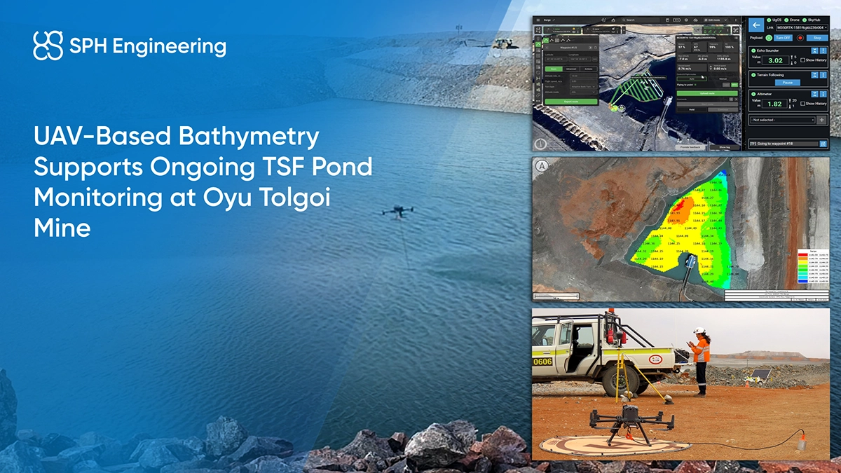
Drone-based bathymetric surveys use single-beam or multi-beam echo sounders to measure water depth, map sediment accumulation, and assess underwater slope stability across the facility. Multi-beam systems provide wider coverage per pass and capture sediment layering in more detail. When combined with above-water photogrammetry or LiDAR, bathymetric data contributes to a complete 3D model of the facility for total volumetric assessment.

Water Quality Sampling Across the Facility
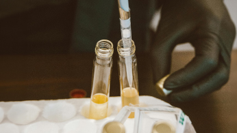
Drone-based sampling collects water from locations inaccessible by foot or boat, including mid-pond points and hazardous surfaces. Deliverables include georeferenced sample locations that tie water quality data to specific points for consistent repeat sampling.
Recommended Drone Solutions for Tailings and Water Asset Bathymetry
Echo Sounder Kit
HARDWARE
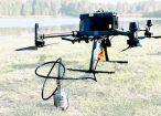
Drone-mounted echosounders provide accurate bathymetric data for depth measurement, sediment monitoring, and underwater terrain mapping.
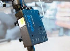
SkyHub is a drone onboard computer that ensures reliable sensor integration and precise, synchronized data collection during every flight.
SOFTWARE

Desktop drone flight planning for the most demanding pilots.

Bathymetric data processing software.

Hydrographic survey mapping software.
TRAINING

Advanced technical training and expert support to elevate your team’s expertise and ensure precise, efficient execution of your drone-mission tasks.
Water Sampling Kit
HARDWARE

Drone-mounted water samplers enable automated collection of liquid samples from locations inaccessible by foot or boat, supporting water quality monitoring across ponds, reservoirs, and other water bodies.
SkyHub is a drone onboard computer that ensures reliable sensor integration and precise, synchronized data collection during every flight.
SOFTWARE
Desktop drone flight planning for the most demanding pilots.
TRAINING
Advanced technical training and expert support to elevate your team’s expertise and ensure precise, efficient execution of your drone-mission tasks.
LiDAR & Photogrammetry
SOFTWARE
UgCS flight planning software with: Terrain-Following, Corridor Scanning, Photogrammetry, LiDAR and Calibration Tools.

Online GIS for Surveyors and Geophysicists.
TRAINING
Advanced technical training and expert support to elevate your team’s expertise and ensure precise, efficient execution of your drone-mission tasks.

Why Mine Engineers Choose Our Bathymetry Monitoring Solutions

Access where crews and vessels cannot go
The drone operator works from solid ground, typically at the embankment crest, with no need to approach the water, the facility structure, or any restricted zones such as pump stations. Where aerial survey data is needed for mission planning, it can be acquired in the same operation before the bathymetric run begins.

Deployable into chemically aggressive liquids
For most mine water assets, standard echo sounders are sufficient. For facilities holding highly acidic or chemically aggressive fluids, SPH Engineering offers a purpose-built alternative with all externally exposed parts manufactured from PTFE (Teflon), including the cable. This makes it compatible with low-pH conditions down to around pH 2 and resistant to more aggressive acids under normal temperature. The sensor includes tilt and temperature monitoring and integrates directly with the drone system.

Georeferenced survey outputs
Depth measurements, bathymetric surface models, depth contour maps, volumetric calculations, and sample location data integrate with GIS, mine planning, and dam safety reporting software.

Multi-application flexibility
The same drone platform supports bathymetric surveys, water sampling, and above-water photogrammetry or LiDAR missions. Combined topographic and bathymetric campaigns on a single site visit produce complete 3D facility models.

Trusted by
SPH Engineering technologies are used by over 70 technology partners, leading universities, and research institutes.






%202.svg)
_black%201.svg)





Your Questions About Drone Bathymetry for Tailings and Water Assets
What type of echo sounder is suitable for TSF monitoring?
Since TSF sediments are mineral rather than organic, both frequencies of a dual-frequency echo sounder reflect off the same interface, making single-frequency the more suitable option. A single-beam or multi-beam echo sounder is selected based on facility depth and coverage requirements.
Can drones replace boat-based bathymetric surveys at a tailings facility?
In most cases, yes. And in some cases they are the only viable option. Drone-based bathymetry eliminates the need to deploy vessels onto the facility, which is critical when the water is chemically aggressive, the surface is unstable, or site access protocols restrict personnel. For facilities with safe access, drone surveys still reduce mobilization time, crew exposure, and cost per survey cycle.
What size and depth can drone bathymetry handle at tailings facilities and water assets?
Drone-based echo sounders are effective to depths of 50–100 meters, which covers the large majority of tailings storage facilities and mine water assets. Facility size is limited mainly by flight endurance. Typical multirotor UAVs carrying an echo sounder fly 20–40 minutes per battery, so larger facilities are surveyed across multiple flights with battery swaps. For most TSFs, a complete survey takes from a few hours to a day.
How much more frequently can we survey with drones vs boats?
Conventional boat-based bathymetric surveys are typically performed once every two or three years due to mobilization cost and logistics. Drone-based surveys can be scheduled quarterly or monthly using a small team and equipment that fits in a few transport cases. This makes it easier to build historical datasets, detect anomalies early, and align with GISTM monitoring expectations.
Can the same drone platform handle bathymetry, sampling, and mapping?
Yes. SPH Engineering's integrated systems are built around payload interchangeability, so one drone platform can support bathymetric surveys, water sampling, photogrammetry, and LiDAR missions by swapping the payload. UgCS mission planning software provides consistent flight planning across all payload types, so operators use the same workflow regardless of which sensor is flying.