


.svg)
_black.svg)


| Model | ECT400S | ECTD24S | ECTD052S | EchoNIMBUS-MBES |
|---|---|---|---|---|
| Type | SBES, Single-frequency | SBES, Dual-frequency | SBES, Dual-frequency | MBES |
| Aqustic frequency, kHz | 450 | 200/450 | 50/200 | 240 |
| Measurement range, m | 0.15 .. 100 | 0.50 ... 200 (200 kHz); 0.15 … 100 (450 kHz) | 1.00 .. 200 (50 kHz); 0.50 .. 200 (200 kHz) | 0.5 … 50 |
| Beam width | 5° Conical (-3dB) | 10°/5° (200/450 kHz) Conical (-3dB) | 27°/7° (50 kHz/200 kHz) Conical (-3dB) | 80° Cross track TX beam width |
| Along track TX beam width | 4° | |||
| RX array # elements | 16 | |||
| Cross track beam width | 7° (conventional beamforming) | |||
| Cross track angular resolution | 1° (angle of arrival) | |||
| Range resolution | 1.0mm | 1.0mm | 1.0mm | 270.5% of range setting |
| Accuracy | 0.2% off the depth measurement | 0.2% off the depth measurement | 0.2% off the depth measurement | |
| Suitable for sediment measurements |  | |  | |
| Integrated tilt/roll sensor | | | | |
| Integrated temperature sensor | | | | |
| Weight of the echo sounder (in the air), kg | 1.3 | 1.3 | 1.85 | 1.8 |
| Weight of all components (in the air), kg (sensor, SkyHub, altimeter, housing, cables, mountings) | 1.9 | 1.9 | 2.45 | 2.4 |
| Suitable drones | ||||
| Titurga Ezers (Lake), Latvia | Titurga Ezers (Lake), Latvia | Lake near Tartu, Estonia | • Titurga Ezers (Lake), Latvia • Confluence of the Daugava and Perse rivers, Latvia | |
| Delivery Information | ||||
• EchoLogger ECT400S echo sounder with tilt and temperature sensor | • EchoLogger ECTD24S echo sounder with tilt and temperature sensor | • EchoLogger ECTD052S echo sounder with tilt and temperature sensor | • Cerulean Surveyor 240-16 MBES sensor with roll/pitch, temperature and depth sensors | |
What's in the Kit | • Foldable arm with sensor housing • Data cable with Ethernet interface and power connector for SkyHub • Transportation/protective hard case | |||
| Protective box size (L x W x H) | 28L x 22W x 9H cm | 28L x 22W x 9H cm | 27.5L x 23W x 15.5H cm | 119L x 41W x 16H cm |
| Outer carbon-made box size (L x W x H) for the delivery | 31L x 22.5W x 10H cm | 31L x 22.5W x 10H cm | 28L x 25W x 16H cm | 120L x 42W x 17H cm |
| Package weight | 2.4 kg | 2.4 kg | 2.45 kg | 2.4 kg |
| HS Code | 90158040 | 90158040 | 90158040 | 90158040 |
SPH Engineering delivers a fully integrated ecosystem for water depth and hydrological surveys—far beyond a simple echo sounder. The package combines the Echo Sounder with the SkyHub onboard computer, radar altimeter for precise altitude control, UgCS flight planning software, and Hydromagic Survey or BeamworX software for data processing and analysis. Supported by expert training, this all-in-one solution equips clients with everything needed to plan missions, collect accurate bathymetric data, process results, and transform them into actionable insights.
Instead of sourcing and integrating components separately, customers receive a turnkey system designed, tested, and supported by SPH Engineering to ensure efficiency, reliability, and confidence in every survey.
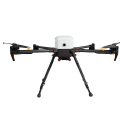
Compatible drones: DJI M400/M350/M300, Inspired Flight IF1200A, Inspired Flight IF800, Harris Aerial H6, and Wispr Ranger Pro and similar UAV


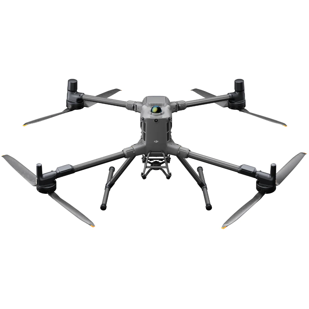


The MBES Calculator provides is a practical tool for optimizing survey productivity, ensuring data consistency, and improving mission planning for UAV-based bathymetric operations.
MBES calculator by SPH Engineering


.jpg)
.jpg)