
Quick Facts
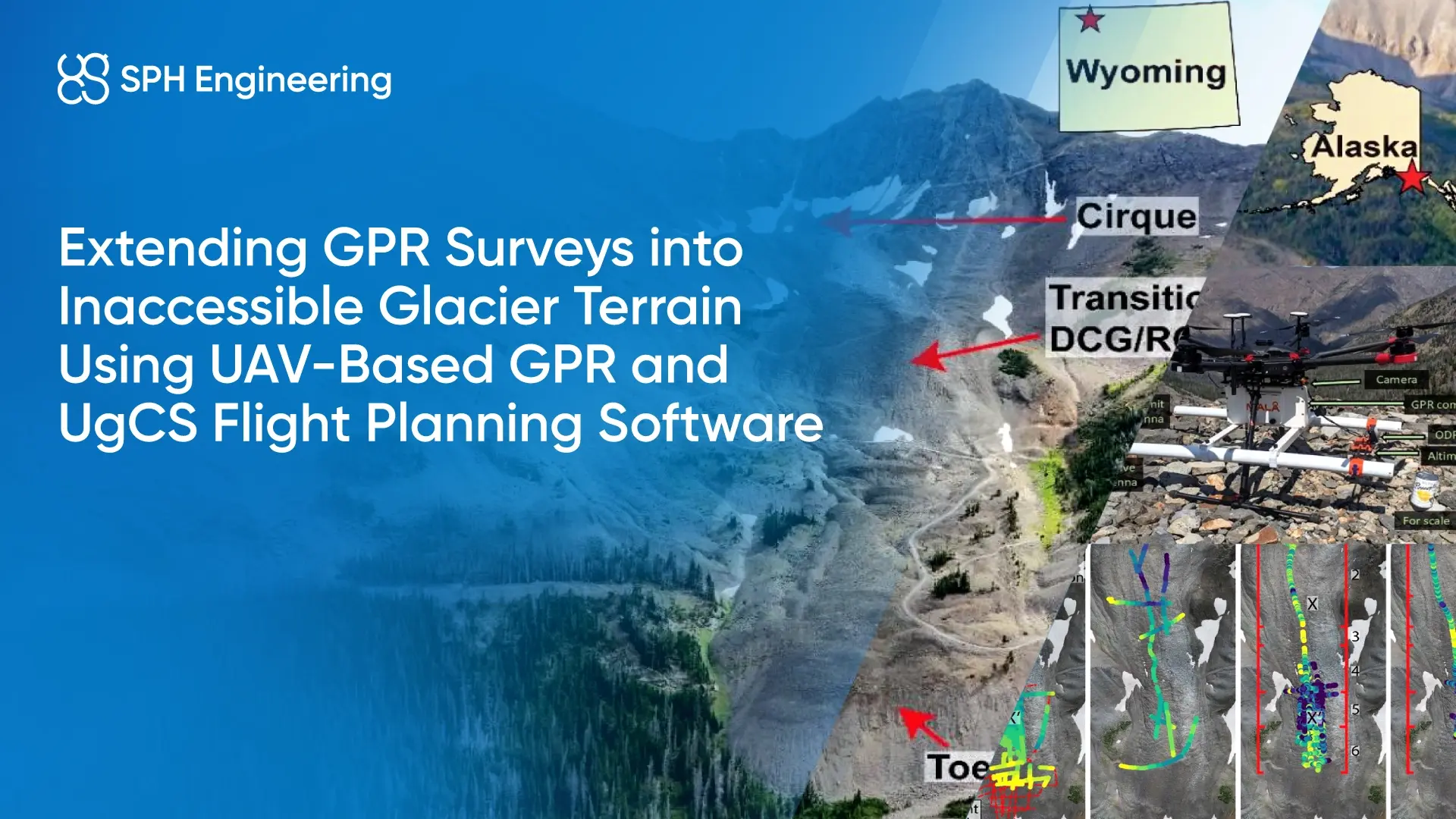
- Locations: Alaska (Sourdough Rock Glacier), Wyoming (Galena Creek Rock Glacier)
- Environment: Steep, debris-covered alpine glaciers
- Challenge: Mapping ice thickness and internal layers in areas unsafe or impossible to access on foot
- Solution: Drone-based GPR system with UgCS flight planning software and SkyHub onboard computer
- Application: Glacier subsurface characterization, debris thickness mapping, ice–debris interface detection, and internal glacier structure analysis.
- Key Result: Detection of debris thickness, glacier depth, and internal layers with expanded spatial coverage compared to surface-based surveys.
Background: Why Debris-Covered Glaciers Are Hard to Survey
Debris-covered glaciers consist of an ice core protected by a surface layer of rock and sediment. This debris layer influences glacier dynamics, ice preservation, and melt processes, but also makes subsurface characterization difficult.
Previous studies at both Sourdough and Galena Creek Rock Glaciers relied on surface-based GPR surveys conducted on foot. While effective, these surveys were time-consuming and limited to areas that could be safely traversed. Steep slopes, large boulders, loose debris, and forested sections restricted access and prevented continuous spatial coverage.
The use of a UAV-mounted GPR system offered a potential solution: acquiring subsurface data without requiring personnel to physically traverse hazardous terrain.

The Challenge: Access Limitations,Survey Safety, and Incomplete GPR Coverage
Conducting subsurface surveys on debris-covered glaciers presents several practical challenges:
- Unsafe terrain for ground-based GPR surveys: Large boulders, unstable debris, and steep slopes increase the risk for field teams.
- Incomplete coverage: Ground-based GPR surveys are limited to accessible paths, leaving gaps in data.
- Time and effort: Manual surveys require significant time for relatively short profile lengths.
- Inaccessible zones: Cirques, transition zones, and steep upper sections are often impossible to survey on foot.
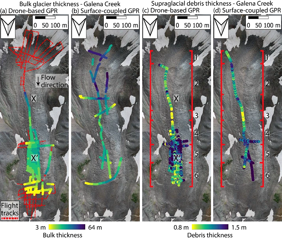
At both study sites, terrain complexity limited surface-based GPR coverage. At Galena Creek Rock Glacier in particular, steep slopes, loose debris, and cirque sections could not be safely traversed on foot, preventing ground-based surveys in key areas of interest.
.webp)
The Solution: Drone-Based GPR with Terrain-Following Flight Planning
To overcome these constraints, the project team deployed a drone-mounted GPR system consisting of
- MALA Geodrone 80 GPR mounted on
- DJI Matrice 600 Pro with
- UgCS flight planning software with a SkyHub onboard computer
The SkyHub module enabled the drone to maintain a controlled altitude above highly variable terrain, while UgCS provided automated mission planning and execution. This configuration allowed the UAV to fly safely over uneven glacier surfaces and collect consistent GPR data.
The drone-based approach enabled:
- Surveys above steep or unstable terrain
- Access to previously unreachable glacier sections
- Faster data acquisition compared to manual surveys
- Reduced exposure of personnel to hazardous conditions
Importantly, the UAV-based GPR data were collected over sites with existing surface-based GPR datasets, allowing direct comparison between methods.

Results: Reliable Subsurface Mapping with Improved Efficiency
The drone-based GPR surveys successfully retrieved key subsurface features at both study sites:
Debris Thickness
- The thickness of the debris layer overlying the ice core was detected and mapped.
- Results showed strong consistency with values obtained from surface-based GPR, within the expected resolution limits of the drone-mounted system.
- Variations in debris thickness correlated with glacier deformation patterns, particularly at Galena Creek.
Glacier Thickness
- The glacier base was detected in multiple sections, with maximum depths exceeding 40 meters in Galena Creek.
- While the UAV-based GPR did not always reach the maximum depths detected by lower-frequency ground-based systems, it reliably captured the main glacier structure across a wider area.
Internal Debris Layers
- Internal reflectors associated with englacial debris layers were identified, particularly in the cirque area of Galena Creek.
- In several cases, these features were detected in areas that had never been surveyed on foot due to safety constraints.
- Clutter simulations confirmed that the observed reflectors were genuine subsurface features rather than off-nadir surface reflections.
Conclusion
This project demonstrates that drone-based GPR is a practical method for extending subsurface glacier surveys into terrain that is inaccessible to surface-based approaches. By removing the need for personnel to traverse dangerous terrain, UAV-based workflows enable safer operations, broader coverage, and high-quality subsurface data.
The approach is particularly valuable for:
- Alpine and polar research
- Climate and cryosphere studies
- Planetary analog investigations
- Any project where access and safety are critical constraints
Drone-based geophysical surveying opens new possibilities for studying complex environments that were previously out of reach.
Read the full report: Revealing the internal structure of Mars-analog glaciers from drone-based radar sounding