
Quick Facts:
- Partner: Patriot Environmental
- Client: Oil and gas operator
- Location: West Texas, Permian Basin
- Application: Drone-based bathymetric survey for frac pond volume measurement
- Technology Used: ECT400S single-frequency echo sounder mounted on DJI M300, integrated with SkyHub onboard computer and supported by UgCS for mission planning
- Deliverables: Volumetric strap chart, color depth map, 3D bathymetric model, aerial pond imagery
Background: Frac Pond Water Planning Before Field Operations
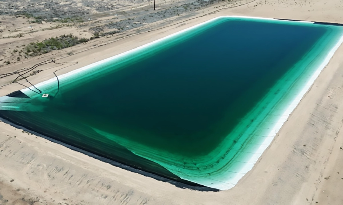
Frac ponds store water used in hydraulic fracturing, keeping large volumes available close to the well site. Before a frac job begins, operators need to know how much water is available and whether additional water must be moved in from another source.
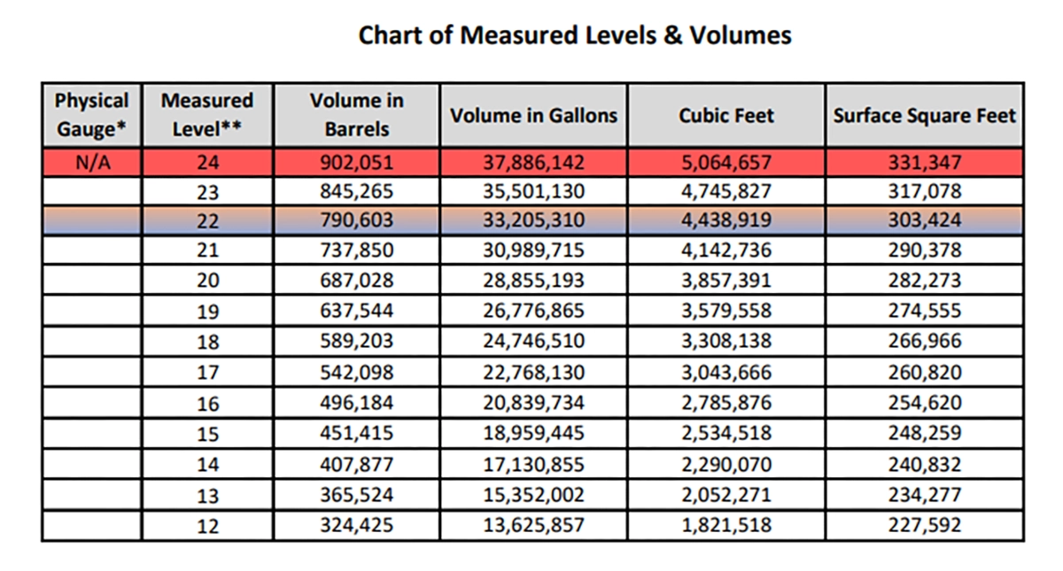
The main output clients need is a volumetric strap chart. This chart connects water level to stored volume, allowing field teams to estimate how many barrels are available at a given pond level.
Challenge: Reducing Boat-Based Work Around Produced-Water Ponds
The traditional approach was to use a boat with sonar attached underneath. While this method worked, it created practical and safety concerns in oilfield environments.
Many frac ponds contain produced water, which may include chemicals, oil, or other contaminants. Launching and retrieving a boat required personnel to work close to the pond edge, carry equipment over the berm, and manually operate the boat across the water surface.
For Patriot Environmental, the main limitations of boat-based bathymetry were:
- crew exposure around produced-water ponds, including work near the pond edge and water surface
- manual boat navigation, which made it harder to keep survey lines evenly spaced across the pond
- more physical handling in the field, as crews had to move and launch boat-based sonar equipment over the pond berm
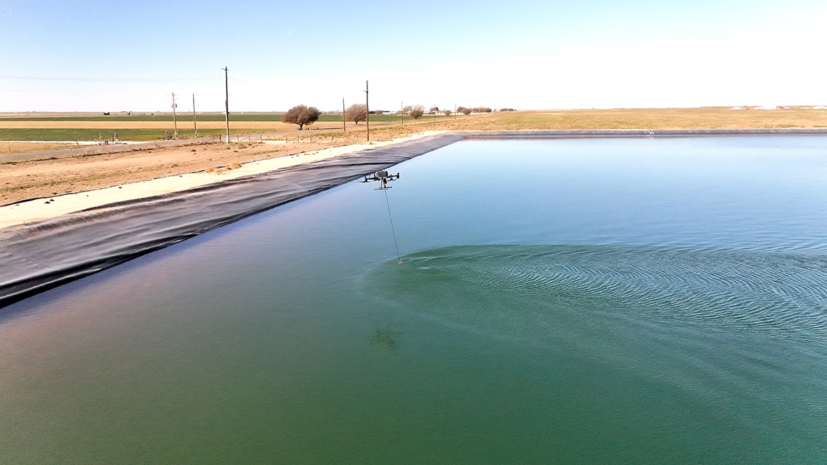
Solution: UAV-Mounted Echo Sounder with UgCS and SkyHub
Patriot Environmental replaced boat-based sonar collection with a UAV-mounted echo sounder workflow. For the survey, the team deployed a DJI M300 drone equipped with an ECT400S single-frequency echo sounder and used UgCS to plan the bathymetric mission. SkyHub was a part of the onboard integration, connecting the drone-based payload workflow with planned data collection.
The collected data was processed into bathymetric and volumetric deliverables. The final report included:
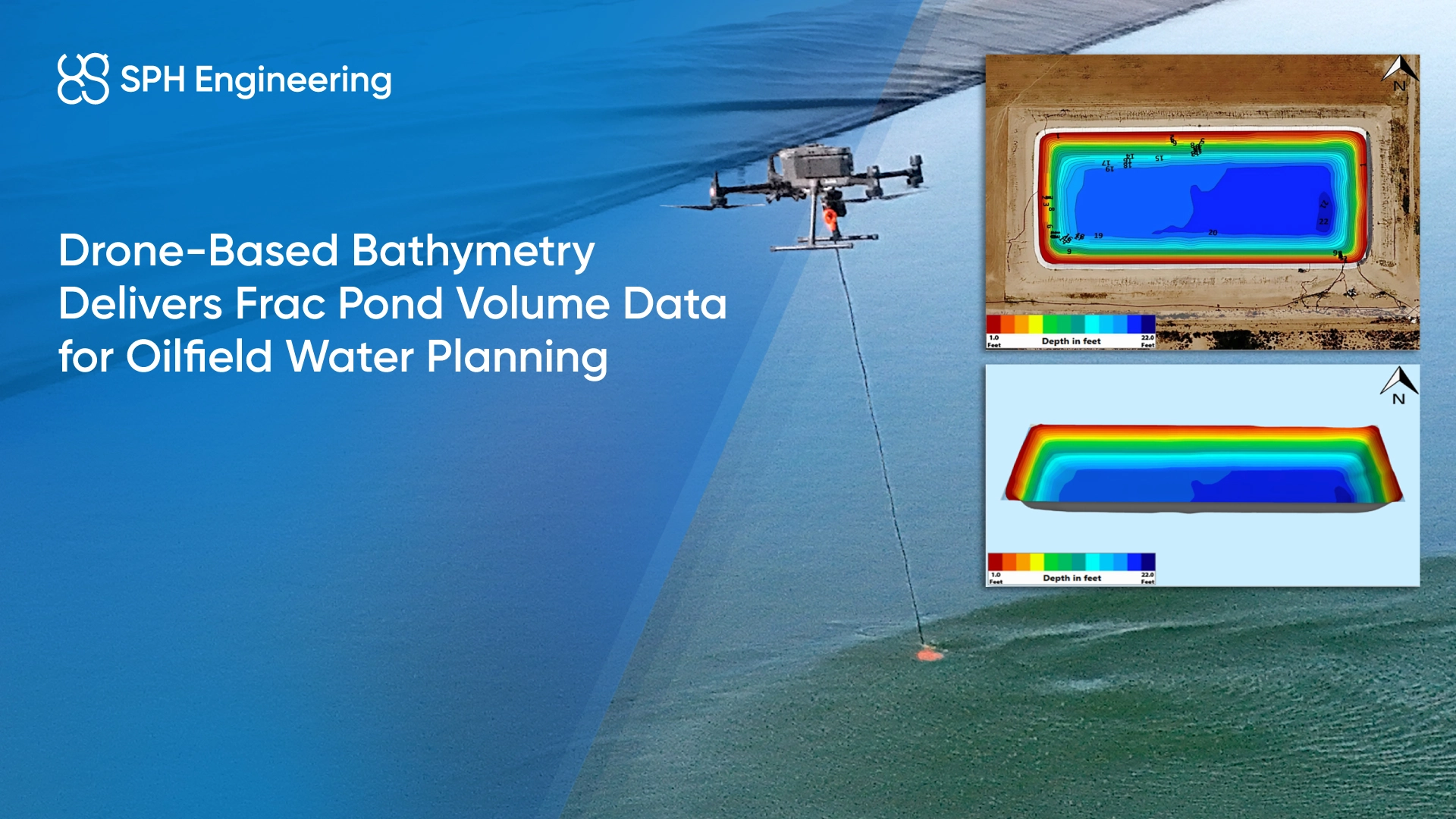
- aerial imagery of the frac pond
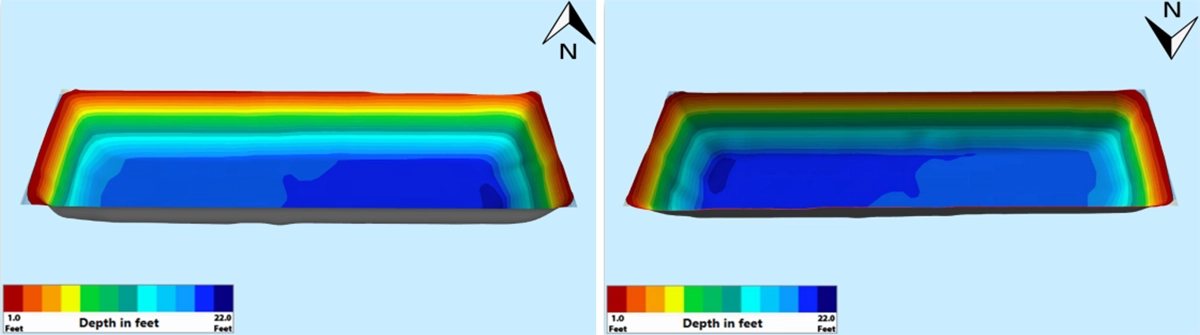
- a color depth map with numerical depth values
- a 3D color model of the pond floor and side slopes
- a measured level and volume chart
Results: Frac Pond Volume Delivered for Water Planning
At the time of the scan, the frac pond measured 22 feet to the sump depth, with a calculated water volume of 790,603 barrels.
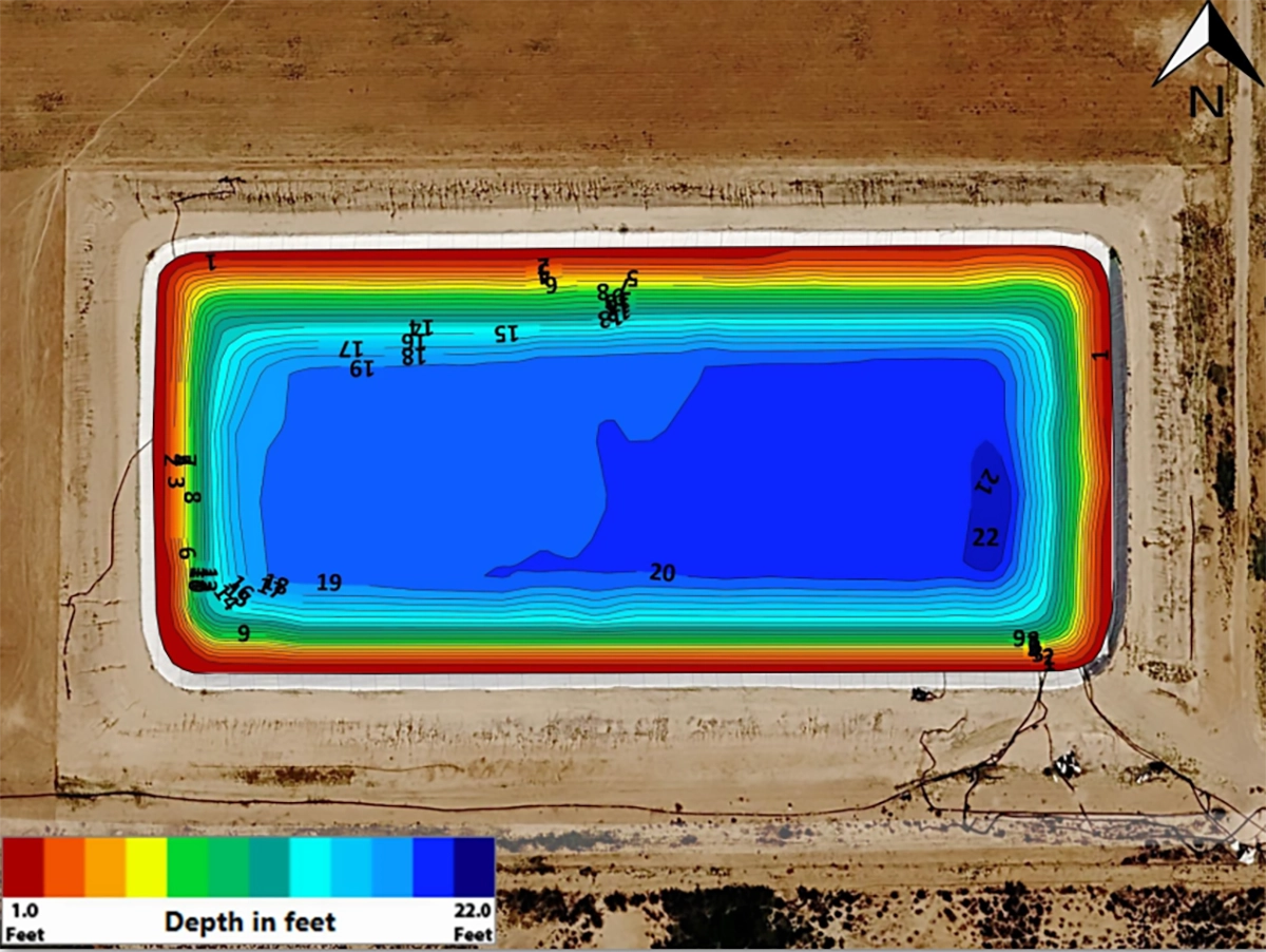
The bathymetric model showed that the pit gradually slopes toward the southeast corner sump. The depth map and 3D color model made this pond geometry visible, giving the client more than a single volume number. The deliverables showed both the current storage condition and the relationship between the measured water level and the total pond volume.
The strap chart showed how the pond level corresponds to the stored water volume. For the operator, this helps answer a practical planning question: how much water is available for upcoming frac activity, and whether additional water needs to be moved before operations begin.
Conclusion
Drone-based bathymetry provides oil and gas operators with a safer, more repeatable way to measure frac pond capacity. For frac ponds like this one, the value is not only in the measured volume, but in turning a pond scan into a practical planning tool: a visual model, a depth map, and a strap chart that field teams can use before water-intensive operations.