
Quick Facts
Partner: Altomaxx Technologies
Location: Calgary, Alberta, Canada
Challenge: Acquire accurate water and sediment depth measurements near a substation for riprap volume calculations.
Solution: SPH Engineering’s integrated Bathymetry Kit with the EchoLogger D052S dual-frequency echo sounder.
Tech Stack: DJI Matrice 300 RTK, EchoLogger ETC D052S (Dual-Frequency), SkyHub (Onboard Computer), Hydromagic (Processing Software).
Key Result: Detailed bathymetric and sediment-depth model enabling engineering teams to optimize reinforcement planning.
Applications: River engineering, sediment analysis, flood impact assessment, and infrastructure design.
The Engineering Need: Accurate Bathymetry for Riprap and Scour Analysis
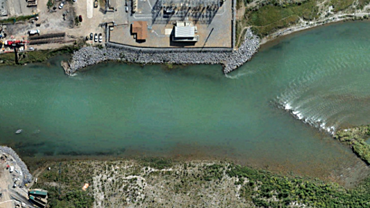
In 2013, Calgary experienced the worst flood in Alberta’s history, which reshaped the Bow River’s banks and caused significant erosion near an electrical substation south of the Ivor Strong Bridge. Temporary riprap was installed to stabilize the affected area, but new bridge expansion plans required updated bathymetric measurements.
Engineers specifically needed both water depth and sediment depth, as riprap volume changes significantly depending on how deep the material sinks into the riverbed. The site’s fast current and limited boat-launch access made traditional vessel-based bathymetry difficult and unsafe.
The Challenge: Why Traditional Vessel Surveys Failed in Fast Currents
The project required fine-resolution measurements in a section of the river characterized by:
- Persistent fast-moving water
- Unstable or unsafe riverbanks
- Limited access points for vessel deployment
- The need to detect sediment thickness, not just water depth
- High positional and geometric consistency across the dataset
Maintaining correct sensor orientation is particularly difficult in flowing water using boats or USVs. UAV-mounted sonar provided a safer and more reliable alternative by eliminating the need for crews to work near unstable shorelines and ensuring high-quality data collection.
The Solution: Dual-Frequency Drone Echo Sounder
To meet these constraints, Altomaxx used a DJI Matrice 300 RTK fitted with an EchoLogger ETC D052S dual-frequency echo sounder (50/200 kHz) as the core of a drone-based echo sounder system. This setup, integrated via the SkyHub onboard computer, allowed for simultaneous capture of:
- High Frequency (200 kHz): For precise water depth and riverbed surface.
- Low Frequency (50 kHz): To penetrate soft sediment and map the sub-bottom structure.
Data Acquisition: Manual Flight for Current Compensation
The survey was carried out on July 12, 2024. Altomaxx flew the drone manually along the Bow River from the Ivor Strong Bridge to approximately 200 m downstream. Manual control allowed the pilot to:
- Keep the echo sounder as upright as possible
- Match UAV speed to the river current
- Follow lines that thoroughly covered the target reach
This approach reduced potential geometrical distortions in the measurements and minimized gaps in the dataset.
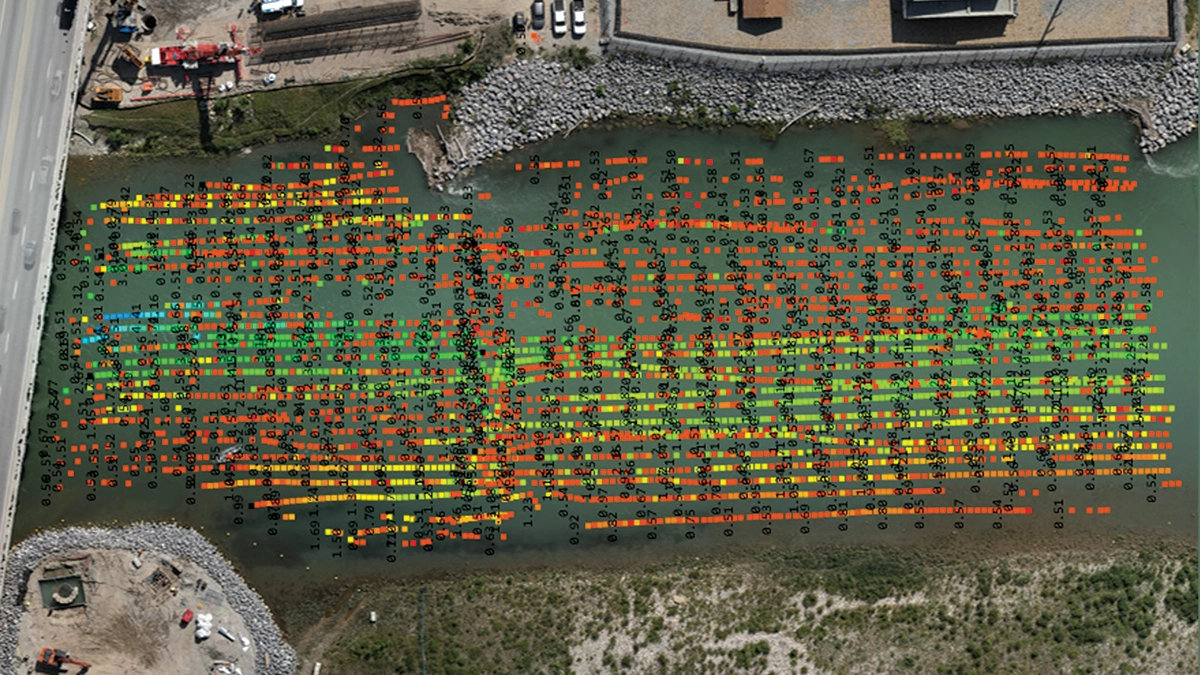
Data Processing
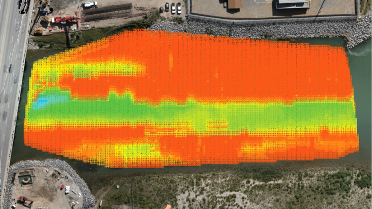
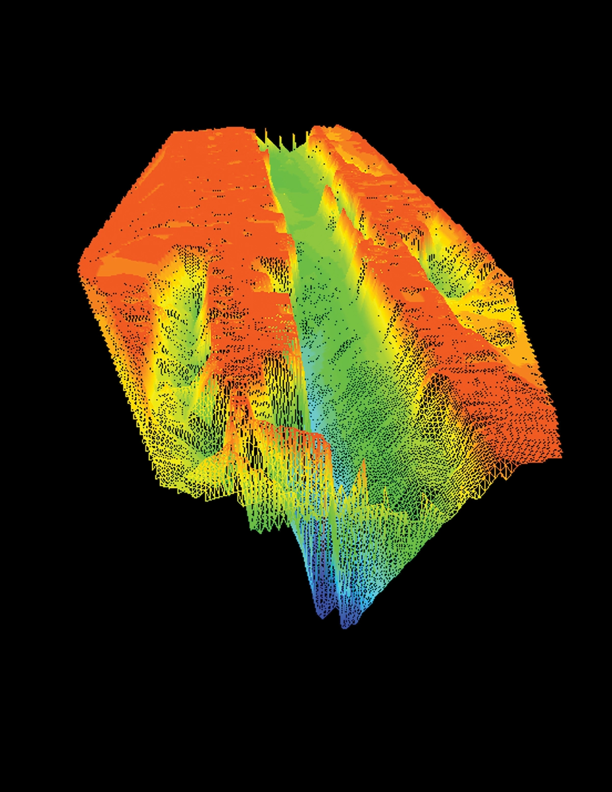
Raw data from the echo sounder was processed using Hydromagic software. Standard steps included importing the data, adjusting map parameters, filtering noise, and aligning depth measurements with GPS coordinates. From this, a matrix of depth values was generated and interpolated into a TIN (triangular irregular network) surface, effectively creating a 3D model of the underwater topography for the surveyed reach.
Results: Sediment Depth Modeling and Riprap Volume Estimation
The processed dataset provided a detailed picture of the riverbed, including:
- Water depth across the surveyed reach
- Sediment depth above more consolidated material
- The position of the thalweg, the deepest part of the channel
- Evidence of where the previous riverbank had subsided into the river
These outputs gave engineers the information needed to estimate riprap volumes with much higher confidence and reduced the risk of over-ordering material and associated transport costs. The survey, completed within a few hours, contrasted with the full day or more that a comparable vessel-based campaign might have required under similar conditions. Just as importantly, the drone-based approach kept staff away from hazardous riverbanks and fast-moving water.
Conclusion
By deploying a drone-based echo sounder system, Altomaxx was able to survey a challenging, fast-flowing reach of the Bow River safely and efficiently. The UAV approach avoided the logistical and safety issues associated with launching and operating vessels in strong currents and delivered a high-resolution bathymetric model within hours.
The resulting water-depth, sediment-depth, and thalweg information supported riprap volume estimations and bank-reinforcement design for the bridge expansion project. This case demonstrates how drone-based bathymetry can provide reliable, decision-ready data in locations where traditional methods are difficult, time-consuming, or unsafe.