Drone-Based Survey Solutions for Mining Operations
- SPH Engineering's drone surveying solutions deliver fast, safe, and repeatable georeferenced data across every stage of the mining lifecycle, from exploration through to site closure.
- Built for active mines and hard-to-access terrain, our integrated drone payload systems offer faster data capture, safer operations, and more cost-effective surveys.

Challenges Our Solutions Solve in Mining
In mining, the hardest surveys are usually the ones tied to open-pit high walls, active blast zones, tailings storage facilities, stockpiles, and large exploration areas. These are the scenarios where conventional survey workflows most often run into access, speed, coverage, and repeatability challenges.

Unsafe Access to Open-Pit High Walls
Open-pit high walls can collapse without warning, which makes manual inspection slow and hazardous. Rope-access inspections take days and put personnel at risk, while even terrestrial laser scanning remains slower than needed in many cases.

Unstable Conditions in Pre- and Post-Blast Areas
Blast operations require documentation before and after detonation to assess material movement, fragmentation, and site safety. The challenge is that these areas remain unstable, so collecting current data quickly without sending crews into the zone becomes difficult.

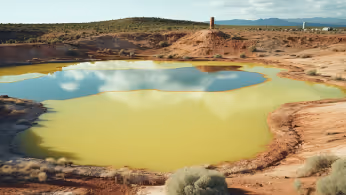
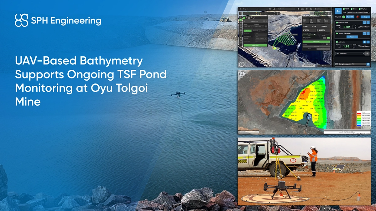
Repeated Bathymetric Monitoring of Tailings Storage Facilities
Tailings storage facilities require regular monitoring to track changes in water bodies and sediment buildup over time. Repeated bathymetric surveys provide updated depth data for ongoing assessment while improving safety and coverage in difficult-to-access areas.

Limited Coverage in Large Exploration Areas
In mineral exploration, teams often need to map large areas before committing to drilling programs. Area coverage itself can be a challenge for conventional methods, especially when researchers need geological, magnetic, terrain, or subsurface data across remote or hazardous ground.

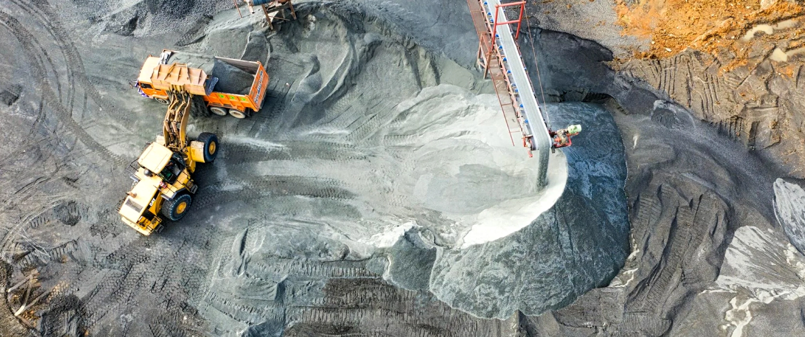
Slow Inventory Checks on Stockpiles
Stockpile measurement is a recurring challenge in mining because inventory data directly affects production planning, blending, and financial reporting. This creates a need for accurate, current volume data, while manual methods and visual estimates are often slower and less reliable for regular tracking.

Tramp Metal in Stockpiles and Risk of Crusher Damage
Ground-engaging tools, drill bits, and other ferrous metal regularly accumulate in stockpiles and are difficult to locate once buried. If this material reaches the crusher undetected, it can cause significant equipment damage and unplanned production downtime. Manual search methods are too slow and disruptive to be practical at operational scale, particularly when stockpiles are large or frequently replenished.
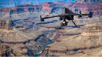
UAV Applications in Mining Surveying & Exploration
Tailings and water assets bathymetry
Drone-mounted echo sounders map water depth, sedimentation, and capacity change across tailings ponds, flooded pits, and mine water reservoirs during UAV bathymetric surveys. Repeatable survey paths track sedimentation-induced volume loss, support dredging planning, and produce documentation for operational and environmental reporting.
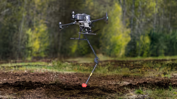
Subsurface Void and Hazard Detection
Subsurface voids, old workings, stopes, and karst features pose real safety and planning risks. Drone-mounted GPR can detect shallow cavities under suitable conditions and may be combined with other geophysical methods depending on site geology and survey objectives. Outputs include georeferenced radargrams and processed 2D or 3D images for interpretation by safety and planning teams.

Open Pit Mapping, Volumetrics and Slope Monitoring
UAV mapping using photogrammetry and LiDAR is widely used in open pits and stockpiles to generate DTMs and DSMs, calculate volumes, and support repeat site monitoring.
It works especially well where steep slopes and frequent geometry changes make repeat ground surveys impractical.
Mineral Exploration and Magnetic Anomaly Mapping
Drone-borne magnetometry supports rapid magnetic mapping over mine sites, helping identify structures, magnetically contrasting lithological boundaries, as well as magnetite-bearing units. Exploration teams use it for early-stage targeting and to guide follow-up fieldwork and drilling programs.
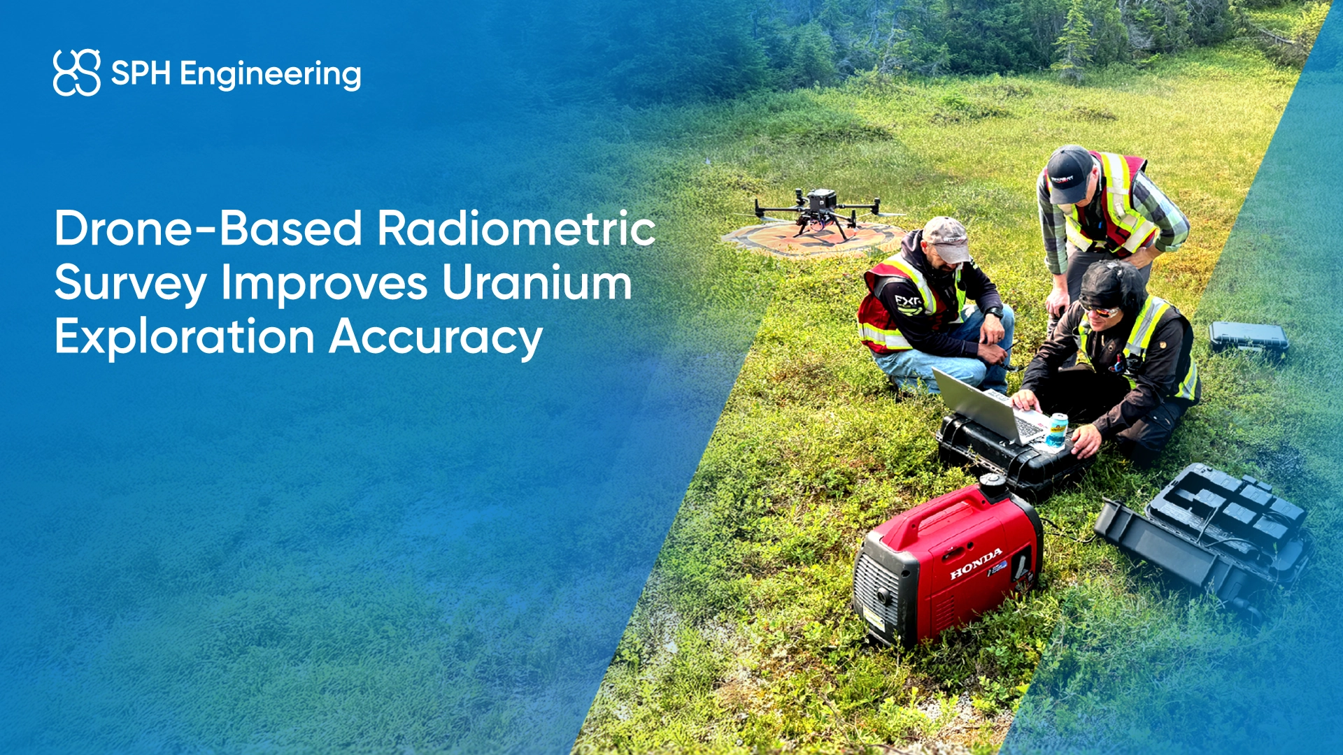
Radiometric Mapping and Surface Geochemistry
Drone-based gamma-ray spectrometry can be used in mining and exploration projects to map variations in naturally occurring radioactive elements, such as potassium (K), uranium (U) and thorium (Th) across large areas. It can also help infer soil properties, including clay content, where radiometric responses correlate with soil texture and composition. This supports surface geochemical interpretation and helps identify patterns relevant to early-stage exploration.
Stockpile Tramp Metal Detection
Drone magnetometer surveys can also be used to locate buried or lost ferrous tramp metals and lost ground-engaging tools (GETs) in stockpiles before material enters the processing unit, especially where the surrounding material is non-magnetic to weakly magnetic or the target is large enough to create a clear magnetic contrast when using a MagNIMBUS gradiometer configuration. This helps to reduce the risk of crusher damage, production stoppages and other unplanned disruptions during processing.
Recommended Drone Solutions for Mining
HARDWARE
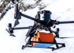
Drone-based GPR system enables non-contact subsurface mapping of glaciers, buried utilities, and voids in areas inaccessible or unsafe for ground surveys.
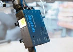
SkyHub is a drone onboard computer that ensures reliable sensor integration and precise, synchronized data collection during every flight.
SOFTWARE

Desktop drone flight planning for the most demanding pilots.

Radsys GPR data processing software for Zond GPRs.

Assess & process GPR and other sensor data.
TRAINING

Advanced technical training and expert support to elevate your team’s expertise and ensure precise, efficient execution of your drone-mission tasks.
HARDWARE
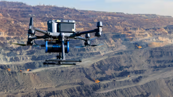
Drone magnetometers enable fast magnetic anomaly mapping for mineral exploration, UXO detection, and ferrous object localization over large areas.
SkyHub is a drone onboard computer that ensures reliable sensor integration and precise, synchronized data collection during every flight.
SOFTWARE
Desktop drone flight planning for the most demanding pilots.
Assess & process GPR and other sensor data.

Online GIS for Surveyors and Geophysicists.

Geophysical data processing and interpretation software.

Geophysical data processing and interpretation software (gravity/magnetics)
TRAINING
Advanced technical training and expert support to elevate your team’s expertise and ensure precise, efficient execution of your drone-mission tasks.
HARDWARE
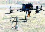
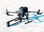
Drone-mounted echosounders provide accurate bathymetric data for depth measurement, sediment monitoring, and underwater terrain mapping.
SkyHub is a drone onboard computer that ensures reliable sensor integration and precise, synchronized data collection during every flight.
SOFTWARE
Desktop drone flight planning for the most demanding pilots.
Assess & process GPR and other sensor data.

Bathymetric data processing software.

Hydrographic survey mapping software.
TRAINING
Advanced technical training and expert support to elevate your team’s expertise and ensure precise, efficient execution of your drone-mission tasks.
HARDWARE
Advanced airborne systems designed for accurate radiation and elemental mapping. Enables efficient and safe data acquisition across complex or hazardous terrains.
SkyHub is a drone onboard computer that ensures reliable sensor integration and precise, synchronized data collection during every flight.
SOFTWARE
Desktop drone flight planning for the most demanding pilots.

Radiometric data processing suite for Medusa Radiometrics hardware.
Assess & process GPR and other sensor data.
TRAINING
Advanced technical training and expert support to elevate your team’s expertise and ensure precise, efficient execution of your drone-mission tasks.
SOFTWARE
UgCS flight planning software with: Terrain-Following, Corridor Scanning, Photogrammetry, LiDAR and Calibration Tools.
Online GIS for Surveyors and Geophysicists.
TRAINING
Advanced technical training and expert support to elevate your team’s expertise and ensure precise, efficient execution of your drone-mission tasks.


Why Mine Engineers Choose Our Drone-based Solutions

Repeatable acquisition geometry
Maintaining consistent altitude and flight path helps keep datasets comparable across repeat surveys, especially when monitoring changes in surface geometry, stockpile volumes, or tailings water bodies over time.

Faster coverage where ground access fails
Steep relief, unstable ground, and remote prospects no longer bottleneck your survey schedule.

Seamless workflow integration
UgCS mission planning and integrated sensor payloads standardise data acquisition across sites, operators, and survey types.

Georeferenced survey outputs
Profiles, grids, surfaces, point clouds, and reports come out ready for GIS, mine planning, and geotechnical and geophysical software.

Reduced exposure in high-risk zones
Teams capture critical datasets near highwalls, tailings facilities, and active haul corridors without putting personnel in harm's way.

Multi-application flexibility
The same UAV platform can support different mining survey applications, including exploration mapping, site modelling, bathymetric surveys, and hazard screening, depending on the sensor payload and survey method.

Trusted by
SPH Engineering technologies are used by over 70 technology partners, leading universities, and research institutes.


%202.svg)
_black%201.svg)


Expert Insights in Mining Surveying


Mining Survey Webinars


Your Questions About Drone Solutions for Mining and Mineral Exploration
How are drone magnetometers used in mineral exploration?
Drone-borne magnetometers fly precise low-altitude grid patterns over mine sites to detect magnetic anomalies linked to ore bodies, structural features, and magnetically contrasting lithological boundaries. The results support target generation, prospect ranking, follow-up ground surveys, and drill planning.
What sensors can be integrated on drones for mining surveys?
Yes. Many academic teams operate SPH Engineering’s systems in glaciers, alpine regions, marine environments, deserts, and other demanding field conditions. The combination of terrain following, altitude control, and robust data logging enables reliable field performance.
How do drone surveys improve safety in mining operations?
Drones reduce personnel exposure in high-risk zones by removing the need for workers to operate near highwalls,within blast exclusion zones, on tailings facilities, and across unstable terrain. Survey teams can collect the required data while keeping people out of these zones.
How quickly can drone-based geophysical surveys cover exploration areas?
Coverage depends on the sensor, terrain, and line spacing, but drone-based geophysical surveys can significantly reduce field time compared with manual crews.
For example, in SPH Engineering’s ground-versus-UAV magnetometer comparison, the drone survey was 45% shorter overall, with a total survey time of 37 minutes versus 67 minutes for the ground-based system in conditions good enough for a terrestrial survey. The time advantage becomes even more relevant in terrain that is harder to walk safely or efficiently.
How do UAV surveys improve stockpile management?
Drone-based surveys improve stockpile management by producing current 3D models and volume calculations for inventory tracking, reconciliation, and production planning. Using photogrammetry or LiDAR, these workflows can achieve centimeter-level accuracy for stockpile and earthwork measurement.