Drone-Based 3D Mapping and Volume Measurement for Survey-Grade Results
SPH Engineering provides the flight planning, sensor integration, and data management tools that surveyors and engineers need to capture centimeter-accurate 3D models and volume calculations from drones.
Our customers use UgCS, SkyHub, and DroneGIS to map stockpiles, construction sites, quarries, and complex terrain, then turn that drone survey data into reliable deliverables that their clients and management teams can act on.
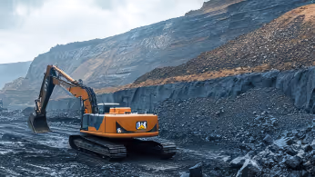
Used by BHP, one of the world's largest mining companies, for daily stockpile surveys
0.4 cm/pixel GSD achieved in peer-reviewed university research (University of Patras)
Works with DJI, Inspired Flight, Autel, Ardu / PX4, and 20+ drone platforms
Full offline operation for remote sites with no cell service

What Makes High-Precision Drone Mapping So Difficult?
Getting a drone in the air is the easy part. Getting survey-grade mapping and volumetric data out of it is where most teams run into problems.

Inconsistent GSD on uneven terrain
Standard drone mapping apps fly at a fixed altitude above the takeoff point. On a quarry face with 80m of elevation change, your GSD varies wildly between the top and bottom of the site. Images captured too high produce blurry, unusable data. Images too low risk a collision. The result: gaps in your model or a full re-flight.

Large-area missions that exceed single-battery coverage
A 500-hectare mining site or a 200 km corridor scan does not fit in one flight. Splitting the mission across multiple batteries introduces overlap gaps, misaligned datasets, and hours of manual flight planning on a tablet screen.

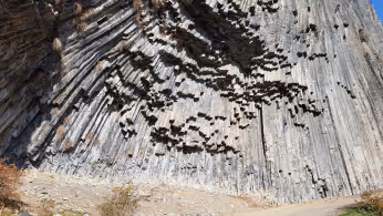
Vertical and oblique surfaces that grid missions miss
Stockpile sides, pit walls, cliff faces, and building facades are invisible to nadir (straight-down) flight patterns. Traditional grid missions only see the top of a stockpile. Stockpile volume calculations based on incomplete geometry undercount material.

Offline operations at remote sites
Cloud-based drone mapping apps stop working when there is no cell service. Many mine sites, rural construction projects, and field survey locations have zero connectivity. If your software needs the internet to load maps or upload flight plans, you cannot fly.

From raw data to trusted survey deliverables
Flying the drone is only half the job. Survey teams need to organize, store, share, and compare datasets across multiple flights, sites, and time periods. Without a system for that, data lives on SD cards and individual laptops.
How Drones Deliver Better Mapping and Volumetric Data
Drone-based surveys replace weeks of ground work with hours of flight time, and the data is more complete.
Uniform GSD across complex terrain
Drone terrain-following algorithms maintain constant altitude above ground, keeping your GSD uniform from flat areas to steep slopes. UgCS lets you import your own elevation model (not just satellite-derived 30m data) so the drone follows the actual surface, not an approximation of it.

Full 3D capture of vertical and oblique surfaces
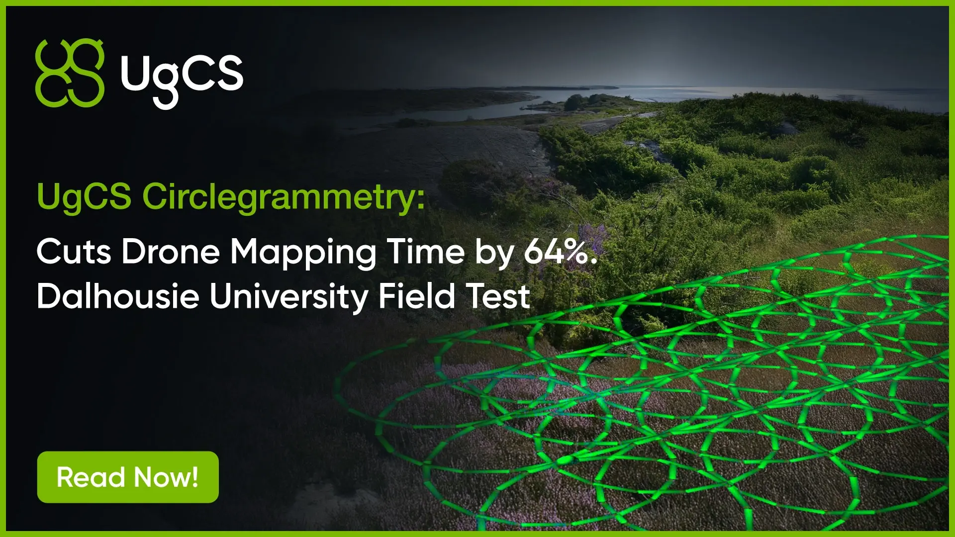
Vertical scan and Circlegrammetry flight patterns capture sides of stockpiles, pit walls, and structures that nadir drone survey missions miss. This means complete geometry for volume calculations and structural inspection, not just a top-down view.

RTK/PPK survey-grade positioning
RTK and PPK corrections deliver centimeter-level georeferencing. SkyHub's onboard computer provides altitude stability with drift of approximately 5 cm (versus several meters from standard barometric altimeters). Accurate positioning means your measurements hold up under audit.

Faster turnaround than ground survey crews
BHP surveys 1.2 km x 1 km stockpile areas in a single battery flight and delivers volume reports from takeoff to final numbers in under one hour. Ground-based surveying of the same area takes days.
No crew exposure to hazardous survey areas
Steep pit walls, active blast zones, unstable stockpiles, and toxic water bodies are surveyed without sending anyone in. The drone goes where people should not.
How It Works

Plan the mission on desktop
Import your site boundary (KML) and digital elevation model (GeoTIFF DEM) into UgCS. The 3D desktop interface lets you visualize the terrain, set flight altitude, overlap, and camera parameters, and preview the entire mission before going to the field.

Fly with terrain awareness
UgCS terrain following keeps the drone at constant AGL using your imported DEM. For sites where centimeter-level altitude control matters (LiDAR, bathymetry, geophysics), add SkyHub with a radar or laser altimeter for True Terrain Following that corrects altitude in real time during flight.

Capture complete geometry
Use area scan for nadir drone photogrammetry, vertical scan for pit walls and structures, Circlegrammetry for oblique 3D capture of stockpiles and complex objects, or corridor mode for linear assets like pipelines and powerlines. UgCS calculates optimal paths for each pattern.

Manage and share data
Upload datasets to DroneGIS, SPH Engineering's cloud-based spatial data platform. Compare surveys over time, share results with stakeholders through a browser, and keep all your site data organized in one place.
Our Solution Stack for Drone Mapping and Volumetrics

UgCS flight planning software with: Terrain-Following, Corridor Scanning, Photogrammetry, LiDAR and Calibration Tools.

Online GIS for Surveyors and Geophysicists.

Advanced technical training and expert support to elevate your team’s expertise and ensure precise, efficient execution of your drone-mission tasks.


FAQs
What accuracy can I expect from drone-based mapping and photogrammetry?
Photogrammetry with RTK/PPK corrections and ground control points routinely delivers 1-3 cm horizontal accuracy and 2-5 cm vertical accuracy. LiDAR provides centimeter-accurate elevation models. GSD depends on flight altitude and camera, but sub-centimeter resolution is achievable. The University of Patras achieved 0.4 cm/pixel GSD using UgCS vertical scan missions with a standard DJI Mavic 3 Enterprise.
How accurate are drone stockpile volume measurements?
Accuracy depends on the quality of the 3D model, which comes down to GSD, overlap, and positioning. With proper flight planning (consistent AGL, sufficient overlap, RTK corrections), drone photogrammetry delivers stockpile volume measurement accuracy within 1-2% of traditional ground survey methods. BHP relies on drone volumetrics for weekly stockpile reporting at operating mines.
Can I plan and fly drone mapping missions offline?
Yes. UgCS runs fully offline on desktop. You cache maps and elevation data before going to the field, plan your mission, transfer it to the drone, and fly. BHP operates this way across multiple mine sites with no cell service, uploading fresh elevation models to tablets nightly from local processing.
What is the difference between terrain following and True Terrain Following?
Terrain following in UgCS uses imported digital elevation models (DEMs) to adjust the drone's altitude along the planned route. True Terrain Following (with SkyHub + a radar or laser altimeter) adjusts altitude in real time during flight based on the actual surface below the drone. The difference matters on surfaces that change frequently, like active mine sites where the ground moves daily from blasting and excavation.
What drones and sensors work with your software?
UgCS supports DJI (Matrice series, Mavic 3 Enterprise, Phantom 4 RTK), Autel, ArduPilot-based platforms, Acecore, Freefly, and more. SkyHub integrates with magnetometers, GPR, echo sounders, multispectral cameras, and water samplers. If your payload connects via serial or Ethernet, SkyHub can likely handle it.
Do I need UgCS Expert or will UgCS Pro work for my mapping project?
UgCS Pro handles photogrammetry grid missions, basic terrain following, and standard mapping workflows well. UgCS Expert is the right choice if you work with LiDAR (it includes IMU calibration tools), need advanced scan patterns, or plan large-scale missions. Start with UgCS Open (free) to evaluate the interface, then choose the tier that matches your sensor and mission complexity.
How does DroneGIS compare to processing software like Pix4D or Agisoft?
DroneGIS is not photogrammetry processing software. It is a spatial data management platform. You process your images in Pix4D, Agisoft Metashape, or your preferred tool, then upload the results (orthomosaics, point clouds, 3D models) to DroneGIS for storage, comparison, and sharing. DroneGIS sits downstream of processing and upstream of decision-making.