Drone-Based Underground Utility Detection for Safer, Faster Subsurface Mapping
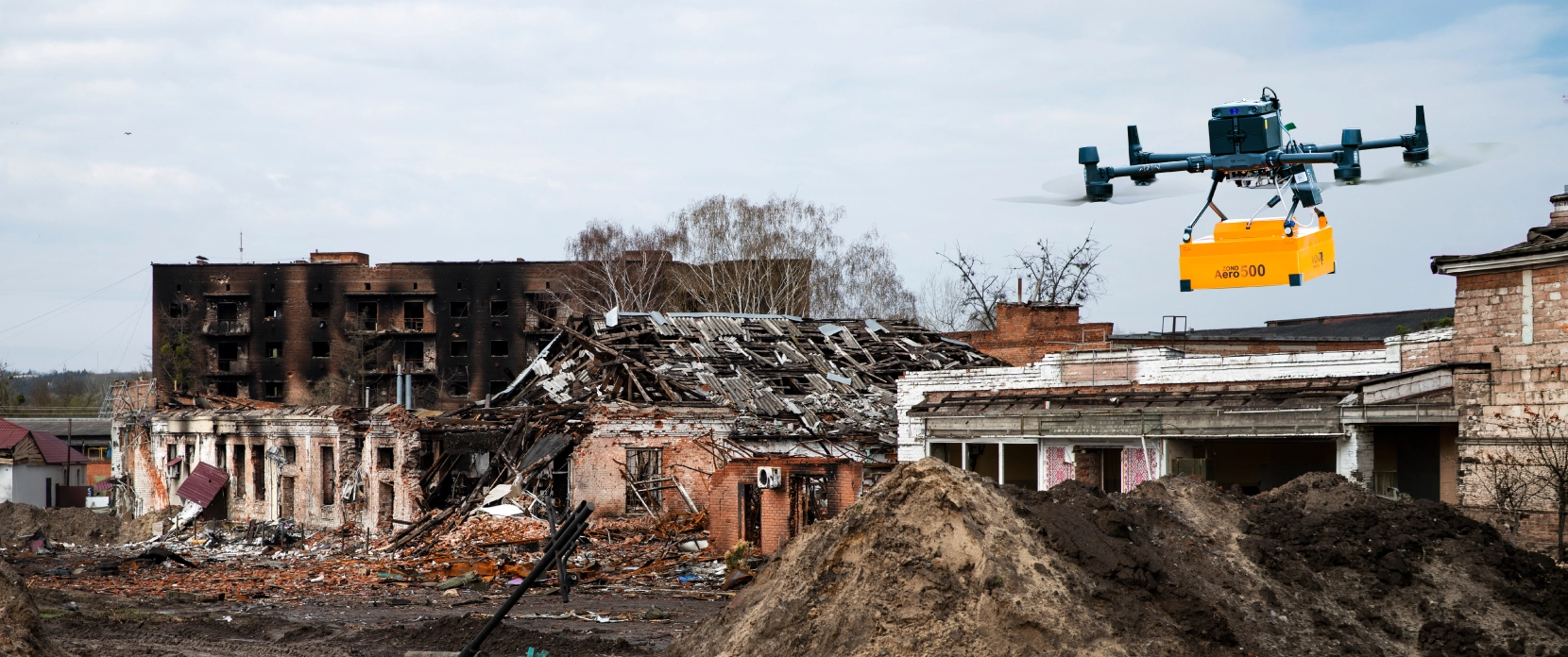
Buried pipes, cables, and other infrastructure can be identified from the air using drone-mounted geophysical survey systems. Our drone-mounted Ground-penetrating radar (GPR) can detect metallic and non-metallic utilities at depths of up to 4 m under favorable conditions, and magnetometer systems can detect metallic utilities at depths of up to 7 meters. Those allow subsurface surveys to be conducted without ground contact, traffic disruption, or crew exposure to hazardous sites. Plan the survey in UgCS, fly with True Terrain Following through SkyHub, and process acquired data in GeoHammer, Prism2, or Geolitix.
- Tested and validated in real-world utility detection projects (UAE, Europe, Americas)
- Universal GPR systems: airborne on a drone or terrestrial on a cart, same hardware
- Field-proven on DJI M400, M350, M300, Inspired Flight, and other professional platforms
- Industry-standard data processing with Prism2, Geolitix, GeoHammer, Oasis Montaj

Why Underground Utility Mapping Is So Difficult
Every year, construction crews encounter buried utilities. A damaged gas main shuts down a site. A severed fiber optic cable takes out the internet for a neighborhood. The cost is not just financial. Utility strikes cause injuries, project delays, regulatory penalties, and lawsuits.
The problem is that existing records are often incomplete, outdated, or wrong. And the conventional tools used to fill those gaps each come with their own limitations.

Incomplete or Outdated Buried Utility Records
Many buried assets were installed decades ago, and records are often missing, imprecise, or never digitized. However, even newer records do not always match actual site conditions or accurately reflect utility locations on current maps. Relying on such documentation can be hazardous, especially when an excavator is operating only a few centimeters from a buried live gas line.

Non-Metallic Utilities Are Invisible to EM Locators
Electromagnetic (EM) locators are often used to detect metallic pipes and live electrical cables. Plastic water mains, fiber optic conduits, concrete ducts, and abandoned infrastructure made of non-conductive materials are generally not detectable by this method. GPR is the primary non-invasive technology that can detect both metallic and non-metallic buried objects.

Ground-based Surveys Are Slow and Disruptive
Cart-based GPR surveys are effective, but they require physical access to the surface. On active construction sites, survey activities must often be rescheduled around heavy machinery and other high-risk areas. On soft, uneven, or contaminated ground, it means hazardous or impractical working conditions for operators.

Large-Areas Surveys Make Manual Methods Impractical
Pre-construction surveys for solar farms, highway corridors, and industrial developments can cover tens of hectares. Covering an area of that size with terrestrial GPR at speeds below 1 m/s can take weeks. Drone-based GPR can cover the same ground faster, while also maintaining straight survey lines and more consistent data.

Depth Estimation Requires More Than Detection
Locating a buried utility is only the first step. Geologists and engineers also need to know how deep it lies, the direction it follows, and, ideally, what type of asset it is. GPR provides depth estimation through Two-Way Time analysis, while magnetometry adds an additional data layer for identifying ferrous objects. When combined, these sensors provide a more comprehensive view than either method alone.
How Drone-Based GPR and Magnetometry Improve Utility Detection
The underlying physics of GPR or magnetometer measurements remain the same whether the sensors are deployed from the ground or mounted on a drone. The same electromagnetic principles apply. What changes is how the sensors are deployed: surveys can be carried out faster, in areas inaccessible on foot, with centimeter-level flight path precision enabled by RTK navigation that a human operator carrying equipment cannot match.
No Ground Contact Required
The drone flies the GPR at a controlled height above the surface. If you use a high-frequency GPR antenna, you must fly low to the ground. No need to clear vegetation, close roads, or walk across contaminated or hazardous ground. Sites that were previously inaccessible to cart-based GPR surveys can be surveyed using drone-mounted systems.

Straighter Lines, More Consistent Data
UgCS pre-programs the survey grid with exact line spacing, flight altitude, flight direction and overshoot. SkyHub and True Terrain Following maintain the antenna at a constant altitude above ground level using a laser or radar altimeter. The result is evenly spaced, parallel profiles that are easier to process and produce cleaner horizontal slices and 3D reconstructions.
Dual-Sensor Capability: GPR and Magnetometer on One Drone
SPH Engineering's integrated systems support both GPR and magnetometer payloads on the same drone platforms. GPR detects both metallic and non-metallic objects. Magnetometers detect ferrous utilities (iron/steel pipes, reinforced concrete) with high sensitivity. Running both sensor types over the same area gives you the most complete subsurface dataset.
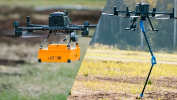
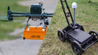
Universal Sensor Hardware: Airborne and Terrestrial Deployment
Zond Aero GPR systems are designed for both drone-based and terrestrial surveys. For example, the same Zond Aero 500 unit that can be mounted on a DJI M350 for aerial surveys can be placed on a cart for street-level scanning in confined spaces. This allows users to invest in a single GPR system and deploy it in the most efficient mode for each project.
Faster Coverage on Large Sites
For open areas, such as solar farm sites, pipeline corridors, greenfield developments, airborne geophysical surveys can significantly outpace ground-based methods. The drone follows pre-programmed path lines at consistent speed while the operator monitors from a safe distance. In one SPH Engineering comparison of ground–based and UAV-based single-sensor magnetometer surveys, the UAV survey reduced total survey time by 45%, taking 37 minutes compared with 67 minutes for the ground-based system. This advantage becomes even more important in terrain that is difficult to traverse safely or efficiently.

How Drone-Based Utility Detection Works, Step by Step

Plan the Survey Grid in UgCS
Import your site boundary (KML, CSV, or draw it on the map). Select the GPR survey pattern: parallel lines with defined spacing (typically 0.5 to 1.0 m for utility detection). UgCS calculates the full mission including line spacing, flight speed, turning behavior, and battery segmentation for long missions.

Configure the Drone Altitude Profile
GPR performance depends directly on antenna height above ground. For utility mapping with a 500 or 600 MHz system, the recommended altitude is 0.6 to 1.0 m above the surface. UgCS supports both AGL (Above Ground Level) with True Terrain Following and AMSL (Above Mean Sea Level) modes. Import a DEM if available, or let SkyHub's onboard altimeter handle real-time altitude adjustments.

Fly the Mission
The drone executes the pre-programmed grid autonomously. SkyHub logs GPR data with precise GNSS coordinates and altimeter readings. Every radar trace is time-stamped and georeferenced. The pilot monitors the flight and data quality from the ground.

Run Field QC in GeoHammer
After landing, use GeoHammer to quickly check data quality in the field. Remove unnecessary flight segments (takeoff, landing, turns between lines) and confirm that subsurface reflections are visible before leaving the site. This reduces the risk of needing a repeat survey.

Process and Interpret Subsurface Data
Upload the cleaned data to Prism2 or Geolitix for full processing, including background removal, gain adjustment, depth calibration, and filtering. The processed data can then be used to generate vertical profiles, horizontal slices, or 3D reconstructions and exported in GIS-compatible formats for integration with site plans in CAD, QGIS, ArcGIS.
Recommended Drone Solutions for Underground Utility Mapping
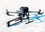
Compatible drone platforms: DJI M400, M350 RTK, M300 RTK, Inspired Flight IF1200A, Harris Aerial H6, Wispr Ranger Pro, Cube/Pixhawk-based platforms.
HARDWARE
Drone magnetometers enable fast magnetic anomaly mapping for mineral exploration, UXO detection, and ferrous object localization over large areas.
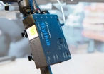
SkyHub is a drone onboard computer that ensures reliable sensor integration and precise, synchronized data collection during every flight.
SOFTWARE

Desktop drone flight planning for the most demanding pilots.

Assess & process GPR and other sensor data.

Online GIS for Surveyors and Geophysicists.

Geophysical data processing and interpretation software.

Geophysical data processing and interpretation software (gravity/magnetics)
TRAINING

Advanced technical training and expert support to elevate your team’s expertise and ensure precise, efficient execution of your drone-mission tasks.


Trusted by
SPH Engineering technologies are used by over 70 leading universities, research institutes, and technology partners.


%202.svg)
_black%201.svg)


When to Use Airborne GPR vs. Cart-Based GPR for Utilities
Drone-mounted GPR is not the correct tool for every utility mapping task. In confined urban environments (streets, parking lots, building interiors), terrestrial GPR remains more practical. The drone needs open airspace and unobstructed ground below the flight path.
Airborne GPR is the better choice when:

The survey area is large and open
(pre-construction sites, solar farm corridors, pipeline routes, greenfield developments)

Ground access is restricted or hazardous
(contaminated land, unstable surfaces, active construction zones)

Speed matters
the drone covers more ground per hour than a person pushing a cart, especially over rough or soft terrain

You need perfectly straight, evenly spaced survey lines
for consistent 3D reconstruction
Zond Aero GPR systems support both modes. The same unit that flies on a DJI M350 fits on a terrestrial cart for street-level work. One investment covers both deployment scenarios. UAV-based GPR surveys can provide higher-quality results because they follow straighter and more consistent survey lines than manual ground-based acquisition.

Webinar Recordings


Frequently Asked Questions
How deep can drone-mounted GPR detect underground utilities?
With a 500-600 MHz system like the Zond Aero 500 or Zond Aero 600, typical detection depth from a drone is 1 to 2 meters in average soil conditions. This covers the standard burial depth range for most water, gas, electric, and telecom infrastructure. Lower-frequency systems (Zond Aero LF at 150-300 MHz) can reach 4 to 8 meters but with lower resolution, making them better suited for large-diameter pipes or deep infrastructure.
Can GPR detect plastic pipes and fiber optic cables?
Yes. GPR detects both conductive (metallic) and non-conductive (plastic, PVC, concrete, fiberglass with metal bearing) objects. This is one of its primary advantages over electromagnetic locators, which only detect metallic utilities or lines with active current. A 500 MHz GPR mounted on a drone can detect non-conductive pipes from approximately 10 cm in diameter, if they are filled with water or air.
Can I use the same GPR system on a drone and on the ground?
Yes. Zond Aero 500/600 NG and Zond Aero 1000 NG are designed as universal systems. They mount directly on drones for airborne surveys and fit on a wheeled cart for traditional ground surveys. The GPR unit, data format, and processing workflow remain practically the same regardless of deployment method.
What drones are compatible with SPH Engineering's GPR systems?
SkyHub and the GPR payload integrate with DJI M400, M350 RTK, M300 RTK, DJI M600, Inspired Flight IF1200A, Harris Aerial H6, Wispr Ranger Pro, and Cube/Pixhawk-based platforms with ArduCopter or PX4 firmware. Mounting hardware is included for supported drone models.
Is drone GPR suitable for urban utility scanning?
Drone-mounted GPR is not usually suited for confined urban environments like streets, sidewalks, or building perimeters. The drone requires open airspace and unobstructed terrain below the flight path. For city utility scanning, use the same Zond Aero GPR on a terrestrial cart. SPH Engineering supplies carts for the Zond Aero 500 and Zond Aero 1000 systems.
Does soil type or moisture affect GPR performance?
Yes. Wet, high-conductivity soils (clay, waterlogged ground, heavily fertilized agricultural land) reduce GPR penetration. As ice also doesn't conduct electricity in the same manner as wet soils, surveys on glaciers are also possible. Dry sand and sandy soils are the most favorable conditions. If possible, schedule drone GPR surveys during dry periods. You can estimate expected results for your survey area soil type using SPH Engineering's online GPR calculator.
What data deliverables can I produce from a utility mapping survey?
Standard underground utility mapping deliverables include vertical profiles (cross-sections along each survey line), horizontal depth slices (plan-view maps at specific depths showing utility paths), 3D reconstructions of detected objects, and GIS-compatible exports (for QGIS, ArcGIS, or CAD software).
How do I know which GPR frequency to use for my project?
Work through three filters in order.
1. Drone or ground-based? Drone surveys limit you to 500 or 600 MHz antennas (1 GHz units have the smallest penetration range from a drone). Ground-based work opens up 1 GHz as well.
2. Target depth. Plug your soil type, expected target depth, and antenna elevation into the free SPH GPR Calculator and rule out any frequency that can't penetrate deep enough to reach your targets.
3. Highest frequency wins. From what's left, pick the highest available frequency. Higher frequency means better resolution and cleaner separation of closely spaced utilities.
For most drone-based utility mapping, this ends up at 500 or 600 MHz.