Quick Facts
- Partner: Geosense
- Location: Kallikrateia, Chalkidiki, Greece
- Application: Coastal erosion monitoring
- Survey area and flight time: approximately 1.5 km² and 14 hours over 3 days
- Challenge: Collecting high-density bathymetric data in shallow coastal waters
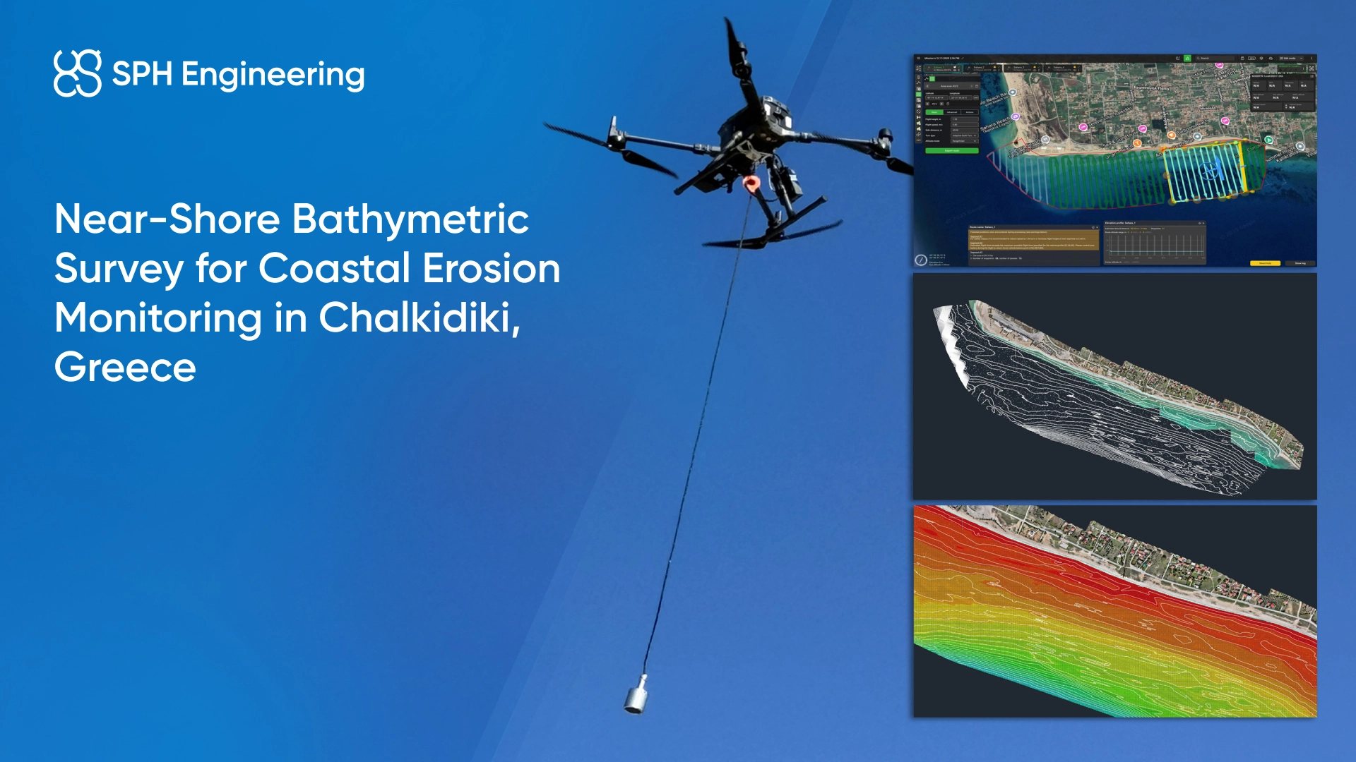
- Solution: SPH Engineering drone-based bathymetry kit with Echologger ECT D24S dual-frequency single-beam echo sounder, SkyHub onboard computer, and UgCS flight planning software.
Background
Coastal erosion is an active concern along the Chalkidiki coastline, where shifting seabed sediment changes the underwater profile from season to season. In Kallikrateia, Chalkidiki, Geosense was tasked with collecting accurate bathymetric information to help assess shoreline deformation and underwater topography changes.
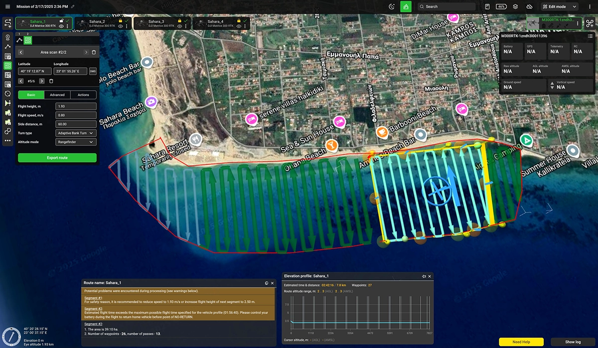
The project area covered approximately 1.5 km². For a site of this size, manual measurements would not be practical. Traditional boat-based echo sounding is slow and difficult to run in shallow water as well. A UAV-based approach allowed the team to work closer to the shoreline and collect dense measurements with greater operational flexibility.
Challenge
The survey required accurate depth measurements across a dynamic coastal environment. Several field conditions had to be managed during planning and data collection:
- Shallow near-shore waters where boat access can be limited
- Shoreline proximity and changing underwater topography
- Potential obstacles, including rocks, buoys, pipes, and other structures
- Wind gusts reaching up to 8 m/s
- Sailing vessels occasionally crossing the survey area
These conditions required careful mission planning, stable equipment, pre-survey obstacle mapping, and constant visual line-of-sight control throughout the operation.
Drone-Based Bathymetry Setup
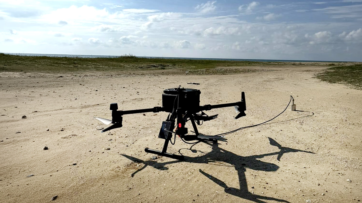
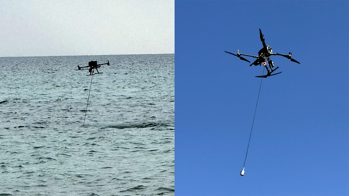
To complete the project, Geosense deployed SPH Engineering’s drone-based bathymetry kit on a DJI Matrice 300 RTK. The setup included an Echologger ECT D24S dual-frequency single-beam echo sounder for depth measurements, SkyHub onboard computer, and UgCS flight planning software.
This configuration allowed Geosense to maintain low-altitude, steady-speed data collection in shallow near-shore waters, where boat-based surveys are slower or harder to carry out safely.
Two-Stage Survey Workflow
The work was carried out in two main stages: coastal mapping and bathymetric data collection. Before the bathymetric flights, Geosense created an orthomosaic of the coastline. This preparatory step helped the team:
- Define the shoreline at 0 m elevation
- Identify rocks, floating obstacles, pipes, buoys, and other potential equipment risks
- Plan the bathymetric mission more safely before flying over water
The bathymetric survey was conducted in November, outside the peak tourist season, to reduce interference from marine traffic and beach activity. During data collection, the drone flew at approximately 1.9 m above the water surface with a ground speed of 0.8 m/s. The full field operation took 3 days and totaled about 14 hours of flight time.
Bathymetric Survey Results
The collected data was processed into a detailed bathymetric model of the survey area. Vertical accuracy and point density were aligned to IHO (International Hydrographic Organization) Order 1 expectations for near-shore work, the standard reference framework for hydrographic survey quality. The final deliverable was a .dwg CAD file containing:
- High-density bathymetric points
- Accurate shoreline delineation
- Bathymetric contours at 50 cm intervals across the survey area
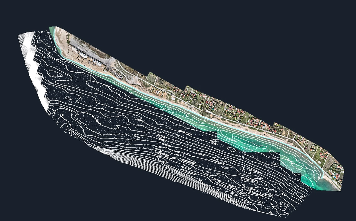

These outputs provide a baseline for local authorities and project stakeholders to monitor erosion, and plan coastal protection measures based on reliable near-shore depth information.
Conclusion
Drone-based bathymetry complements traditional boat-based hydrographic surveys in the shallow near-shore zone where vessels can't safely operate. The Kallikrateia dataset gives local authorities a baseline against which to compare future surveys, turning a one-off measurement into a repeatable coastal erosion monitoring workflow.