
Quick Takeaways: Drone Surveying Integration Results
- MicroGeo broadened its capabilities with SPH Engineering’s integrated payload solutions.
- UgCS flight planning software enabled advanced drone workflow planning and automation.
- Live field demonstrations proved real-world performance of GPR, magnetometer, and echo sounder payloads.
- The partnership strengthened MicroGeo’s position in the Italian surveying technology market.
About MicroGeo: Surveying Technology and Mapping Solutions Provider
MicroGeo is an Italian company that has been working in the surveying and measurement field since 2002. With more than 20 years of experience, the company focuses on digital reality technologies, primarily laser scanners and drone-based solutions. These drone surveying solutions support mapping, inspection, and environmental analysis workflows.
Over the years, MicroGeo has grown significantly in both revenue and team size, thus becoming a recognized player in the Italian surveying market. MicroGeo mainly focuses on selling surveying tools and drone technologies. In addition, they provide theoretical and practical training courses and organize hands-on practice sessions.
MicroGeo positions itself not just as a reseller, but as a partner to surveying professionals. Therefore, the company provides consulting, training, and access to technologies that fit their projects’ needs.
Strategic Objective: Strengthening Market Position in Italy With Integrated UAV Payload Solutions
MicroGeo aimed to increase market share and establish itself as a leading surveying technology provider in Italy. The company sought to become the first brand customers think of when searching for surveying solutions.
To support this objective, MicroGeo worked to cover the full spectrum of surveying needs, including monitoring, drones, laser scanning, digital reality solutions, and e-commerce distribution. Reaching this goal required continuously identifying advanced and reliable technologies that could complement the existing portfolio and expand practical applications for clients.
Collaboration with SPH Engineering: Integrating Advanced UAV Payload Technology
According to MicroGeo, the market associates SPH Engineering with high-end technology and strong brand value. This recognition played an important role in the collaboration. Integrating these solutions allowed MicroGeo to expand its offering with technologies already known and trusted in the market.
One of the key advantages MicroGeo identified is the ability to integrate SPH Engineering payload solutions with standard DJI Matrice platforms. This allows clients to upgrade their existing drone systems rather than invest in larger or entirely new hardware. With one drone platform, customers can adapt to different surveying scenarios by switching payloads according to project needs.

Demo Day in Tuscany: Real-World UAV Sensor Applications
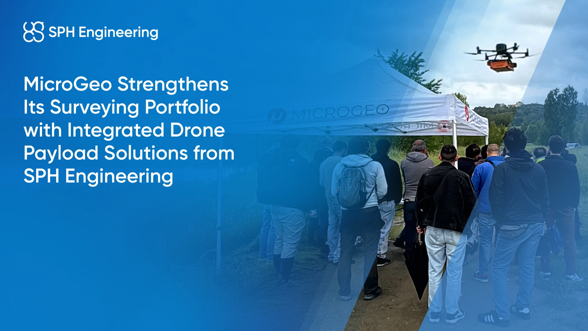
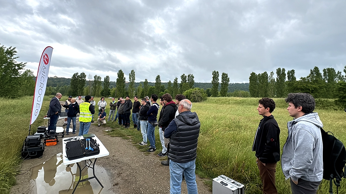
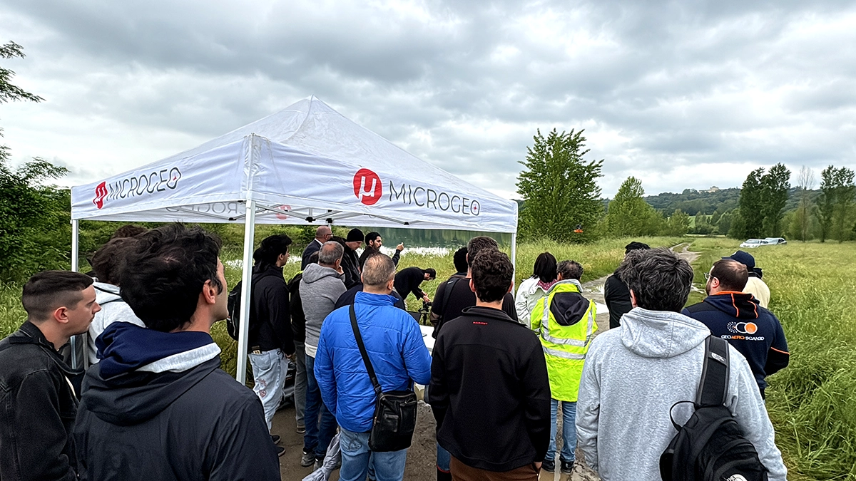
To introduce these solutions to the Italian market, MicroGeo and SPH Engineering organized a Demo Day on May 21, 2025, at Lago di Bilancino in Tuscany, Italy. This field workshop offered professionals a hands-on opportunity to explore drone applications and sensor technologies in real conditions.
Live demonstrations included DJI UAV platforms equipped with specialized sensors such as GPR for subsurface exploration and utility detection, magnetometer technology for ferrous material detection and an echo sounder for bathymetric surveys. Participants were able to observe the complete drone workflow, from aerial data acquisition to data processing and analysis using software tools designed for UAV-based operations.
In addition to the technical demonstrations, the event created space for professional exchange. Industry experts, drone specialists, and surveying professionals gathered to discuss applications, integration challenges, and market trends.
As a result, the event generated strong interest in specialized UAV payload solutions, which are not yet standard tools for all surveyors.
Implementation and Integration Experience
From the planning stage, SPH Engineering supported the initiative both technically and marketing-wise. On the technical side, SPH Engineering contributed to preparing the sensor integrations and event setup. Marketing-wise, the collaboration included providing materials, merchandise, and sponsorship support through social media channels.
This coordination took place before and during the event. Despite challenging weather conditions in the morning, the joint preparation ensured that the demonstrations ran as planned. According to MicroGeo, the collaboration was well-organized and constructive, contributing to the successful execution of the Demo Day.