

Ground-penetrating radar sends short electromagnetic pulses into the ground and records the reflections that return from buried objects and the boundaries between materials. What it can find, and how deep and cleanly it scans, depends mainly on antenna frequency, the electrical properties and moisture/salinity of the ground or material, and the distance between the antenna and the target.
The sections below break the numbers down by use case, by the type of system you would buy, and by what a survey provider charges. The point isn't to hand you a single price. It's to show you which number actually applies to your project.
Typical GPR cost ranges
Most quoted GPR costs could either refer to the price of equipment and the price of a survey. Within each, the spread is wide because a 1 GHz concrete scanner and a low-frequency glaciology system share a name and almost nothing else.
Here is the shape of the market as of 2026. Treat these as planning ranges only, because actual quotes can vary by region, supplier, site conditions, and reporting requirements.
A few factors explain why the same job can be quoted at $1,200 or $4,000. Site accessibility comes first. An open field scans faster than a slab threaded with rebar under live machinery. Target depth and the resolution you need decide the antenna frequency, and that decides which system shows up. Then there's the deliverable: a field markout costs less than a processed 3D model with a written report. Data processing, mobilization, and how far the crew has to travel round it out.
GPR Equipment Costs (Buying Your Own System)
If you run surveys regularly, owning makes more sense than hiring. The question becomes which class of system, because the GPR equipment cost gap between tiers is large.
A single-channel GPR machine cost looks attractive on paper, and for a contractor who scans concrete before coring, it's often the right call. But the average cost of GPR equipment climbs quickly once you add GNSS integration, multiple antenna frequencies, advanced processing software, and cloud workflows. The difference between a basic locator and a survey-grade system is mostly software, antenna options, and how the data comes off the unit.
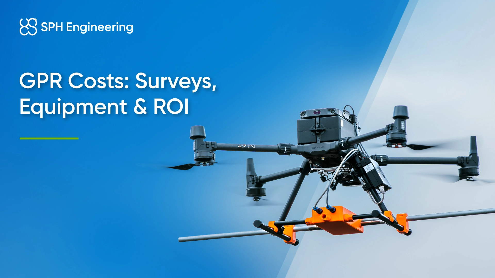
UAV-mounted systems sit in their own category. The upfront number is higher than a single cart because the radar is only one part of the package. A drone-based setup pairs the GPR with an onboard computer for data logging and true terrain following, a laser or radar altimeter depending on the terrain, and flight-planning software. SPH Engineering's universal GPR line, for example, runs the same Zond Aero radar on a cart or under a drone, so the sensor investment carries across both methods. The SkyHub onboard computer logs every trace with GNSS and altimeter readings, and UgCS flies the survey lines automatically.
The trade-off is the part buyers miss. A UAV system costs more to acquire, but it cuts operational cost hard in terrain where a ground crew is slow, unsafe, or simply can't go. A cart may cover roughly half a hectare per day on suitable terrain while a drone can cover several hectares per day on open sites, depending on line spacing, flight altitude, terrain, and data quality requirements. Over enough projects, the higher purchase price pays back through throughput and avoided risk. We compare the two approaches directly in ground versus UAV-based GPR.
If you want to size a specific system, the shop lists GPR systems and components with pricing, from the high-resolution Zond Aero 1000 for near-surface detail to the deep-penetrating Zond Aero LF family for geology and glaciers.
GPR survey costs when hiring a service provider
Not every project justifies owning a system. For a one-off site, or for work outside your usual depth range, hiring a provider is the less expensive route. You're paying for the equipment, the operator's experience, and the clarity of what gets handed back to you.
GPR survey cost gets quoted in a few ways, and which one you see depends on the job. You pay either per hour, per day, per project or based on the area, by linear meter or hectare.
Before you accept a quote, work out roughly what the survey should cost you. The GPR calculator estimates target detectability, resolution, and signal travel time for your specified soil type, target depth, and antenna frequency, so you can sanity-check whether a provider's proposed setup will even find what you're looking for.
What affects GPR costs?
The same survey area can be quoted at twice the price, depending on conditions you might not think to ask about. These are some of the main factors that move the number:
- Required depth. Deeper targets need lower-frequency antennas, which often means a larger, more specialized system and more careful work.
- Soil and site conditions. Dry sand and ice are nearly ideal and let the signal travel far. Wet clay, fertilized farm soil, and anything saline attenuate the signal rapidly, reducing the practical depth and data clarity.
- Site accessibility. Open, flat ground scans quickly. Confined spaces, live infrastructure, rough terrain, and hazardous areas slow everything down or rule out a method entirely.
- Antenna frequency and resolution. Asking for fine detail on small targets means a high-frequency system and tighter survey-line spacing, which adds field time.
- Data processing and reporting. A field markout is less expensive. A filtered dataset, a 3D reconstruction, and a written interpretation report take skilled hours that show up on the invoice.
- Travel and mobilization. Getting the crew and equipment to a remote site can rival the cost of the scanning itself.
The ROI of a GPR investment
The headline equipment price is the part everyone fixates on, and it's the smallest part of the real picture. The cost that matters is the total cost of ownership against what the system earns or saves you.
For a survey business, the math is straightforward. Take the system cost, divide it by the margin you clear per project, and you have a break-even count. Commercial operators commonly recover a GPR purchase within roughly eight to fifteen projects, after which the equipment is working in your favor. The variables that move that count are your day rate, how many billable days the system runs, and how much ground it covers per day.
For a project owner buying a survey rather than equipment, ROI is about avoided cost. A clear scan that prevents one utility strike, or catches a void before construction, or rules out a redesign, can pay for itself many times over. The biggest cost on most excavation projects isn't the scan. It's the strike nobody saw coming, and the delay, liability, and rework that follow.
To put numbers against your own situation, the GPR survey ROI calculator lets you enter your variables and see where the investment lands.
When you read the result, three figures are worth separating. The payback period tells you how long until the system has covered its own cost. Cost avoidance is the value of problems the survey prevents, which for owners often dwarfs the survey fee. And throughput gain is the extra work the method lets you take on, especially relevant when a faster survey method frees up billable days. A system can look expensive on payback alone and still be the obvious choice once cost avoidance and throughput are in the picture.
When a UAV GPR is the most cost-effective option
Drone-mounted GPR is the right tool under a specific set of conditions, and on those jobs it can outperform ground-based methods in safety or coverage rate. Reach for it when:
- The site is large and open, and a ground crew would spend days covering what a drone clears in hours.
- The terrain is rough or impossible on foot: ice and snow, rocky uneven ground, areas split by rivers, avalanche-prone slopes.
- Stepping onto the survey area is dangerous: crevassed glaciers, contaminated soil, unstable surfaces.
- You need precise, repeatable survey lines for monitoring the same area over time.
- Terrestrial productivity makes no economic sense, such as mapping large open areas for shallow bedrock, buried boulders and rocks, or other broad subsurface targets.
For confined spaces, city streets, or anywhere with tall vegetation, a cart or handheld setup is still the better and less expensive choice, and a universal system gives you both. The field record backs this up. See how a drone GPR mapped buried water pipes at high resolution, handled retaining wall quality control without contact, and supported mining operations alongside an echo sounder. You might also be interested in this side-by-side comparison of UAV and ground-based GPR by Medusa Explorations, which shows where the airborne method holds its own on data quality.
Conclusion
Buying a GPR system runs from about $10,000 for a single-channel cart to well over $100,000 for a multi-channel array, with UAV-ready setups landing in between once you count the radar, onboard computer, altimeter, GNSS, and software.
Hiring a survey crew runs roughly $1,000 to $5,000 a day, shaped by depth, soil, access, and the deliverable you need. The least expensive option on paper is rarely the lowest-cost one once you account for coverage, risk, and the cost of a result you can't trust.