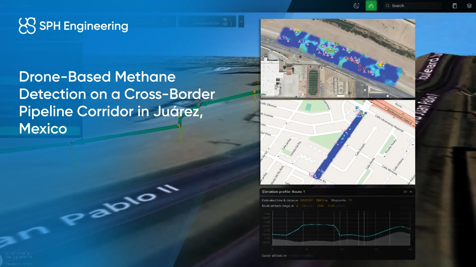
Quick Facts
- Company: Acre Mexico
- Location: Juárez, Mexico
- Application: Drone-based methane detection for pipeline and pressure-reducing stations inspection
- Challenge: Detecting methane indications across urban and industrial pipeline infrastructure
- Technology Used: Falcon Plus TDLAS methane detector and Flux Aero methane sniffer, integrated with SkyHub and supported by UgCS for mission planning and DroneGIS for data processing and visualization
- Key Result: The demonstration managed to identify methane readings and showed how aerial detection can help guide targeted follow-up inspections.
Background
Natural gas pipeline corridors like the one Acre Mexico surveyed can pass through urban streets, industrial areas, and valve station infrastructure. For inspection teams, this means that methane detection workflows need to need both linear corridor screening and closer checks around specific assets.
For this project, Acre Mexico conducted a drone-based methane detection demonstration near the Mexico-US border. The work was carried out on a pipeline corridor located on the Mexican side and focused on assessing how aerial methane detection can contribute to first-pass screening of gas infrastructure.
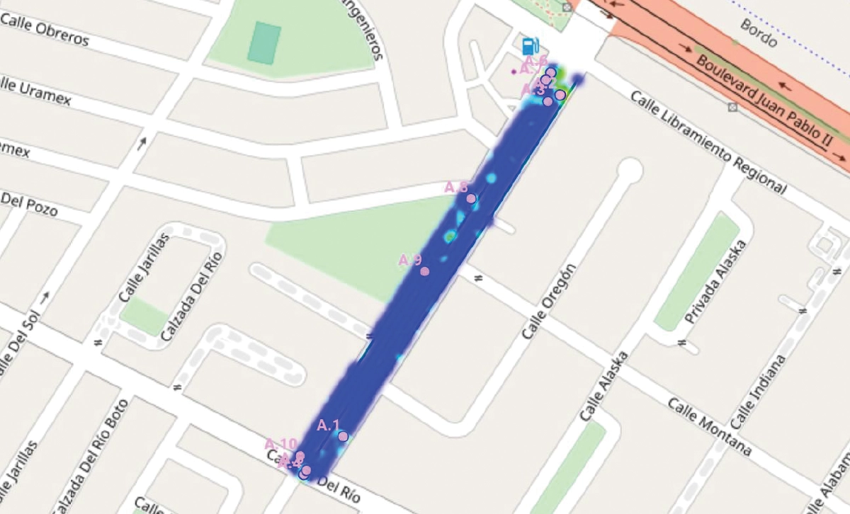
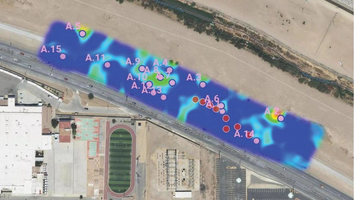
The survey covered two main areas: a residential corridor along an urban distribution line and a pressure-reducing station near the border. These locations allowed for testing Falcon Plus and Flux Aero in different infrastructure settings and comparing how each sensor contributed to methane detection and spatial data visualization.
The Challenge: Detecting methane indications across mixed urban and industrial infrastructure
The inspection area included both an urban residential corridor and surface pipeline infrastructure near a border pressure-reducing station. These conditions required a method that could support systematic coverage while keeping operations safe and efficient.
Several factors influenced the inspection workflow:
- Methane dispersion depended on wind direction and speed.
- Flight paths needed to be aligned to improve the chance of crossing potential methane plumes.
- Urban streets, fenced infrastructure, and station areas required flexible data collection.
- Aerial results needed to be easy to interpret and useful for follow-up inspection.
The project was focused on methane detection, not emissions quantification. The goal was to identify readings and potential leak zones that could be checked further with close-range or ground-based methods.
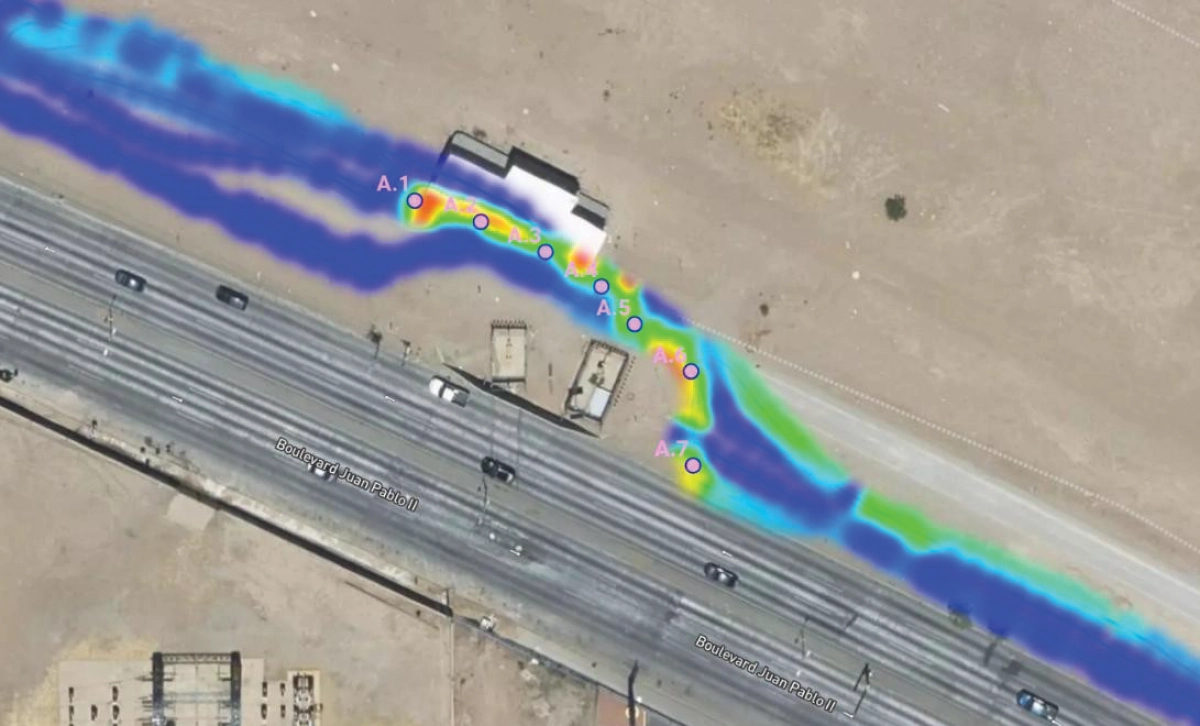
Demonstration of drone methane detection using Falcon Plus and Flux Aero
Falcon Plus was used for aerial scanning over wider corridor segments. It uses tunable diode laser absorption spectroscopy (TDLAS) to detect methane along the path of a laser beam between the drone and the ground and provides integrated readings in ppm·m. This approach is useful for identifying methane plumes and locating areas that may require closer inspection.
Flux Aero was used for direct methane concentration readings at the sensor inlet, reported in ppm. It provides closer inspection of localized methane indications near infrastructure such as valves, joints, vents, or areas that are difficult or unsafe for personnel to access directly.
The missions were planned and flown using UgCS Expert flight planning software.
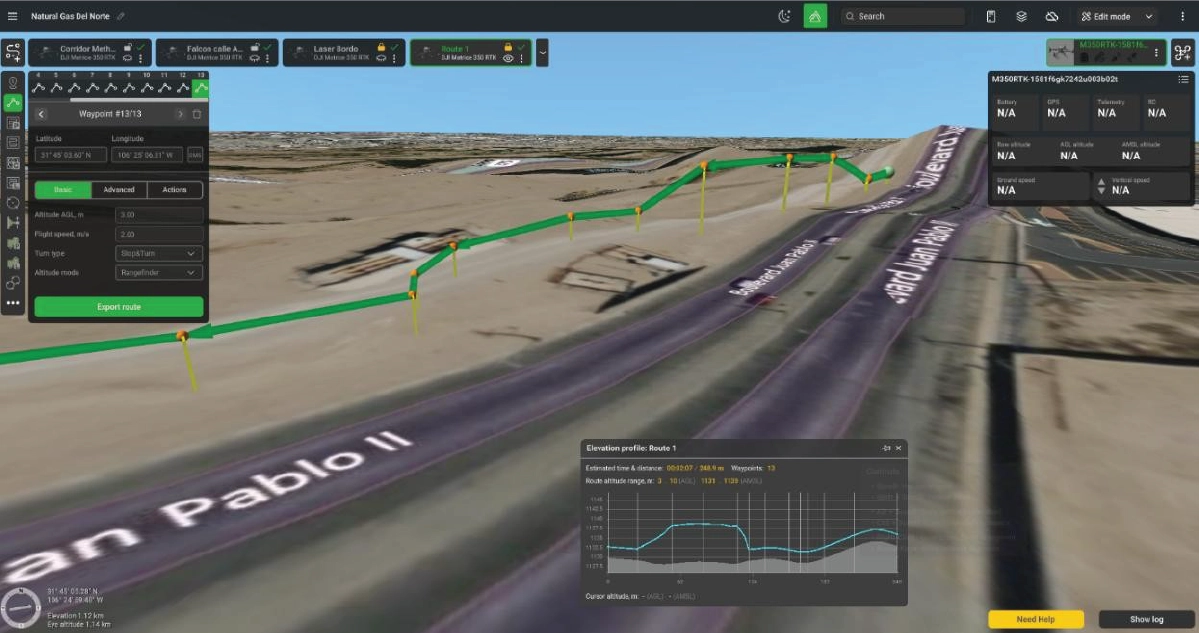
Sensor data was processed and visualized in DroneGIS, where the partner generated methane maps with annotated latitude, longitude, and methane values. This allowed the results to be reviewed by location and sensor type, helping highlight anomalous readings for spatial interpretation.
Results and Conclusion: Aerial screening identified methane readings for targeted follow-up
The demonstration showed that drone-based methane detection can support pipeline inspection by identifying methane readings from the air and visualizing them on maps for follow-up review.
Falcon Plus handled wider-area scanning and helped identify methane plume indications across the inspected corridor. Its flight profile made it suitable for initial screening, especially where a rapid overview of larger areas was needed.
Flux Aero provided direct methane concentration readings and supported closer inspection of localized areas. This made it useful for checking specific points of interest and confirming methane indications near infrastructure.
The combined workflow demonstrated how aerial methane detection can help inspection teams move from broad screening to targeted follow-up. Instead of inspecting an entire corridor with the same level of effort, they can use drone-based results to prioritize areas with elevated readings.
Key practical outcomes included:
- Methane indications detected in real field conditions.
- Data visualized by location for easier interpretation.
- Separate sensor outputs used for complementary inspection purposes.
- Potential follow-up areas identified for ground crews or close-range verification.
- A workflow that can improve inspection efficiency while providing safer access to difficult areas.
Conclusion
Drone-based methane detection fits into the wider Leak Detection and Repair (LDAR) workflow that pipeline operators run under regulatory frameworks like Mexico's CRE pipeline integrity rules and the US EPA OOOOb standard. Aerial screening with Falcon Plus and Flux Aero gives operators a way to triage long corridors before deploying ground crews with handheld analyzers or optical gas imaging (OGI) cameras, useful in places where on-foot access is slow, fenced, or unsafe.