
Quick Facts
- Project: UAWOS
- Location: Benin
- Application: River hydrometry, water surface elevation monitoring, flow velocity measurement, riverbed mapping
- Challenge: Accessing vegetated floodplains and remote river sections under tropical conditions
- Solution: UAV-based hydrometry surveys combined with targeted in-situ validation
- Key Result: Strong consistency between drone-based and traditional hydrometric measurements with improved spatial detail
- Tech Stack: Radar altimetry payload (Geolux LX-80), Doppler radar payload (Geolux RSS-2-AB), water penetrating radar (Zond Aero LF), orthophoto and LiDAR mapping, in-situ reference instruments (ADCP, sonar, Ott MF-Pro, satellite altimetry)
Hydrological and Environmental Context of the Ouémé River
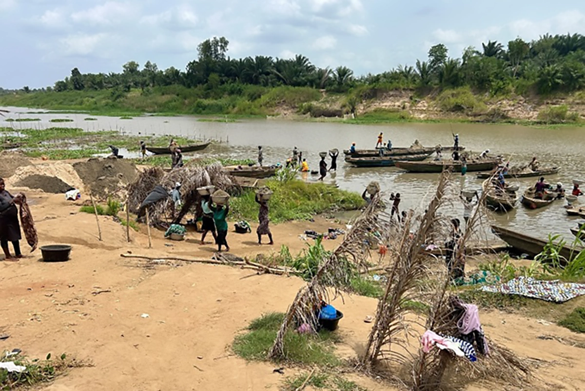
The Ouémé River extends approximately 500 km from its source in the Atakora Mountains to its outlet in the Gulf of Guinea and plays a central role in Benin’s hydrological system. Seasonal changes between dry and wet periods strongly influence river dynamics and daily life along its banks, supporting activities such as fishing and sand extraction.
The survey focused on two areas: a six-kilometer stretch around the Bonou gauging station and the region near the Zou River inflow at Dasso. Each site was subdivided into ten cross sections to support detailed hydrometric observations under varying flow and channel conditions.
Access and Measurement Constraints in Remote Tropical River Sections
Despite favorable hydrological conditions during the transition between dry and rainy seasons, the survey posed significant logistical challenges. The Zou inflow area was particularly remote, with perennially vegetated floodplains that limited ground access to cross sections. Dense tropical vegetation and high temperatures further complicated field operations.
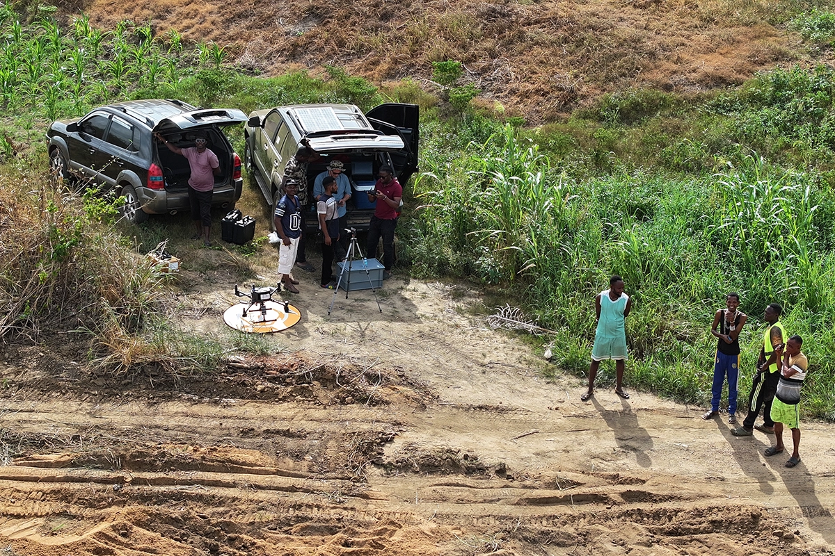
Traditional ground-based access methods proved impractical for many locations. Reaching cross sections on foot would have required extensive clearing, while transporting equipment through floodplains was time-consuming and physically demanding.
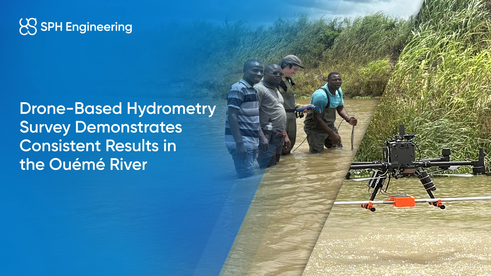
Drone-Based Hydrometry Survey Supported by In-Situ Measurements
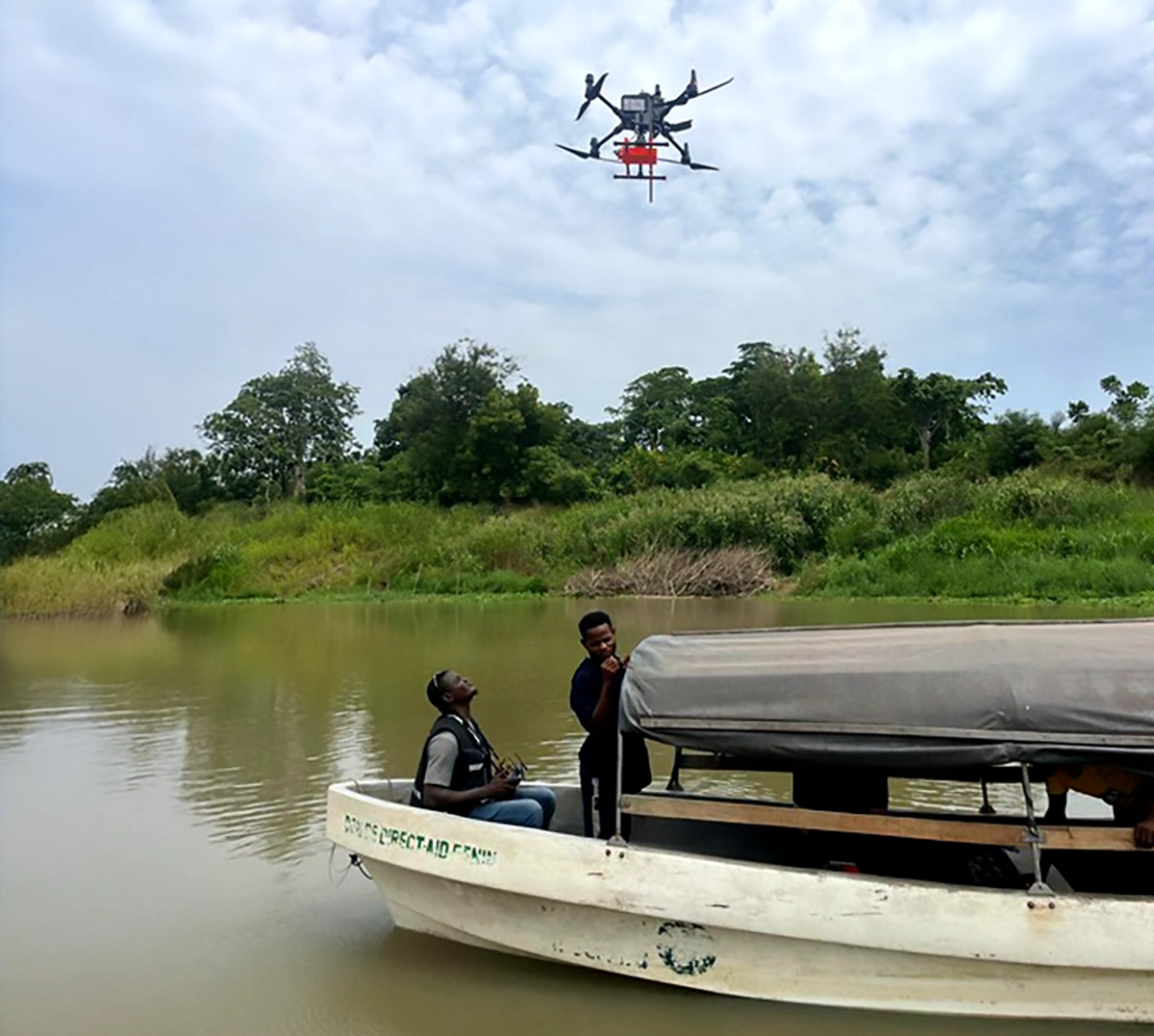
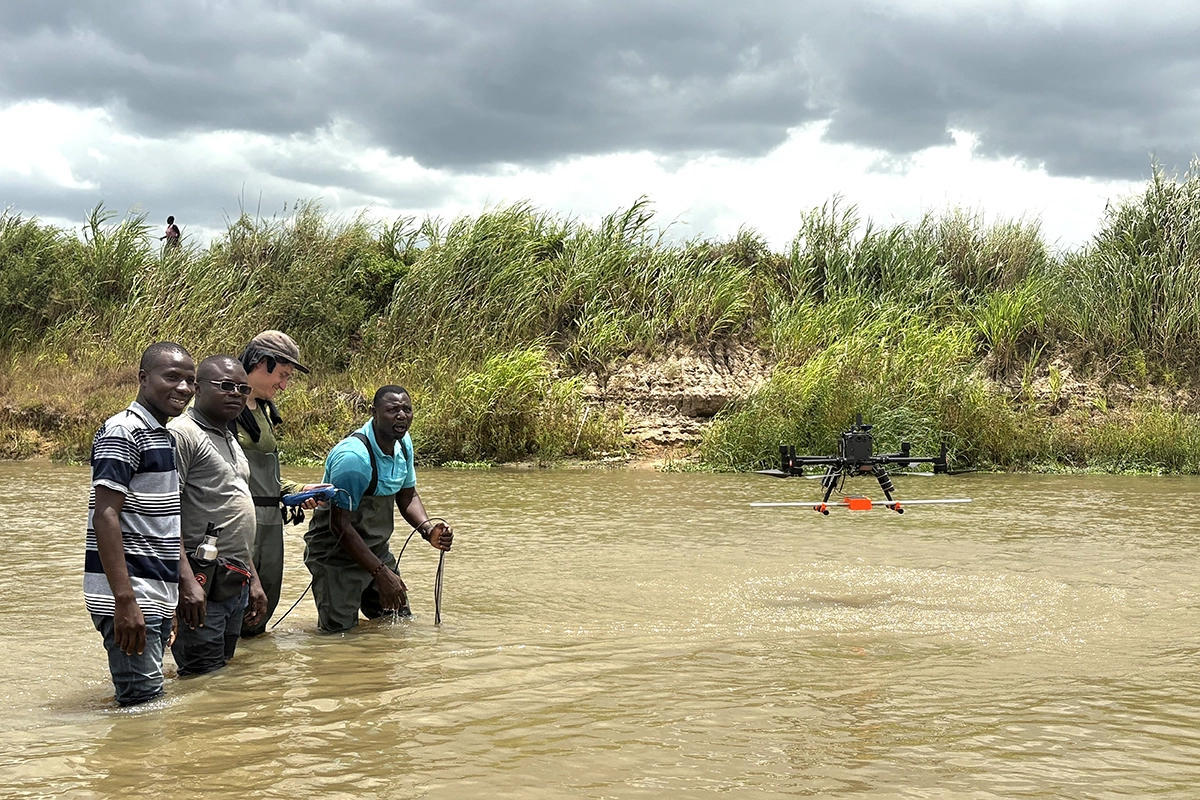
To address these constraints, the UAWOS team deployed UAS-based hydrometry systems and operated drones directly from boats. This approach enabled efficient movement between cross sections while reducing physical exposure to heat and vegetation.
Drone-based measurements included:
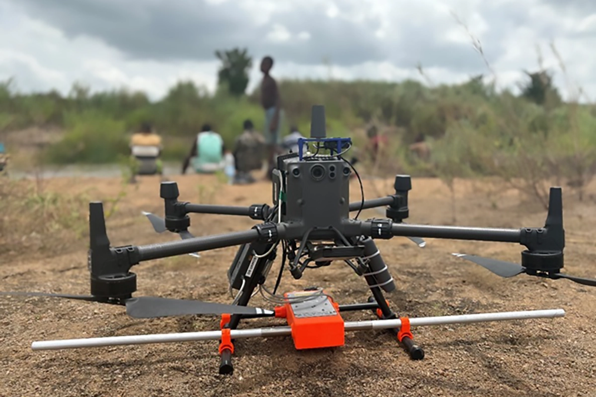
- Orthophotos and LiDAR coverage of both survey areas
- Water surface elevation measured using radar altimetry
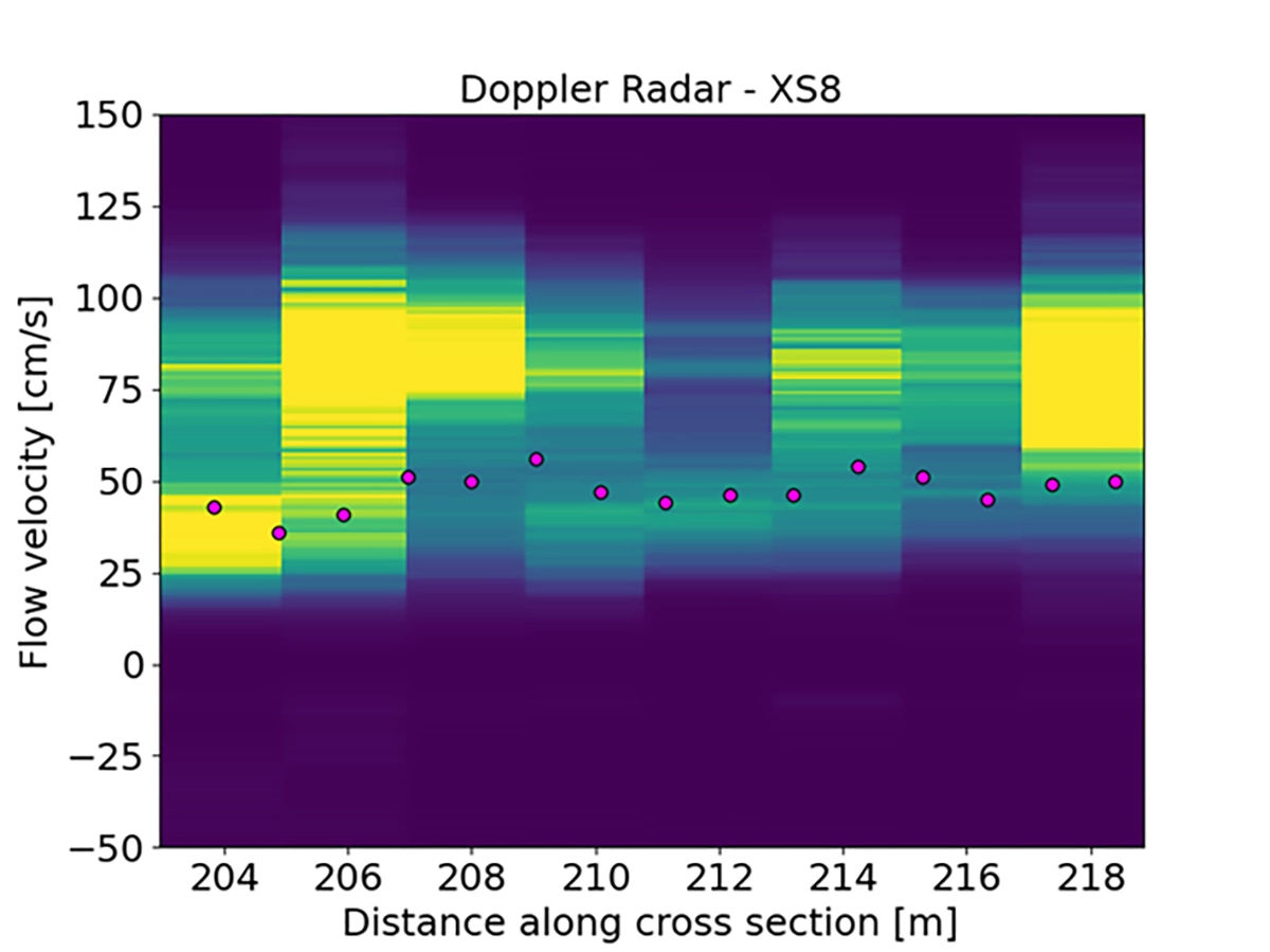
- Flow velocity captured with Doppler radar
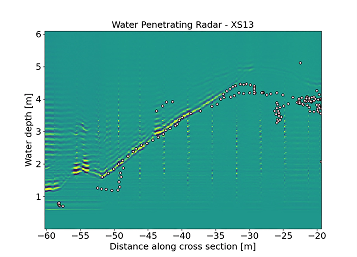
- Riverbed geometry mapped using SPH Engineering’s integrated WPR system
Traditional in-situ measurements were conducted in parallel for validation purposes, including:
- Velocity measurements using ADCP and Ott MF-Pro
- Bed geometry mapping with sonar
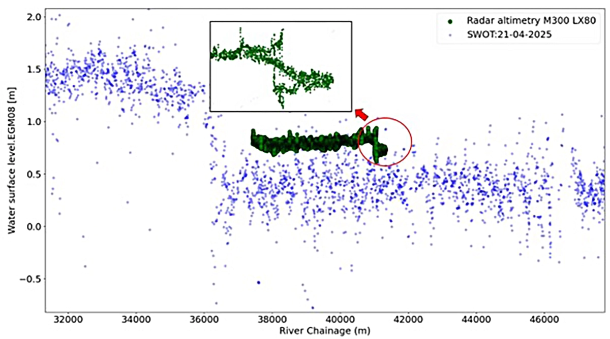
- Water surface elevation reference from satellite altimetry (SWOT)
Consistent Results Between Drone-Based and Traditional Hydrometric Measurements
All selected cross sections were successfully surveyed within a four-day period. Initial data processing shows strong consistency between drone-based and traditional measurements for velocity, bed geometry, and water surface elevation.
Notably, radar-based water surface elevation measurements captured small-scale variations that were not resolved by satellite altimetry. This highlights the capability of UAS-based sensors to deliver high-resolution hydrometric data in complex river environments.
Conclusion
The Ouémé River survey demonstrates the effectiveness of UAS-based hydrometry for collecting high-resolution river data in remote and vegetated environments. By combining airborne radar measurements with targeted in-situ validation, the UAWOS team achieved reliable hydrometric results while improving operational efficiency and site accessibility. The campaign confirms the value of drone-based approaches for river monitoring in tropical regions where traditional methods face significant limitations.