
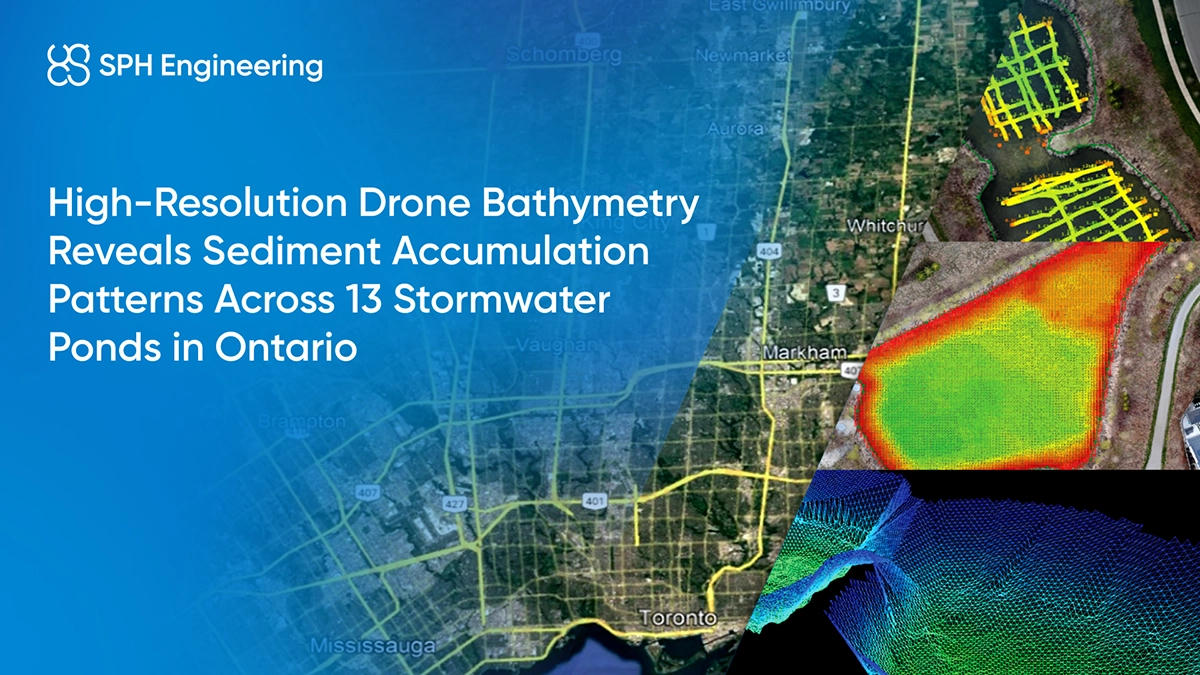
Quick Facts
- Partner: Altomaxx Technologies
- Location: Ontario, Canada
- Survey Challenge: Safely and efficiently measure water and sediment depths across multiple small, vegetation-dense stormwater ponds where vessel-based surveys are impractical.
- Bathymetry Solution: Drone-based bathymetry using a DJI Matrice 300 RTK with an EchoLogger ETC D052S dual-frequency echo sounder, manual flight acquisition, and post-processing in Hydromagic.
- Key Result: High-density bathymetric models were generated for 13 ponds, including detailed sediment-volume estimation and elevation-based surface reconstruction.
- Applications: Stormwater infrastructure assessments, sediment-accumulation analysis, municipal engineering support.
Background: Bathymetry Needs in Municipal Stormwater Management
Stormwater ponds play a critical role in municipal water management by controlling runoff, reducing flood risk, and trapping sediment before it reaches downstream systems. Their performance depends on maintaining adequate storage capacity and understanding how sediment accumulates over time. Municipalities periodically reassess these basins to confirm that depth profiles still match engineering design expectations and to determine if dredging or maintenance is required.
Accurate bathymetric and sediment-depth information is essential for long-term planning, yet many stormwater ponds differ widely in size, shape, access conditions, and environmental characteristics. These factors influence the selection of suitable survey methods and the level of detail required for reliable modelling and comparison.

The Challenge: Obtaining Precise Depth and Sediment Data in Restricted Pond Conditions
The project required high-resolution measurements of water depth, sediment thickness, and total pond volume across 13 stormwater basins in King City, Nobleton, and Schomberg. Many of these ponds presented restrictive physical conditions that made data acquisition difficult. Several sites were small, irregularly shaped, or surrounded by thick vegetation, while others had uneven or unstable shorelines with no safe place to enter the water.
Traditional bathymetry that uses manned or remote-controlled vessels (USVs) often fails in these environments because:
- There is too little maneuvering space for stable navigation
- Vegetation around the shoreline blocks access
- Launching and retrieving a vessel is unsafe or impossible
- Boat propellers risk damage from submerged plants and debris
The municipalities needed consistent, engineering-grade bathymetric data, yet the physical and safety constraints prevented conventional vessel-based approaches from delivering the required accuracy or efficiency.
The Solution: Dual-Frequency Drone Bathymetry for Precise Water and Sediment Mapping
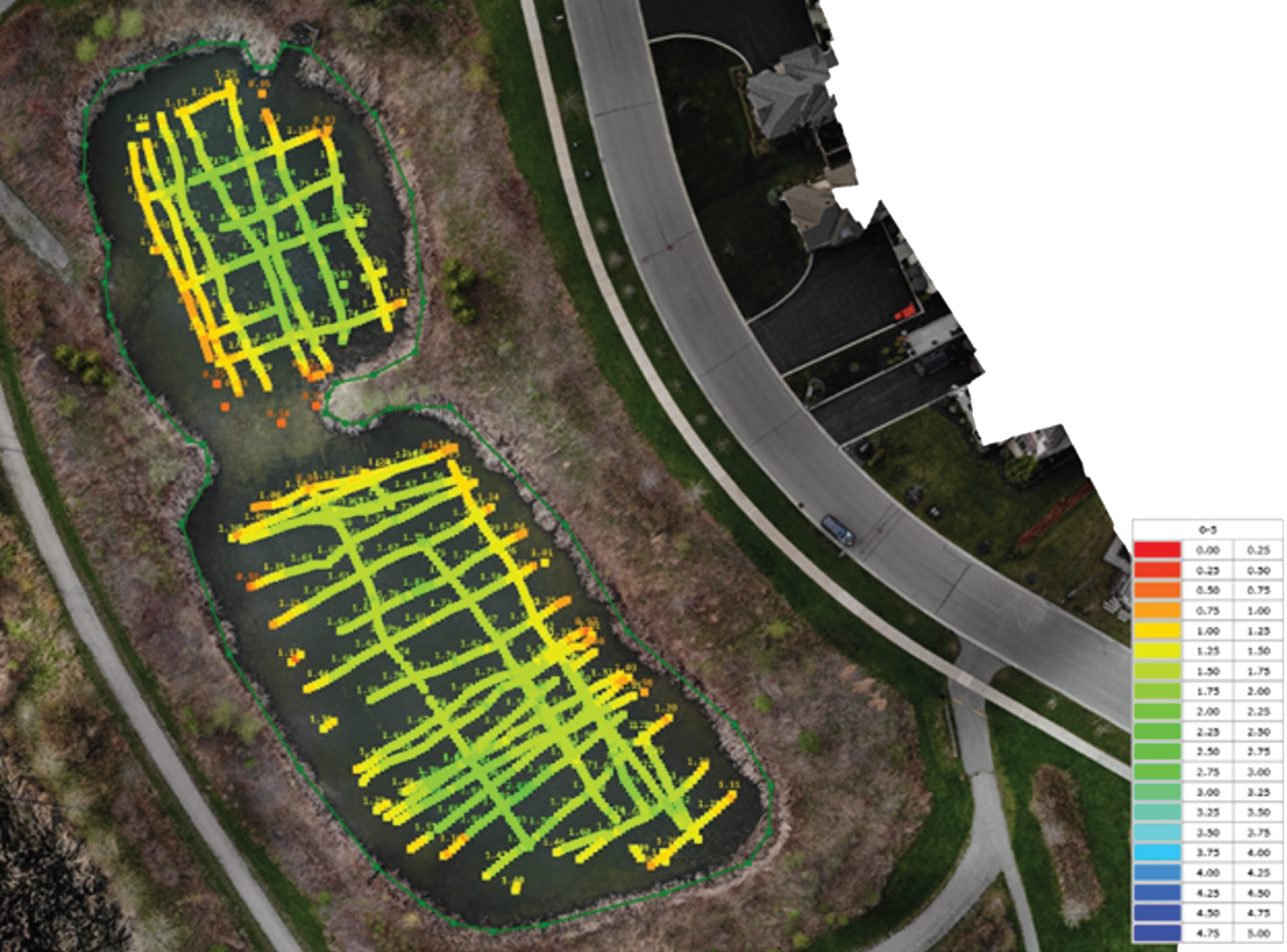
Altomaxx deployed a drone-based bathymetry system to overcome the limitations of vessel operations. The DJI Matrice 300 RTK carried the EchoLogger ETC D052S echo sounder, which captures both low-frequency (50 kHz) and high-frequency (200 kHz) acoustic returns to separate water-column depth from soft sediment layers. Manual flights allowed the team to maintain control near vegetation and pond edges.
Key elements of the survey approach included:
- Two-meter flight-line spacing for high-density spatial coverage
- Emlid GNSS base with NTRIP correction to improve positional accuracy
- Emlid rover measurements to record water-surface elevations for elevation-based outputs
- Hydromagic software supporting GPS adjustment, noise filtering, TIN model generation, and final interpretation
This configuration enabled accurate mapping in areas where traditional bathymetry would be unsafe or infeasible.
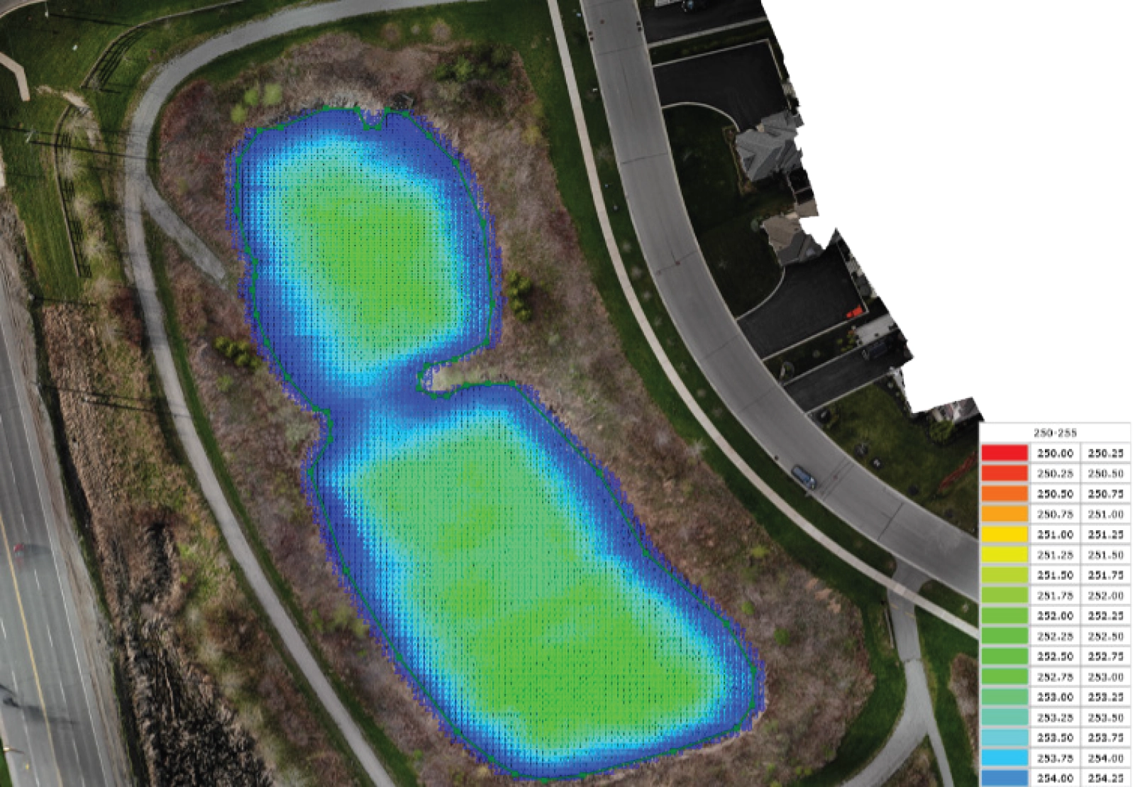
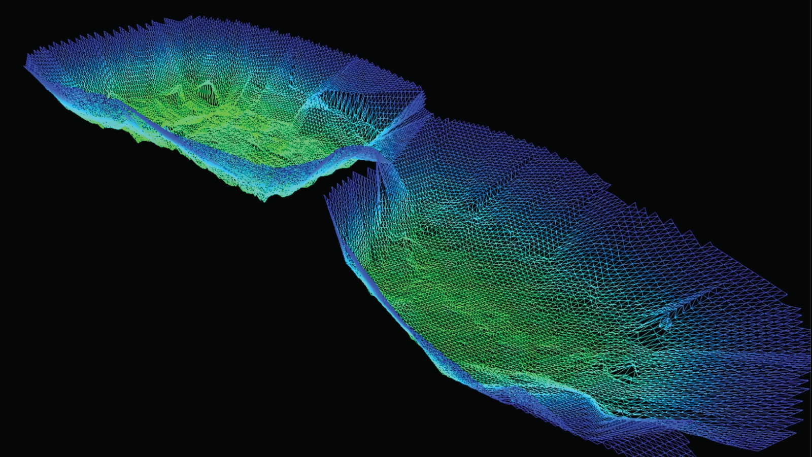
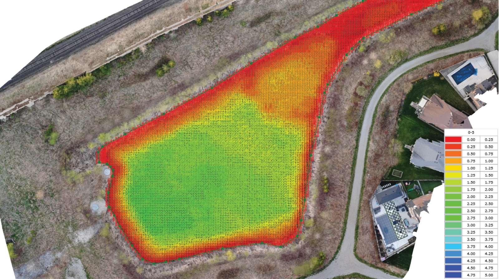
The Results: Detailed Elevation Models and Quantified Sediment Volumes
The drone-based approach delivered high-resolution bathymetric datasets for all 13 stormwater ponds. The dense acoustic returns and processed elevation surfaces provided clear visual and quantitative insights into underwater topography, sediment accumulation, and long-term changes relative to design drawings.
Notable outcomes included:
- Most ponds showed minimal sediment accumulation, consistent with expected performance
- One pond showed significant sediment infill, with 10,477 m³ of total pond volume and 7,512 m³ of sediment
- A Delta Matrix, (differential map derived from low- vs high-frequency data), clearly highlighted sediment distribution zones
- Municipal stakeholders gained accurate models for capacity evaluation, environmental planning, and maintenance scheduling
- Field efficiency improved substantially: ponds that would require a full day with vessel methods were surveyed safely within a few hours
Conclusion
Drone-based bathymetry provided a safe, accurate, and efficient method for evaluating the condition of stormwater ponds across multiple Ontario communities. The rapid deployment of a drone-mounted dual-frequency echo sounder allowed Altomaxx to capture detailed water-column and sediment information in areas inaccessible to traditional survey vessels. The resulting elevation-based models enabled municipalities to assess sediment accumulation, verify engineering designs, and better understand long-term pond performance.