
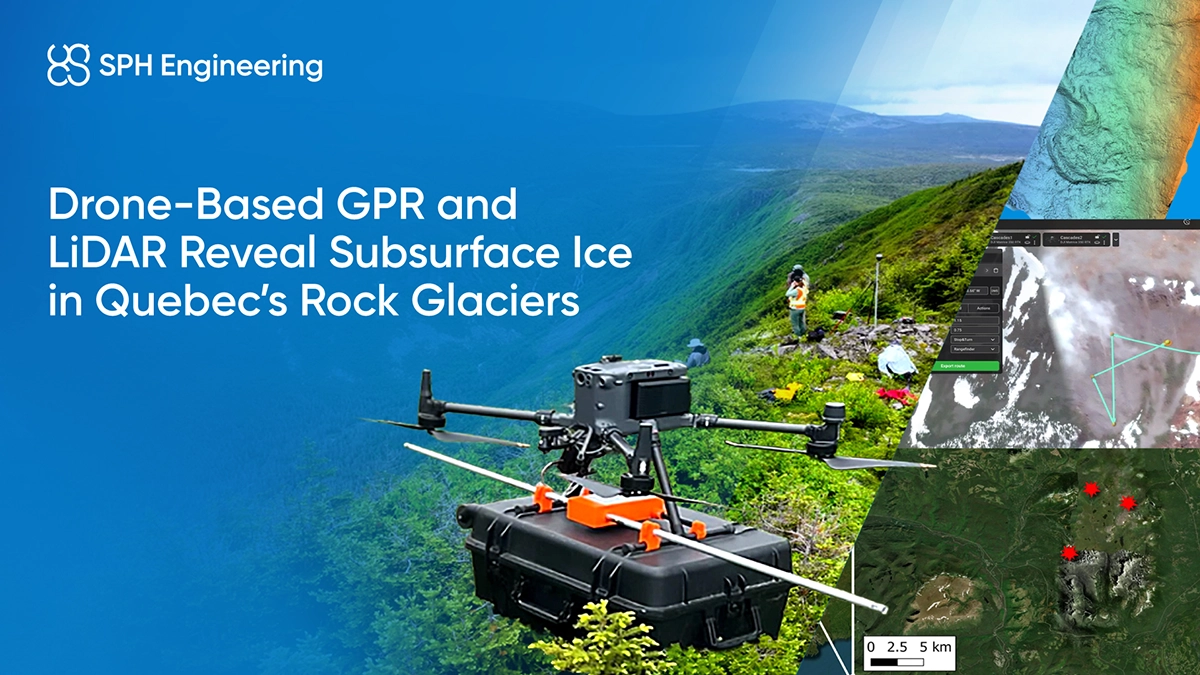
SPaRS-Lab surveyed several rock glaciers in Quebec’s Chic-Choc Mountains using a combination of UAV-mounted GPR and LiDAR. The team acquired detailed surface and subsurface datasets in terrain inaccessible to traditional methods. The results revealed complex internal layering and zones of possible ice enrichment. This approach demonstrates an efficient, safe method for monitoring climate-sensitive alpine environments.
Quick Facts
- Institution: SPaRS-Lab, University of New Brunswick
- Partner: Measur
- Location: Chic-Choc Mountains, Gaspé Peninsula, Quebec, Canada
- Challenge: Remote, vegetation-covered alpine terrain preventing conventional permafrost surveys.
- Solution: SPH Engineering’s integrated UAV GPR Kit that includes UgCS flight planning software, SkyHub drone onboard computer, and Zond Aero LF GPR.
- Tech Stack: UgCS Flight Planning, SkyHub (Onboard Computer), Zond Aero LF (GPR), DJI M350 RTK, DJI Zenmuse L2 (LiDAR).
- Key Result: High-resolution DEMs and radargrams, GPR penetration depths up to ~20 m, and an integrated 3D dataset of rock glacier morphology and internal structure.
- Applications: Permafrost research, climate monitoring, glacial geomorphology, risk assessment.
Background: Why Use Drone GPR for Permafrost and Rock Glacier Monitoring?
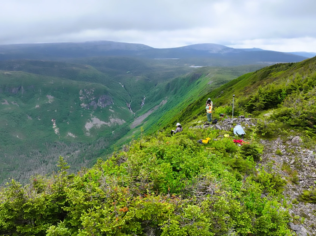
Rock glaciers provide vital insights into permafrost evolution and regional climate history, but many remain poorly documented due to steep terrain, long approach hikes, and dense vegetation. Traditional ground-based GPR and terrestrial mapping tools are often impractical or unsafe in these environments.
UAV-mounted geophysical sensors such as drone-based GPR, offer a way to obtain high-resolution subsurface data without placing crews into hazardous terrain. By combining aerial imaging with deep-penetration radar, researchers can analyze both the surface morphology and the internal structure of alpine periglacial features.

The Challenge: Alpine Geophysical Surveys in Inaccessible Terrain
The Chic-Choc Mountains feature rugged topography, inaccessible valleys, and dense subarctic forest cover. These conditions prevent the deployment of cart-based or handheld GPR systems.
To understand the evolution and internal composition of local rock glaciers, SPaRS-Lab needed:
- Accurate terrain models beneath thick vegetation
- Subsurface imaging deep enough to resolve ice-rich zones
- Safe low-altitude radar flights across uneven, rocky slopes
- A system light enough to hike several kilometers to survey sites
Without UAVs, acquiring these datasets would have required unsafe or prohibitively slow ground-based operations.
The Solution: Integrated UAV GPR and LiDAR Workflow

To meet these challenges, SPaRS-Lab deployed a multi-sensor drone workflow integrating geophysical and remote sensing tools.
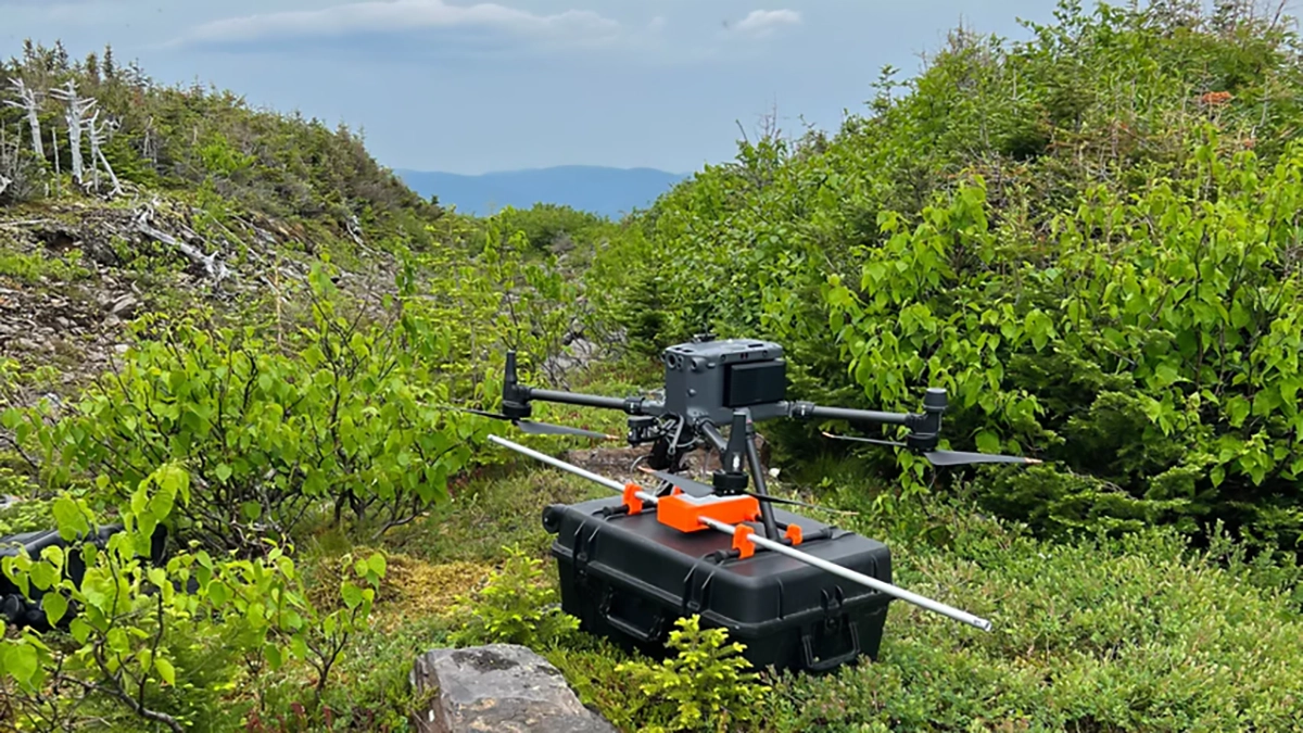
Drone-Based Zond Aero LF GPR (by SPH Engineering)
- Provided low-frequency (100-300 MHz) for deep scanning.
- Delivered clear radargrams showing internal layering and reflectors.
- Enabled subsurface imaging of up to 12-20 m under favorable conditions.
- Mounted on a DJI M350 RTK using the SkyHub onboard computer for stable, repeatable acquisition
LiDAR & Photogrammetry
LiDAR and optical data were used to generate high-resolution DEMs and orthophotos. These surface models provided structural context for interpreting the radar data.
This combination of UAV platforms, the Zond Aero LF GPR, the LiDAR payload, and GNSS, allowed researchers to integrate terrain models, radargrams, and structural interpretations into a unified geospatial dataset.
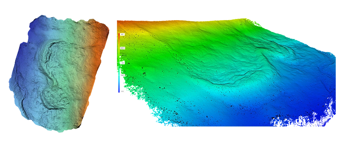
Results: 3D Surface Models and Deep Subsurface Ice Detection
High-resolution LiDAR terrain models
Dense point clouds (~450 pts/m²) revealed ridges, furrows, lobes, and deformation structures characteristic of rock glaciers.
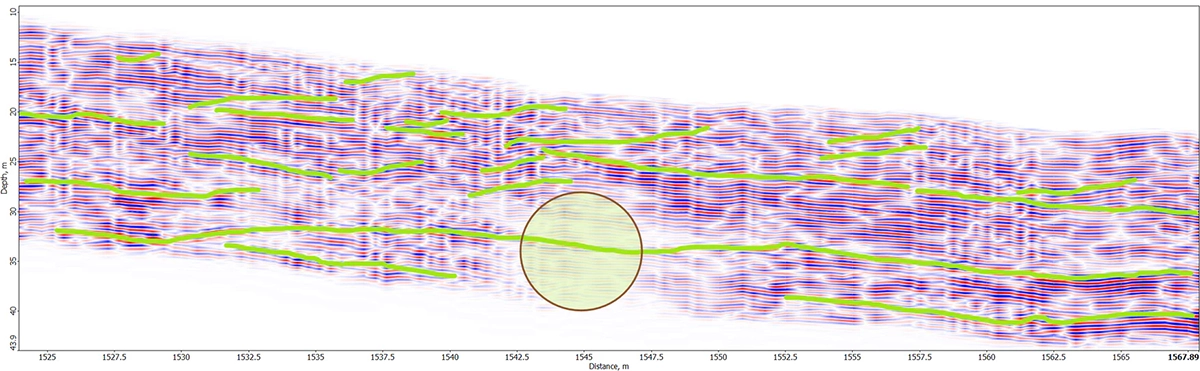
Subsurface ice and structural layering detected
GPR profiles showed inclined reflectors, disrupted layers, and high-amplitude zones indicating possible ice-rich permafrost or buried massive ice.
Deep penetration across varied terrain
The 100 MHz antenna achieved up to ~20 m penetration, delivering interpretable reflections even over rocky and organic-rich ground.
Reliable UAV performance in harsh conditions
Despite moderate winds and intermittent rain, the DJI M350 RTK maintained stable flight, while SkyHub ensured dependable radar operations at low altitude.
Comprehensive deliverables
- DEMs & point clouds
- Orthophotos & surface morphology maps
- GPR radargrams & interpreted subsurface layers
- Integrated 3D dataset for scientific analysis
"Without the aerial access capabilities of the remotely piloted aircraft, the type of data that was gathered simply could not have been collected." Dr. Kynan Hughson, University of New Brunswick’s Department of Earth Sciences
Conclusion
SPaRS-Lab successfully demonstrated that UAV-mounted geophysical sensors can provide detailed insights into rock glacier structure, ice content, and surface evolution in terrain where ground surveys are impossible. The deployment of UAV-mounted Zond Aero LF from SPH Engineering, with equipment supplied and supported by Measur, enabled deep subsurface imaging and high-accuracy mapping in remote alpine environments.
This approach establishes a scalable method for monitoring permafrost, informing climate research, and investigating geohazards in mountainous regions.