
Drone Methane Detection for Oil and Gas Facilities & Pipelines
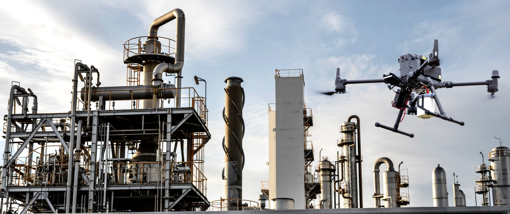
Drone methane gas detection lets you inspect pipeline corridors, compressor stations, well pads, tank batteries, and processing facilities for leaks without sending crews on foot or putting helicopters into hazardous airspace.
SPH Engineering's drone-mounted Falcon Plus TDLAS methane detector performs aerial LDAR, detecting methane from a safe distance, meeting EU 2024/1787 Type 2 LDAR detection thresholds. Plan flights in UgCS, fly with True Terrain Following through SkyHub, and process georeferenced emission data in DroneGIS.
Field-proven on a live gas pipeline in airspace where no helicopter could fly safely.
Aligns with US (EPA, CARB) and Canadian detection thresholds as well.
Runs on common heavy-lift drones, including Blue UAS Cleared List platforms for federal and security-sensitive sites.

Why Pipeline and Facility Methane Inspections Are So Hard to Do at Scale
Oil and gas operators face shorter LDAR inspection cycles and lower detection thresholds under tightening methane emission regulations. Existing methods of detecting fugitive emissions don't scale economically across thousands of miles of pipeline and dispersed facility networks. These problems show up on every operator's desk.

Helicopter inspections cost too much for routine LDAR
Manned aircraft inspections are fast but expensive, typically $1500 to $3000 per flight hour, and they cannot operate safely in congested industrial airspace. The Houston pipeline section that SPH Engineering surveyed in 2024 was unflyable by helicopter because of utility wires and tensioners at varying altitudes and angles. Drones replaced the manned aircraft entirely on that section.

Walking the line is slow and exposes crews to risk
Foot-based inspection covers a few kilometers per day. Crews work through swampland, dense vegetation, snowpack, and active facility yards. Slow coverage and crew safety risk both compound across thousands of miles of pipeline.

Methane is invisible and disperses fast
Without a sensor, you cannot see a leak. Once methane reaches the atmosphere, prevailing winds disperse the plume within minutes. Detection methods need fast response times and consistent measurement geometry, or they miss leaks between passes.

Tightening LDAR regulations push inspection frequency higher
The EU Methane Regulation calls for leak detection and repair (LDAR) Type 2 checks every 8 to 18 months. US programs under the EPA and California's CARB can require them as often as quarterly, and Canada mandates at least three inspections a year. Doing inspections more often and catching smaller leaks increases crew time and helicopter hours with each additional cycle.

Imprecise readings send crews chasing nothing
Vehicle-mounted sniffers and handheld detectors pick up background CH4 from wetlands, livestock, and upwind sources. Without precise geographic referencing of every reading, repair crews can spend days investigating false leads. Pinpoint coordinates separate real leaks from background noise.
How Drone Methane Detection Solution Helps Regulatory Compliance
Solution facilitates fast initial leak screening required to prioritize further detailed inspections according to regulation/standard.
| Region | Regulation/Standard | Emission Detection Threshold | Recommended Inspection Timeline |
|---|---|---|---|
| European Union (EU) | Regulation (EU) 2024/1787 (Type 2 LDAR) | Approx. 500 ppm (~1 g/h methane) | Compressor/Valve stations: 4-9 months; Pipelines: 12-24 months |
| EPA Method 21 | 500 ppm | Quarterly to annual | |
| Quad Oa (40 CFR Part 60 Subpart OOOOa) | 500 ppm | Semi-annual to annual | |
| CARB LDAR | 500 ppm | Quarterly to annual | |
| Canada (Federal) | Federal Methane Regulations (SOR/2018-66) | ≥500 ppm | At least 3 times per year |
What Drone-Based Methane Inspection Changes for Oil & Gas Operators
The Falcon Plus TDLAS methane detector sends out a laser beam tuned to a kind of light that only methane absorbs. Carbon dioxide and water vapor do not absorb it, so the sensor responds to methane alone, and other gases in the air will not cause a false reading. The drone carries the sensor, SkyHub tags every reading with a precise location and time, and UgCS plans the flight down to the meter. Together, they replace helicopter passes and ground walks with repeatable, automated inspections that record exactly where every reading was taken.
Cover terrain a vehicle can't reach and a helicopter shouldn't risk
Drone surveys reach pipeline sections through swamp, dense brush, and tight industrial corridors. They handle airspace strung with wires and tensioners at multiple heights, where a helicopter cannot safely fly. The same drone inspects compressor stations, well pads, and tank batteries with no changes.
Real-time leak alerting during the flight
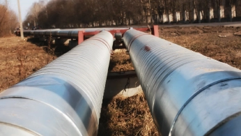
The Falcon Plus reports column density (ppm·m) every 25 ms. UgCS flight planning software displays each reading on the live map during the flight, so the operator sees suspect locations before landing. No waiting for post-processing to know where to deploy a repair crew.
RTK georeferencing for repair-ready coordinates
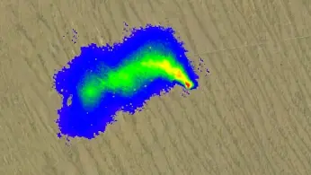
Every methane reading gets a precise GNSS coordinate from RTK-corrected drone positioning, recorded by SkyHub. Each spike in PPM·m corresponds to a known location, accurate to centimeters. Repair crews navigate directly to the source instead of walking the line.
Documentation built for regulatory submissions
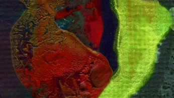
DroneGIS automatically extracts active survey lines, removes turn and transit segments, cleans sensor noise, and renders an emission map over satellite or orthophoto imagery. Output formats include CSV, KML, georeferenced raster, and report-ready PDF. Documentation partially complements EU 2024/1787 reporting, EPA Quad Oa (OOOOa) filings, CARB LDAR submissions, and internal audits.
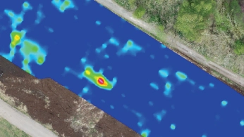
One workflow across pipeline ROW, compressor stations, well pads, and processing facilities
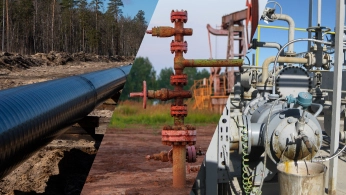
The same drone, sensor, and software inspect every asset class in an oil and gas portfolio. Pilots learn one system. Repair crews work from one consistent data format. Asset managers see one set of emission maps across the network.
Blue UAS options for federal and security-sensitive sites
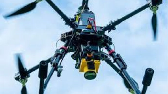
Federal pipelines, military energy infrastructure, and security-sensitive midstream facilities can deploy the Falcon Plus on Wispr Ranger Pro, Inspired Flight IF1200A, or Harris Aerial H6 platforms, all on the Blue UAS Cleared List. Same sensor, same flight planning, same data format.
How Drone Methane Detection Works, From Mission Plan to Repair Order

Plan in UgCS
Import the pipeline corridor (KML or shapefile) or facility boundary into UgCS. Set the survey grid. UgCS handles battery segmentation for long missions and multi-segment flights to maintain visual line of sight along extended ROW.

Fly with True Terrain Following
SkyHub maintains constant altitude above ground using a laser or radar altimeter. This keeps the laser path length consistent across the entire survey, which is essential for reliable methane readings. The drone executes the grid autonomously while the operator monitors flight and live data on the controller.

Detect leaks in real time
The Falcon Plus TDLAS sensor emits an infrared laser at 1.653 µm. When the beam crosses a methane plume, the gas absorbs energy at that exact wavelength and the sensor logs the reading as PPM·m.

Log georeferenced data with SkyHub
SkyHub records every methane reading along with the drone's position, altitude, attitude, and timestamp. Output formats include CSV, KML, and full mission logs. The system runs offline. No internet connection is required during the survey.

Process in DroneGIS and generate compliance documentation
Upload the data files to DroneGIS. The platform extracts active survey lines, removes turn and transit data, cleans sensor noise, and renders an emission map over satellite or orthophoto imagery. Export to GIS-compatible formats for integration with asset management systems and regulatory submissions.

Recommended Solutions
Methane Detection Kit
HARDWARE
Drone and robot-mounted methane sensors, available in laser-based (TDLAS) and direct-sampling (sniffer) configurations, detect and localize fugitive emissions across pipeline corridors, wellheads, and industrial facilities.
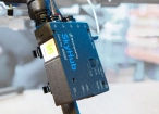
SkyHub is a drone onboard computer that ensures reliable sensor integration and precise, synchronized data collection during every flight.
SOFTWARE

Desktop drone flight planning for the most demanding pilots

Drone survey data management and GIS visualization platform
TRAINING

Advanced technical training and expert support to elevate your team’s expertise and ensure precise, efficient execution of your drone-mission tasks.
Why Oil & Gas Operators Choose Our Methane Detection Solutions

Methane-Specific Readings
Falcon Plus uses a TDLAS laser tuned to methane absorption, so crews can focus on CH₄ fugitive emissions indications instead of unrelated atmospheric signals. For LDAR teams, this means fewer false leads and faster prioritization of suspected fugitive emissions.

See Suspect Locations in Real Time
Methane readings appear during the flight, so pilots can identify suspect areas before landing. Instead of waiting for overnight processing, inspection teams leave the site with mapped indications ready for follow-up checks.

Inspect Live Assets Without Shutdowns
The sensor reads methane from 10 to 80 m away, allowing drones to screen pressurized pipelines, compressor stations, well pads, tank batteries, and processing areas from a safe standoff. Operators can inspect active infrastructure without sending crews into higher-risk zones.

Emission Maps for LDAR Records
DroneGIS converts survey data into georeferenced emission maps by extracting active survey lines, cleaning sensor noise, and visualizing readings over satellite or orthophoto layers. The outputs can support internal audits, repair planning, and regulatory reporting workflows under EU 2024/1787, EPA Quad Oa, CARB, and similar programs.
Methane detection results according to laboratory tests
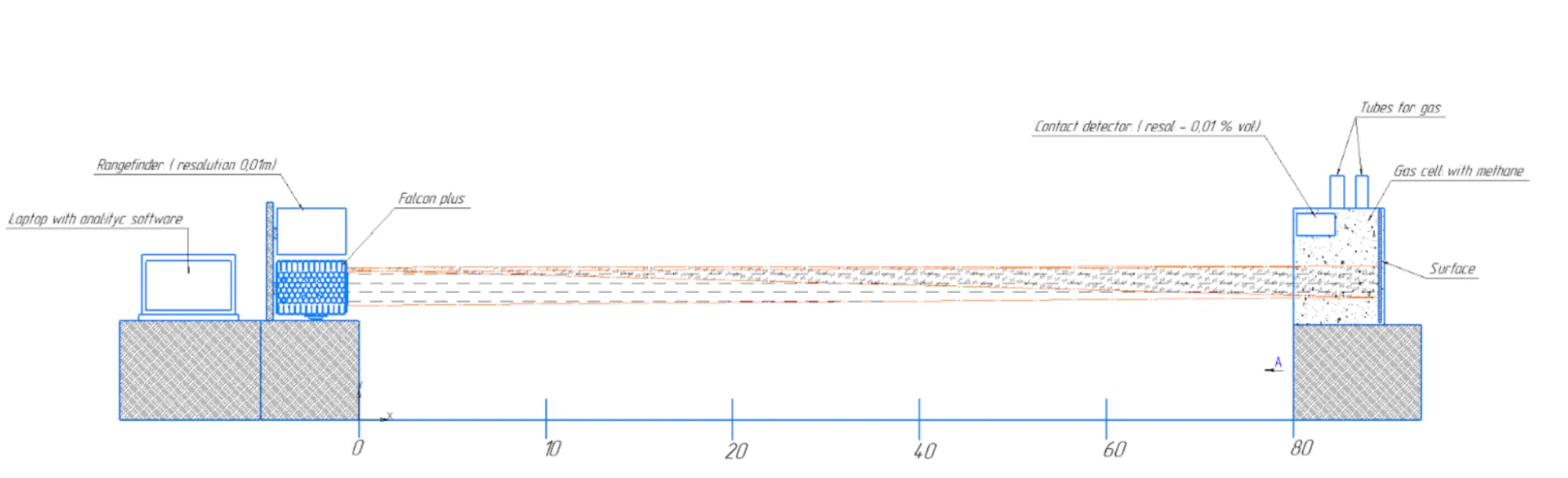
Extensive testing was performed to confirm sensor detection capabilities at different distances and different methane concentrations.
General test conditions:
- Weather information: Wind 4-6 m/s. Partly cloudy. Temperature 14 degrees Celsius
- Reflective surface: Cardboard with reflectance at 1653 nm approx 20-40%. For the reference grass reflectance is 40-60%.
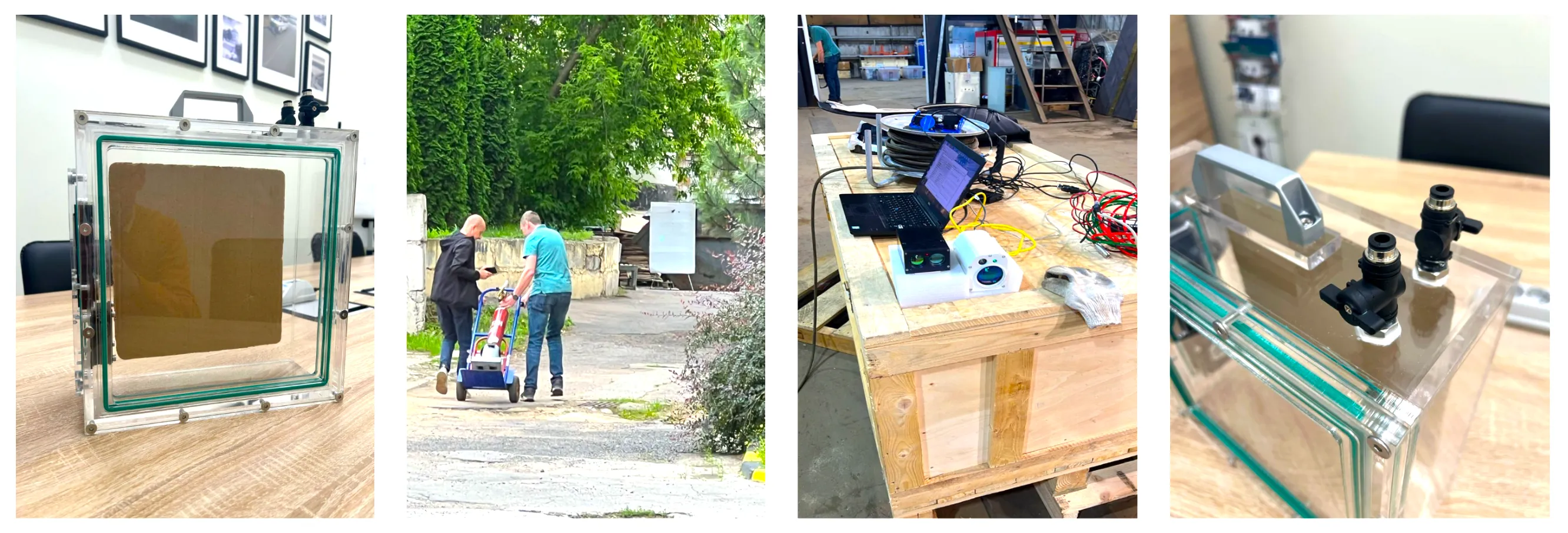
Test 1.
Detection with methane gas cell
| 10 | 20 | 40 | 60 | 80 | ||
|---|---|---|---|---|---|---|
| VOL% | PPM | |||||
| 0.01% | 100 | 18 | 20 | 38 | 13 | - |
| 0.02% | 200 | 42 | 49 | 54 | 52 | - |
| 0.05% | 500 | 120 | 108 | 118 | 123 | 70 |
| 0.10% | 1000 | 197 | 205 | 190 | 215 | 200 |
| 0.50% | 5000 | 980 | 870 | 1010 | 850 | 790 |
| 1.50% | 15000 | 3700 | 3600 | 3550 | 3200 | 3250 |
Test 2.1.
Detection with a gas cloud from an artificial gas leak

| 10 | 20 | 40 | 60 | 80 | ||
|---|---|---|---|---|---|---|
| L/min | gr/h | |||||
| 0.5 | 20 | 120 | 148 | 130 | 150 | 129 |
| 1 | 40 | 250 | 150 | 320 | 219 | 180 |
| 2 | 80 | 2300 | 1890 | 2100 | 190 | 460 |
Test 2.2.
Detection with a gas cloud from an artificial gas leak with a precision rotameter
| gr/h | 70 | 53 | 7 | 6.6 | 6 | 3.2 | 2.8 | 1 |
|---|---|---|---|---|---|---|---|---|
| Distance, m | ||||||||
| 35 | 1500-2000 | 400-650 | 50-170 | 40-150 | 40-120 | 40-90 | 0-50 | - |
Comparison with Car- and Helicopter-based TDLAS surveys
| Car | Drone | Helicopter | |
|---|---|---|---|
| Average km/day | 200-300 | 80-100 | 500-700 |
| Terrain | Roads | Any | Any |
| Cost, hour | Medium | Low | High |
| Survey automation | Manual driving | Automatic | Manual piloting |



Drone Methane Detection for Landfill Sites
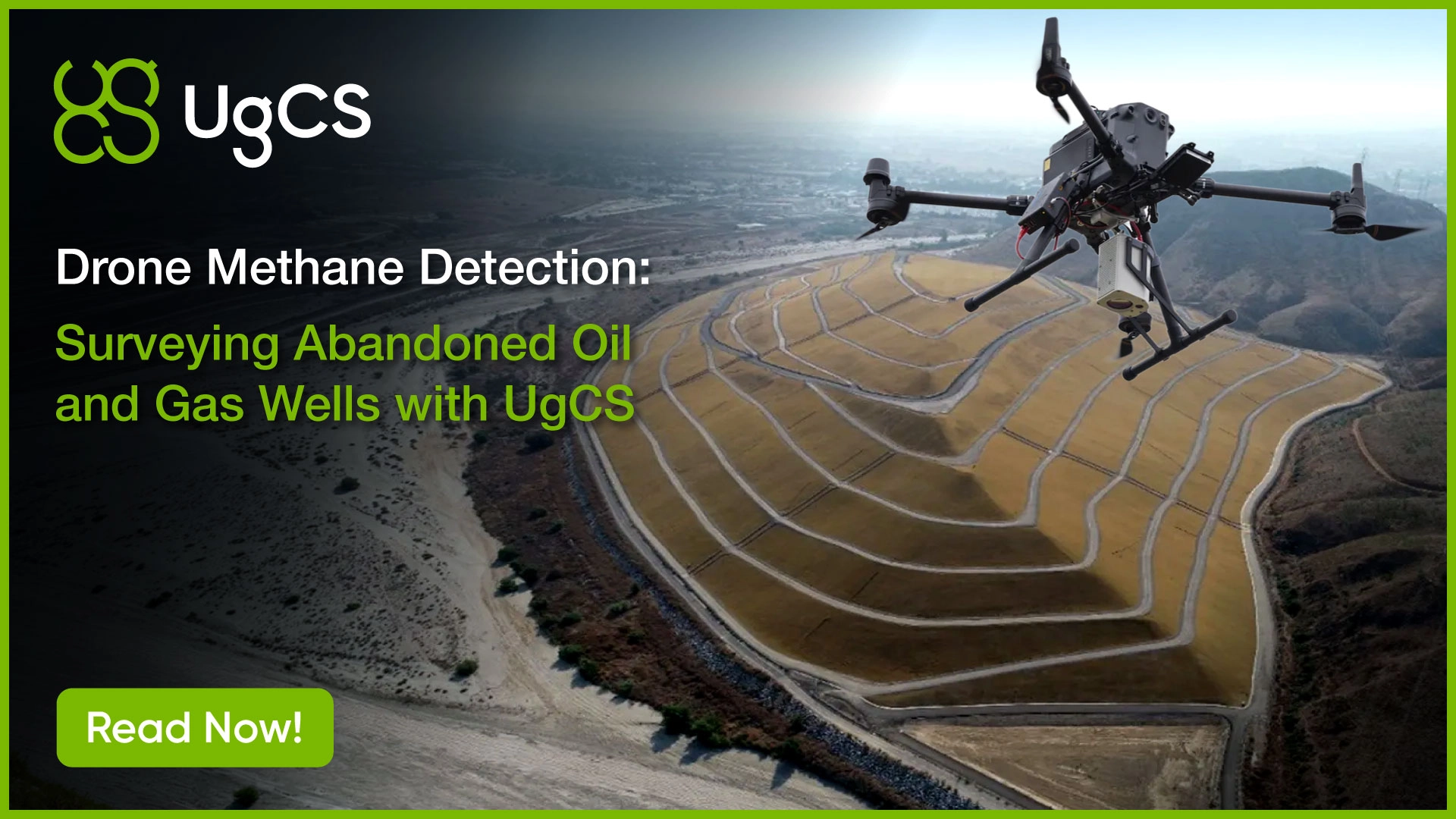
The same drone and Falcon Plus setup that screens oil and gas assets also works over landfills. The drone flies a grid across the site, the laser logs methane along its path, and DroneGIS turns the readings into an emission map that shows where landfill methane is escaping and how strong each source is.
Landfill operators use this to support gas-control obligations under the EU Landfill Directive, the US EPA Landfill Methane Outreach Program (LMOP), and Canadian provincial guidelines, and to cut both environmental impact and regulatory risk. Screening fugitive methane from the air covers the whole site faster than walking it and reaches areas that are awkward or unsafe to inspect on foot.


.jpg)

Trusted by Drone Operators in Energy and Industrial Inspection






%202.svg)
_black%201.svg)





What Operators Say About Our Methane Gas Detection System

It was the most complex airspace I've ever flown, with wires and tensioners at all altitudes, angles, and directions. The DJI M350 and Laser Falcon methane detector performed exceptionally, proving that even the most challenging environments can be surveyed safely and effectively with the right technology.
Watch Our Methane Inspection Webinars


.jpg)
Drone Methane Detection FAQs
What detection threshold does the Falcon Plus achieve, and which regulations does that meet?
Pergam laboratory tests confirm the Falcon Plus reliably detects 500 ppm methane at distances of at least 40 m, and 1000 ppm at distances of at least 60 m. The 500 ppm at 40 m specification meets the EU 2024/1787 Type 2 LDAR detection criterion for above-ground inspections. The 1000 ppm at 60 m specification meets the same regulation's Type 2 criterion for underground inspections. The 500 ppm threshold also aligns with EPA Method 21, EPA Quad Oa (40 CFR Part 60 Subpart OOOOa), CARB LDAR, and Canada's federal SOR/2018-66 requirements.
Can drone methane inspection replace helicopter LDAR?
For long pipeline corridors over open terrain, helicopters still cover more kilometers per day (500 to 700 km vs 80 to 100 km for drones). The economic case for drones is in the segments where helicopters cannot operate safely (congested industrial airspace, dense vegetation, populated areas), in localized facility inspections (compressor stations, well pads, tank batteries), and in routine LDAR cycles where helicopter cost per inspection becomes the bottleneck. The Houston, TX project specifically used a drone because the airspace was unflyable for a manned aircraft.
How does drone methane inspection compare in cost to helicopter LDAR?
A helicopter has a high fixed cost per flight, a pilot, fuel, and mobilization, but covers a lot of ground per day, so it stays useful for very long, open corridors where coverage speed matters most. A drone has little of that overhead: a small crew launches it on site and it flies the route on its own, keeping the cost per inspection low. Its limit is range, since it covers far less distance per day. So the drone is usually the more economical choice for localized assets like compressor stations and well pads, for congested or inaccessible sites, and for repeat LDAR cycles where a low per-inspection cost adds up over the year.
What is the difference between methane screening and methane quantification?
The Falcon Plus performs screening, which means locating methane emission sources and ranking them by relative intensity for further analysis. Screening is what most LDAR programs require: find the leak, prioritize repair. Quantification means determining the emission rate (mass or volume per unit time) and requires either direct flow measurement at the source or modeling-based estimation. The Falcon Plus is not a quantification tool. For programs that require quantification, the screening output is paired with a follow-up quantification method on located leaks.
How does the Falcon Plus compare to optical gas imaging (OGI) cameras?
OGI cameras render methane as a visible plume in an infrared video, so detection depends partly on what the operator sees on screen. The Falcon Plus uses TDLAS, which returns a numeric column-density reading (ppm·m) for each point along the laser beam, giving a consistent, position-tagged value the software can map and rank on its own. Both are screening methods rather than quantification tools, so the practical difference is a numeric per-point reading versus a visual plume image.
What is the practical drone survey speed for a long pipeline corridor?
The Falcon Plus has a maximum survey speed of 30 m/s , in practice limited by the drone platform's safe cruise speed and battery endurance. The DJI M350 carrying the Falcon Plus and SkyHub flies for approximately 20 to 30 minutes per battery. For long corridor segments, UgCS supports multi-segment missions with battery swap waypoints, so coverage continues from where the previous segment ended without gaps.
What drones are compatible with the Falcon Plus methane detection system?
Compatible drones include DJI M300 RTK, DJI M350 RTK, DJI M600, Inspired Flight IF1200A, Harris Aerial H6, Wispr Ranger Pro, SkyFront Perimeter 8, and others. The Wispr Ranger Pro, IF1200A, and H6 are on the Blue UAS Cleared List for U.S. federal and security-sensitive operations.
What does the operator see during the flight?
UgCS shows the live flight path and drone status. Each methane reading appears on the screen, so the pilot can see suspect locations during the survey, before landing.
What output formats does the system produce for regulatory submissions?
The Falcon Plus and SkyHub export readings as CSV (raw measurements with timestamps and coordinates), KML (visual overlay for Google Earth and similar tools), and full mission logs. DroneGIS post-processing produces emission maps as georeferenced raster layers, GIS-compatible vector formats, and report-ready PDFs. These outputs support EU 2024/1787 reporting, EPA Quad Oa filings, and CARB LDAR submissions.
Does soil moisture, vegetation, or wind affect detection?
Wind is the most significant variable. Methane disperses with prevailing winds, so survey planning should account for wind direction and speed. Pergam's laboratory tests were conducted at 4 to 6 m/s wind. Low vegetation almost does not affect methane survey. Soil moisture itself does not directly affect TDLAS detection because the laser only measures atmospheric methane, not subsurface gas.
Can the system find sub-500 ppm leaks?
The Falcon Plus's laboratory-confirmed sensitivity threshold for detection in ideal conditions is approximately 500 ppm at 40 m (1 g/h methane flow rate). Smaller leaks may be detected at shorter distances or under favorable wind conditions, but routine LDAR programs should plan around the 500 ppm specification because it aligns with the regulatory threshold (EU 2024/1787 Type 2, EPA Method 21, EPA Quad Oa, CARB LDAR, SOR/2018-66) anyway.
Is drone methane inspection allowed on operating oil and gas facilities?
Drone operations on operating facilities require coordination with the site operator's HSE team, an approved flight authorization (FAA Part 107 in the U.S., EASA SORA in the EU, or equivalent national authorization elsewhere), and compliance with the operator's site safety plan. The Falcon Plus is eye-safe (Class 1 IR detection laser), so the laser does not introduce additional hazards. The Class 3R green pointer must be kept away from human eyes and is the operator's responsibility to manage during the survey. Flying above ATEX zones is subject to a separate approval as drone-based systems are not ATEX-certified.