
Drone-Based Open Pit Mine Mapping, Volumetrics and Slope Monitoring
SPH Engineering provides flight planning, terrain-following, and data management tools used to capture centimeter-accurate digital terrain models (DTMs), digital surface models (DSMs), and point clouds from drones for open pit mine surveying.
With UgCS flight planning software and DroneGIS, teams can map open pits and benches, measure stockpile and excavation volumes, run cut-and-fill calculations, and compare high-wall and slope geometry between survey campaigns for change detection. For sites where constant altitude above changing terrain is critical, SkyHub with a radar or laser altimeter enables True Terrain Following based on the actual surface below the drone.


Challenges in Open Pit Surveying Solved by UAV Technology
Open pit operations change shape constantly through excavation, blasting, and material movement. Often the highest-value survey areas are the least safe to reach on foot. Open pit mine surveying, volumetrics, and slope monitoring work run into the same recurring constraints around access, frequency, and data consistency.

Unsafe access to open-pit high walls
High walls can fail without warning, so inspecting them on foot or by rope access is hazardous, slow, and not often enough to track how the wall is changing.

Geometry changes faster than ground surveys can keep up
A 500-hectare mining site or a 200 km corridor scan does not fit in one flight. Splitting the mission across multiple batteries introduces overlap gaps, misaligned datasets, and hours of manual flight planning on a tablet screen.

Slow, infrequent stockpile inventory
Stockpile volumes are needed for production planning, blending, and financial reporting, but surveying them on the ground is slow and estimating them by eye is inaccurate, so the numbers are often rough or out of date.

Vegetation and poor image conditions limit camera-only slope models
Vegetation, ground cover, shadow, and poor surface texture can limit photogrammetric reconstruction on slopes and benches. Camera-only surveys may model the visible canopy or exposed surface rather than the true ground. In these conditions, LiDAR can improve bare-earth modelling and reveal slope features that are difficult to identify from imagery alone.

Inconsistent acquisition geometry undermines change detection
Comparing surveys over time only works when altitude and flight path stay consistent, which is difficult to achieve by hand near walls and on steep ground.
UAV Mapping Applications for Open Pits, Stockpiles and Slopes
Open pit and bench mapping
Drone photogrammetry and LiDAR capture current pit and bench geometry for design conformance, progress tracking, and survey records. Deliverables: georeferenced point clouds, DTMs, DSMs, orthomosaics, and contour maps.

Stockpile and excavation volumetrics
The same surveys also measure volumes: how much sits in a stockpile, and how much material has been added or removed through cut-and-fill analysis. With good ground control, photogrammetry or LiDAR can be accurate to within a few centimeters, enough for inventory, reconciliation, and production planning. Deliverables: volume reports, cut-and-fill surfaces, and 3D site models.

Slope and high-wall geometry for change detection
Repeat surveys capture high-wall and slope geometry so crews can detect changes in the surface (DEM differencing) and support geotechnical review and slope-design work. UgCS Vertical Scan and Circlegrammetry tools automate flight at a constant distance from a wall face, keeping ground sampling distance (GSD) consistent for comparison over time.

Combined photogrammetry and LiDAR on vegetated or shadowed slopes
Where vegetation, shadow, or poor surface texture limits camera-only surveys, LiDAR can improve bare-earth modelling and help reveal slope features that are difficult to identify from imagery alone. In the Melizzano landslide study, UAV LiDAR supported terrain modelling on a steep slope covered by vegetation, while UAV-GPR mapped the buried surface the landslide was sliding along.

How Drone Mapping and Volumetrics Work on a Mine Site

Plan the mission on desktop
Import the site boundary, the latest digital elevation model (DEM), and a recent map overlay. On the 3D desktop, set the flight lines, altitude, overlap, and camera settings, and preview the whole mission before fieldwork. Because an open pit changes shape with blasting and excavation, planning on the most recent elevation and map data keeps terrain following accurate and the flight plan aligned with the pit's current shape.

Fly with terrain awareness
UgCS terrain following keeps the drone at constant AGL using your imported DEM. For sites where centimeter-level altitude control matters (LiDAR, bathymetry, geophysics), add SkyHub with a radar or laser altimeter for True Terrain Following that corrects altitude in real time during flight.

Capture complete geometry
Use area scan for nadir drone photogrammetry, vertical scan for pit walls and structures, Circlegrammetry for oblique 3D capture of stockpiles and complex objects, or corridor mode for linear assets like pipelines and powerlines. UgCS calculates optimal paths for each pattern.

Manage and share data
Upload datasets to DroneGIS, SPH Engineering's cloud-based spatial data platform. Compare surveys over time, share results with stakeholders through a browser, and keep all your site data organized in one place.

Recommended Drone Solutions for Open Pit Mapping, Volumetrics and Slope Monitoring
GPR Kit
HARDWARE
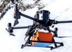
Drone-based GPR system enables non-contact subsurface mapping of glaciers, buried utilities, and voids in areas inaccessible or unsafe for ground surveys.
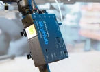
SkyHub is a drone onboard computer that ensures reliable sensor integration and precise, synchronized data collection during every flight.
SOFTWARE

Desktop drone flight planning for the most demanding pilots.

Radsys GPR data processing software for Zond GPRs.

Assess & process GPR and other sensor data.
TRAINING

Advanced technical training and expert support to elevate your team’s expertise and ensure precise, efficient execution of your drone-mission tasks.
Echo Sounder Kit
HARDWARE
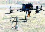
Drone-mounted echosounders provide accurate bathymetric data for depth measurement, sediment monitoring, and underwater terrain mapping.
SkyHub is a drone onboard computer that ensures reliable sensor integration and precise, synchronized data collection during every flight.
SOFTWARE
Desktop drone flight planning for the most demanding pilots.

Bathymetric data processing software.

Hydrographic survey mapping software.
TRAINING
Advanced technical training and expert support to elevate your team’s expertise and ensure precise, efficient execution of your drone-mission tasks.
Gamma-Ray Spectrometer Kit
HARDWARE
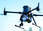
Advanced airborne systems designed for accurate radiation and elemental mapping. Enables efficient and safe data acquisition across complex or hazardous terrains.
SkyHub is a drone onboard computer that ensures reliable sensor integration and precise, synchronized data collection during every flight.
SOFTWARE
Desktop drone flight planning for the most demanding pilots.

Radiometric data processing suite for Medusa Radiometrics hardware.
Assess & process GPR and other sensor data.
TRAINING
Advanced technical training and expert support to elevate your team’s expertise and ensure precise, efficient execution of your drone-mission tasks.
LiDAR & Photogrammetry
SOFTWARE
UgCS flight planning software with: Terrain-Following, Corridor Scanning, Photogrammetry, LiDAR and Calibration Tools.

Online GIS for Surveyors and Geophysicists.
TRAINING
Advanced technical training and expert support to elevate your team’s expertise and ensure precise, efficient execution of your drone-mission tasks.
Magnetometer Kit
HARDWARE
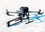
Drone magnetometers enable fast magnetic anomaly mapping for mineral exploration, UXO detection, and ferrous object localization over large areas.
SkyHub is a drone onboard computer that ensures reliable sensor integration and precise, synchronized data collection during every flight.
SOFTWARE
Desktop drone flight planning for the most demanding pilots.
Assess & process GPR and other sensor data.
Online GIS for Surveyors and Geophysicists.

Geophysical data processing and interpretation software.

Geophysical data processing and interpretation software (gravity/magnetics)
TRAINING
Advanced technical training and expert support to elevate your team’s expertise and ensure precise, efficient execution of your drone-mission tasks.

.jpg)


Why Mine Surveyors and Geotechnical Engineers Choose Our Mapping Solutions

Repeatable acquisition geometry
Consistent altitude and flight path keep datasets comparable across repeat surveys, which is what makes change detection reliable.

Faster coverage where ground access fails
Steep terrain, unstable ground, and active areas no longer bottleneck the survey schedule.

Reduced exposure near high walls
Teams capture data near high walls and active zones without putting personnel in harm's way.

Use the drones and sensors you already own.
UgCS plans flights for major drone and LiDAR systems in one piece of software, so a mixed fleet runs through a single, consistent workflow instead of a separate app per manufacturer.

Trusted by
SPH Engineering technologies are used by over 70 leading universities, research institutes, and technology partners.






%202.svg)
_black%201.svg)





Your Questions About Drone Mapping, Volumetrics and Slope Work in Open Pit Mining
Can drone photogrammetry and LiDAR replace ground survey for pit and stockpile volumes?
For routine geometry and volume work, in most cases, yes, and they add safety and frequency that ground crews cannot match near high walls. With proper survey control, photogrammetry or LiDAR can reach centimeter-level accuracy for stockpile and earthwork measurement. Survey-grade control through RTK, PPK, or ground control points anchors the results.
Should I use photogrammetry or LiDAR for pit slopes?
Use photogrammetry for exposed rock where you also want imagery, and use LiDAR where vegetation, shadow, or very steep ground defeats a camera-only survey. On a 57 degree vegetated slope at Melizzano, UAV LiDAR produced a bare-earth DTM that revealed scarps photogrammetry could not. Many teams fly both in one UgCS project.
Can drones monitor slope stability in real time?
No. Drone photogrammetry and LiDAR provide periodic surface-geometry capture and change detection between surveys, which supports geotechnical review and slope-design work. Continuous or real-time deformation monitoring is the role of ground-based slope stability radar, InSAR, or prism and total-station networks.
How accurate are drone-derived volumes and surfaces?
Accuracy depends on the sensor, flight height, ground sampling distance, and survey control. With proper control, high accuracy is achievable for stockpile and earthwork measurement, and drone photogrammetry can deliver stockpile volumes within 1 to 2 percent of ground survey, given consistent AGL, sufficient overlap, and RTK corrections.
How often should I fly an open pit for stockpile and slope work?
It depends on how fast the site is changing and what the data feeds, but drones let you survey far more often than ground crews because a saved flight plan runs in minutes at little cost. Stockpile inventory is commonly flown weekly or fortnightly at active sites and monthly for slower piles, while pit progression and bench or slope geometry are typically monthly, or more often after blasting or heavy rain.
What regulations apply to drone surveys on a mine site?
Drone operations follow the rules of your national civil aviation authority, for example, EASA with SORA in the European Union, the FAA Part 107 framework in the United States, and authorities such as CASA, Transport Canada, or SACAA elsewhere. Slope and ground-control management on a mine is governed by jurisdiction-specific mine-safety regulation.