
Drone-Based Geophysical Surveys for Subsurface and Technical Assessment
SPH Engineering integrates GPR and magnetometer payloads on professional drones, planned in UgCS and flown with SkyHub True Terrain Following, to map what lies below the surface without ground contact. Detect buried utilities, locate UXO and ferrous objects, find voids and archaeological features, and run aeromagnetic surveys over terrain that stops a cart or a survey crew. Plan the survey in UgCS, fly with SkyHub, and process in GeoHammer, Prism2, Geolitix, or Oasis Montaj.
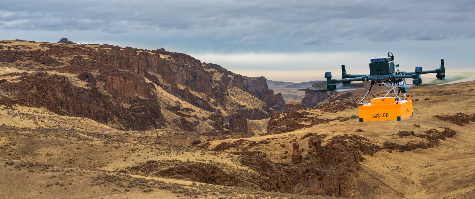
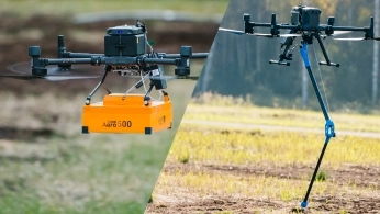
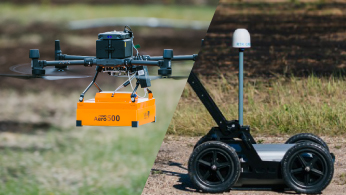
Universal GPR systems: airborne on a drone or terrestrial on a cart, same hardware
GPR detects metallic and non-metallic objects; magnetometers detect ferrous targets to about 7 m depth
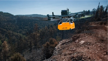
SkyHub holds the sensor at constant low altitude for clean, repeatable data
Field-proven on DJI M400, M350, M300, Inspired Flight, and other professional platforms

Why Subsurface Assessment Is So Hard
Existing records are often incomplete or wrong, and the conventional tools used to fill the gaps each have limits. Getting reliable subsurface data comes down to the right sensor, flown the right way.

Incomplete or wrong subsurface records
Many buried assets were installed decades ago and never digitized, and even current records often do not match site conditions. Relying on them is hazardous when an excavator is working centimeters from a live gas line.

Non-metallic targets are invisible to EM locators
Electromagnetic locators find metallic pipes and live cables, but plastic mains, fiber conduits, concrete ducts, and abandoned non-conductive infrastructure stay hidden. GPR is the primary non-invasive method that detects both metallic and non-metallic objects.

Ground-based geophysics is slow and unsafe
Cart-based GPR and walked magnetometer surveys need physical access to the surface. On contaminated, uneven, or active sites that means rescheduling around hazards or putting operators at risk.

Large or inaccessible areas defeat manual methods
Pre-construction sites, exploration blocks, and former conflict zones can cover tens of hectares of rough ground. Covering that on foot at survey speed takes weeks, if the terrain is walkable at all.

Detection is only the first step
Locating a target is not enough; geologists and engineers need depth, direction, and ideally type. GPR provides depth through Two-Way Time analysis, and magnetometry adds a layer for identifying ferrous objects. Combined, they give a fuller picture than either method alone.
How Drone-Based GPR and Magnetometry Improve Subsurface Surveys
The physics of a GPR or magnetometer measurement is the same on the ground or in the air. What changes is how the sensor is deployed: faster, in places people cannot reach, on flight lines straighter than any hand-pushed cart.
No ground contact required
The drone flies the sensor at a controlled height above the surface, with no clearing vegetation, closing roads, or walking across contaminated or hazardous ground. Sites that were off-limits to cart-based surveys become surveyable.
Straighter lines, more consistent data
GPR and magnetometer on one platform
SPH Engineering's integrated systems carry both payloads on the same drones. GPR detects metallic and non-metallic objects; magnetometers detect ferrous targets (steel pipe, cast iron, rebar) with high sensitivity. Running both over the same area gives the most complete subsurface dataset.
Universal sensors, airborne or terrestrial
Zond Aero GPR systems are built for both modes. The same unit that flies on a DJI M350 fits on a cart for street-level work, so one investment covers both deployment scenarios.
Reach terrain that grounds a crew
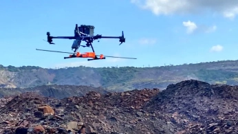
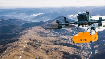
Steep, rugged, or remote ground that defeats manual flying is exactly where automated terrain following pays off. The Geological Survey of Norway flew 436 lines at a constant 35 m above ground over rugged terrain where, in their words, the survey would otherwise have been impossible.
Faster coverage on large sites
The drone follows pre-programmed lines at consistent speed while the operator monitors from a safe distance. Magnetometer UXO surveys reach roughly one hectare per hour, faster with multi-sensor payloads.
How a Drone Geophysical Survey Works, Step by Step

Plan the survey grid in UgCS
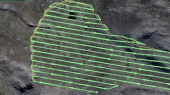
Import your site boundary (KML, CSV, or draw it on the map) and set the survey pattern: parallel lines with defined spacing (typically 0.5 to 1.0 m for GPR utility detection, wider for aeromagnetics). For magnetometers, add figure-eight calibration legs. UgCS calculates the full mission, including spacing, speed, turning behavior, and battery segmentation for long missions.

Configure the altitude profile
Sensor performance depends on height above ground. A 500 or 600 MHz GPR runs at 0.6 to 1.0 m; a magnetometer flies as low as one meter or less for UXO. UgCS supports AGL with True Terrain Following and AMSL modes. Import a DEM, or let SkyHub's onboard altimeter adjust altitude in real time.

Fly the mission
The drone executes the pre-programmed grid autonomously. SkyHub logs every radar trace or magnetic reading with precise GNSS coordinates and altimeter readings, time-stamped and georeferenced. The pilot monitors flight and data quality from the ground.

Run field QC in GeoHammer
After landing, use GeoHammer to check data quality on site: trim takeoff, landing, and turns, and confirm that subsurface reflections or magnetic anomalies are present before leaving. This reduces the risk of a repeat survey.

Process and interpret
Process GPR data in Prism2 or Geolitix (background removal, gain, depth calibration, filtering) and magnetic data in Oasis Montaj or SENSYS MAGNETO (anomaly processing, target localization). Generate vertical profiles, horizontal slices, and 3D reconstructions, and export to QGIS, ArcGIS, or CAD.

Recommended Drone Solutions for Subsurface Surveys
GPR Kit
HARDWARE
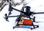
Drone-based GPR system enables non-contact subsurface mapping of glaciers, buried utilities, and voids in areas inaccessible or unsafe for ground surveys.
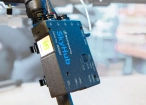
SkyHub is a drone onboard computer that ensures reliable sensor integration and precise, synchronized data collection during every flight.
SOFTWARE

Desktop drone flight planning for the most demanding pilots.

Radsys GPR data processing software for Zond GPRs.

Assess & process GPR and other sensor data.
TRAINING

Advanced technical training and expert support to elevate your team’s expertise and ensure precise, efficient execution of your drone-mission tasks.
Magnetometer Kit
HARDWARE
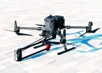
Drone magnetometers enable fast magnetic anomaly mapping for mineral exploration, UXO detection, and ferrous object localization over large areas.
SkyHub is a drone onboard computer that ensures reliable sensor integration and precise, synchronized data collection during every flight.
SOFTWARE
Desktop drone flight planning for the most demanding pilots.
Assess & process GPR and other sensor data.

Online GIS for Surveyors and Geophysicists.

Geophysical data processing and interpretation software.

Geophysical data processing and interpretation software (gravity/magnetics)
TRAINING
Advanced technical training and expert support to elevate your team’s expertise and ensure precise, efficient execution of your drone-mission tasks.
Which GPR Frequency for Your Survey?
Frequency sets two things: how deep the radar penetrates and how small an object it can resolve. For drone-based detection, 500 to 600 MHz systems hit the practical sweet spot for most utility and archaeology work.


Why Geophysical Teams Choose SPH Engineering

1. The only flight planner with dedicated geophysical survey tools
Survey grids, figure-eight magnetometer calibration, low-altitude AGL profiles, and DEM-aware routing are built in, not improvised on a controller screen.

2. GPR and magnetometry on one platform
Run both sensors over the same area on the same drones for the most complete subsurface dataset: metallic and non-metallic from GPR, ferrous targets from magnetometry.

3. Universal sensors, one investment
Zond Aero GPR systems fly on a drone and fit on a terrestrial cart with the same data format and workflow, so confined urban work and open-site surveys use the same hardware.

4. Industry-leading terrain following
Import your own high-resolution DEM and hold exact low AGL across rugged terrain, the capability NGU credited with making a survey possible that manual piloting could not.

5. 100+ drone platforms, one workflow
DJI, Inspired Flight, ArduPilot, PX4, and more, including NDAA-compliant Blue UAS. Switch airframes without switching software or retraining pilots.

6. Industry-standard processing and global support
Data flows into Prism2, Geolitix, GeoHammer, and Oasis Montaj. Backed by direct access to the team and a customer base in 150+ countries.

Trusted by






%202.svg)
_black%201.svg)





Frequently Asked Questions
How deep can drone GPR and magnetometers detect?
A 500 to 600 MHz GPR typically detects targets 1 to 2 m deep from a drone in average soil; lower-frequency LF antennas (150 to 300 MHz) reach 4 to 8 m at lower resolution. Magnetometers detect ferrous targets to about 7 m. Wet, clay, or saline soils reduce GPR penetration.
Can GPR detect plastic pipes and fiber optic cables?
Yes. GPR detects both conductive (metallic) and non-conductive (plastic, PVC, concrete) objects, which is its main advantage over electromagnetic locators that only find metallic utilities. A 500 MHz GPR can detect non-conductive pipes from roughly 10 cm in diameter.
Can I use the same GPR system on a drone and on the ground?
Yes. Zond Aero systems are universal: they mount on a drone for airborne surveys and fit on a wheeled cart for traditional ground surveys, with the same data format and processing workflow either way.
Is drone GPR the right tool for every job?
No. In confined urban environments (streets, parking lots, building interiors), terrestrial GPR remains more practical because the drone needs open airspace and unobstructed ground below the flight path. Airborne GPR wins on large, open, or hazardous sites. The same Zond Aero unit covers both modes.
What does magnetometry add that GPR cannot, and vice versa?
Magnetometry detects ferrous objects (steel, cast iron, rebar, ferrous UXO) and is fast over large areas, making it a strong first pass. GPR detects both metallic and non-metallic objects and provides depth through Two-Way Time analysis. Run together, they give a fuller subsurface picture than either alone.
What drones and sensors are compatible?
SkyHub and the GPR or magnetometer payload integrate with DJI M400, M350 RTK, M300 RTK, M600, Inspired Flight IF1200A, Harris Aerial H6, Wispr Ranger Pro, and Cube/Pixhawk-based platforms running ArduCopter or PX4. Mounting hardware is included for supported models.