
Drone-Based Hydrology Surveys for River Discharge, Surface Flow Velocity and Water Level
UAV hydrometry combines drone-based measurements of water-surface elevation, surface flow velocity, and riverbed geometry for river discharge estimation.
- Estimate discharge at selected cross-sections beyond the fixed gauging network or add spatial observations between and around established stations.
- Combine water-surface elevation, surface velocity and riverbed measurements during a single field campaign using separate, coordinated flights.

Hydrometry Challenges UAV Workflows Can Address
River discharge, or streamflow, is a core variable for flood forecasting, water-resource assessment, and hydrological and hydraulic modeling. Fixed river gauges provide essential long-term records, but they observe discrete locations. Targeted UAV surveys can provide spatial observations in ungauged or difficult-to-access reaches and during field campaigns when conventional in-water measurements are impractical or unsafe.

Fixed gauges provide observations at specific locations
Fixed gauging stations provide long-term water-level records and, at many sites, continuous discharge estimates. At many stations, a rating curve relates measured water level to discharge. Their limitation is spatial: each station represents a specific river location.

Point measurements leave spatial gaps
A station can provide high-temporal-resolution observations at one site, but it does not directly resolve spatial variation in water-surface elevation, channel geometry or flow along the intervening reach.

Vegetated and steep-banked reaches block access
Dense vegetation, steep banks and unstable ground can make conventional in-water surveying difficult or unsafe and can restrict suitable instrument locations.

Flood conditions make contact measurement dangerous or impossible
During extreme flows and floods, measuring a river cross-section by contact methods can be impossible, dangerous or very time-consuming. USGS describes large floods and rapidly changing flows as conditions in which conventional direct discharge measurement can become unreliable, unsafe or impossible.

Some established flow measurements still require in-water deployment
Conventional river discharge measurements may require instruments to be placed in or moved through the water. Acoustic Doppler current profiler (ADCP) surveys are commonly carried out from a boat, tethered platform, or another site-specific deployment, while current-meter measurements may require wading or another in-water setup.

Manual gauging is slow at cross-section scale
Conventional velocity-area stream gauging requires repeated depth and velocity observations across the river cross-section; standard field procedures may use 20 or more measurement verticals, depending on channel conditions and the required uncertainty.
UAV Hydrometry Applications for River Research and Monitoring
Water-surface elevation profiles along a river reach
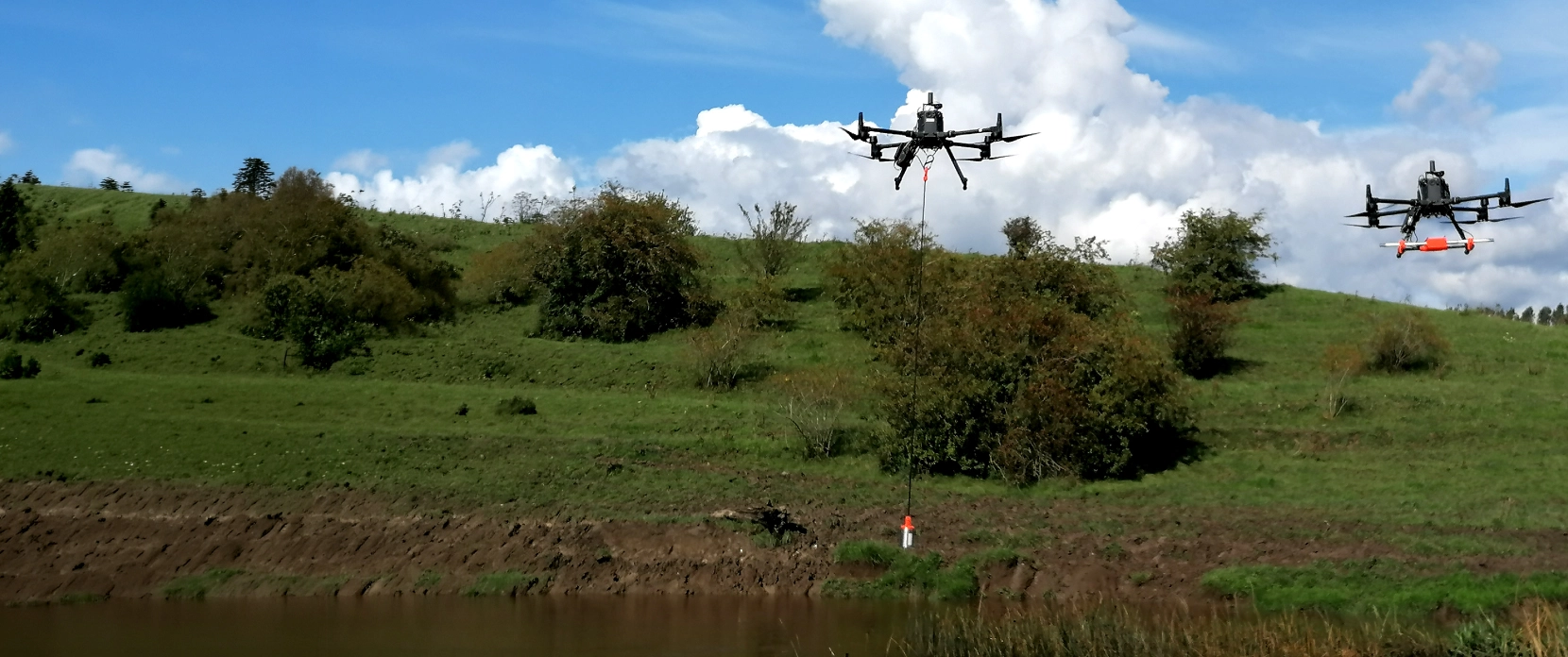
An RTK/PPK-enabled drone flies along the river centerline with a downward-looking radar altimeter mounted on a stabilized gimbal. The radar measures the distance to the water surface, which is combined with the drone’s georeferenced position to derive water-surface elevation. The current UAWOS WSE Surveying Protocol specifies sub-meter along-river resolution, expected vertical accuracy of 3 cm or better, and VLOS productivity of 1.5–4.5 km/h. The resulting elevation profile can be used to estimate water-surface slope and support hydraulic model calibration.
Riverbed elevation and geometry from combined LiDAR, echo sounder or low-frequency GPR
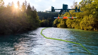
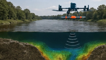
LiDAR maps the exposed banks and floodplain, while an echo sounder or low-frequency GPR profiles the riverbed below the water surface. Sensor choice depends on water depth, conductivity, submerged vegetation, bed conditions, and flow. The current UAWOS Riverbed Geometry Surveying Protocol specifies an expected accuracy of 10 cm or better for the underwater workflows, depending on the sensor and site conditions.
Flow velocity measurement at river cross-sections by drone-borne Doppler radar
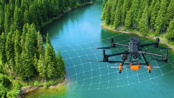
Drone-borne Doppler radar measures surface flow velocity across selected river cross-sections without contact with the water. Unlike image-based velocimetry, it does not require visible tracers or daylight. The current UAWOS Flow Velocimetry Surveying Protocol specifies an expected accuracy of 0.1 m/s or better under suitable conditions. Reliable measurements require sufficient water-surface roughness for radar backscatter.
Riverbed change between repeat campaigns
Repeat surveys at consistently georeferenced cross-sections can identify changes in bed elevation and cross-sectional geometry where the observed difference exceeds the combined survey uncertainty. This can support monitoring of scour and deposition intersecting the surveyed sections. With sufficient reach-scale bathymetric and bank-topography coverage, repeat campaigns can also support analysis of bar and bank migration.
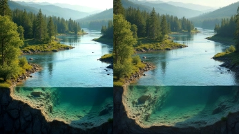
How Our Drone Hydrology Survey System Works

The hydrology payload clips to the drone.
Water level radar, surface velocity radar, echo sounder, or GPR. Connect SkyHub. Under 15 minutes.
Import the river centreline into UgCS.
Draw the centreline for the water level profile for water surface elevation or mark your cross-sections for other sensors. Set altitude, speed, hover time. Upload to the drone. No internet connection needed.
Fly automated missions.
Survey water-surface elevation along the river reach, profile selected cross-sections with sonar or GPR, and collect Doppler surface-velocity observations from hover waypoints. SkyHub records and georeferences supported sensor data, while UgCS controls the planned flight geometry and low-altitude True Terrain Following where required.
Transfer data. Process and align the measurements.
Process each sensor dataset to obtain water-surface elevation, bathymetry or riverbed geometry, and surface velocity, then reference the outputs to the common river centerline and surveyed cross-sections.
Estimate discharge and report the method.
Combine cross-sectional geometry with a selected method for converting measured surface velocity to depth-averaged or bulk velocity, then estimate discharge in m³/s. The conversion method and associated uncertainty should be documented, and reference measurements should be used for validation where appropriate.

Recommended Drone Solutions for River Hydrometric Surveys
Hydrology Kit
HARDWARE
.png)
A radar altimeter measures the distance to the water surface and, combined with the sensor's RTK/PPK position, yields a georeferenced water-surface elevation profile for slope analysis, hydraulic modeling and discharge estimation, while surface velocity radars measure surface speed at a cross-section without tracers, illumination or contact with the water.
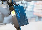
SkyHub is a drone onboard computer that ensures reliable sensor integration and precise, synchronized data collection during every flight.
SOFTWARE

Desktop drone flight planning for the most demanding pilots.

Hosting platform for collaboration.

Assess & process GPR and other sensor data.
TRAINING

Advanced technical training and expert support to elevate your team’s expertise and ensure precise, efficient execution of your drone-mission tasks.
Echo Sounder Kit
HARDWARE
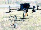
Drone-mounted echosounders provide accurate bathymetric data for depth measurement, sediment monitoring, and underwater terrain mapping.
SkyHub is a drone onboard computer that ensures reliable sensor integration and precise, synchronized data collection during every flight.
SOFTWARE
Desktop drone flight planning for the most demanding pilots.

Bathymetric data processing software.

Hydrographic survey mapping software.
TRAINING
Advanced technical training and expert support to elevate your team’s expertise and ensure precise, efficient execution of your drone-mission tasks.
GPR Kit
HARDWARE
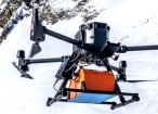
Drone-based GPR system enables non-contact subsurface mapping of glaciers, buried utilities, and voids in areas inaccessible or unsafe for ground surveys.
SkyHub is a drone onboard computer that ensures reliable sensor integration and precise, synchronized data collection during every flight.
SOFTWARE
Desktop drone flight planning for the most demanding pilots.

Radsys GPR data processing software for Zond GPRs.
Assess & process GPR and other sensor data.
TRAINING
Advanced technical training and expert support to elevate your team’s expertise and ensure precise, efficient execution of your drone-mission tasks.


Why Research Teams Use SPH Engineering Solutions for UAV Hydrometry

Documented methods for reproducible research
UAWOS publishes open surveying protocols for water-surface elevation, riverbed geometry and surface-flow velocimetry, together with technical reporting on river-discharge estimation. SPH Engineering is part of the Horizon Europe UAWOS consortium and provides UgCS and SkyHub technology used in the integrated field workflows. Peer-reviewed outputs include the Rönne Å multi-sensor hydrometry dataset and the Water Resources Research study of UAS-borne Doppler surface velocimetry.

Open methods, peer-reviewed research and public datasets
The Horizon Europe UAWOS project, coordinated by the Technical University of Denmark (DTU), publishes open surveying protocols for water-surface elevation, riverbed geometry and surface-flow velocimetry, together with technical reporting on river-discharge estimation. SPH Engineering is part of the UAWOS consortium, contributing UAV payload integration and survey workflow technology. Peer-reviewed outputs include the Rönne Å multi-sensor hydrometry dataset and the Water Resources Research study of UAS-borne Doppler surface velocimetry. Additional datasets from UAWOS river campaigns in Europe and Africa are publicly available through the UAWOS data repository.

Every variable from one campaign
A compatible UAV platform can be reconfigured with different hydrometry payloads during the same field campaign. Separate flights can collect water-surface elevation, riverbed geometry and surface-velocity observations, while UgCS and SkyHub provide a common mission-planning and sensor-integration workflow. These measurements provide the principal UAS inputs used for subsequent discharge estimation.

Data that goes straight into your existing tools
Output formats depend on the payload and processing level. Current UAWOS workflows use formats including CSV and SEG-Y for hydrometry data, together with common geospatial formats such as KML, GeoTIFF and LAS for supporting datasets. This allows processed results to be transferred into GIS, modelling and research workflows without locking the project to a single reporting format.

Trusted by
SPH Engineering technologies are used by over 300 leading universities, research institutes, and technology partners.






%202.svg)
_black%201.svg)





Testimonials

"Our goal is to develop intelligent drones able to automatically examine large areas to search for avalanche victims. UgCS enables complex flight mission planning and visualisation in the Bavarian Alps, including automatic terrain avoidance."
"Our university laboratory hosts a variety of UAS to support scientific investigators, from the U.S. and abroad, on a wide range of projects across the environmental applications spectrum. Among a variety of options UgCS has emerged as our choice for efficiently acquiring Structure from Motion data. We like the terrain following ability that UgCS provides, in addition to the ease with which we can quickly configure our thermal, multispectral, and hyperspectral cameras with the aircraft. We can count on UgCS to help us successfully complete our missions and appreciate the excellent customer support."
“By providing micro-level actionable insights about every leaf and plant, our mission is to help growers make the agroindustry future more sustainable, innovative, and profitable regardless of the ever-changing environment. UgCS helps us a lot to work with the drone pilots and service, shortening the onboarding and decreasing the room for errors."
News
Your Questions About Drone Hydrology Surveys for River Research
How accurate is a drone river discharge estimate compared with conventional gauging
Accuracy depends on uncertainty in cross-sectional geometry, water-surface elevation and surface-velocity measurements, and on the method used to convert surface velocity to a representative depth-averaged or bulk velocity. There is no single discharge-accuracy value that applies to every river or survey configuration. UAWOS treats discharge as a derived quantity rather than a direct UAV measurement, so the selected conversion method and its uncertainty should be documented. For research and engineering applications, UAV-derived discharge should be compared with an established reference method where practical.
Does this replace our gauging station network?
No. It complements the gauging network. Fixed stations provide continuous long-term records at established locations, while UAV surveys add spatial observations at selected ungauged or difficult-to-access cross-sections. They are particularly useful for targeted campaigns, spatial gaps between stations and conditions where in-water measurements are difficult or unsafe.
What field conditions can limit a UAV hydrometry survey?
Suitability depends on the measurement method. Doppler velocimetry requires sufficient water-surface roughness, meaning that it is not suitable for very slow rivers without any waves on the surface. GPR performance depends strongly on water conductivity, depth and bed properties. Tethered echo sounders can be difficult to operate in fast flow or dense submerged vegetation. Low-altitude surveys also require adequate obstacle clearance, GNSS performance and permitted flight conditions, while wind, precipitation and airspace restrictions can prevent safe UAV operation. Site conditions should therefore be assessed before selecting the payload and survey geometry.
When should we use the echo sounder vs. the low-frequency GPR for the riverbed?
Choose according to water depth, electrical conductivity, submerged vegetation, bed characteristics, and flow conditions. GPR is contactless but is strongly constrained by electrical conductivity, water depth, and bottom properties; the current UAWOS riverbed protocol indicates that, depending on depth and bottom conditions, GPR can typically be used up to approximately 300–400 μS/cm (<200 μS/cm is recommended for best possible performance of the method), while more conductive water can rule it out. Tethered sonar is not subject to the same electric conductivity limitation, but its deployment becomes more difficult in faster flow, and its measurements can be affected by submerged vegetation (for single-frequency echo sounders; dual-frequency devices provide clean data even for vegetated bottoms).
How is drone-borne Doppler velocimetry different from image-based velocimetry?
Image velocimetry derives surface velocity by tracking visible patterns or tracers in image sequences, so suitable surface texture or seeding, illumination and image stabilisation are important. Doppler radar derives surface velocity from the Doppler shift of microwaves reflected by the moving water surface and does not require seeding or daylight. It does, however, require sufficient water-surface roughness for reliable backscatter. Field velocity values can be displayed during acquisition, while precise reporting uses post-processing of the recorded Doppler spectra.
Do we need special permissions for the radar sensors?
Radio-frequency compliance is sensor-, configuration-, and country-specific and is separate from UAV operating permission. Researchers should confirm the exact radar payload and intended airborne use with the manufacturer and relevant national authority before deployment. In the EU, radio equipment is subject to the applicable Radio Equipment Directive and national spectrum requirements. In the United States, operators should not assume that rules applicable to terrestrial GPR automatically cover an airborne water-penetrating-radar configuration: 47 CFR §15.503 defines GPR for this subpart in relation to operation in contact with or within one metre of the ground, while qualifying UWB imaging systems are also subject to the operating restrictions in §15.509 and FCC coordination requirements under §15.525.