
Drone-Based Subsurface Void, Sinkhole, and Hazard Detection
SPH Engineering's drone-based ground-penetrating radar (GPR) systems deliver remote, georeferenced near-surface data across active and legacy mining sites.
Built for terrain that is unsafe, unstable, or inaccessible to ground crews, our airborne GPR systems image the shallow subsurface to detect subsurface voids, cavities, and old workings and support decisions on ground stability, mine subsidence risk, embankment integrity, and buried infrastructure.

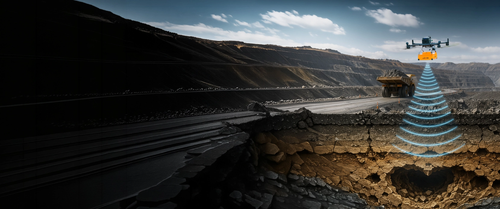
Near-Surface Voids and Hazards That Threaten Mining Operations
Mining sites carry persistent uncertainty in the shallow subsurface. Legacy workings close to the surface, natural cavities, internal moisture inside embankments, and forgotten infrastructure all create risk that cannot be assessed visually. The consequences range from equipment loss and production stoppages to catastrophic failures with environmental damage and human-safety impacts.

Mine Subsidence Risk Over Shallow Workings
Many active and brownfield mining sites sit above historic workings whose records are incomplete, inaccurate, or missing. Where shallow stopes, drifts, shafts, or collapsed workings lie within the practical investigation depth of GPR, they can create mine subsidence risk under haul roads, pads, stockpiles, and new construction areas. Drone-based GPR helps screen these zones for shallow voids, disturbed ground, and collapse-prone features before visible surface deformation appears. Deeper workings or conductive ground conditions require complementary methods such as microgravity, ERT, seismic investigation, or drilling.

Karst, Sinkhole, and Mine Subsidence Risk Mapping
In carbonate, evaporite, and some volcanic settings, dissolution and weathering create natural voids that may evolve into sinkholes through ground subsidence. These features are not always visible at the surface until failure has begun.

Internal Integrity of Tailings Embankments
Visual inspection of a water-retention embankment does not reveal internal moisture distribution, preferential seepage paths, or progressive saturation in the structure. Subsurface anomalies often precede surface signs of distress.

Buried Infrastructure Under Active Sites
Active operations are crossed by pipelines, cables, drainage, and legacy foundations that must be located accurately before any ground-disturbing work. Outdated or missing records create excavation hazards and drilling risk.

Inaccessible or Hazardous Terrain
Tailings beaches, fresh waste rock dumps, contaminated ground, unstable highwalls, and active failure scarps cannot be safely entered by survey crews or wheeled equipment. Survey work that depends on ground access is delayed, narrowed, or skipped.

Underground Coal Fires Create Expanding Subsurface Voids
Underground coal fires consume the coal seam they burn through and, where mining left coal pillars as roof support, can ignite and burn out those pillars as well. The result is a slow but unrelenting expansion of unsupported subsurface space, often across square kilometres and persisting for years or decades.
How Drone GPR Detects Subsurface Voids and Ground Hazards
Airborne GPR images the shallow subsurface across large areas to locate historic stopes, drifts, and shafts that lie within the depth range of the chosen antenna and the conditions of the host ground. Low-frequency configurations extend penetration depth, while higher frequencies provide finer resolution of shallow targets. Realistic depth of investigation is typically up to about 10 to 15 meters for low-frequency systems in low-conductivity ground, and significantly less in water-saturated, conductive ground.
Karst and Sinkhole Risk Mapping
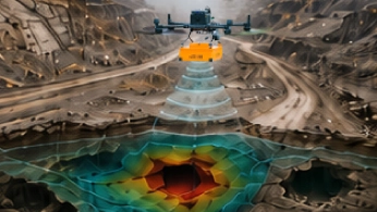
Drone-based GPR can help map near-surface dissolution features, weakened zones, and the progressive cavities behind sinkholes and mine subsidence in carbonate and other subsidence-prone terrain. Repeat surveys track cavity growth over time and support change detection, risk prioritization, and early warning before the surface fails.
Embankment Internal Integrity
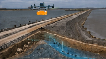
Airborne GPR detects dielectric contrasts associated with internal moisture distribution and stratigraphic anomalies inside water-retention embankments. Reliable interpretation requires baseline surveys, repeated acquisition for change detection, and ground truth from boreholes or instrumentation. Airborne ground-penetrating radar (GPR) can support moisture-condition monitoring in tailings storage facilities (TSFs), especially for larger or more remote sites.
Buried Infrastructure and Utility Mapping
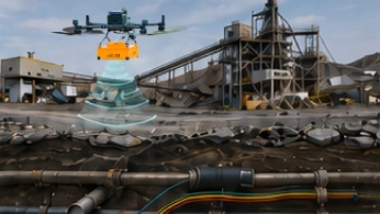
Higher-frequency GPR handles utility locating across a site, buried pipelines, cables, foundations, and drainage, at high spatial resolution and shallow depth. Georeferenced outputs feed directly into site planning systems.
Recommended Drone GPR System for Subsurface Detection
GPR Kit
HARDWARE
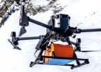
Drone-based GPR system enables non-contact subsurface mapping of glaciers, buried utilities, and voids in areas inaccessible or unsafe for ground surveys.
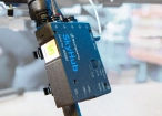
SkyHub is a drone onboard computer that ensures reliable sensor integration and precise, synchronized data collection during every flight.
SOFTWARE

Desktop drone flight planning for the most demanding pilots.

Radsys GPR data processing software for Zond GPRs.

Assess & process GPR and other sensor data.
TRAINING

Advanced technical training and expert support to elevate your team’s expertise and ensure precise, efficient execution of your drone-mission tasks.
Why Mining Operators Choose SPH Engineering for Subsurface Detection

GPR positioned within a broader geotechnical workflow
Airborne GPR delivers rapid, large-area imaging of the near-surface that complements drilling, deeper geophysics, and instrumentation. It does not replace these methods. SPH supports buyers in identifying when GPR is the right tool and when another method is.

Stable airborne GPR coupling through True Terrain Following system
Reliable GPR data depends on a consistent antenna height above the ground. SPH integrates a laser and radar altimeters with a designed in-house True Terrain Following system so the drone maintains a steady elevation over slopes and surface irregularities.

One integrated workflow from planning to interpretation
UgCS mission-planning software, SkyHub onboard computer, GeoHammer processing software and supported GPR systems are designed to operate as a single stack. Mission planning, onboard acquisition, and processing are aligned, with consistent geotagging and data formats.

Hardware that works in the air and on the ground
The Zond Aero LF, 500 NG, 600 NG, and 1000 NG cover a range of airborne and terrestrial deployment options. Teams can adapt to site conditions without reinvesting in different hardware.

Payload swap on the same drone platform
The same drone platform can carry GPR for subsurface imaging and, on separate flights, LiDAR, echo sounders, magnetometers, or other payloads for surface and subsurface mapping. Interpretation of each dataset still requires the appropriate specialist, but the field hardware footprint is consolidated.

Trusted by
SPH Engineering technologies are used by over 70 leading universities, research institutes, and technology partners and all major mining companies.






%202.svg)
_black%201.svg)





Your Questions About Drone-Based GPR for Subsurface Detection
Can drone GPR monitor a tailings dam for internal moisture?
It can contribute to it. Surface-deformation methods (InSAR, GNSS, prisms) show whether the facility has moved; they do not directly show internal moisture conditions, seepage pathways, or pore-pressure changes. Airborne GPR detects dielectric contrasts associated with moisture variation, internal layering and possible preferential seepage paths inside the embankment and across the beach, adding a non-invasive subsurface screening layer. Reliable results need a baseline survey, repeat acquisition for change detection, and validation against piezometer, borehole or other site-instrumentation data. The operator flies from the crest or solid ground, reducing the need to walk on unsafe tailings surfaces. GPR supplements a GISTM-aligned monitoring program; it does not replace deformation or piezometric monitoring.
Can drone GPR detect voids before mine subsidence reaches the surface?
Within limits, yes, and when site conditions are favorable. GPR can image shallow voids and disturbed ground beneath apparently stable ground, before mine subsidence becomes visible at the surface, provided the void lies within the antenna's depth range and the overlying ground is dry and low-conductivity enough to transmit the signal. In wet clay, saline soils, or conductive tailings the radar signal may be strongly attenuated and the void may be invisible to GPR, which is when methods such as microgravity, electrical resistivity tomography, seismic investigation, or drilling may be more appropriate. So GPR can be a useful early-screening method in favorable ground, but it is limited in conductive ground and the wrong tool in conductive ground; pre-survey site characterization helps determine whether GPR is suitable or should be combined with other methods.
Will drone GPR reach the voids on our site?
Penetration depends on the antenna frequency and on the electrical conductivity of the ground. In favorable ground (dry sand, gravel, competent rock with low conductivity), an LF dipole configuration can reach up to 12 meters in soil with relative dielectric permittivity equal to 5 and specific attenuation not exceeding about 5 dB/m. A 500 MHz shielded antenna reaches up to 4 meters in average normal soil at a 100 ns time range. A Zond Aero 600 NG reaches up to 4 meters from the ground in average normal soil, and up to 2 meters with an antenna elevation of 0.6 m.
In conductive ground (wet clay, saline soils, fine-grained mine tailings, mineralized groundwater), real-world penetration is significantly reduced and may fall to only a few dozens of centimeters or even zero, depending on frequency and site conditions. Pre-survey site characterization is required to estimate realistic penetration on a specific site.
When is drone-based GPR not the right tool?
GPR is not appropriate when one or more of the following applies.
- The target depth exceeds the practical penetration of the chosen antenna in the local ground.
- The ground is strongly conductive (wet clay, saline soils, conductive tailings, ore-bearing groundwater).
- The target has insufficient dielectric contrast with the surrounding material (for example, a water-filled cavity in saturated soil with similar permittivity).
- The required resolution is finer than centimeter-scale resolution near the surface, or the target footprint is smaller than the antenna footprint at depth.
- The site cannot be flown safely due to obstacles, vegetation, or restricted airspace.
In these cases, ground-coupled GPR, electrical resistivity tomography, seismic methods, microgravity, or direct investigation by drilling may be more appropriate. SPH is open about these limits during pre-sales discussions.
Why does antenna height above the ground matter so much?
A consistent antenna height above the ground is essential for reliable GPR signal coupling and for reliable depth interpretation.
Variation in elevation changes the recorded two-way travel time to the surface and can distort interpretation if not corrected. In the UAV-based test at Baloži, the GPR was mounted on the rails of a DJI Matrice 350 RTK UAV with a laser-guided True-Terrain Following system to keep the GPR antenna at a steady altitude of 0.5 meters above the ground.
Residual variations are corrected in processing through static correction.
Can drone GPR work over an active tailings facility?
Yes. The drone operator works from solid ground, typically at the embankment crest, with no need to walk on the tailings surface. Airborne ground-penetrating radar (GPR) can support moisture-condition monitoring in tailings storage facilities (TSFs), especially for larger or more remote sites.
Reliable monitoring of internal moisture requires baseline acquisition, repeated surveys for change detection, and validation against borehole or instrumentation data.
How does drone GPR compare with electrical resistivity tomography (ERT)?
GPR and ERT are highly complementary rather than competing methods. GPR is much faster to deploy and delivers high spatial resolution at shallow depths in favorable ground. ERT can also produce very high-resolution subsurface images, with resolution that can be tuned by electrode spacing for the target depth and it performs very well in conductive ground, for example, clay, where GPR signal penetration is limited.
The trade-off is in field effort and interpretation. ERT acquisition is significantly slower than GPR: a single line can take hours rather than minutes, more complex multi-line or 3D surveys typically require multiple field operators, and data processing must be done by an experienced geophysicist who can manage inversion, mesh design, and quality control. In practice, GPR and ERT are routinely combined on the same site: GPR delivers fast, high-resolution shallow imaging across larger areas, and ERT fills in the depth and conductive-ground gaps where GPR underperforms.
How is GPR data interpreted, and how is it validated?
Point targets such as buried pipes or small cavities appear as diffraction hyperbolas in radargrams; layered structures appear as continuous horizontal reflectors. Depth conversion requires a site-specific electromagnetic wave velocity, estimated through hyperbola fitting or a known reference target. Interpretation is validated against existing ground truth (boreholes, test pits, known infrastructure).
Where ground truth is absent, GPR results are treated as hypotheses for targeted investigation or follow-up.
Is drone GPR useful for mineral exploration?
For mineralized targets, GPR has significant limitations. Many mineralized environments contain conductive lithologies, alteration, or saline groundwater, which strongly attenuate the GPR signal. Standard exploration geophysics relies more on magnetics, electromagnetics, gravity, and radiometrics.
GPR has a role in shallow regolith and overburdened characterization but is not the primary exploration tool.
What regulations and standards apply to drone GPR surveys on mining sites?
Drone operations follow the aviation rules of the country of operation. In the European Union, this includes the EASA framework and Specific-category authorizations for larger or higher-risk operations. In the United States, FAA Part 107 applies, with waivers for beyond-visual-line-of-sight where needed.
For the GPR method itself, ASTM D6432 in the US provides the standard reference for ground-coupled GPR in subsurface investigation. No equivalent ASTM standard currently exists for airborne GPR specifically, and airborne practice draws on ground-coupled standards adapted to UAV acquisition.
Mine safety regulations are jurisdictional and operator-specific. Where ICMM principles apply, GISTM provides additional expectations for tailings facility management and monitoring.