
Drone Water and Drainage Measurement for Construction Sites
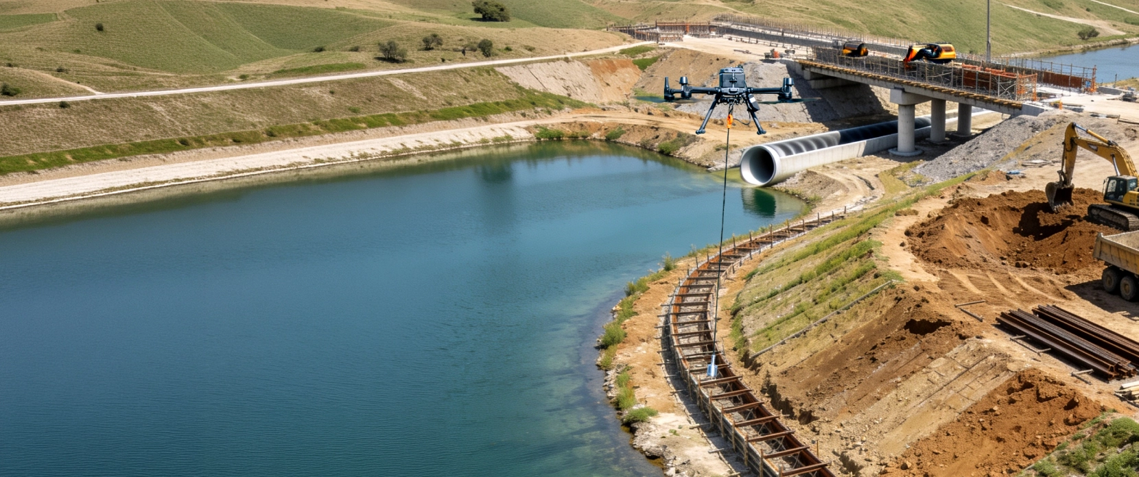
Construction projects create water that has to be measured: detention and sediment ponds, dewatered excavations, drainage channels, and the structures going into rivers and floodplains.
SPH Engineering's Bathymetry Kit maps the bed of detention ponds, sediment ponds, and drainage channels from a drone, so the depth data your civil and environmental teams need lines up with the rest of your site survey, in the same coordinate system, on the same software.
Pond, basin, and channel beds captured in the same coordinate system as your photogrammetry or LiDAR survey.
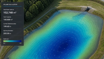
Detention and sediment pond capacity you measure and track for permit compliance.
Quantify scour and erosion around piers, cofferdams, and culverts before and after.
Channel cross-sections and bed elevation ready for your drainage and flood models.

The Water Problems a Site Survey Leaves Unsolved
Your drone survey covers the site down to the waterline and stops. The water on and around the project still drives drainage design, compliance, and structural risk, and it stays unmeasured.

Water leaves a hole in the site model
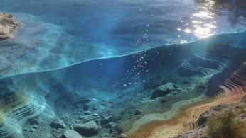
Ponds, flooded excavations, and drainage channels return no elevation data from photogrammetry or LiDAR. The model is blank exactly where you need depth for earthworks and drainage design.

Detention and sediment pond capacity drifts unseen
Detention and sediment ponds lose volume to silt across a project. Without measuring the bed, you cannot prove the basin still holds its required capacity or know when it needs dredging.

Scour around piers and culverts endangers structures
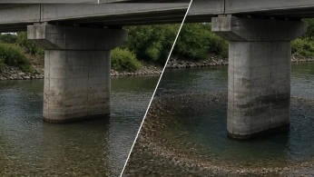
Bed change around piers, cofferdams, culverts, and outfalls is hard to see and risky to measure by hand. Undetected scour undermines foundations during and after construction.

Erosion and sediment control needs evidence
Environmental permits require proof the controls are working. That means repeatable before-and-after data captured the same way each time, not one-off spot checks.

Drainage and flood models need below-water geometry
Grading and earthworks models end at the waterline. Stormwater, culvert-capacity, and flood-risk models need bed elevation and channel cross-sections to be complete.
What the Bathymetry Kit Measures on a Construction Site
This is what the water survey delivers for the build. The capability sits on the Bathymetry Kit; the value here is in how the data plugs into construction decisions.
One continuous site surface, banks to bed
Water data merges with your existing photogrammetry or LiDAR survey, so the site model runs unbroken from dry ground to channel bed without stitching datasets together by hand.
Detention pond capacity, on demand from the bed surface
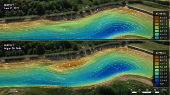
Stored volume comes straight from the surveyed bed surface. Re-fly the survey through the project to track silt accumulation for detention pond maintenance and schedule cleanout before you fall out of compliance.
Scour and erosion quantified around structures
Survey the bed around piers, cofferdams, culverts, and outfalls before, during, and after construction, then compare surveys to see exactly where material has eroded or deposited.
Compliance evidence you can repeat
Identical re-flights produce the before-and-after record regulators want for erosion and sediment control, documented and defensible.
Drainage and flood-model inputs
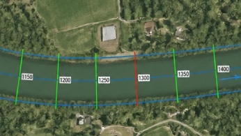
Bed elevation and channel cross-sections feed the stormwater, culvert-capacity, and flood models your civil team runs in ArcGIS or hydraulic software.
How the Kit Turns Site Water Into a Usable Surface

Plan and fly the water body
Plan parallel lines over the pond, basin, channel, or structure surround in UgCS and fly from the bank, with SkyHub holding the sensor at constant height above the water for clean depth data.

Build the bed surface
Clean the sonar logs and interpolate them to a bed-elevation surface in your hydrographic and GIS tools.

Turn it into a site decision
Calculate pond capacity, compare surveys for scour and sediment change, and export cross-sections for drainage and flood models.

Recommended Drone Solutions for Water and Drainage on Construction Sites
Site water surveys use the standard SPH Engineering Echo Sounder Kit: a single-beam echo sounder under a professional drone, with SkyHub holding height above the water and logging each ping with GNSS, planned and configured in UgCS.
Echo Sounder Kit
HARDWARE
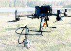
Drone-mounted echosounders provide accurate bathymetric data for depth measurement, sediment monitoring, and underwater terrain mapping.

SkyHub is a drone onboard computer that ensures reliable sensor integration and precise, synchronized data collection during every flight.
SOFTWARE

Desktop drone flight planning for the most demanding pilots.

Bathymetric data processing software.

Hydrographic survey mapping software.
TRAINING

Advanced technical training and expert support to elevate your team’s expertise and ensure precise, efficient execution of your drone-mission tasks.
Why Construction Teams Choose the SPH Engineering Bathymetry Kit for Site Water

Water data that fits your site survey
Same drone, same coordinate system, one continuous surface from ground to bed. No separate hydrographic contractor or dataset to reconcile.

Built for repeatable compliance monitoring
Identical re-flights give the before-and-after records you need for erosion and sediment control and for pond-capacity reporting.

Reaches site water safely
Shallow, obstructed, and contaminated site water is surveyed from the bank, with nobody on the water.

Feeds your civil workflow
Open data formats flow into ArcGIS and the hydraulic and drainage models your engineers already use.

One provider across the whole site
Water surveys sit alongside site mapping, construction monitoring, and subsurface assessment from the same vendor, with direct support and a customer base in 150+ countries.

Trusted by






%202.svg)
_black%201.svg)





Frequently Asked Questions
How do I measure a detention or sediment pond's capacity?
Survey the pond bed from the drone, build a surface, and run a GIS surface-volume calculation against the design or water level. Re-flying the survey over time shows how much capacity sediment has taken, so you can dredge before you fall out of compliance.
Can I monitor scour around piers, cofferdams, or culverts during construction?
Yes. Survey the bed around the structure before, during, and after construction, then compare surveys to quantify erosion and deposition. The method captures thousands of points, far more detail than spot measurements by hand.
Can the data go into our drainage and flood models?
Yes. The survey produces bed elevation and channel cross-sections, the inputs stormwater, culvert-capacity, and flood models need. The modeling runs in your civil or GIS software; the kit supplies the underwater geometry it was missing.
How does this fit with our existing drone site survey?
It uses the same software and coordinate system, so water data merges directly into your site model. One provider covers mapping, monitoring, subsurface, and water across the project.
Pond and channel depth is usually one layer of a wider drone construction site survey that also covers earthworks, stockpiles, and structures.
I am not in construction. Do you have a general bathymetry page?
Yes. This page focuses on construction applications. For the survey method, accuracy, supported hardware, and the full case study, see the Bathymetry page.