
Drone-Based Solutions for Mineral Exploration and Magnetic Anomaly Mapping
SPH Engineering's drone-based magnetometer systems run high-resolution aeromagnetic surveys that map magnetic variations across exploration prospects at ground-survey-level spatial resolution with coverage rates closer to airborne campaigns.
Used for drone magnetic survey work, including direct mapping of magnetic mineralization, structural mapping that supports targeting of non-magnetic deposits, anomaly follow-up from regional surveys, and ore-body-scale delineation prior to drilling. A range of magnetometer options is available to match the target, terrain, and drone platform. The same UAV setup also supports radiometric, GPR, and other geophysical sensors through payload swapping.

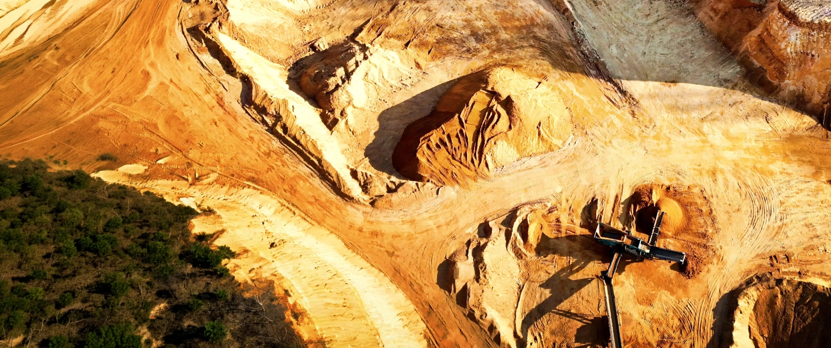
Drone Magnetic Surveys Fit in Mineral Exploration
Magnetic data is one of the oldest, most cost-effective, and most widely used geophysical inputs to mineral exploration. The challenge is rarely whether to acquire magnetic data, but how to acquire it at the right scale, with sufficient resolution, and through interpretable processing for the specific target type. Drone-based magnetometry sits between two endpoints (ground surveys and crewed airborne surveys) and addresses the limitations of both.

Regional aeromagnetic data lacks the resolution for prospect-scale targetingInconsistent GSD on uneven terrain
Government and legacy airborne magnetic surveys provide regional context but were typically flown at altitudes of 80 to 200 m and line spacings of 50 to 400 m. At those parameters, geologic features smaller than approximately 100 m may be smoothed or unresolved. For exploration teams that need to refine prospect-scale targets, follow up on regional anomalies, and define ore-body geometry before drilling, regional data alone is insufficient.

Ground surveys are slow and limited in rugged terrain
Walking magnetic surveys deliver high spatial resolution but are slow and access-limited. In dense vegetation, steep relief, water bodies, lack of cut lines, and similar conditions, ground surveys can take substantially more time than equivalent drone coverage. Crew exposure to terrain hazards adds further operational risk.

Drilling decisions require high-confidence target delineation
Drilling is the most expensive single line item in most exploration budgets, and a single confirmed intercept or a series of dry holes can materially affect project's valuation. The pressure to de-risk drill targeting before committing a budget is intense. High-resolution magnetic surveys at prospect to ore-body scale provide direct support for drilling decisions: refined anomaly geometry, identification of structural controls, inversion-modelled depth and shape estimates, and (where mineralization is magnetic) direct ore-body delineation. The Pocheon case in Korea is a published example of this pathway end-to-end, where drone-based magnetic survey results informed drilling that subsequently confirmed a new ore body.

Constrained budgets demand cost-effective survey methods
Global non-ferrous mineral exploration spending totaled $12.40 billion in 2025, marking the third consecutive year of decline in nominal terms. Capital allocation continued to shift toward mine site and near-mine exploration, while grassroots exploration reached a historic low share of total budgets. For exploration teams under this pressure, the choice between a full crewed airborne campaign and no new magnetic data at all is a real one. Drone-based surveys deliver prospect-scale data at significantly lower mobilization cost than crewed campaigns, which makes them viable for projects where a full helicopter survey would not be approved.

Remote and rugged terrain limits ground and crewed-airborne access
Many promising exploration targets are in terrain that is difficult or unsafe for ground crews and impractical for crewed airborne mobilization: remote prospects without road access, forested areas without cut lines, mountainous or glaciated zones, post-disaster ground, and sites with limited seasonal access windows. Drone-based magnetic surveys reach these targets from a single launch point at the edge of the survey area, removing crew exposure and reducing the logistical footprint of the field campaign.

Outdated or incomplete legacy datasets need validation and infill
Many exploration districts rely on legacy airborne datasets acquired decades ago, with coarse line spacing, dated processing standards, and gaps in coverage that reflect the priorities of the time. Re-flying a regional campaign at modern standards is rarely justified at the prospect level. Drone-based surveys fill the gap: they validate legacy anomalies against current high-resolution data, refine target boundaries, and provide a defensible modern dataset for technical reports, JORC-type or NI 43-101-style reporting, and investor due diligence.
UAV Aeromagnetic Applications for Mineral Exploration and Magnetic Anomaly Mapping
Drone-based magnetic surveys deliver continuous coverage of an exploration area at a spatial resolution typically higher than crewed airborne work at the prospect scale. Outputs include total magnetic intensity grids, reduction-to-pole and reduction-to-equator transforms, vertical and horizontal gradients, analytic signal maps, anomaly delineations, and inversion-derived subsurface models. The applications below cover the dominant use cases in mineral exploration.
Direct Detection of Iron Ore and Magnetic Mineralization
Magnetite-bearing mineralization produces strong magnetic responses that can be mapped directly. Banded iron formations, magnetite skarns, some massive sulfide deposits with significant pyrrhotite content, and some Ni-Cu sulphide systems all fall into this category. Drone surveys at lower altitudes than crewed campaigns improve the amplitude of detected anomalies and the resolution of subsurface body delineation, supporting target ranking and drill-hole positioning.
Structural Mapping of Faults, Contacts, and Intrusions
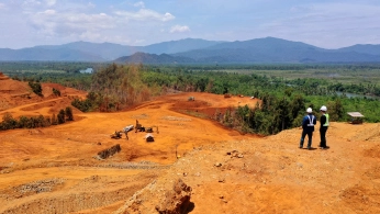
Magnetic susceptibility variations between rock units expose the structural framework of an exploration area: fault traces, lithological contacts, dyke swarms, intrusive bodies, fold geometries, and shear zones. This is often the most valuable output of a magnetic survey, particularly for targets that are not themselves strongly magnetic. Structural maps derived from drone magnetometer data feed directly into 3D geological models, target generation workflows, and prospectivity assessment.

Indirect Targeting for Non-Magnetic Deposits
For deposits that are not themselves strongly magnetic (many Cu-Au-Mo porphyry centers, sediment-hosted base metals, lode gold systems and lithium-bearing brine systems), magnetic data support targeting indirectly. Magnetic anomalies can highlight intrusive centers, magnetite-destructive alteration halos (for example, phyllic/sericitic alteration may produce magnetic lows, while potassic alteration can produce highs or lows depending on magnetite content), structural corridors that focus mineralizing fluids, and contacts between favorable host lithologies. Combined with radiometric, geochemical, and structural data, magnetic surveys are a standard input to prospectivity mapping.
Anomaly Follow-Up from Regional Surveys
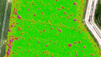
Government and historical airborne surveys provide regional magnetic coverage that identifies broad anomalies of potential interest. Drone-based surveys are well-suited to following up on these anomalies at higher resolution: refining the geometry, locating the center and edges of the source, separating compound anomalies, and supporting decisions on whether to commit to drilling. This complements rather than replaces regional surveys.
Ore-Body Delineation Prior to Drilling
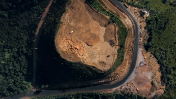
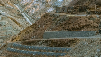
Once a target has been selected, drone-based magnetic surveys at very high resolution can refine ore-body geometry, support inversion modelling, and contribute to drill-hole positioning. The Pocheon case demonstrates this workflow: drone magnetic survey, inversion, drilling, and confirmation of a new ore body.
Magnetic Susceptibility Mapping for Lithological Discrimination
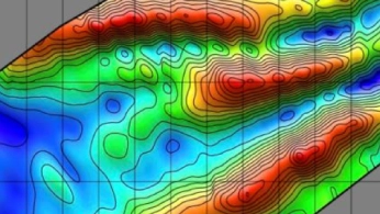
Different rock types carry different magnetic susceptibilities depending on their iron and titanium content, primary mineralogy, and alteration history. Drone-mag-derived susceptibility maps support lithological mapping at exploration scale, particularly where surface geology is obscured by overburden, vegetation, or weathering, and where outcrops are sparse.
Magnetic and Radiometric Combined Surveys for Prospectivity Mapping
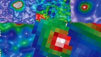
Drone platforms support magnetic surveys combined with radiometric, photogrammetry, and other payloads by swapping the sensor between missions. Combined campaigns produce co-registered magnetic and radiometric datasets that feed directly into prospectivity mapping workflows, where the two methods provide complementary information (structural framework from mag, near-surface radioelement composition from radiometrics) on the same exploration target.
Recommended Drone Magnetometer Solutions for Mineral Exploration
Magnetometer Kit
HARDWARE
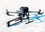
Drone magnetometers enable fast magnetic anomaly mapping for mineral exploration, UXO detection, and ferrous object localization over large areas.
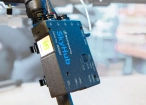
SkyHub is a drone onboard computer that ensures reliable sensor integration and precise, synchronized data collection during every flight.
SOFTWARE

Desktop drone flight planning for the most demanding pilots.

Assess & process GPR and other sensor data.

Online GIS for Surveyors and Geophysicists.

Geophysical data processing and interpretation software.

Geophysical data processing and interpretation software (gravity/magnetics)
TRAINING

Advanced technical training and expert support to elevate your team’s expertise and ensure precise, efficient execution of your drone-mission tasks.

Why Exploration Teams Choose Our Magnetic Survey Solution

Higher resolution than crewed airborne surveys
Drone-borne magnetic surveys fly at lower altitudes (typically 5 to 50 m AGL for mineral exploration) and tighter line spacing than crewed airborne campaigns (typically 80 to 200 m altitude). The result is significantly higher spatial resolution of magnetic anomalies, supporting prospect-scale targeting and detailed structural mapping that broader airborne surveys cannot resolve.

Sensor options matched to target sensitivity and survey scale
The SPH Engineering magnetometer portfolio covers a broad range of mineral exploration needs. Atomic total-field sensors such as QuSpin QTFM Gen-2 deliver scalar sensitivity below 3 pT/√Hz and are available in single-sensor or gradiometer configuration, which combines high sensitivity with common-mode noise rejection that removes drone-induced and other coherent interference. Fluxgate options across single-sensor, two-sensor gradient, and five-sensor array configurations match different budgets, target sizes, survey scales, and gradient measurement needs. Sensor selection is part of the project scoping, not a fixed assumption.

Low-clearance flying for high-resolution detailed surveys
Several magnetometers in the portfolio use self-foldable mounts or direct leg attachment, which enables flying at very low sensor-to-ground clearance when high-resolution work is required. This reduces the operational complexity of suspended-cable sensor systems for those use cases and can simplify field operations. For larger drones and atomic-grade work, suspended-cord configurations are also available.

Repeatable acquisition geometry through UgCS automation
Automated flight planning in UgCS produces consistent flight paths, altitude profiles, and line spacing across surveys and revisits. This is what makes magnetic datasets directly comparable across surveys, supports time-series analysis of changing surveys, and ensures dataset quality for follow-up interpretation, inversion, and drill planning.

Reduced exposure in remote and rugged terrain
Drone-based surveys reach forested, mountainous, swampy, or otherwise hard-to-access prospects without putting field crews into the survey area. The drone operator works from a designated launch point, often at the edge of the survey area or on access roads.

Multi-sensor compatibility with the same platform
The same UAV platform supports magnetometry, gamma-ray spectrometry, GPR, methane detection, photogrammetry, LiDAR, and bathymetric surveys by swapping the payload between missions. This supports combined exploration campaigns covering magnetic, radiometric, and structural data at one site without remobilizing a different drone fleet.

Processing aligned with established aeromagnetic methodology
Magnetic survey data processing typically includes established aeromagnetic methodology: diurnal corrections, IGRF removal, heading and platform-noise correction where applicable, and standard gridding and transformation products (total magnetic intensity (TMI), gradients, analytic signal, reduction-to-pole). Recommended processing software includes GeoHammer, and Seequent Oasis Montaj, which support magnetic data processing and interpretation workflows.

Trusted by
SPH Engineering technologies are used by over 70 leading universities, research institutes, and technology partners.






%202.svg)
_black%201.svg)





Blogs posts



Your Questions About Drone-Based Magnetic Surveys
What does a drone-based magnetometer measure?
The sensor measures the total intensity (and optionally the vector) of the Earth's magnetic field at the sensor location. After subtracting the regional field, temporal variations, and platform-induced interference, the residual signal represents magnetic anomalies caused by variations in magnetization, including induced and remanent magnetization, in rocks and cultural objects (such as utilities). Strong responses come from magnetite-bearing units; subtle responses come from contrasts in weakly magnetic lithologies and structural features.
Can drone magnetic surveys replace crewed airborne surveys?
Not for regional reconnaissance over thousands of square kilometers, where crewed aircraft remain cost-effective. For prospect-scale surveys (typically tens to hundreds of square kilometers), follow-up of regional anomalies, detailed structural mapping, and ore-body-scale delineation, drone-based surveys typically deliver better data at lower mobilization cost, depending on terrain, airspace, endurance, and BVLOS permissions. Many exploration programs use both: regional crewed airborne for reconnaissance, drone surveys for prospect-scale follow-up.
How does magnetometry compare with radiometric surveys for mineral exploration?
The two methods measure fundamentally different physical phenomena and answer different questions. Magnetometry responds to magnetization contrasts in subsurface rocks and cultural sources; depth sensitivity is not fixed and depends on source size, magnetization, depth, noise level, and survey geometry. Radiometric measures estimated concentrations of radionuclides (K, U, Th) in the upper near-surface. They are complementary, not interchangeable. Many exploration programs acquire both over the same target as standard inputs to prospectivity mapping.
Does drone magnetometry work for non-magnetic deposits like porphyry copper or sediment-hosted base metals?
Yes, but indirectly. Magnetic data contributes to non-magnetic deposit targeting by mapping the structural framework (faults, intrusions, contacts) and alteration patterns that control mineralization. Some porphyry systems show magnetic lows where magnetite has been destroyed by alteration, while magnetite-bearing potassic zones may produce magnetic highs or more complex signatures. Many structural corridors that host base metal deposits are visible in magnetic data even when the deposits themselves are not magnetic. The interpretation requires combining magnetic data with radiometric, geochemical, and structural information.
What is heading error and how do drone-based magnetometers handle it?
Total-field magnetometers can show different readings depending on the sensor orientation relative to the Earth's field, even when the actual field has not changed. This is a heading error. Modern atomic total-field sensors such as QuSpin QTFM Gen-2 specify uncompensated heading error below about 3 nT and a small axial dead zone, but survey design and processing still need to manage orientation effects. Fluxgate vector magnetometers measure all three field components (Bx, By and Bz) and derive the total field, which handles orientation effects differently but requires its own calibration. Dual-sensor or suspended-cord configurations can reduce platform interference and dead-zone risk, but the right approach depends on the sensor selected and the survey conditions.
What flight altitude and line spacing should we use?
Typical drone-based magnetic surveys for mineral exploration are flown at 5 to 50 m above ground level, with line spacing usually similar to the altitude. Higher altitude allows obstacle clearance over trees and terrain; lower altitude increases anomaly amplitude and resolution. Survey direction is usually chosen perpendicular to the expected geological strike. The Pocheon case used 60 m altitude and 50 m line spacing, which is a reasonable starting point for detailed iron ore work. UgCS handles flight planning with automated terrain following.
How is drone-induced magnetic interference removed from the data?
Drones generate electromagnetic noise at relatively high frequencies (typically in the 30-50 Hz range from motors and electronics), which can usually be removed using low-pass filtering during data processing. This approach works well when the sensor is mounted close to the drone (within roughly 3-5 m). At greater sensor-to-drone distances, typically achieved with suspension-cord mounting beyond 3 m, motor-induced EM noise drops below the magnetometer's noise floor and ceases to be the limiting factor. However, long suspension cords introduce a different problem: pendulum motion of the sensor produces movement-induced noise in the data that is harder to remove than the EM noise it was meant to avoid.
In practice, two mounting approaches are used, each with its own trade-off:
Rigid or foldable mount close to the drone.
The sensor remains within the drone's EM noise field, but the noise is high-frequency and predictable, so standard low-pass filters remove it during processing. This is the configuration used by foldable-arm magnetometers in the SPH portfolio.
Suspension-cord mount at extended distance.
The sensor is far enough from the drone that motor EM noise is below the sensor's noise floor, but pendulum dynamics (particularly after U-turns and changes in flight direction) introduce motion-induced artifacts that require more complex processing to manage.
Neither approach is universally superior; the right choice depends on the target, the sensor type, and the survey conditions.
Can magnetic surveys be conducted near active mine infrastructure or in industrialized areas?
Yes, with appropriate planning. Magnetic surveys near active mine sites, abandoned workings, power lines, ferrous infrastructure, or industrial areas will pick up the magnetic responses of those cultural sources alongside the geological signal. Survey design accounts for this through several approaches: flight planning that maintains a safe distance from infrastructure, gradiometer configurations that emphasize short-wavelength local anomalies and reduce common-mode noise, careful processing that recognizes and masks cultural sources, and (where relevant) data interpretation that distinguishes geological from cultural responses. Targets within the immediate footprint of magnetically noisy infrastructure are harder to resolve than targets in clean ground, which is a consideration for survey scoping.