
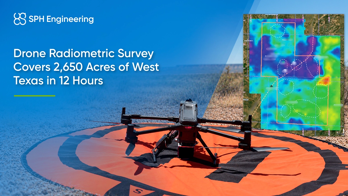
The resulting maps showed radiometric patterns across the prospect area and provided additional information for comparison with previous ground measurements and existing exploration targets.
Quick Facts
- Partner: Martlet Aerial Surveys
- Location: West Texas, United States
- Application: Radiometric mapping for oil and gas prospect assessment
- Survey area: Approximately 2,650 acres (1,072 ha)
- Flight-line length: 164.2 km
- Flight altitude: 3 m AGL
- Flight-line spacing: 90 m
- Operating time: 12 hours, including approximately 10 flight hours
- Key result: One operating day versus four days for previous ground campaign, with more than 25% additional area covered; results challenged the client’s proposed next drilling prospect.
- Technology: DJI Matrice 400, Medusa Radiometrics MS-700 gamma-ray spectrometer, SPH Engineering’s UgCS and SkyHub
- Outputs: Total gamma count and potassium, thorium, and uranium maps
Radiometric Mapping Between Ground and Crewed Aircraft Surveys
Martlet developed its drone survey workflow to address the practical limitations of ground and crewed aircraft acquisition.
Handheld and ATV surveys required access across the property and considerable time in the field. Their individual measurement locations provided ground reference data, but spatial patterns between those locations depended on interpolation.
Crewed aircraft could cover larger areas quickly, but higher flight altitudes and wider line spacing limited spatial detail. Mobilization costs also made that approach less practical for some projects.
Considering the limitations of these approaches, Martlet decided to proceed with low-altitude drone flights to collect measurements continuously along planned survey lines while the crew operated from a secure location. The system and field procedures had undergone more than eight months of refinement before this project.
Drone Radiometric Equipment and UgCS Flight Planning
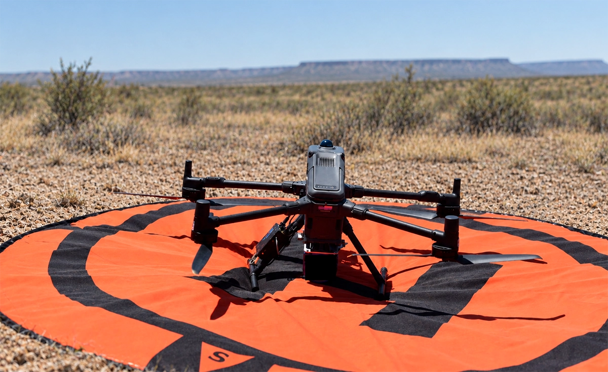
The survey used a DJI Matrice 400 carrying a Medusa Radiometrics MS-700 gamma-ray spectrometer weighing approximately 10 lb (4.7 kg). SPH Engineering’s SkyHub onboard computer controlled the payload and logged its continuous measurement stream.
Martlet planned the terrain-following grid in SPH Engineering’s UgCS drone flight planning software, with flight lines spaced 90 m apart. The low-altitude approach supported flights as low as 3 m above ground level (AGL) where terrain and obstacles permitted.
The team compiled the flight data into a single dataset and took it back to the office the following day for processing and contour generation.
Managing Heat During Low-Altitude Survey Flights
The operation took place in dry scrubland, with shade temperatures at or above 105°F (40.5°C). Heat was the main operational constraint: batteries required cooling before they could return to the charging cycle.
The crew scheduled battery rotations around cool-down periods and used air conditioning to cool overheated batteries. Approximately 25 battery swaps supported the day’s operations.
Flight planning also accounted for trees up to approximately 7 m tall, brush up to 3 m, power lines, corrals and oil and gas processing infrastructure. Horses on the property required an approach that minimized disturbance.
Radiometric Maps for Oil and Gas Prospect Assessment
Post-processing produced four complementary map layers:
- Total gamma count
- Potassium-40
- Thorium-232
- Uranium-238
The element-specific maps included corrections for environmental factors. The team displayed radiometric patterns alongside producing wells, dry holes and prospects previously identified on seismic structure maps.
The total gamma count map showed a clear contrast between lower and higher values in the northern part of the area. A band of higher values extended north–south along the eastern side. Martlet interpreted this as a possible halo effect, while the southern prospects warranted further scrutiny based on the gamma response. The potassium, thorium and uranium maps showed broadly similar spatial patterns to the total gamma count map.

Survey Coverage and Comparison with Ground Measurements
Martlet completed the airborne acquisition in one operating day. According to the client’s comparison, the drone survey covered more than 25% additional area relative to the previous ground campaign, which had taken four days.
The client also reported that the processed contours provided comparable or better spatial resolution than the earlier ground survey. The client’s comparison was qualitative.
The radiometric results contributed to a reassessment of exploration priorities. According to Martlet, they challenged the client’s proposed next drilling prospect and drew attention to another known prospect that had received less consideration.
Supporting Further Exploration Decisions
According to the client, the drone survey reproduced more than 75% of the findings from the previous ground survey and covered over 25% more area in one day, compared with four days of ground operations.
The radiometric maps showed agreement with the earlier ground survey and independent magnetometer data. The client also reported correspondence with the outcomes of existing wells, including producing and dry wells.
These results called the client’s proposed drilling target into question and pointed toward another known prospect that was not a priority at the time. The project demonstrated how drone-based radiometric mapping could contribute to exploration decisions alongside existing geophysical and well data.