

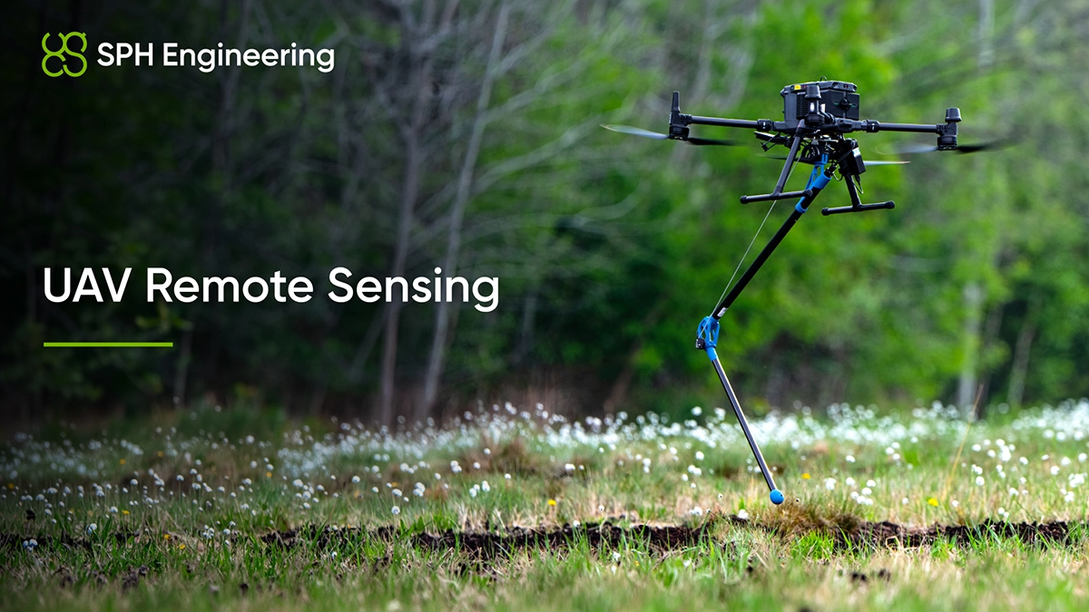
Remote sensing with drones today covers a much wider set of applications than aerial photography. It's how engineers find buried utilities before excavation; how mining operations map shallow waters that vessels can't safely reach; how environmental teams detect, screen, and estimate methane emissions across landfills without sending people through unsafe atmospheres; and how survey crews build forest canopy models in a morning that used to take a week of fieldwork.
This guide is written for technical teams considering or already running UAV remote sensing programs. The focus is on the operational decisions that determine whether your survey produces usable data or expensive noise.
How UAV remote sensing compares to satellite and manned aircraft surveys
UAV remote sensing exists alongside satellite and manned-aircraft remote sensing. The choice between them depends on what you need to see, how often, and at what resolution.
Satellites are unbeatable for area coverage and routine monitoring. A single Sentinel-2 pass covers an entire region. The trade-off is resolution and timing. Very-high-resolution commercial Earth observation satellites resolve about 30 cm per pixel, and only when the orbit aligns with the area of interest. If you need higher resolution, faster turnaround, or sensing methods that satellites cannot physically perform, you go lower.
Manned aircraft sit between satellites and drones. They carry heavier sensors, fly for hours, and cover large regions in a single mission. Resolution is better than satellite for many mapping tasks (typically 5 to 20 cm GSD for aerial photogrammetry), but mobilization is slower, costs are higher, and low-altitude work still requires aviation permissions, airspace coordination, and safety planning.UAVs offer the highest spatial resolution, fastest mobilization, and often the lowest cost per acquisition for small to medium areas. Centimeter to sub-centimeter GSD is achievable under suitable camera, altitude, and control conditions. Same-day repeat surveys are normal. And UAVs can fly low enough and slow enough to carry geophysical sensors that satellites and most manned aircraft can't deploy at all. GPR is the obvious example. So is drone-mounted bathymetry over water bodies that aren't safe for boats.
Where each platform sits cleanly:
Remote sensing with UAVs complements rather than replaces satellite and aerial work. Use a drone when you need higher resolution, lower altitude, faster turnaround, or sensors that physically can't operate from higher platforms.
Active and passive UAV sensors and what each does best
UAV sensors split into two practical families: passive sensors that measure existing radiation reflected off a target, and active sensors that emit a signal and measure what comes back. Each behaves differently across weather, lighting, and surface conditions.
Passive UAV sensors for imaging and spectral analysis
Passive imaging covers RGB cameras, multispectral arrays (typically four to ten bands across visible and near-infrared), hyperspectral systems with hundreds of narrow bands, and thermal cameras. They're sensitive to lighting, shadows, atmospheric scattering, and time of day. A multispectral survey flown under inconsistent cloud cover produces reflectance values that don't tile cleanly between flight lines.
Multispectral and thermal imaging dominate precision agriculture. NDVI, NDRE, and similar vegetation indices feed into yield estimation, crop disease detection, and irrigation efficiency models. Thermal imagery picks up canopy water stress before it shows in the visible spectrum. Forestry teams use multispectral and hyperspectral sensors for species classification, defoliation mapping, and post-fire damage assessment. Power line and infrastructure inspection runs heavily on thermal cameras, which spot overheating components that visual inspection misses.
Radiometric calibration before and after flight is essential for quantitative work. The practical workflow usually combines sensor-specific corrections such as dark-currant, flat-field, spectral-response, and absolute calibration coefficients with reference-panel and/or irradiance measurements in the field. Skip any of these steps and your reflectance values may not match between flights, between sensors, or with satellite reference data you might want to fuse them with.
Hyperspectral systems with line-scanning sensors need a different geometric correction workflow than multispectral teams typically expect, which is one of the more common reasons hyperspectral pilots fail.
Active UAV sensors for surface and subsurface measurement
Active sensors emit their own signal. LiDAR sends laser pulses. GPR sends radio-frequency waves into the ground. Echo sounders transmit acoustic pulses through water.
These work in conditions that defeat passive sensors - at night, through canopy vegetation (LiDAR), under water (Echo Sounders), beneath the surface (GPR), but each has its own failure modes that don't appear on datasheets.
Remote sensing drones don’t stop at LiDAR. The interesting work over the past five years has moved further down the stack.
Drone-mounted LiDAR has become the standard for forest biomass estimation, terrain modeling under vegetation, and high-density topographic surveys where photogrammetry struggles. Pulse density, scan angle, and altitude all interact. Get the parameters wrong and the canopy returns dominate over the ground returns you actually want.
Ground-penetrating radar mounted on drones can resolve buried metallic and dielectric where there is enough dielectric contrast and where the antenna frequency, flight height and ground conductivity are suitable. Lower-frequency antennas reach further but lose resolution. Highly conductive soils (wet clay, saline ground, contamination) attenuate the signal sharply, and no amount of post-processing recovers a signal that was not recorded in the field.
Magnetometers detect magnetic anomalies without contact, including ferrous objects and magnetized geological sources. Drone-mounted systems are now used routinely for unexploded ordnance (UXO) detection, pipeline mapping, and shallow archaeological surveys. The main integration issue is magnetic interference from the drone itself, which is why many systems suspend the sensor on a tow line several meters below the platform or use a gradiometer configuration that cancels ambient magnetic noise between two vertically stacked sensors and removes the need for a base station. Echo sounders mounted on UAVs collect bathymetric data in shallow water (single-beam systems work well under 30 meters, multibeam reaches deeper) without launching a vessel. The trade-off is acoustic decoupling between the sensor and water surface, which limits accuracy in choppy conditions or when surface films distort the acoustic return.
Methane detectors using tunable diode laser absorption spectroscopy measure path-integrated methane concentration along the laser path. They're now the standard tool for landfill, pipeline, and oil and gas leak surveys, where on-foot inspections cover a fraction of the area at the same time and may put crews into atmospheres they shouldn't be breathing.
Gamma-ray spectrometers and side-scan sonars are a smaller but established UAV remote-sensing category for mineral exploration, radiological mapping, contaminated-site assessment, and underwater surveying respectively. The integration challenge for both is power draw and data rate; both run hotter than a multispectral camera and need an onboard computer that can keep up.
Choosing among these UAV sensors is rarely a question of which is "best." It's a question of what the target is, what you need to measure about it, and what regulations allow you to fly in that location. Imagery answers different questions than GPR does. Hyperspectral data tells you nothing useful about what's two meters underground.
Flight planning is where remote sensing drone surveys succeed or fail
Sensor selection gets the marketing budget. Flight planning determines whether the data is any good.
For photogrammetry, the rules are well established: around 70-80% forward overlap, and at least 60-70% side overlap. Ground sample distance (GSD) and altitude are dictated by the required image quality and camera resolution. Software like UgCS can calculate the GSD based on the altitude, or adjust it automatically when the required GSD is set. Adjust GSD and overlap for vegetation density and terrain relief. The flight pattern is forgiving because Structure-from-Motion processing can absorb minor deviations.
Geophysical surveys are not forgiving. A drone-mounted GPR or magnetometer needs to fly at a consistent height above ground, often within one to three meters of the target. Flying at lower altitudes increasess the risk of collision with the ground or vegetation, and signal strength varies sharply with distance to the surface. If your altitude changes by several meters across a 50-hectare site because the terrain rises, the data becomes difficult to compare quantitatively between flight lines. Half the survey may look like one anomaly. The other half may look like nothing.
This is where True Terrain Following matters, and where the standard "follow elevation model" mode that most consumer drone apps offer falls short. That mode interpolates from a coarse digital elevation model and ignores anything that's changed since the model was built (a felled tree, a new pile of overburden, a stream that shifted course after the last flood). Real terrain following uses a radar or laser altimeter on the drone itself to measure actual height above ground in real time. SPH Engineering's UgCS flight planning software is one of the few platforms that supports this in production, paired with the SkyHub onboard computer.
The altimeter choice itself involves a trade-off most teams don't think about until they hit a problem. A laser altimeter can be very precise on dry ground with a good return, but it may be unreliable over water, ice, snow, and bright sand because the surface either absorbs the laser or returns it diffusely. A 24 GHz radar altimeter cuts through fog, rain, and bright sun and works over any surface, though it's restricted in some jurisdictions for radio-frequency reasons. For bathymetric surveys, radar is essentially mandatory. For forestry under canopy, laser usually wins.
Corridor missions for power lines, pipelines, and roads need different planning logic than area surveys. The flight path follows a polyline rather than a polygon, with the sensor offset and oriented to capture the asset and its immediate surroundings. Get the offset wrong and you've flown the corridor at the wrong distance. Too close and you've missed context. Too far and your resolution drops below useful.
Both points apply as operational requirements. The data you collected only answers your starting question if the flight pattern was right for the sensor and the asset.
Drone and sensor integration is where projects stall
A drone has a flight controller. A sensor has its own data acquisition system. Getting them to communicate, share GNSS position and time, react to flight events, and produce data that downstream software can read is non-trivial. It's where most "we'll just bolt our sensor onto a drone" projects stall, often after several thousand dollars of bench testing and a couple of failed field trials.
The work of integration covers power management for the sensor (drone batteries are not designated as regulated power supplies for external payloads), real-time geotagging of sensor readings with the drone's GNSS/RTK position, synchronization between the drone's flight log and the sensor's data stream, and trigger logic for telling the sensor when to start and stop recording or fire a measurement at a waypoint. Then there's the question of output formats. GPR output ranges from SEG-Y to vendor formats like .dzt and .dzx (GSSI), .dt1 (Sensors & Software), or .rd3 (MALA). NMEA-0183 for echo sounders. Mostly .csv or .asc for magnetometers. Each downstream processing tool wants something slightly different. And the operator needs a way to see the sensor's status mid-flight without aborting the mission to land and check.
This is the gap that purpose-built drone onboard computers like SkyHub fill. They sit between the flight controller and the sensor, manage power, georeference data, log everything, and expose a unified interface. Building your own is possible, and several research groups have. It can take six to eighteen months and produces something that works for one specific drone paired with one specific sensor. As soon as you change either, the integration may need to be redesigned.
There's a related point about data sovereignty. A growing number of geophysical surveys involve data the client does not want touching a cloud: UXO clearance for defense, archaeological work near sensitive sites, infrastructure surveys with security implications. Onboard, offline processing matters here. Cloud-tethered platforms are a hard sell to clients with confidentiality requirements, and a non-starter for some.
Limits of remote sensing drones in real deployments
A guide to UAV remote sensing that doesn't include the limitations is a brochure.
Range and endurance
Most multirotor platforms used for sensing fly 20-45 minutes per battery. For large-area surveys (a 5,000-hectare forest, say) that means many flights, multiple battery swaps, and a real risk of weather or daylight changing between flights and corrupting or introducing inconsistencies into the dataset. Fixed-wing UAVs extend range substantially, with flight times of two to four hours common, but they're awkward for low-altitude geophysical work that needs hover capability and slow forward speed. Hybrid VTOL platforms split the difference by taking off vertically and transitioning to fixed-wing flight, though they pay for it in payload capacity and complexity. The platform choice is downstream of the sensor and the survey area, never the other way around.
GNSS-denied environments
Survey accuracy depends on RTK or PPK positioning. In dense urban canyons, under heavy canopy, near tall metallic structures, or at high latitudes with poor satellite geometry, GNSS quality drops. Some platforms can hold position briefly with visual-inertial odometry, but no UAV currently produces survey-grade absolute positioning during a real GNSS outage. Tunnel jobs, deep mine pits, and dense city centers run into this constraint routinely.
Regulatory ceilings
Beyond visual line of sight operations remain restricted in most jurisdictions. In the EU open category, flight altitude is typically capped at 120 meters above ground level outside of waivered operations. For some sensors (high-altitude hyperspectral, large-area methane mapping) that altitude cap is a real bottleneck. The drone can technically fly higher, but the operating approval may not allow it.
Sensor weight and platform pairing
Drone-mounted sensors keep getting smaller, but precision agriculture-grade hyperspectral systems, high-resolution LiDAR units, and multibeam echo sounders can still be heavy. Carrying a 5 kg payload can cut flight time by a third or more on a DJI M350-class platform. That math has to be done before you commit to a sensor. Doing it after means redesigning the workflow when the platform can't carry the payload at survey speeds.
Data volume
A 30-minute LiDAR flight at high pulse rate can easily produce tens of gigabytes of raw data. A multispectral survey of 200 hectares can produce thousands of images, depending on GSD, overlap and camera configuration. Plan storage, processing, and transfer infrastructure before you scale up surveys, or your team will spend more time moving files than collecting them.
UAV remote sensing can replace or at least reduce ground-based surveys where access is hard, the area is large, the environment is dangerous, or repeat measurements are needed at intervals that ground crews can't sustain. It does not replace ground surveys where centimeter-level absolute accuracy on specific targets is required, or where regulations don't permit overflight at the altitudes the sensor needs.
Data processing costs more than the UAV or the sensors
Buying a drone and a sensor feels like the major investment. It usually isn't. The recurring cost lands in data processing: software licenses, processing time, and the trained personnel who can read the output.
Each sensor type produces a different deliverable and runs through a different software ecosystem. Photogrammetry produces orthomosaics, digital surface models, and dense point clouds, processed through Agisoft Metashape, Pix4D, RealityCapture, or DroneDeploy. LiDAR yields classified point clouds and bare-earth digital terrain models, handled in TerraSolid, LP360, or open-source PDAL. GPR data goes into Prism2, GPR-Slice, Geolitix, or SPH Engineering's GeoHammer, and comes out as radargrams and depth slices.
GeoHammer also handles most routine magnetometer processing - cutting profiles, marking anomalies, and building intensity grids - often an order of magnitude faster than Oasis Montaj for straightforward jobs. For deeper geophysical modeling, Oasis Montaj remains the reference tool for total magnetic intensity grids and analytic signal maps. Echo sounder data into Hydromagic Survey or BeamworX, producing bathymetric surfaces and contour maps. Each pipeline requires real expertise. Vendor tutorials (Geolitix has a strong series for GPR) get you started, but production-grade output still takes hands-on time under someone who knows what a clean deliverable looks like.
Some of this can be unified at the pre-processing stage. Tools like SPH Engineering's GeoHammer handle quick assessment and pre-processing of GPR, magnetometer, and CSV-format data, which speeds up the QA loop and catches problems while the team is still on site. Catching a data issue in the field, such as bad altimeter readings, a dropped GNSS lock, or a sensor that lost calibration mid-flight, is dramatically cheaper than discovering it back in the office and having to remobilize. The cost difference can be substantial.Change detection workflows add another layer. Comparing two surveys flown weeks or months apart requires the underlying data to be properly co-registered and radiometrically consistent. Differences in altitude, illumination, sensor calibration, or even GNSS constellation health between flights show up as false change. Quantitative monitoring (vegetation health over a growing season, subsidence over a quarry, pipeline integrity over years) lives or dies on this discipline.
Processing time is also routinely underestimated in project schedules. A photogrammetry survey of 500 hectares at 3 cm GSD is usually not done in an afternoon on a workstation. Expect multiple overnight runs, occasional failures that force re-runs, and several rounds of QA before the deliverable goes to the client. Build that into the project schedule from the start.
How to scope a UAV remote sensing program
A UAV remote sensing program operates as a stack of components. The drone is one. The sensor is another. The flight planning software, the onboard computer that manages the sensor, the post-processing pipeline, and the trained operators are all part of what determines whether the program produces useful results. Strength in four parts and weakness in the fifth still gives you bad data.
If you're starting from scratch, work backward from the deliverable. What does the client need to see: a 3D model, a contamination map, a buried-feature report, a vegetation classification, or a methane heatmap? That decides the sensor. The sensor decides the drone, the flight pattern, and the processing chain. The flight pattern decides whether you need real terrain following, RTK GPS, an onboard computer, or just a stock platform with a camera.
If you're already running surveys and the data isn't meeting expectations, the problem usually traces back to one of three things: altitude inconsistency that the standard flight modes mask, sensor calibration that has not been maintained, or post-processing using settings copied from a tutorial without understanding what they do. Walk through those before assuming you need new hardware. New hardware doesn't fix process problems.
UAV remote sensing has matured fast over the past decade. The platforms exist. The sensors exist. The integration tooling exists. What separates teams that get clean data from teams that don't is operational discipline. Equipment budget alone won't close the gap.
If you're scoping a project that involves geophysical, hydrographic, or environmental sensing and want to skip the trial-and-error phase, SPH Engineering's team works directly with clients on sensor selection, integration, and operator training. We'd rather discuss your specific application than have you guess at it.