

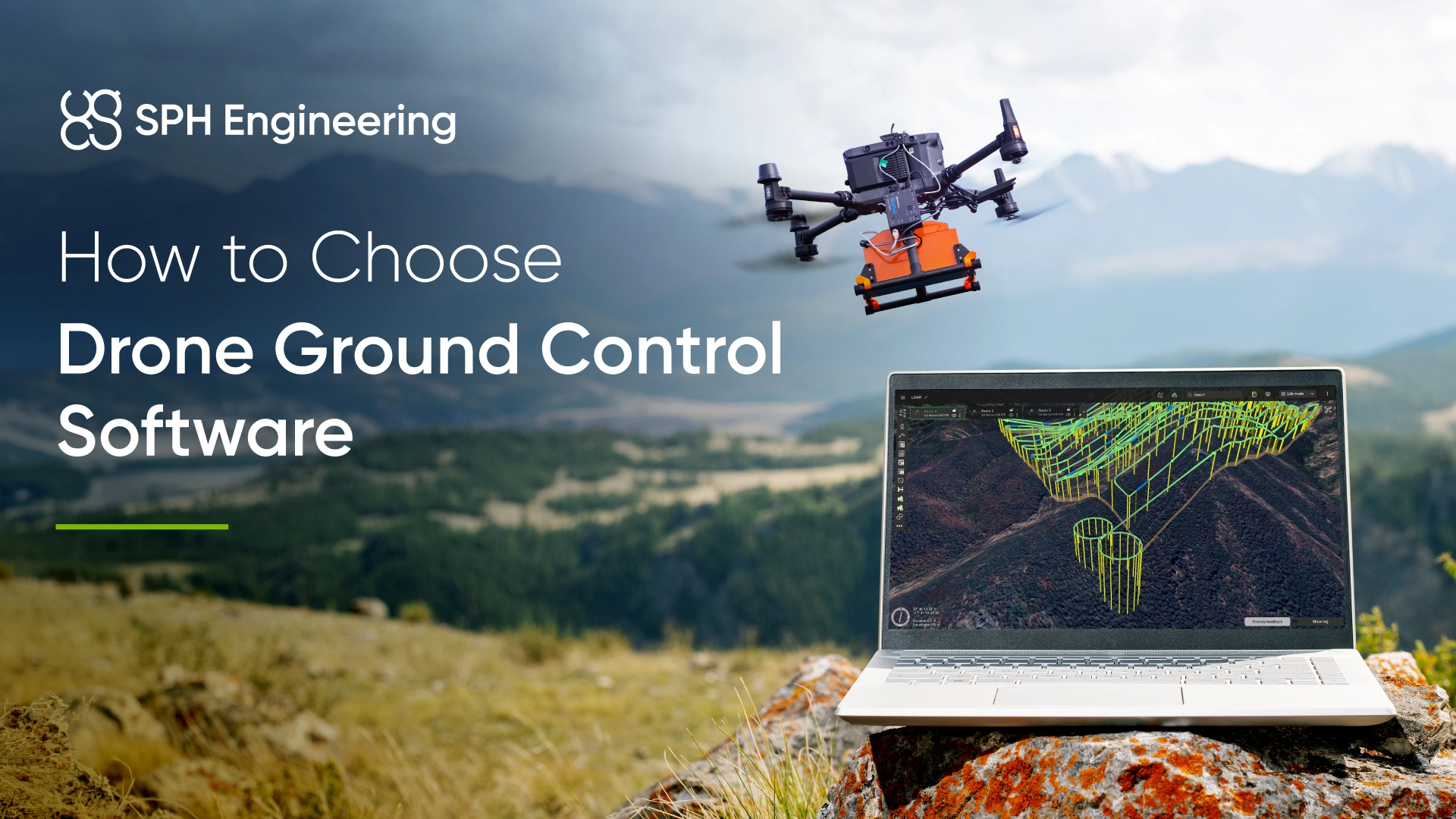
What drone ground control software does
Drone ground control software is the operator's interface to the aircraft before, during and after a flight. Products cover the following functions to different degrees:
- Mission planning and automation: Flight paths, waypoints and altitude profiles, plus generated patterns such as survey grids, corridor scans and structure orbits, with camera or sensor actions and lost-link behavior set for each mission.
- Live telemetry: Position, altitude, ground speed, battery state, GNSS satellite count and link quality, displayed throughout the flight.
- In-flight control: Mode changes and commands such as take off, pause, resume, land and return to home, sent over MAVLink or the manufacturer's link.
- Payload and video control: Live video, gimbal angle, zoom, and camera or sensor triggering.
- Autopilot setup and firmware: Firmware installation, compass and accelerometer calibration, and parameter tuning before the aircraft flies.
- Logs and airspace awareness: Flight log download and analysis, image geotagging, and display of no-fly zones or ADS-B traffic.
UgCS plans and flies missions but does not configure autopilots or flash firmware. ArduPilot and PX4 operators who plan in UgCS keep Mission Planner or QGroundControl installed for vehicle setup and calibration.
Drone ground control software compared
UgCS
UgCS (Universal Ground Control Software) is desktop drone flight planning software built for professional surveys, inspections, academic and geophysical missions across mixed fleets, with one planning workflow covering DJI aircraft, MAVLink autopilots and several other manufacturers. Planning happens in a full-screen 3D view with elevation profiles, multi-segment routes, and KML or CSV import. The finished route uploads to the aircraft directly over MAVLink, or reaches DJI and Autel aircraft through route export. Built-in and custom no-fly zones and ADS-B support are part of the planning environment.
- Platform: Windows and macOS
- License: Proprietary. UgCS Open is a free tier of UgCS running the same engine under daily usage limits, with paid Pro, Expert and Enterprise editions above it. Perpetual licenses include the first year of support and updates.
- Aircraft: DJI (including Matrice 400, Matrice 4 series, Matrice 30 and Mavic 3 Enterprise), Autel EVO Max, Freefly Alta X and Astro, Inspired Flight, Watts Innovations PRISM, Acecore, Blue UAS and other NDAA-compliant platforms, and ArduPilot or PX4 multicopters, helicopters and fixed-wing aircraft, across 100+ platforms
Terrain following
UgCS uses SRTM 1 arc-second elevation data at approximately 30 m resolution as its default terrain source. Users can import higher-resolution DEM and DSM data in GeoTIFF format, with datasets finer than 1 m/pixel downsampled during import. Smart AGL generates terrain-following flight paths based on elevation data, accounting for terrain changes and steep slopes. Adjustable AGL Tolerance controls how closely the planned route follows the terrain, while trajectory smoothing helps limit abrupt altitude changes. With suitable high-resolution elevation data, UgCS supports planning missions as low as approximately 8 m AGL, although actual flight clearance depends on terrain data accuracy, positioning, and aircraft performance.
LiDAR toolset
LiDAR Area and LiDAR Corridor tools in the Expert and Enterprise editions calculate line spacing from the sensor field of view, insert figure-8, U-shape or back-and-forth IMU calibration patterns into the mission, and control turn geometry through bank turns, loop turns, adjustable corner radius, overshoot segments and area buffers. The tools work with DJI L-series sensors and third-party systems from YellowScan, Rock Robotic and RIEGL, and each setting is explained in the step-by-step LiDAR mission setup guide. The University of Granada used the LiDAR toolset in the Espique Valley, running 19 flights with a CHCNav AlphaAir 450 to build a 4.2 billion point cloud that revealed 36 archaeological sites under forest canopy.
Corridor mapping
Centerlines import from CSV or KML, the flight plan follows terrain along the route, and the mission segments at battery swap points without coverage gaps. CLpartner planned a 20 km by 200 m corridor over Philippine jungle on a DJI M300 RTK with an L1 sensor, using KML import of construction drawings to keep the flight lines on the surveyed alignment. Trident Industries moved powerline inspection planning into UgCS Enterprise with the corridor tool and DEM-based terrain following, and reported a 70% reduction in planning time per mission with 30 to 40% faster field execution.
Photogrammetry and vertical work
Area scan handles nadir grids with overlap and GSD control, and GSD stays consistent over uneven ground when the route is planned against an imported DEM. Circlegrammetry automates oblique capture with configurable camera tilt for stockpiles and structures. Vertical scan and facade tools cover walls, pit faces, and building elevations. These feed 3D mapping and volumetric measurement workflows.
Non-camera sensors
Area scan builds survey patterns with no camera profile attached, for magnetometer, GPR, echo sounder and methane missions flown low and slow on tight line spacing. Paired with the SkyHub onboard computer, UgCS adds True Terrain Following from a radar or laser altimeter, plus geotagged data logging for sensors that have no internal logger, including magnetometers, GPR, echo sounders, methane detectors and gamma-ray spectrometers.
DJI and Autel workflow
Routes export to DJI Pilot 2 as KMZ files, or sync to DJI remote controllers through UgCS Cloud on supported models. Autel aircraft receive routes through export to Autel Explorer. The UgCS Companion and UgCS for DJI mobile apps connect directly to supported DJI models in the field.
Offline operation
Map tiles and elevation data cache to disk before departure, so mission planning, route upload, and telemetry all run with no connectivity at the site. Imported DEM and DSM files sit locally too, which matters on the sites where offline planning is needed most, such as mineral exploration ground, glacier work, and post-disaster survey areas with no cellular coverage at all.
Multi-drone and team operation
UgCS Commander, licensed separately, runs synchronized multi-drone missions with several aircraft flying automated routes at the same time. The Enterprise edition adds multi-node deployment, where several field laptops connect to a central server and share missions, plus SDK access.
Limits
No autopilot configuration or firmware handling. Planning is desktop-only, with the Companion app covering field connectivity.
QGroundControl
QGroundControl is open-source drone ground control software for MAVLink vehicles, developed alongside PX4 and providing full vehicle setup for both PX4 and ArduPilot. One application covers firmware flashing, sensor calibration, parameter editing and tuning, mission planning and flight monitoring. Version 5.1, released in 2026, added a log viewer for .bin, .ulg and .tlog files, a built-in NTRIP client for RTK corrections, and new ArduPilot configuration pages. Organizations can produce custom branded builds through its plugin architecture.
- Platforms: Windows, macOS, Linux and Android. iOS is no longer a standard build.
- Aircraft: Every vehicle type PX4 and ArduPilot support, including multirotor, fixed-wing and VTOL. No native DJI support.
- Mission planning: Survey, Corridor Scan and Structure Scan patterns, with camera definitions, separate front and side overlap, and either altitude or ground resolution as the input. Structure Scan is not yet supported on ArduPilot firmware. Geofences and rally points.
- Terrain data: Survey and Corridor Scan can follow terrain using elevation data from an online service, with tolerance and maximum climb and descent settings. Importing a site DEM or DSM is not part of the documented workflow.
- Offline use: Map tiles and elevation data can be downloaded for an area before the flight.
- Multi-vehicle: Several MAVLink vehicles can connect to one instance. The operator switches the active vehicle, and selected actions can be sent to all of them.
- License: Free and open source, dual-licensed under Apache 2.0 and GPLv3.
For PX4 and ArduPilot fleets, QGroundControl covers vehicle setup and standard grid and corridor work at no license cost.
Mission Planner
Mission Planner is the ArduPilot project's drone ground control software, focused on configuring, tuning and diagnosing ArduPilot vehicles. It provides the full parameter list and tree, guided calibration, firmware installation including custom builds, dataflash and telemetry log graphing, a MAVLink inspector, and a built-in SITL simulator. The flight data view combines a HUD with GStreamer video, ADS-B traffic and a Remote ID panel. The current stable release is 1.3.83 from September 2025, with beta builds published through 2026.
- Platforms: Windows. Linux runs it under Mono with some functions unavailable, and the macOS and Android builds are experimental or in beta.
- Aircraft: ArduPilot Copter, Plane and Rover.
- Mission planning: Waypoint missions built from MAVLink commands, spline waypoints on Copter, and generated Survey (Grid), Simple Grid and circular survey patterns with camera, overlap and GSD settings. Geofences, rally points, and KML or SHP polygon import.
- Terrain data: Missions can use a Terrain altitude frame, with elevation from ArduPilot's terrain server at about 30 m resolution. ArduPilot's documentation describes terrain following on this data as suited to flights at 60 m and above.
- Offline use: Map tiles can be prefetched for an area, and elevation tiles are read from local files once downloaded.
- Multi-vehicle: An experimental swarm mode connects several vehicles, described in the documentation as beta.
- License: Free and open source under GPLv3.
Python scripting and plugins extend it for custom workflows, and geotagging from the autopilot's camera trigger messages supports photogrammetry processing.
DJI Pilot 2
DJI Pilot 2 is DJI's flight application for its enterprise aircraft, preinstalled on DJI enterprise remote controllers and updated with their firmware. It covers route planning and execution, payload control, network RTK and the D-RTK 2 base station, and inspection tools including Live Mission Recording, PinPoint and AI Spot-Check. DJI FlightHub 2 adds browser-based route planning, mission sync to pilots and live streaming, and the DJI Cloud API connects Pilot 2 to third-party platforms. Routes use a documented KMZ format with WPML, and Pilot 2 imports KML and KMZ routes from other planning software.
- Platforms: DJI RC Plus, RC Plus 2 Enterprise, RC Pro Enterprise and Smart Controller Enterprise.
- Aircraft: DJI enterprise aircraft, including the Matrice 400, Matrice 350 RTK, Matrice 4 series, Matrice 30 series and Mavic 3 Enterprise series.
- Mission planning: Waypoint, Mapping, Oblique and Linear routes. Smart Oblique runs with the Zenmuse P1 and on the Mavic 3 Enterprise, Slope and Geometric routes on the Mavic 3 Enterprise, and Smart 3D Capture on the Matrice 4 series. The Zenmuse L2 supports Waypoint, Area and Linear routes with a live point cloud on the controller.
- Terrain data: DSM Follow uses an imported DSM in GeoTIFF format or one downloaded inside the app. Real-Time Follow uses onboard sensors on the Mavic 3 Enterprise, Matrice 4 series and Matrice 400, with restrictions in rain, snow, fog and low light.
- Offline use: Offline basemaps import as MBTiles, and Local Data Mode switches off all network connections.
- Multi-vehicle: One aircraft per controller. Coordination across several aircraft and DJI Docks runs through FlightHub 2.
- License: Preinstalled on DJI enterprise controllers. FlightHub 2 has a free Standard tier and a paid Professional tier.
DJI Zenmuse P1, L2, H20 and H30 payloads are controlled natively, and third-party payloads such as gas detectors integrate through the DJI Payload SDK. Desktop planning goes through FlightHub 2 or through third-party planners that export KMZ routes.
Dronelink
Dronelink is a flight automation platform aimed at drone service providers and enterprise teams in construction, energy, telecom and inspection. Missions are built from reusable components in a web planner or mobile app, and execute either as DJI onboard waypoints or through virtual stick control, which lets aircraft without onboard waypoint support fly automated routes. Missions longer than DJI's 99-waypoint limit split automatically and resume across batteries, devices and pilots. Integrations include Airdata, Pix4D and WebODM.
- Platforms: Web planner, iOS and Android apps, and DJI controllers including the RC Pro, RC Plus and RC Plus 2.
- Aircraft: A wide range of DJI consumer and enterprise models, including the Mavic 3 Enterprise and Matrice 4E and 4T. Some newer DJI models are supported through KMZ export to DJI Fly or Pilot 2 only, and the Matrice 300 and 350 RTK are listed as unofficial. Autel EVO II on iOS and the Anzu Raptor series. No ArduPilot or PX4 support.
- Mission planning: Grid, crosshatch and linear maps, waypoints, orbits, vertical mapping, facades, inspections and panoramas, combinable in a single mission.
- Terrain data: Terrain follow on maps and waypoints using ESRI World Elevation data, on the Starter and Growth plans. Custom DEM import is not available.
- Offline use: Plans downloaded to the device can be flown without a network connection, and onboard waypoint missions continue if the radio link drops.
- Multi-vehicle: One aircraft per device, with team accounts for multiple pilots.
- License: The app is free for manual flight. Automation requires a paid Hobbyist or Professional plan.
Drone Harmony
Drone Harmony is a Swiss platform for 3D flight planning and infrastructure inspection, organized into Asset Inspector, 3D Flight Planner and Remote Drone Operations modules. Plans are built in DH Web and flown with DH Mobile on Android devices and DJI controllers, or scheduled on DJI Docks. Power Scanner generates transmission and distribution line inspections from tower and cable data in PLS-CADD, KML or CSV format, and Tower Scanner covers telecom towers. Supported cameras include the DJI Zenmuse H20, H30 and P1, the Phase One P3, Sony survey cameras and the Mavic 3 Multispectral.
- Platforms: DH Web in a browser, and DH Mobile on Android phones, tablets and DJI controllers.
- Aircraft: DJI Matrice 4, Matrice 350 and 300 RTK, Matrice 30, Mavic 3 Enterprise series and DJI Docks 1 to 3, plus the Anzu Raptor, Parrot Anafi UKR and ACSL Soten. No ArduPilot or PX4 support.
- Mission planning: Mapping, perimeter, inspection and terrain plan types, including terrain-following grids, Hill Scan for steep slopes, facades, linear scans and point-cloud-based planning on the Enterprise tier.
- Terrain data: Airbus WorldDEM at 12 m resolution as standard, national 2 to 10 m datasets for several European countries and parts of Australia on paid tiers, and custom GeoTIFF terrain and LAS or LAZ point cloud uploads.
- Offline use: Synced sites are stored on the device for flight without internet. Terrain data does not sync automatically and has to be loaded before going offline.
- Multi-vehicle: Drones and docks across several sites are managed from one interface, with team management on the Enterprise tier.
- License: Subscription, with Starter and Professional tiers and Enterprise pricing on request.
MAVProxy
MAVProxy is command-line drone ground control software for ArduPilot, written in Python and maintained by ArduPilot core developers. It is used for scripting, SITL testing, running headless on a companion computer, and forwarding MAVLink telemetry to several other applications at once. Graphical modules add a moving map, a mission editor and a console, and version 1.8.75 (September 2026) added a 3D terrain view, a mission height profile and camera and gimbal control.
- Platforms: Linux and macOS through pip, a Windows installer, and headless operation with no GUI.
- Aircraft: ArduPilot Copter, Plane, Rover and Sub. PX4 connects, with partial flight data display.
- Mission planning: Waypoint, fence and rally editing from the command line or the mission editor module. No area survey tool in a current release.
- Terrain data: SRTM elevation from ArduPilot's terrain server, cached locally, with an offline mode that stops downloads.
- Multi-vehicle: A swarm module controls two to ten vehicles individually or as a group.
- License: Free and open source under GPLv3.
Litchi
Litchi is an autonomous flight app for DJI aircraft built around a waypoint engine with up to 15 actions per waypoint, plus orbit, follow, track and panorama modes. Litchi Pilot, in open beta on Android since December 2023, extends support to newer DJI aircraft including the Mavic 3 Enterprise, Matrice 4 series, Matrice 350 RTK and Matrice 400. The Litchi Hub web planner, in open beta since May 2025, adds grid mapping with adjustable overlap.
- Platforms: Android and iOS apps, Litchi Pilot on Android only, and Litchi Hub in a browser.
- Aircraft: DJI only. Some newer models fly Litchi Hub routes through KMZ export to DJI Fly.
- Terrain data: Above-ground altitude in the legacy Mission Hub, using online elevation or an imported DEM in Esri ASCII Grid format.
- License: One-time purchase for the original app. Litchi Pilot and Litchi Hub pricing has not been published during the beta.
APM Planner 2 and PIX4Dcapture Pro
APM Planner 2 is an ArduPilot application for Windows, macOS and Linux covering firmware installation, calibration, parameter editing, waypoint missions and log graphing. Its latest release is 2.0.30 from July 2023, and ArduPilot's documentation describes it as having a smaller user base and a reduced feature set compared with the other options. It has no area survey patterns.
PIX4Dcapture Pro was retired by Pix4D on July 31, 2025, and removed from the App Store and Google Play, together with the Mission Planner tool in PIX4Dcloud. Pix4D now lists third-party capture apps for its users, including UgCS, Drone Harmony, Dronelink and QGroundControl, and announced partnerships with Drone Harmony and with SPH Engineering for UgCS in July 2025.
How to compare drone ground control software
Compare drone ground control software on the aircraft it supports, the devices it runs on, the missions it can plan, how it handles terrain, and the cost of running it across a fleet.
Aircraft and autopilot support
Check native support for every airframe and autopilot in the fleet, including aircraft the team plans to add.
- QGroundControl, Mission Planner and MAVProxy work with MAVLink autopilots. DJI Pilot 2, Dronelink, Drone Harmony and Litchi are built around DJI aircraft, with a few other brands on Dronelink and Drone Harmony. UgCS plans for DJI, MAVLink autopilots and several other manufacturers from one interface.
- Support varies by model within a brand. Dronelink lists some DJI models as KMZ-export-only or unofficial, and DJI Pilot 2 route types depend on the aircraft and payload, so check the vendor's list for the exact aircraft and controller.
- Running two planners for a mixed fleet, such as a Matrice 350 for photogrammetry and a Pixhawk airframe for magnetometry, adds training time, a second license and the risk of a mission planned in the wrong interface.
Operating system and devices
Where planning happens affects how much of a plan the operator can check before launch.
- Desktop planners give a full-size map and 3D view for large or complex plans: UgCS on Windows and macOS, QGroundControl on Windows, macOS and Linux, and Mission Planner on Windows.
- Mobile and controller apps suit field changes and single-device setups: QGroundControl on Android, DJI Pilot 2 on DJI controllers, and the Dronelink, Drone Harmony and Litchi apps.
- Browser planners, including Dronelink's web planner, DH Web, Litchi Hub and DJI FlightHub 2, need a connection at planning time and sync plans to the flight device.
Mission types
Area grids with overlap and GSD control are standard across the survey-oriented products above, so compare the specialist patterns:
- Corridor planning for roads, pipelines and powerlines: QGroundControl Corridor Scan, DJI Pilot 2 Linear routes, Dronelink linear maps, Drone Harmony linear scans and Power Scanner, and UgCS Corridor with KML or CSV centerlines and battery swap points.
- Vertical and 3D structure capture: QGroundControl Structure Scan on PX4, DJI Pilot 2 Geometric routes and Smart 3D Capture, Drone Harmony facade, Hill Scan and Tower Scanner, and UgCS vertical scan, facade and Circlegrammetry tools.
- LiDAR planning: DJI Pilot 2 handles Zenmuse L2 routes, and UgCS calculates line spacing from the sensor field of view and inserts IMU calibration patterns for DJI L-series and third-party LiDAR. In planners without a LiDAR mission type, calibration legs are built manually as waypoints.
- Non-camera sensors: magnetometers, GPR, echo sounders, methane detectors and gamma-ray spectrometers need low altitude, tight line spacing and slow ground speed, and several of them have no internal data logger. Check whether the planner builds a survey pattern with no camera profile attached, and whether the onboard system can trigger and geotag the payload.
- Simultaneous multi-drone missions: QGroundControl switches between connected vehicles, MAVProxy's swarm module and Mission Planner's experimental swarm mode command groups of ArduPilot vehicles, and UgCS Commander runs automated routes on several aircraft at once.
Terrain data and altitude control
The terrain source sets the lowest altitude at which a terrain-following mission can be flown safely.
- Global elevation models at 12 to 30 m resolution suit flights with margin above the ground. ArduPilot's terrain data, used by Mission Planner and MAVProxy, is described in its documentation as suited to 60 m and above, and Drone Harmony suggests 20 m and above for WorldDEM.
- Imported site data supports lower routes over uneven ground. UgCS plans against an imported DEM or DSM down to around 8 m AGL, DJI Pilot 2 follows an imported DSM, and Drone Harmony accepts custom GeoTIFF terrain and point clouds.
- Real-time terrain following measures ground distance during the flight. DJI Real-Time Follow runs on the Mavic 3 Enterprise, Matrice 4 series and Matrice 400, and SkyHub with UgCS holds a constant AGL from 0.5 m for geophysical sensors, using a radar or laser altimeter.
- Altimeter choice has its own constraints. Laser altimeters lose reliability over water, ice, snow, and dry sand in bright sun, which affects ice and glacier work directly. 24 GHz radar altimeters are not permitted in every jurisdiction, so the frequency has to be checked against national regulations before a system ships.
Offline operation and repeatability
Remote survey sites often have no cellular coverage, and monitoring contracts depend on reflying the same mission months apart.
- Check that map tiles and elevation data can be cached before departure. QGroundControl, Mission Planner, MAVProxy and UgCS all support this, and imported elevation files in UgCS stay on the laptop. Browser planners need connectivity to create or edit a plan.
- Repeat surveys need a saved mission that stores every parameter and still flies the same way after an aircraft firmware update. Mission files saved in a desktop planner can be reopened, checked against the previous flight and reflown, which is how UgCS is used in university and research monitoring projects.
Logs, analysis and customization
Teams that develop or maintain their own aircraft need deeper diagnostics and extension options than teams flying off-the-shelf platforms.
- Log analysis and simulation: Mission Planner offers dataflash graphing, a MAVLink inspector and SITL, QGroundControl's log viewer reads .bin, .ulg and .tlog files, and MAVProxy works with MAVExplorer for log graphing.
- Customization: QGroundControl supports custom branded builds, Mission Planner runs Python scripts and plugins, MAVProxy accepts custom Python modules, DJI offers the Cloud API and Payload SDK, Drone Harmony provides an API, and UgCS Enterprise includes SDK access.
Licensing and support
Compare license terms together with support, training and the number of tools the team has to maintain.
- QGroundControl, Mission Planner and MAVProxy are free and open source, supported through community forums and GitHub.
- DJI Pilot 2 comes with DJI enterprise controllers, with FlightHub 2 as a free or paid add-on.
- Dronelink and Drone Harmony are subscriptions, with terrain features and team management on higher tiers.
- UgCS has a free Open tier, paid editions on subscription or perpetual license, and vendor support with pilot training and regular webinars.
Which drone ground control software to pick
- Building or maintaining ArduPilot aircraft: Mission Planner for configuration, tuning and log analysis, with QGroundControl as a cross-platform alternative. A separate planner alongside it once missions need imported elevation data or LiDAR patterns.
- PX4 aircraft, including tablet-based field operation: QGroundControl for vehicle setup, standard surveys and corridor scans.
- DJI enterprise aircraft with DJI payloads: DJI Pilot 2, with FlightHub 2 for desktop planning and team coordination.
- DJI fleets that need web planning and team workflows: Dronelink for component-based automation across many DJI models, or Drone Harmony for structure, utility and dock-based inspection.
- Mixed fleets across DJI, Autel, Freefly and ArduPilot or PX4 airframes: One planner covering all of them, such as UgCS, plus the native tool for autopilot configuration on the open airframes.
- LiDAR, geophysical, or low-altitude sensor work: Decide the terrain following method first, then select software that supports it.
- Development and testing: MAVProxy, alongside whichever graphical tool the team already uses.
Free drone ground control software covers straightforward work: a single platform, waypoint or grid missions, terrain with enough margin that 30 m elevation posts are close enough. Paid planning software becomes justified where terrain gets difficult, payloads stop being cameras, fleets span more than one manufacturer, or a client is paying for repeat surveys that have to match the previous dataset. Below that line, Mission Planner and QGroundControl do the job. UgCS Open is free to install if you want to test the boundary for the missions you fly.
Frequently asked questions
What is drone ground control software?
The application used to plan a drone mission, upload it to the aircraft, monitor telemetry during the flight and review logs afterwards. Some products also configure the autopilot and flash firmware. UgCS, QGroundControl, Mission Planner and DJI Pilot 2 are common examples.
What is the difference between drone ground control software and a ground control station?
Drone ground control software is the application. A ground control station is the full ground-side system the operator works from, including the computer or controller, telemetry radio, antennas and power, with the software running on it. ArduPilot and PX4 documentation often calls the software itself a ground station or GCS, which is why the two terms are used for the same thing online.
What is the best drone ground control software?
It depends on the aircraft and the mission. For configuring and tuning an ArduPilot airframe, Mission Planner. For PX4 vehicles and tablet-based field operation, QGroundControl. For DJI enterprise aircraft with DJI payloads, DJI Pilot 2. For survey work needing imported elevation data, LiDAR patterns, non-camera payloads, or one workflow across mixed hardware, a desktop planner such as UgCS.
Is there free drone ground control software?
QGroundControl, Mission Planner, MAVProxy and APM Planner 2 are free and open source. DJI Pilot 2 comes preinstalled on DJI enterprise controllers. UgCS Open is a free tier of a commercial product with daily usage limits, excluding the LiDAR toolset and corridor mapping.
What types of drone ground control software are there?
By function, there are configuration and tuning tools such as Mission Planner, manufacturer flight apps such as DJI Pilot 2, survey mission planners such as UgCS, browser-based planners such as Dronelink and Drone Harmony, and command-line tools such as MAVProxy. By platform, they split into desktop applications and mobile or controller-based apps.
Can drone ground control software fly multiple drones at once?
QGroundControl connects several MAVLink vehicles and switches between them. MAVProxy's swarm module and Mission Planner's experimental swarm mode command groups of ArduPilot vehicles. UgCS Commander runs simultaneous automated missions across several aircraft, and DJI coordinates multiple aircraft and docks through FlightHub 2.
Does drone ground control software work without internet?
It depends on where the elevation and map data come from. Software that fetches terrain from an online service needs connectivity at planning time unless the data was cached in advance. Software that caches map tiles and elevation locally, or accepts an imported DEM, plans and flies fully offline.
Do I need separate drone ground control software for a DJI drone?
Not to fly one. DJI Pilot 2 on enterprise aircraft, or DJI Fly on consumer models, covers manual flight and automated routes. Separate mission planning software becomes useful for a single workflow across DJI and non-DJI aircraft, or for desktop planning of large, repeat or LiDAR surveys.