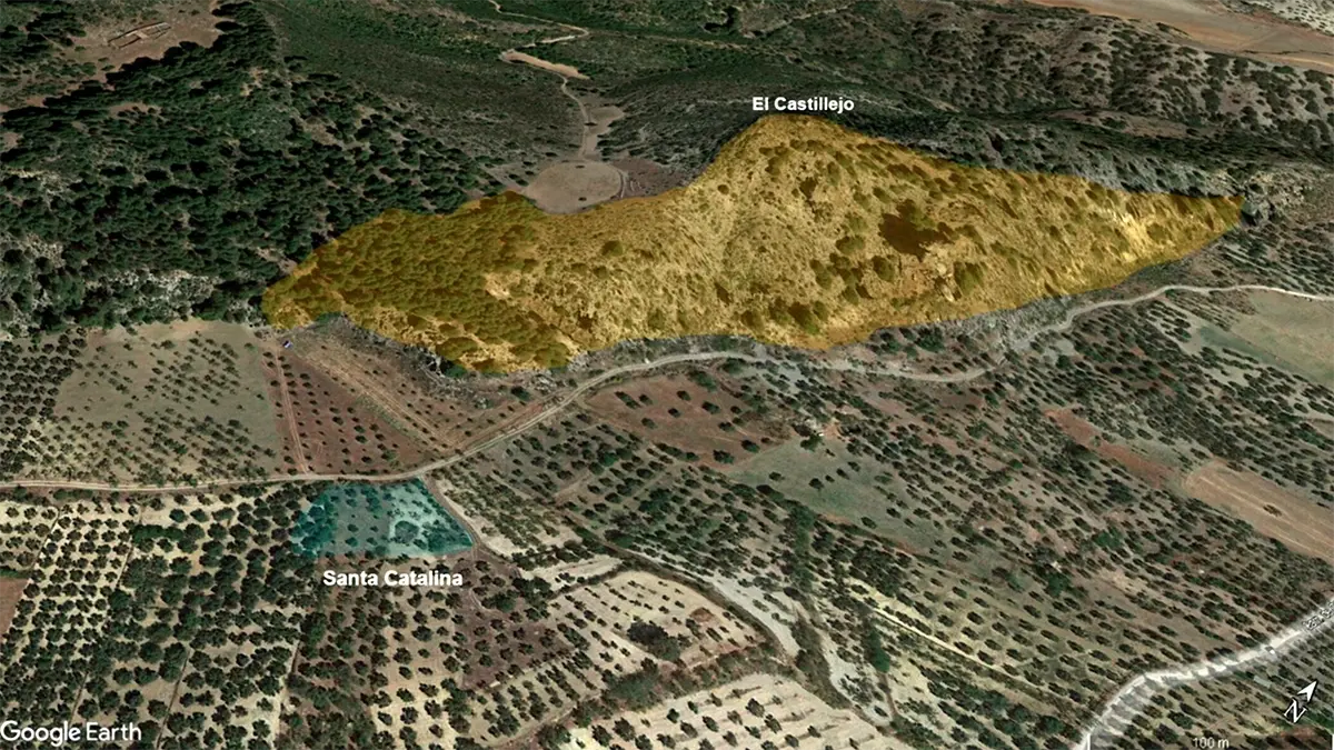
A traditional ground survey was out of the question; the terrain was too rugged and the area too vast. The only viable path forward was a comprehensive LiDAR mapping survey by drone, capable of piercing the forest canopy to map the terrain below.
But this approach came with its own set of critical demands. To produce scientifically valid data, every flight had to be executed with absolute precision. The drone needed to maintain a constant altitude relative to the dramatically changing ground elevation. Any deviation would compromise the data's integrity, rendering the entire mission a failure. The team needed a flight in platform that was not just capable, but exceptionally reliable.
The Solution: A Strategy of Precision Automation
The success of the mission hinged on the quality of the flight plan. The research team chose UgCS to serve as the operational core for the entire survey, programming 19 individual flights to systematically cover the vast area.
UgCS provided two essential capabilities that were critical for the mission's success:
- High Resolution Terrain Following. The valley's topography was the mission's biggest variable. To counteract this, the team imported a custom Digital Terrain Model (DTM) of the area into UgCS. They then programmed the flight plan to maintain a strict 80-meter altitude
above the ground.UgCS automatically calculated the complex flight path, ensuring the DJI Matrice 350 RTK drone flawlessly followed the ground's contours. This was the only way to guarantee a consistent point density (366 pts/m²) across the entire site—a prerequisite for high-quality data. - Automated Sensor Calibration. The CHCNav AlphaAir 450 LiDAR system requires a precise figure-8 flight pattern to calibrate its Inertial Measurement Unit (IMU) before each data capture. Manually flying this pattern is difficult and introduces a high risk of error. The team simply integrated this vital step into the UgCS mission plan. Before each survey, the software automatically executed the IMU calibration pattern perfectly, ensuring the sensor was performing at its peak and the data would be accurate

The Outcome: A Hidden History Revealed in Data
The meticulous planning paid off. The 19 flights generated a massive, high-fidelity point cloud of over 4.2 billion measurements. LiDAR processing software allowed the researchers to digitally remove the forest canopy to extract the underlying digital terrain model (DTM)
For the first time in 70 years, they could see the true shape of the ground.
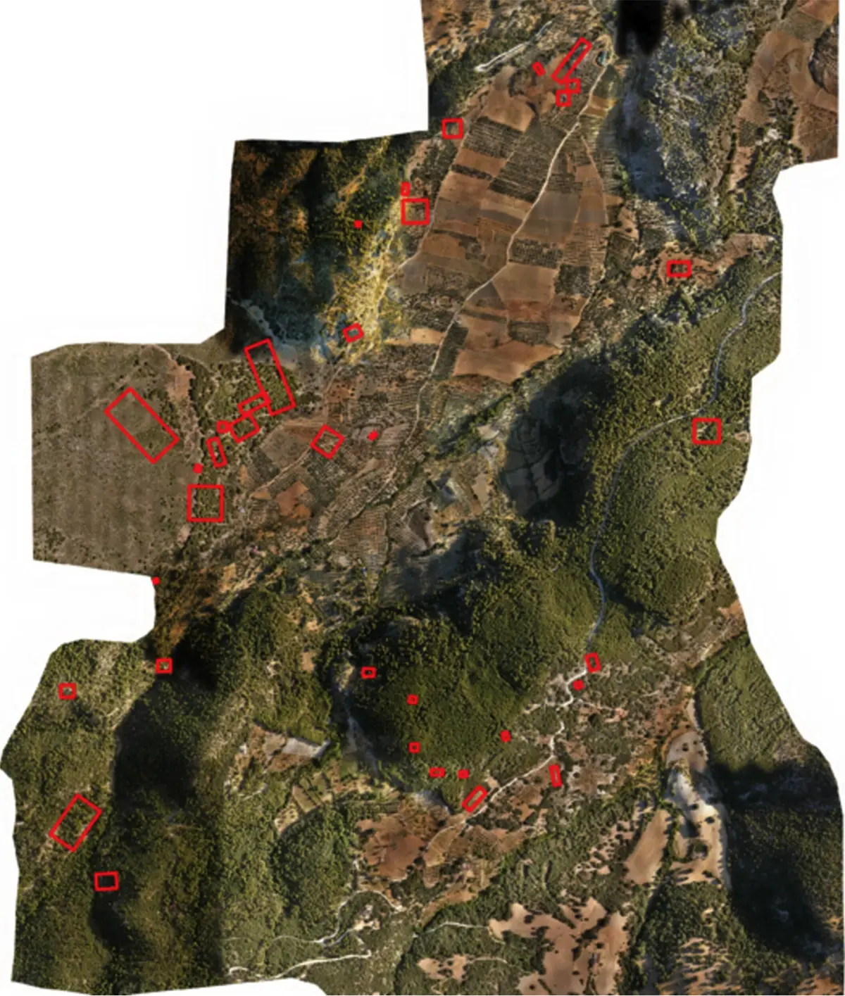
The DTM revealed subtle, unnatural anomalies - the straight lines of buried foundations, the circular depressions of furnaces, and the faint traces of ancient irrigation channels known as acequias. After identifying 67 potential locations from the data, the team conducted field inspections.
The results were stunning:
They confirmed the existence of 36 previously unknown sites of archaeological interest. The discoveries included entire buildings, mining entrances, and a large rectangular enclosure that historical records had never mentioned.
Why UgCS Was Critical to Mission Success
The discovery of 36 historical sites was a direct result of acquiring clean, consistent, and comprehensive data. UgCS was the tool that made this possible.
- It Ensured Data Integrity. The mission's scientific validity rested on the quality of the LiDAR scan. By flawlessly executing terrain-following flights, UgCS guaranteed a uniform data density. This consistency was the key that allowed researchers to spot subtle anomalies that would have been lost in a noisy or incomplete dataset.
- It Maximized Team Efficiency. UgCS automated the entire flight workflow, from takeoff and calibration to mission execution and landing. This level of automation allowed a small team to manage a large-scale, multi-day project with confidence and efficiency, significantly reducing the manual workload and potential for pilot error.
- It Mitigated Operational Risk. Flying a valuable drone and sensor package over rugged, inaccessible terrain is inherently risky. By pre-planning and automating every aspect of the flight in UgCS, the team minimized the risk of human error in the field, safeguarding their equipment and ensuring the project could be completed successfully.
In projects where the margin for error is zero, the quality of the flight plan determines the quality of the outcome. As the University of Granada's research demonstrates, UgCS provides the reliability and precision required to turn ambitious survey goals into groundbreaking discoveries.
This case study is adapted from the findings presented in the research paper: "Remote Sensing Analysis and LiDAR Experimenting in the Espique Valley (La Peza, Granada, Spain)".
All credit for the original research, methodology, and discoveries belongs to the authors:
Jesús Rodríguez Bulnes, Julio M. Román Punzón, and José M. Martin Civantos of the Universidad de Granada. Their work was published in the journal
Archaeological Prospection (2025; 32:395-407) by John Wiley & Sons Ltd.
This case study highlights the role of UgCS in the Espique Valley LiDAR project. It is not a full reproduction of the published research and omits additional methodologies, software, and validation techniques (e.g., ArcGIS Pro, Agisoft Metashape, CHCNav RS10 SLAM) that were essential to the study. For the complete methodology, analysis, and findings, readers should refer to the original article in Archaeological Prospection (2025; 32:395–407).
