
Background
The Mimbres Culture Heritage Site in Grant County, New Mexico, is a historically significant archaeological site once inhabited by the Mimbres people, an ancient Native American community. Despite two earlier excavations, large portions remain unexplored due to the site's challenging location, such as uneven terrain and limited physical access. These geographical and environmental constraints have historically impeded traditional archaeological exploration methods.
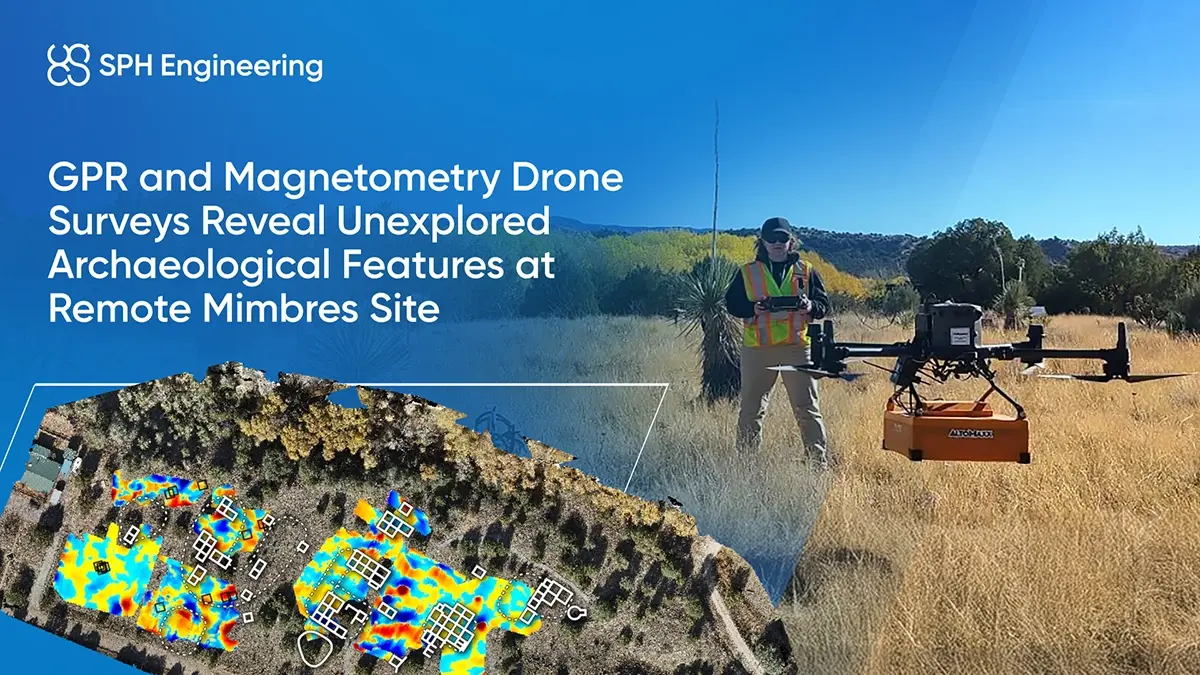
In response, Northrop Grumman, a global aerospace and defense technology company, initiated the Cultural Scans for an Interactive 3D Experience (SITEs). The goal is to digitally preserve and investigate such historically valuable locations. Conducted with the help of drone technology experts Measur and Altomaxx, the project specifically targeted advanced, non-invasive exploration methods. SPH Engineering’s drone-based ground-penetrating radar (GPR) and magnetometer integrated systems were selected for subsurface investigation.
Challenges
Mimbres Heritage Site presented considerable obstacles for archaeological exploration, which impacted the practicality and effectiveness of the traditional approach:
- Limited archaeological knowledge. The site had vast unexplored areas due to minimal previous archaeological research, leaving substantial unknowns regarding the extent and specifics of the archaeological features.
- Logistical complexity and cost. Transporting traditional archaeological equipment and personnel to the remote location posed significant logistical difficulties and high costs.
- Dense vegetation. The thick vegetation covering much of the site restricted visibility, hindering standard ground surveys and causing interference with sensor readings and data clarity.
- Terrain complexity. Choosing conventional survey methods could lead to inconsistent coverage, potential safety hazards, and variable data accuracy due to uneven and rugged terrain.
Solution
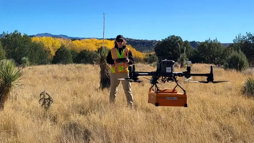
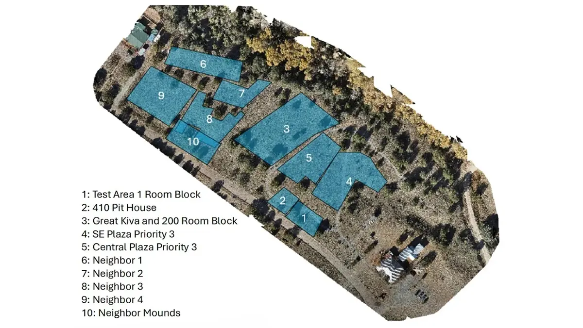
Altomaxx conducted drone-based surveys using a DJI M350 RTK drone equipped with Zond Aero 500 GPR and MagDrone R3 magnetometer systems. The site was divided into ten survey areas, and the drone was flown in perpendicular north-south and east-west patterns to ensure full coverage.
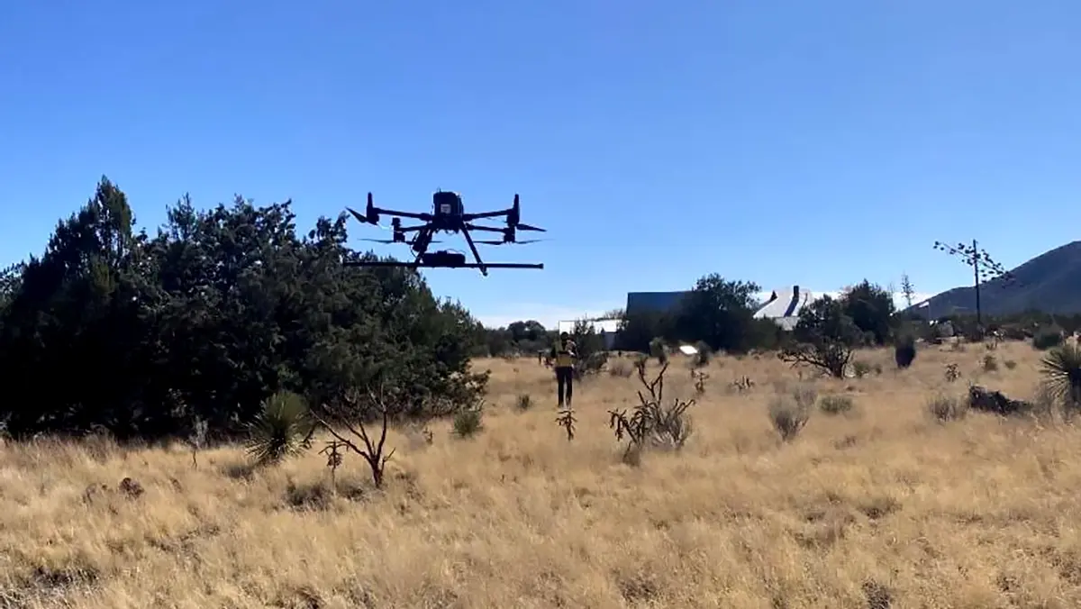
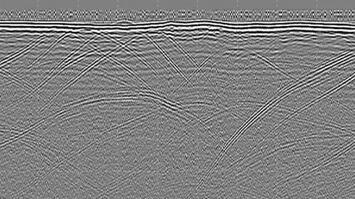
Survey involved manually piloted drone flights, with paths adjusted in real time to account for vegetation and terrain variability. GPR data was collected with 1-meter line spacing, while magnetometer data was gathered along lines spaced at 2 meters.
GPR data was processed using Geohammer and Prism2.70 with filters to minimize vegetation-induced noise.
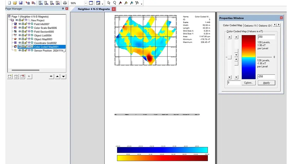
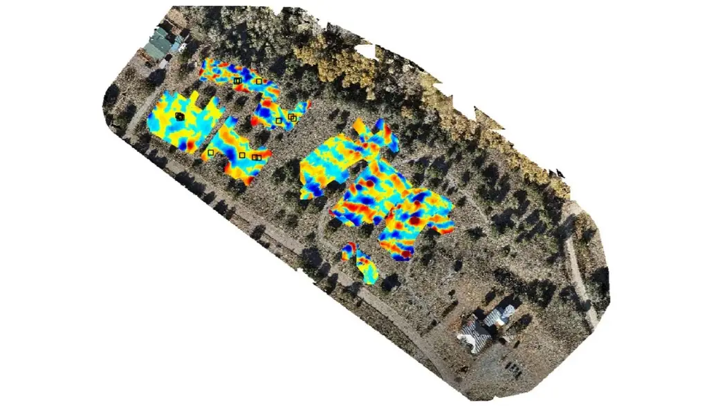
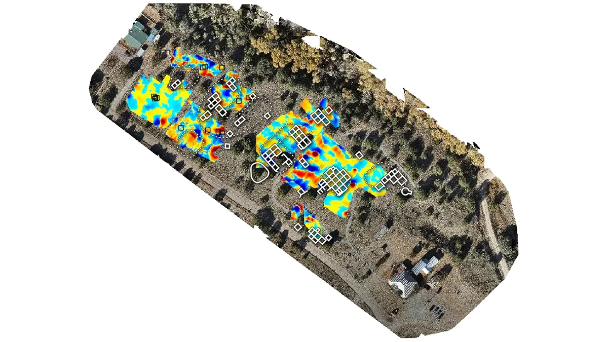
Magnetometry data was first cleaned using the MagDrone Data Tool and then analyzed in Magneto. Final results were visualized and integrated with site maps using QGIS.
Key Discoveries
Drone-based surveys accurately pinpointed locations and helped expand the knowledge base of buried features:
In several sections of the site, magnetometer data revealed concentrated and well-defined anomalies suggestive of substantial subsurface features. These included signals consistent with buried structures, voids, or large anthropogenic disturbances. Great Kiva & 200 Room Block, in particular, showed a high-intensity anomaly extending more than four meters deep.
Adjacent GPR data confirmed significant soil disturbances in zones where vegetation interference was minimal. In areas of dense vegetation, however, GPR effectiveness was limited. Despite this, in certain locations where conditions allowed, GPR added critical validation to magnetic findings by revealing distinct stratigraphic disruptions.
Where both sensors were able to collect usable data, overlapping anomalies indicated a high probability of architectural features. GPR was instrumental in distinguishing between natural subsurface variation and human-made structures, especially in areas where magnetometer readings alone were ambiguous.
Adoption of aerial LiDAR technology is recommended to enhance surface mapping. Its ability to penetrate vegetation canopy and capture subtle topographic variations will support further interpretation and prioritization of archaeological targets.
Conclusion
Drone-based magnetometry and GPR proved highly effective in overcoming logistical and environmental limitations at the Mimbres Culture Heritage Site. By delivering precise, targeted archaeological findings, the technology sets a practical benchmark for future archaeological endeavors in similar contexts and facilitates informed excavation and research strategies.
Read the full case study