
At a Glance
- Area: 5 km²
- Lines & Flights: 170 survey lines across 50 flights
- Altitude: 50m AGL (constant, terrain-following)
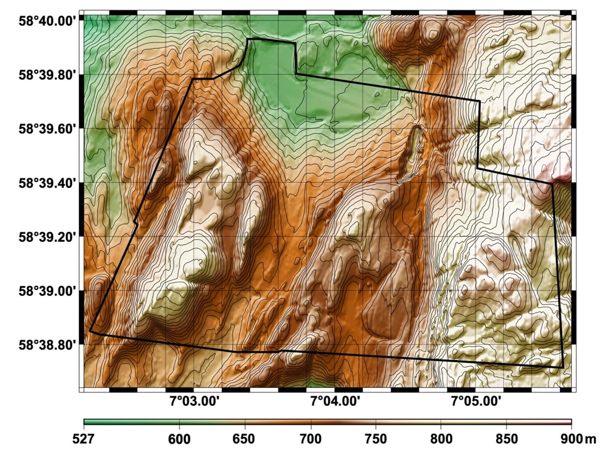
- Terrain Data: 10m DEM imported from Hoydata.no
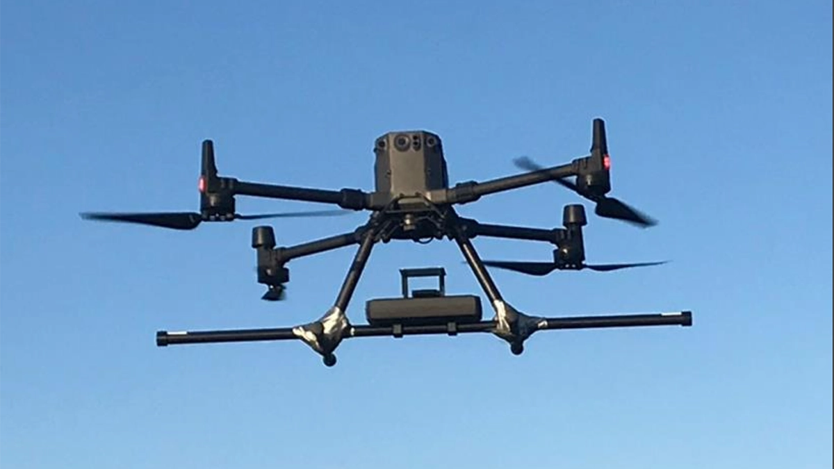
- Platform & Sensor: DJI M300 + SENSYS MagDrone R3 (3-component fluxgate)
- Data Rate: 200 Hz raw 1 Hz down-sampled
- Base Station: GEM GSM-19 for diurnal correction
- Safety: Spotter with second RC for BVLOS edge cases
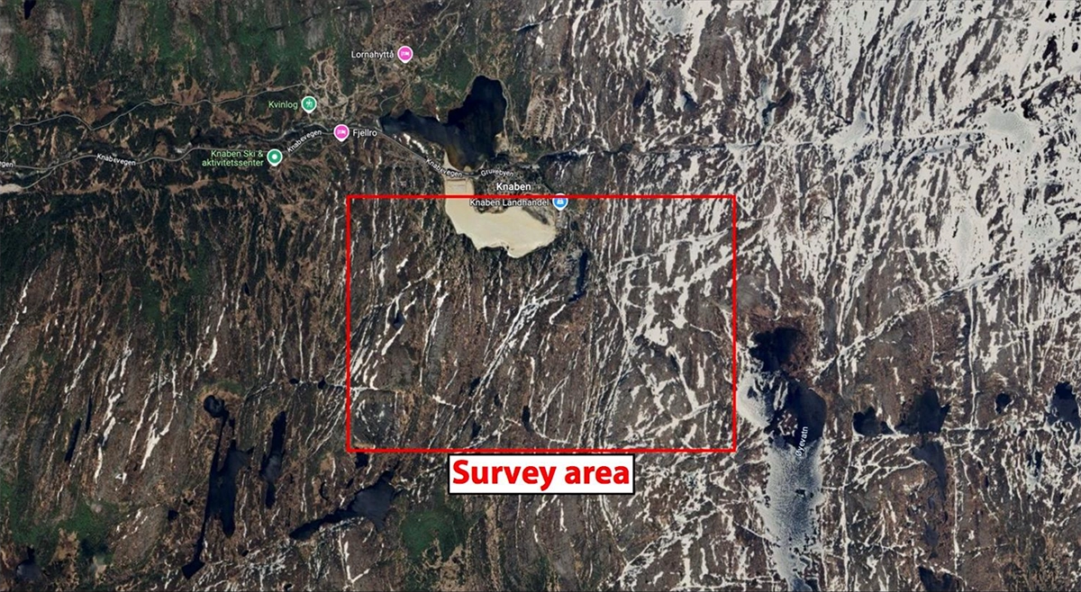
- Location: Knaben, Norway
This mission demanded a sophisticated system of flight automation, rigorous data processing, and expert field protocols to overcome the immense logistical and technical challenges. This is the story of how that system came together, with UgCS.
Objective: High-Resolution Drone Aeromagnetic Survey (NGU)
NGU aimed to conduct a high-resolution drone aeromagnetic survey over a 5 km² area to map geological formations. The operation was significant, requiring 50 separate flights to complete 170 survey lines.
The Technology Stack and Field Setup:
- Platform: A DJI M300 drone, chosen for its reliability in demanding environments.
- Sensor: The highly sensitive SENSYS MagDrone R3, a three-component fluxgate magnetometer.
- Flight Automation: UgCS Mission Planning Software.
Human Oversight: To ensure safety in the complex terrain, the operation relied on a spotter equipped with a second remote controller, a critical element for maintaining control when the drone was beyond the pilot's line of sight.
The core challenge was maintaining a strict
50-meter altitude above ground level (AGL). In the steep valleys of Knaben, manual flight was not a viable option. NGU needed a flight planner that could automate this critical task with precision.
UgCS: The Linchpin of the Flight Plan
The mission's feasibility hinged on solving the flight path problem. The NGU team used UgCS's Terrain Following capability to create a proper 3D mission plan. By importing a 10-meter resolution Digital Elevation Model (DEM) from Hoydedata.no, they could automatically generate a flight path that precisely draped over the landscape.
This automation was the key that unlocked the mission. It allowed the drone to navigate the terrain autonomously, but as the team discovered, real-world fieldwork always has lessons to teach.
Lessons from the Field: Navigating Real-World Complexities
Professional drone operations are rarely a simple "push-button" affair. The NGU mission highlighted how success depends on adapting to software limitations and logistical hurdles.
Beyond Software.
The mission also depended on expert human intervention and planning. The spotter was vital for preventing an uncontrolled landing when the drone was out of the pilot's range. Furthermore, the team had to manage the magnetometer's battery life, which required mid-day swaps to ensure continuous data collection.
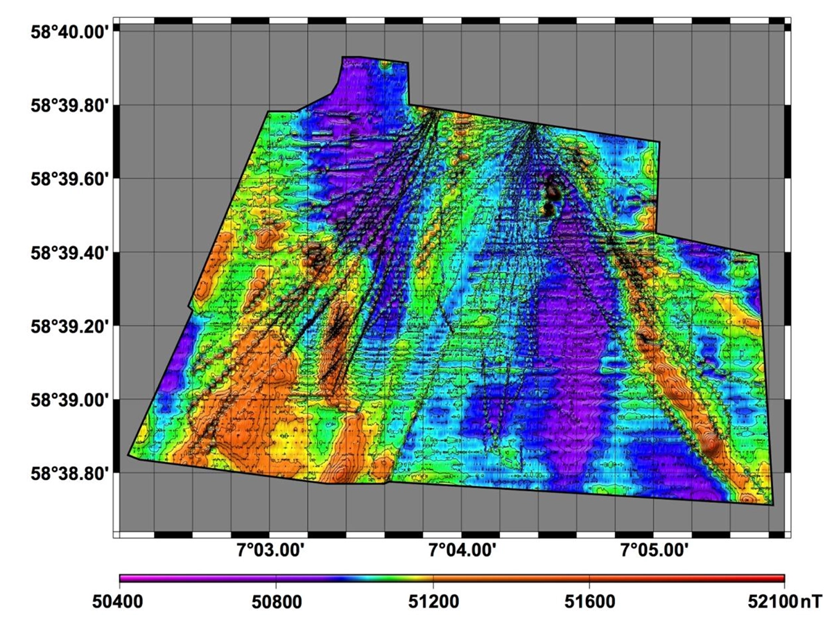
Data Processing Workflow: 200 Hz -> 1 Hz, Base Corrections & Final Maps
Achieving data integrity was a systematic process where UgCS's stable flight path was the crucial first step.
- Stable Data Acquisition. By maintaining a consistent 50-meter AGL, UgCS provided the stable platform necessary for the sensor to collect clean initial readings.
- Noise Reduction. The raw magnetometer data was captured at a very high frequency (200 Hz). To reduce noise, the data was later
down-sampled to 1 Hz, a standard and effective processing technique. - Environmental and Hardware Corrections. Finally, the data was corrected for external factors. A stationary GEM GSM-19 base magnetometer was used to record and remove diurnal variations in the Earth's magnetic field. Proprietary software was also used to compensate for the drone's own magnetic influence on the sensor readings.
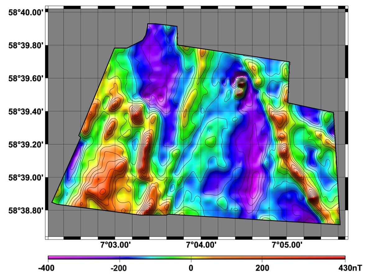
Results & Conclusion: Terrain Following Made the Survey Possible
While fieldwork presented numerous challenges, the NGU team's final conclusion in their report is clear and powerful. Even after encountering and overcoming a software limitation, their assessment of UgCS's role was unambiguous:
“Without this software, the complex terrain would have made the survey impossible."
The Knaben survey is a testament to modern geophysical exploration. It shows that success in the world's most demanding environments is achieved through a robust system, one that combines intelligent flight automation, rigorous data science, and the irreplaceable expertise of the field crew. In that system, UgCS served as the indispensable tool that made the entire operation possible.
The article was published with the permission of Florent Szitkar, the author. NGU Report, Geology For Society.
Report no.: 2024.039
ISSN: 0800-3416 (print)
ISSN:2387-3515 (digital)