

When the required result needs full-bottom coverage of scour or bank slopes, the EchoNIMBUS-MBES multibeam replaces single-beam profiles. For boat, USV and RTK pole work, single-beam sounders and a compact multibeam from Teledyne Odom, Seafloor Systems, Ohmex, CEE HydroSystems and NORBIT are listed in the comparison table for reference.
SPH Engineering integrates EchoLogger sounders and the EchoNIMBUS-MBES with drones, and does not sell the other systems listed. SPH Engineering has not tested these systems; their specifications are taken from each manufacturer's published datasheet as of October 2026. Field results are from SPH Engineering customer projects and the Rönne Å study. Calculated figures are labeled.
Quick picks by river survey job
How the systems were compared
River surveys differ from coastal work in ways that change which specification matters. Each system was assessed against:
- Minimum depth: Riffles, bars and margins are often shallower than 0.5 m, and the echo sounder’s dead zone decides whether they are mapped or interpolated.
- Beam width: a narrower beam has a smaller footprint on the bed, which gives more detail on banks, scour holes and around structures.
- Frequency options: Vegetation and soft sediment need specific frequency pairs; single-frequency units cannot separate them.
- Platform fit: Weight, power and data link decide whether the sounder goes on a drone, a USV, an RTK pole or a boat, and the platform decides how much the transducer tilts and trails in current.
- Output: Full echogram output allows bottom picks to be reviewed and corrected during processing. Depth-only serial output does not.
Datasheet accuracy was given little weight. The single-beam systems here quote 0.1 to 0.2% of depth, some with a fixed term of 1 to 2.5 cm, which at 5 m comes to 3 cm or less. In river work, sound speed, latency and water surface referencing errors can be larger than that.
Echo sounder comparison table
Other systems for boats, USVs and RTK poles
(manufacturer specifications, not tested by SPH Engineering)
EchoLogger ECT 400S for shallow rivers and bank profiles
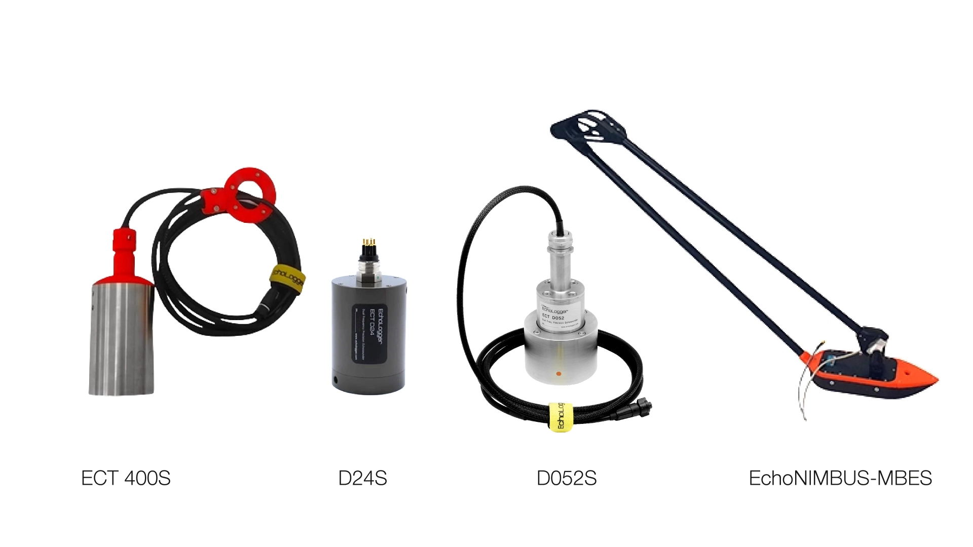
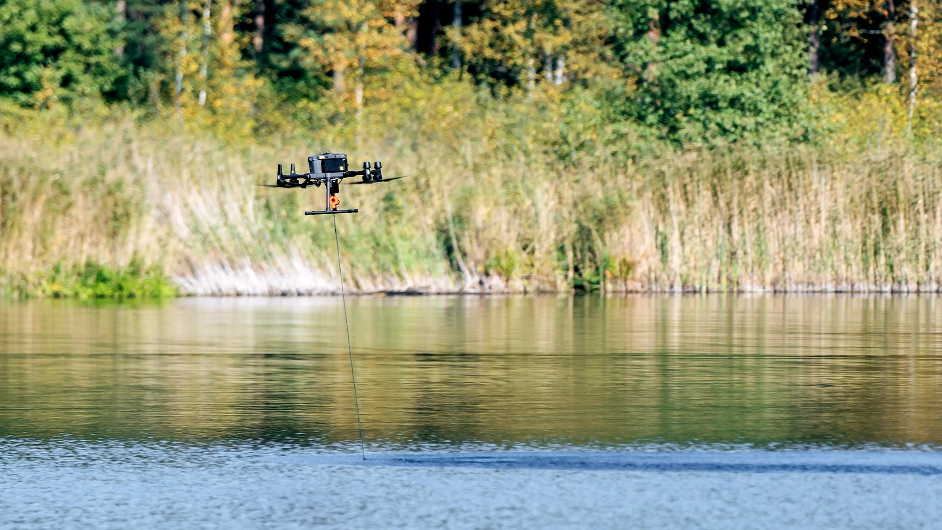
The ECT 400S is a 450 kHz single-beam sounder with a 5° beam and a 0.15 m minimum depth, integrated by SPH Engineering for drones including the DJI M400, M350 and M300, and the Inspired Flight IF800 and IF1200A. The whole system weighs 1.9 kg.
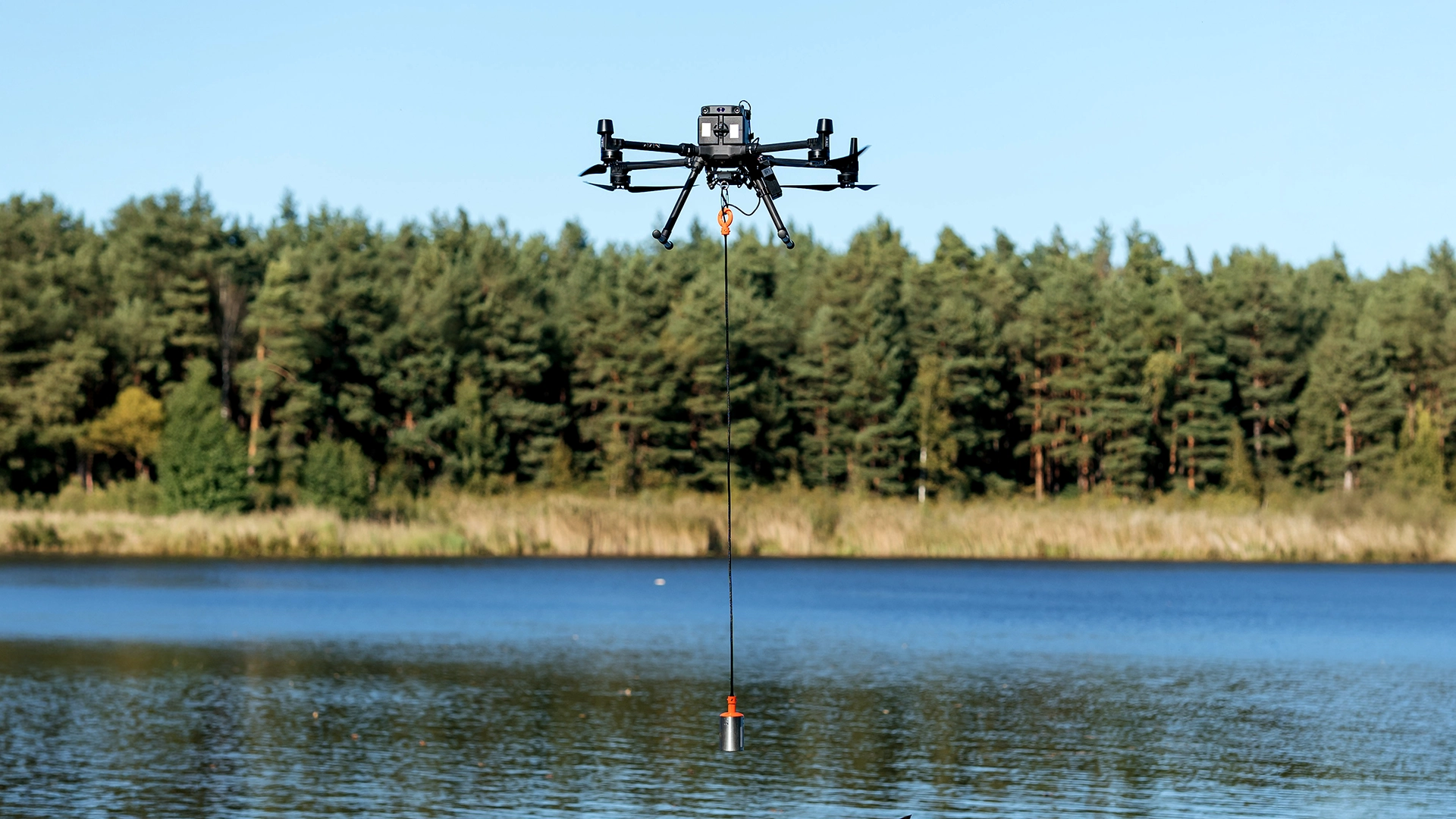
The narrow 5° beam gives a small footprint for bank profiles, and the short 0.15 m dead zone lets it map most riffle margins that a boat cannot reach.
In the Rönne Å project in Sweden, run by UAWOS with DTU, ECT 400S soundings from a drone deviated from reference measurements by less than 10 cm.
Sensor motion is the main limit in moving water. Flying slower, a standard procedure taught in the BATHY-1 course, and placing survey lines against the flow keep the suspended sensor stable, and SkyHub filters out soundings recorded at excessive tilt. Drone echo sounder missions are typically flown in river currents of up to about 1 m/s. For deeper or vegetated rivers, the dual-frequency models below fit better.
EchoLogger ECT D24S for vegetated rivers
The D24S pairs 200 kHz (10° beam, 0.5 to 200 m) with 450 kHz (5° beam, 0.15 to 100 m) in a 1.9 kg drone-mounted system. In rivers with submerged macrophytes, the 450 kHz channel tends to return from the canopy top while 200 kHz reaches further toward the bed, and the difference between the two can be mapped as vegetation height.
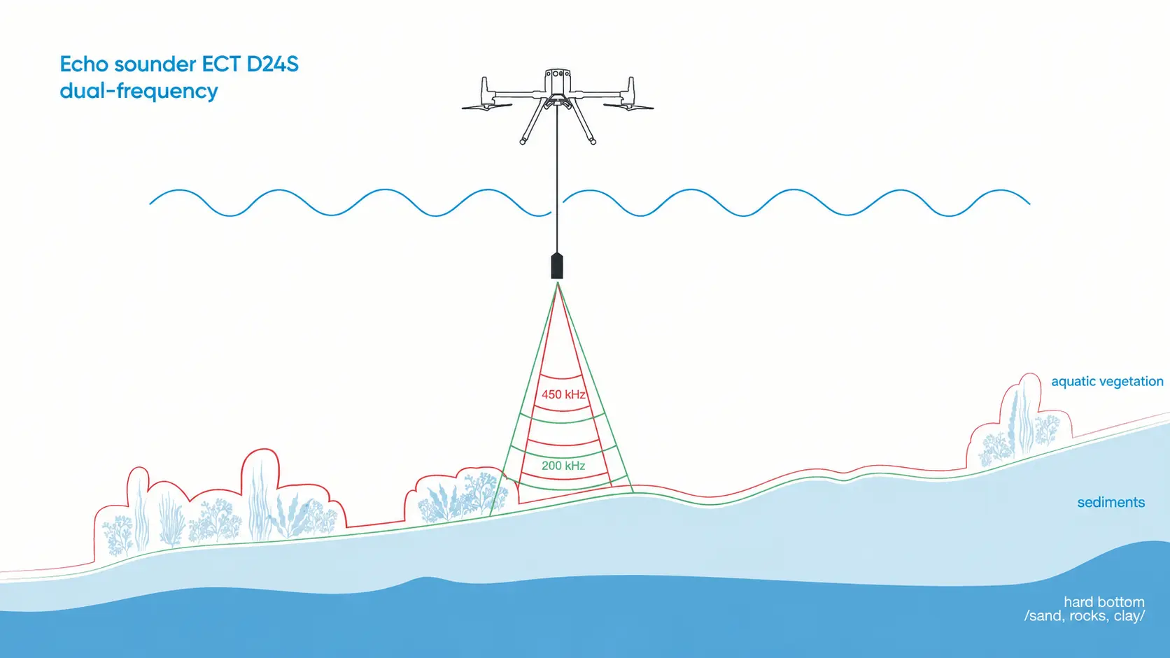
It also covers deeper water than the ECT 400S. Dense, tall vegetation can still stop both frequencies short of the bed. In the Rönne Å project, drone-borne water-penetrating radar was used for heavily vegetated reaches, measuring depth to ± 8 cm against an ADCP.
EchoLogger ECT D052S for reservoirs, sediment and deeper channels
The D052S combines 50 kHz (27° beam, 1.0 to 200 m) with 200 kHz (7° beam, 0.5 to 200 m) and weighs 2.45 kg. The 200 kHz channel returns from the water-sediment interface, and 50 kHz penetrates soft deposits, so the separation estimates sediment thickness in reservoirs, behind weirs and in harbor basins on rivers.
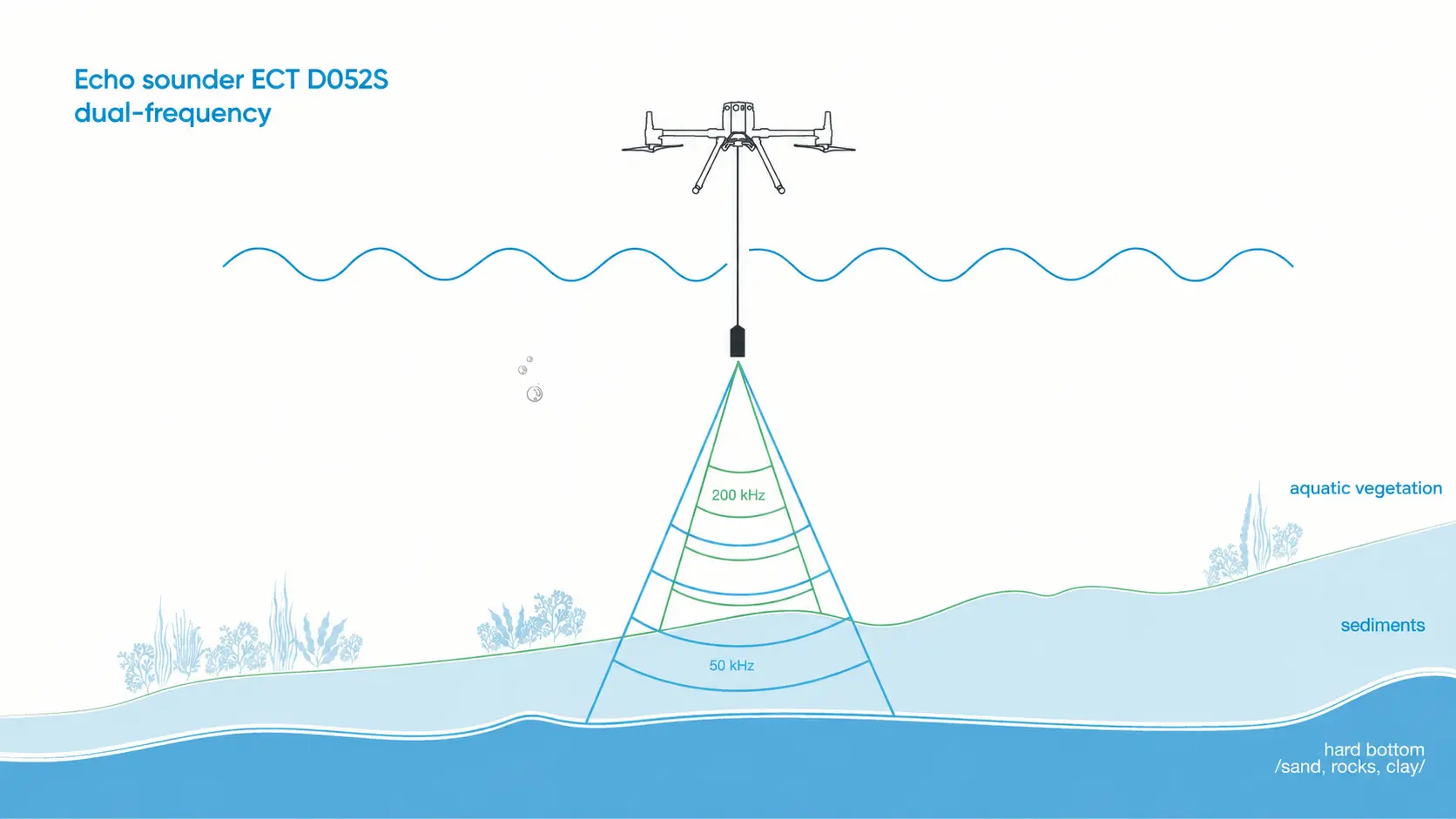
It is the most widely used configuration in SPH customer river projects:
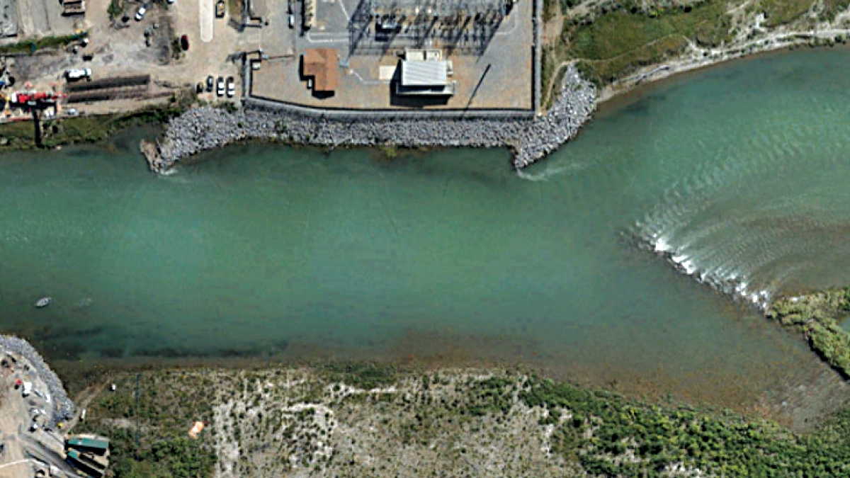
- On the Bow River in Canada, Altomaxx flew a DJI M300 with the D052S manually so the drone matched surface current and kept the sensor upright. The survey took a few hours, compared with a full day or more using the team’s previous method.
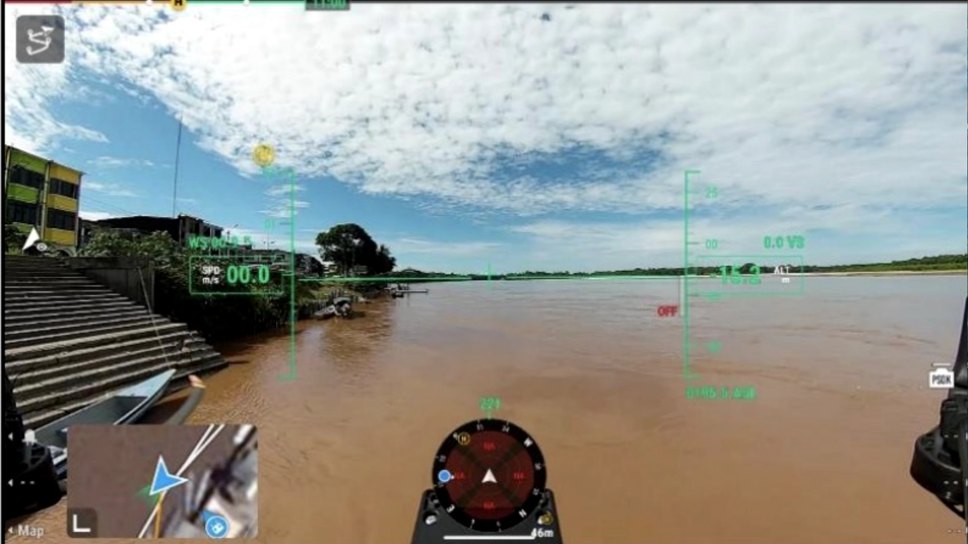
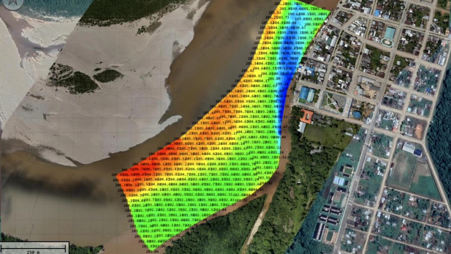
- On the San Miguel and Putumayo rivers in Ecuador, Andean Drone Solutions flew a DJI M350 with the D052S. Hovering and lowering the sensor point by point failed in the current, so the team flew continuous sweep lines aligned with the flow, collecting more than 25,000 points between 0.7 and 9.9 m deep. After GNSS latency correction in Hydromagic, results matched boat surveys.
EchoNIMBUS-MBES for scour, dredging and full-bottom coverage
The EchoNIMBUS-MBES carries a Cerulean Surveyor 240-16 multibeam on a drone: 240 kHz, 80° swath, 4° along-track beam, 0.5 to 50 m depth, 2.4 kg. Processing runs in BeamworX or Hydromagic.
Swath width shrinks with depth, so shallow rivers need many survey lines, but each line images the bank continuously. That removes the gaps between single-beam profiles that can hide scour holes at piers. SPH Engineering’s multibeam survey planning calculator estimates optimal survey line spacing, and a sample multibeam dataset from the Daugava and Pērse confluence in Latvia is available to view online.
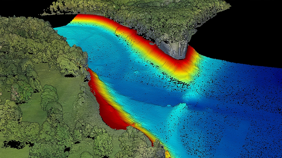
Multibeam brings more processing work than single-beam, including patch tests for roll, pitch and yaw offsets before the survey. Where profiles at fixed cross sections are the required result, single-beam remains faster to process.
Boat, USV and RTK pole systems from other manufacturers
Where a boat can launch and operate safely, single-beam sounders such as the Teledyne Odom Echotrac E20, Seafloor Systems HydroLite Plus, Ohmex SonarMite BTX and CEE HydroSystems CEEPULSE 100 are used from boats, USVs, RC boats and RTK poles, and the NORBIT WINGHEAD i77h is a compact multibeam with an integrated INS for boats and USVs. Their published specifications are in the second comparison table. Drone-suspended sounders cover the reaches these platforms cannot get to: shallow braided channels, rivers without launch points, and sites where crews cannot safely enter the water.
What decides accuracy on a river
The figures below are calculated from the IHO S-44 formula and the freshwater sound speed equation.
The IHO S-44 allowance barely grows with depth
At river depths the constant term dominates the IHO S-44 standard’s vertical allowance, TVU = √(a² + (b·d)²):
A sounder quoted at 0.2% of depth uses 1 cm of a 25 cm Special Order tolerance at 5 m.
Match sound speed to the water
Freshwater sound speed is about 1,447 m/s at 10 °C and 1,482 m/s at 20 °C. With a seawater default of 1,500 m/s, depths at 5 m read 18 cm deep at 10 °C and 6 cm deep at 20 °C. Sensitivity is about 4 m/s per °C, so measuring water temperature to ± 1 °C keeps the error near 1.4 cm at 5 m. For simpler surveys where sound speed cannot be modeled, a fixed value of 1,500 m/s or 1,481 m/s (close to fresh water at 20 °C) is standard practice, and the BATHY-2 course covers when each applies. Salt wedges in tidal reaches add roughly 1.3 m/s per PSU and need a profile.
Latency moves soundings off position
An uncorrected 200 ms offset between ping and GNSS at 2 m/s shifts soundings 0.4 m along track, which becomes 0.23 m of vertical error on a 30° bank. A latency test with reciprocal lines over a slope measures the offset, and Hydromagic applies the correction in processing, as in the Ecuador project above. On drone-suspended systems the transducer hangs on a cable of at least 2.1 m, which keeps the aircraft high enough above the water for reliable altimeter readings. Pole-mounted kits place the GNSS antenna directly above the transducer.
Bed elevation needs the water surface along the reach
Bed elevation is water surface elevation minus transducer draft minus depth reading. On a river falling 0.5 m per km, one gauge reading applied 1 km away misplaces the bed by 0.5 m. RTK water-edge heights along both banks, or water surface heights logged by the drone from its GNSS and altimeter, fix this; in the Rönne Å project, radar altimetry gave water surface elevation within 3 cm.
Choosing an echo sounder system for your river
A supplier can recommend a configuration once these are known:
- Required accuracy, as an IHO order or a ± value, and whether it applies to depth or bed elevation
- Shallowest and deepest depths in the survey area
- Bed type and vegetation
- How much of the cross section is bank, and whether full-bottom coverage is needed
- Current velocity and launch access
- Reach length and gradient
- Required result: profiles, a point cloud, a surface, volumes or sediment thickness
SPH Engineering supplies drone-integrated echo sounders with UgCS flight planning, processing in Hydromagic or BeamworX, sample datasets from Latvian and Estonian lakes, and training (BATHY-1 and BATHY-2 for single-beam echo sounders, MBES-1 and MBES-2 for multibeam echo sounders). Send the details above to the SPH Engineering team and request a configuration recommendation for your site.

