
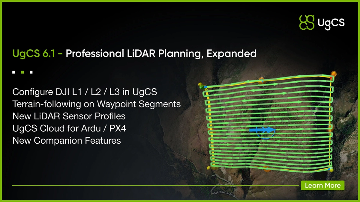
For LiDAR operators, that means selecting the sensor, planning the route, setting key payload parameters, accounting for terrain, and preparing calibration in UgCS before going to the field.
For teams flying non-DJI aircraft, UgCS 6.1 also introduces a new way to move UgCS flight plans to Android remote controllers for execution in QGroundControl.
Configure DJI L1, L2 and L3 directly in UgCS
The biggest change in 6.1 is for DJI LiDAR operators.
UgCS can now configure key parameters for DJI Zenmuse L1, L2, and L3 directly in the flight plan. Supported for DJI M350 and M400. Those include:
- return mode
- sampling rate
- scanning mode
Previously, these settings had to be configured separately in DJI Pilot 2.
Now the route and key LiDAR acquisition settings can be prepared together in UgCS.
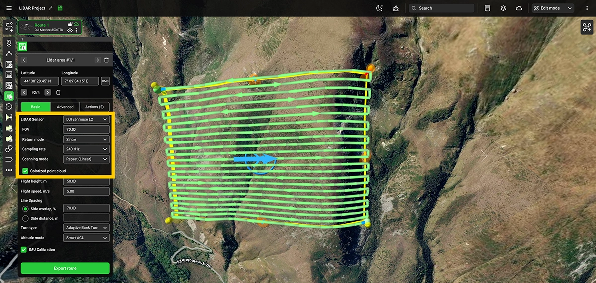
For survey teams, this makes pre-flight review easier: the flight geometry, terrain, calibration logic, and LiDAR configuration can all be checked during the same planning process.
New LiDAR sensor profiles, including your own
UgCS 6.1 makes setting up LiDAR sensors much faster.
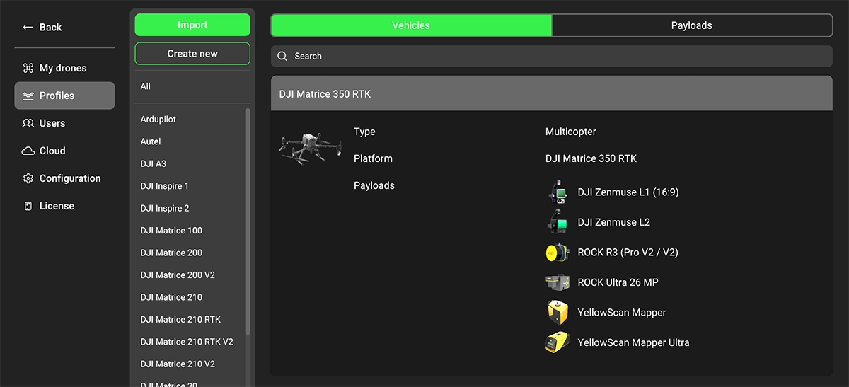
The release includes ready-made profiles for DJI Zenmuse L1, L2 and L3 as well as ROCK Robotic and YellowScan sensors. Choosing a profile automatically fills in the sensor's field of view (FOV) value.
But professional operators use far more LiDAR systems than we can realistically pre-load into UgCS.
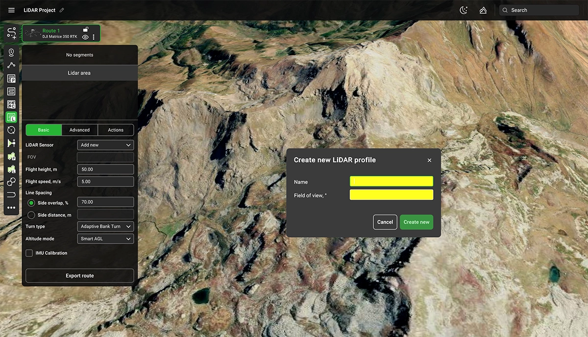
So 6.1 also makes it easy to create your own LiDAR profile directly from the sensor drop-down.
Just enter:
- the sensor name
- its FOV
UgCS saves the profile, and it will be available for future LiDAR missions.
No digging through configuration menus. No rebuilding the same sensor setup every time.
This is particularly useful for survey companies operating mixed-payload fleets or specialist LiDAR systems not included in the built-in profiles.
LiDAR planning is more than drawing flight lines
Many decisions that affect a LiDAR dataset happen before takeoff.
Flight altitude. Line spacing. Terrain. Sensor field of view. IMU calibration. Turn behaviour. Payload settings.
That is why UgCS has dedicated LiDAR Area and LiDAR Corridor planning tools rather than treating LiDAR as another generic mapping grid.
UgCS already provides professional LiDAR workflows including:
- automatic IMU calibration patterns
- terrain following
- custom DEM, DTM and DSM import
- LiDAR-specific Area and Corridor planning
- turn control designed for survey routes
- 3D route and elevation review
- planning for DJI, ArduPilot and PX4 aircraft
UgCS 6.1 adds the sensor itself more directly into that workflow.
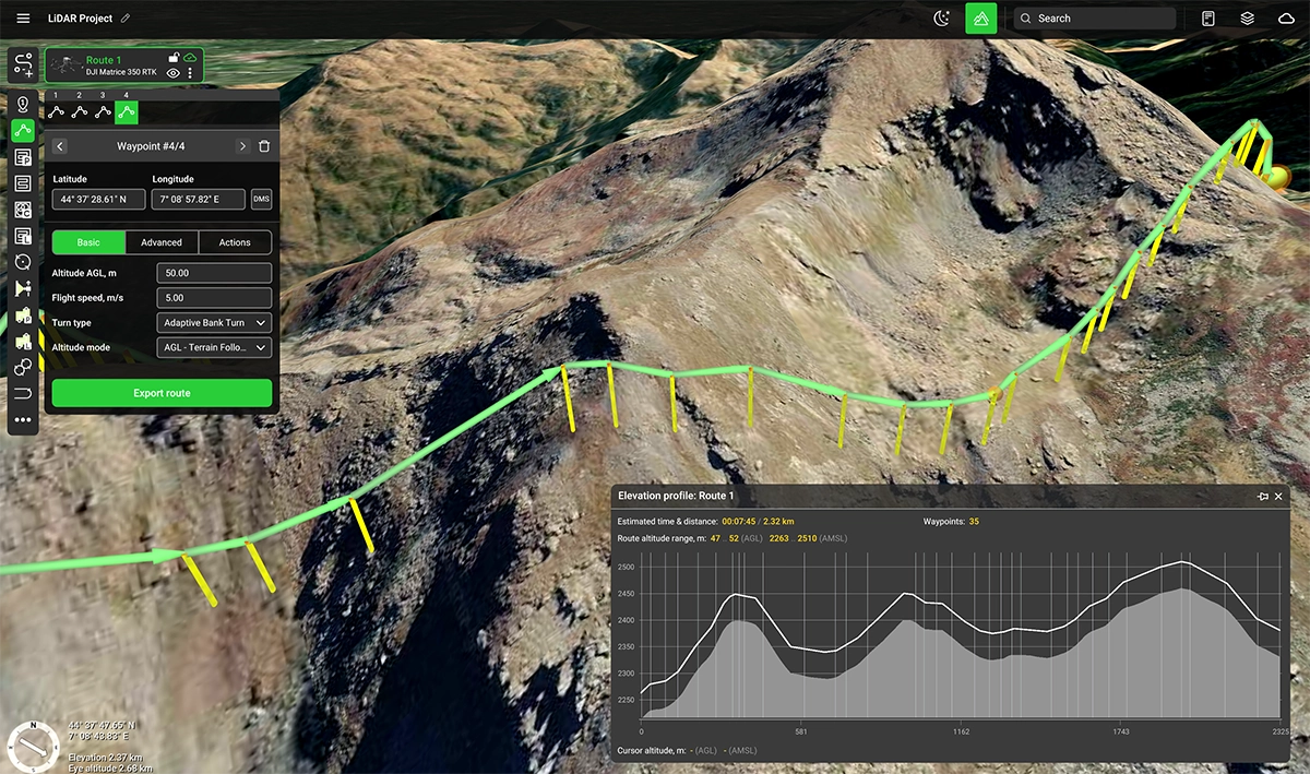
Terrain Following Now Works on Waypoint Segments
Terrain following is no longer limited to survey segments.
With UgCS 6.1, waypoint segments can use the new AGL Terrain Following mode, allowing the planned route to follow changing terrain while the drone travels to and from the survey area.
Previously, operators working in hilly or mountainous terrain often had to add intermediate waypoints manually, build workaround segments, or plan the transit at a much higher altitude.
Now UgCS can calculate that terrain-following transit as part of the mission.
The result: less manual planning, better terrain clearance planning, and a more consistent AGL throughout the route.
Who is UgCS 6.1 for?
The LiDAR improvements are particularly relevant for:
Drone survey companies running regular LiDAR area and corridor projects.
DJI Enterprise operators flying Zenmuse L1, L2 or L3 who want to prepare more of the mission on a desktop before going to the field.
Infrastructure and utility teams planning LiDAR surveys of powerlines, roads, railways, pipelines and other long corridors.
Mining, forestry and terrain-mapping teams working over sites where maintaining the intended relationship between the sensor and changing terrain is critical.
Mixed-fleet operators using different payloads or combining DJI aircraft with ArduPilot or PX4 platforms.
UgCS Cloud now extends to ArduPilot and PX4 workflows
UgCS 6.1 also expands the connection between UgCS and Ardupilot / PX4 drones.
The new UgCS Cloud app for Android allows to sync routes planned on your UgCS desktop to the drone's RC. Sign in to the same UgCS Cloud account in both places, and every route you plan is ready to hand over to QGroundControl.
This gives ArduPilot and PX4 operators another way to use UgCS for detailed desktop mission planning while continuing to execute flights through QGroundControl in the field.
More improvements in UgCS 6.1
UgCS 6.1 also makes imported routes much more capable.
CSV route import now supports camera triggers, video controls, zoom, camera yaw, POIs and turn types. This means externally generated routes can arrive in UgCS with much more of the mission logic already included.
For teams building repeatable workflows, scripts or custom planning tools, this opens up a more automated way to prepare missions.
A route can be generated outside UgCS, exported as CSV and imported with the required actions already attached, instead of rebuilding them manually afterwards.
That also makes UgCS easier to integrate into AI-assisted planning workflows. Teams can use their own scripts or models to generate route data in CSV format, then bring it into UgCS for review, validation and execution.
The release also improves ArduPilot route behaviour, feedback and diagnostics, alongside multiple stability fixes.
Point-cloud quality starts in UgCS
LiDAR acquisition is unforgiving of poor planning.
UgCS is built to move more of those decisions into mission preparation.
With 6.1, that workflow becomes stronger for DJI L1, L2 and L3 and easier to standardise across different LiDAR systems.
Download UgCS 6.1 and plan your next LiDAR mission.