

Three constraints decide the outcome before sensor specification enters the picture.
What decides payload choice before the datasheet does
How close the sensor can fly to the target
For compact, dipole-like magnetic targets, anomaly amplitude can decrease approximately with the cube of sensor-to-target distance, so small changes in flight altitude produce large changes in what a magnetometer records. Altitude also decides whether two nearby anomalies stay separable.
At the Oklahoma State University CENFEX seeded range, MagNIMBUS picked 20 targets at 1.0 m altitude, 43 at 0.5 m and 57 at 0.2 m over the same 131 buried and surface objects, and a SENSYS MagDrone R1 flown over the same field returned comparable counts at the two altitudes it covered. Two things produced that spread. Weak anomalies sitting inside the noise at 1.0 m came clear of it lower down. And because objects on that field are laid out 1 m apart along each line, anomalies that merged into one feature at higher altitude resolved into separate picks closer to the ground, including small targets whose signal a nearby large object had been swamping. Counts from a field laid out that densely say as much about survey geometry as about the sensor.
Airborne GPR also loses penetration as antenna height increases. In dry sand, a 100 MHz GPR antenna can reach 15 to 20 m when towed on the ground and 7 to 10 m when flown. The reduction reflects the longer propagation path and weaker coupling to the ground, so data quality improves as flight altitude drops.
Whether the target has a property the sensor can sense
A magnetometer responds to magnetic-field anomalies from ferromagnetic material, with amplitude set by target size, shape, magnetisation and sensor-to-target distance. Plastic, aluminium and copper produce no useful magnetic anomaly, which is why non-ferrous ordnance at the OSU range appeared in the magnetic data only where it contained ferrous components, the exception being a conductor carrying current, which generates a field of its own. GPR responds to dielectric contrast and its signal will not penetrate through metal at all. A methane detector responds to a gas plume that has to physically reach the aircraft.
Whether the required flight pattern is flyable at the site
Flying lower to gain sensitivity often calls for tighter line spacing for small-target detection, which increases flight time and battery changes. Doppler velocity measurement over water needs stable flight, precise angle control and enough surface texture to return a signal, conditions that low-altitude river surveys do not always offer. A pattern that works on paper can be impossible over a forested corridor or inside a restricted airspace.
Once those three are settled, the sensor choice usually narrows to one or two options.
Sensor selection at a glance
Drone magnetometers for buried ferrous targets
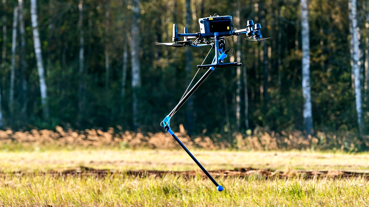
Magnetometry is the default choice when the target is ferrous and buried, which covers unexploded ordnance, abandoned wells, tramp metal in stockpiles, and magnetic mineralisation in exploration work.
Two sensor families behave differently in the field. Atomic total-field sensors such as the QuSpin QTFM Gen-2 used in MagNIMBUS record scalar total magnetic intensity and can be integrated for very low clearance flight. Triaxial fluxgate sensors such as the FGM3D in the SENSYS MagDrone R1 record three vectorial components (Bx, By and Bz) and attach to any aircraft carrying at least 1 kg. In the OSU comparison both magnetometers recorded at 250 Hz and returned the same count at 1.0 m and two apart at 0.5 m, which puts the decision on integration and workflow more than raw sensitivity.
The trade-off to plan for is coverage. Flying lower raises sensitivity to small targets and narrows the ground each line usefully covers, so line spacing has to come down with the altitude, which adds flight time and battery changes. Read more on detection ranges in magnetic survey technology before committing to a survey design, and browse drone magnetometer systems once the altitude and spacing are fixed.
Ground-penetrating radar (GPR) for subsurface structure
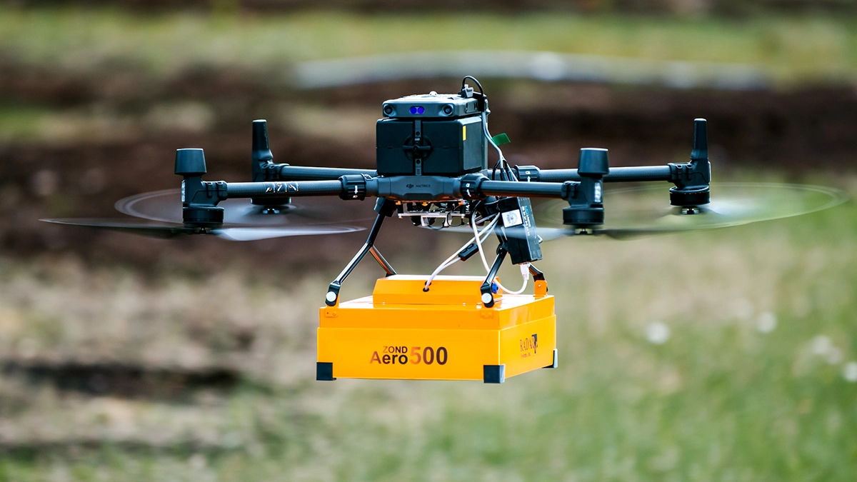
GPR is suited to targets and interfaces with sufficient dielectric contrast: buried utilities, voids and sinkholes, pavement and bedrock layers, ice and snow thickness.
Signal penetration is controlled by both the geological medium and the antenna frequency. Published airborne examples span from well below a metre in conductive ground to tens of meters in favourable low-loss materials. Snow and ice extend penetration three to four times further than dry sand, which is why a low-frequency airborne system was able to locate a P-38 wreck under roughly 100 m of Greenland ice back in 2018.
Frequency selection follows target depth and size together with the properties of the medium.
- 500 to 600 MHz for utility mapping, void screening and archaeology in the 1 to 4 m range
- 150 to 300 MHz for bedrock and stratigraphy between 4 and 15 m
- 50 to 100 MHz for glaciology and deep geology beyond 15 m
Antenna-swappable systems in the Zond Aero LF family cover jobs that span more than one of those bands. The full GPR depth breakdown explains the medium dependency, and drone GPR systems lists the available frequencies.
Echo sounders and GPR for bathymetry
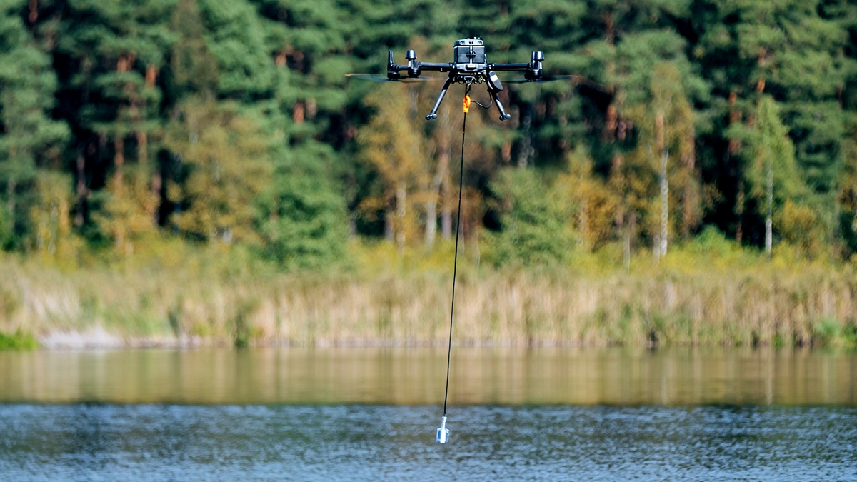
Two different payloads map the same thing, and the water decides which one works.
Single- and dual-frequency echo sounders in the EchoLogger ECT series measure water depth and sediment layers directly and are the reliable option in open water: tailings ponds, settling ponds, dredging channels, mine pits and lakes without safe boat access. Dual-frequency units, such as the ECT D052S (50 / 200 kHz), can in suitable soft-bottom conditions distinguish the soft upper layer from the harder bed beneath it, which matters for dredging volume estimates.
GPR flown over water works where an echo sounder struggles and in some cases complements the acoustic data. In the Rönne Å survey a Zond Aero LF unit returned riverbed profiles through shallow vegetated sections that acoustic sensors could not resolve. Its performance depends strongly on water electrical conductivity, depth, surface clutter and bed conditions; turbidity by itself is not the controlling limitation for radar.
Neither payload requires a vessel, which is usually the deciding argument on sites where launching one is slow or unsafe. Drone echo sounders cover the ECT range.
Methane detectors for leak and emission surveys
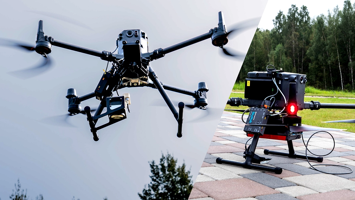
Methane detection depends strongly on sensor architecture. TDLAS sensors measure path-integrated methane along the laser beam between the drone and a reflecting surface; direct-sampling sniffers measure methane concentration in air drawn through the sensor inlet. In both cases, flight planning determines whether the laser path or sensor inlet intersects the plume.
Wind is therefore the primary planning variable. A plume drifts downwind of its source, so a survey flown across the prevailing wind at a consistent height above the asset intercepts it and one flown along the wind may miss it entirely. Concentration readings locate the plume; pinpointing the source usually needs a second, tighter pass.
The payload suits pipeline corridors, well pads, compressor stations and landfill caps, where the alternative is walking the asset with a handheld detector. Survey design guidance sits on the drone methane gas detection application page, and available sensors are listed under methane detection.
Gamma-ray spectrometers for radiometric mapping
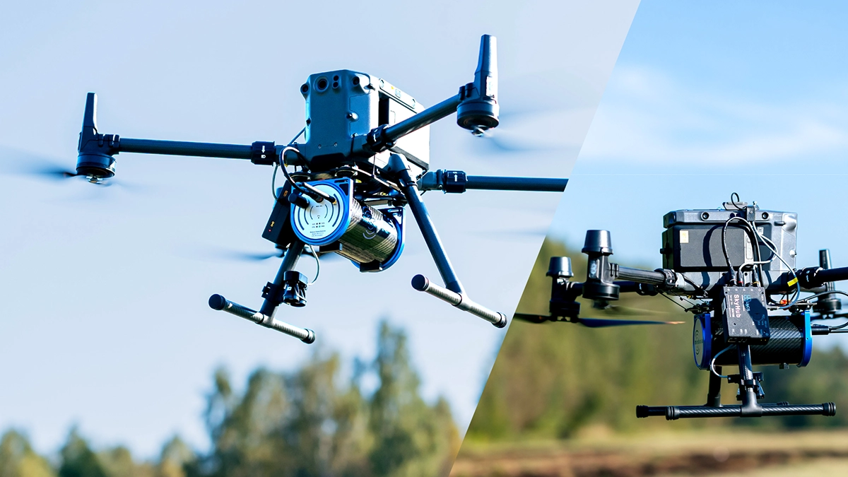
Gamma-ray spectrometry measures gamma-emitting radionuclides. For natural radiometric surveying, potassium is derived principally from K-40, while uranium and thorium are commonly reported as equivalent uranium (eU) and equivalent thorium (eTh) because the measurement relies on daughter products in their decay series. Artificial radionuclides, such as Cs-137 can also be mapped when present. The method supports near-surface radioelement mapping, lithological interpretation and contamination screening. It does not locate discrete non-radioactive objects, though localised radioactive hotspots do show up.
The constraint is counting statistics. Gamma flux falls off with distance, and a usable spectra requires enough counts within each measurement interval. Sensitivity and spatial resolution can be improved by lower altitude, slower speed, longer integration time or a larger detector, depending on the target and survey design. Crystal volume drives sensitivity, and larger crystals mean more payload weight, which is where aircraft selection enters.
It pairs naturally with magnetometry on exploration projects because the two answer different questions about the same target area. Sensors including the Medusa Radiometrics MS-350 are listed under gamma-ray spectrometers, and the radiometric mapping application page covers typical survey design.
Hydrometric radar for water level and discharge
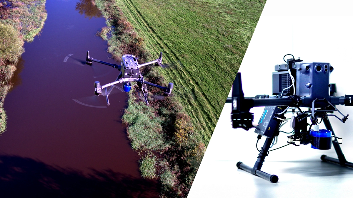
River discharge is derived from channel cross-sectional area and mean flow velocity; no single airborne sensor provides every input. Water surface elevation can come from a radar altimeter such as the Geolux LX-80. A Doppler radar such as the Geolux RSS-2-300W measures surface velocity, which must be related to cross-section mean velocity before discharge is calculated from the combined data. Bed geometry can come from an echo sounder or GPR.
The reason to fly is access. Fixed gauging stations only exist where infrastructure already does, and in-water instruments are unusable during the flood events that matter most. Contactless measurement removes both limits.
Airborne Doppler is the least forgiving element. Accurate velocity readings need stable flight, precise angle control and a water surface with enough texture to scatter the signal. SPH Engineering's work in the Horizon Europe UAWOS consortium has run this configuration on rivers including the Rönne Å in Sweden, the Torne on the Swedish-Finnish border, the Po in Italy and the Ouémé in Benin, with results validated against ground truth at centimetre level. Sensors are listed under hydrology.
Metal detectors for surface and shallow metal
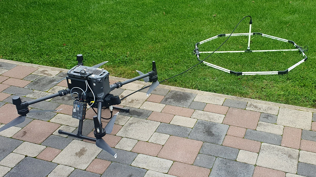
An airborne metal detector detects conductive metal regardless of whether it is ferrous, which is the one thing a magnetometer cannot do.
The cost is clearance. Electromagnetic induction range is short, so the coil has to fly low and hold that altitude precisely, which restricts the payload to open, reasonably flat ground. On broken terrain or dense vegetation, the flight profile becomes impractical before the sensor becomes the limitation.
Where it earns its place is gold, aluminium, copper and brass targets that magnetic data simply does not contain. Our drone metal detectors page shows the available systems.
LiDAR, photogrammetry and optical payloads
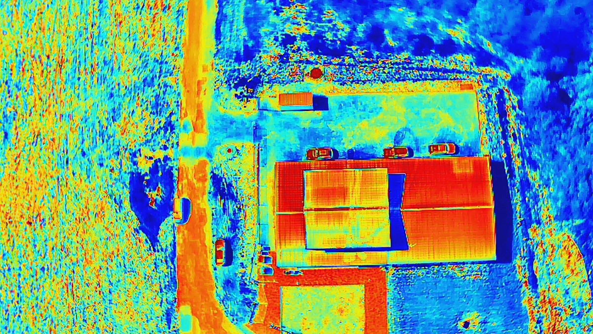
These payloads measure the surface, which makes them complementary to everything above.
LiDAR returns ground geometry beneath vegetation canopy and is the standard for corridor mapping, forestry and terrain models where photogrammetry cannot see the ground. Photogrammetry from an RGB camera produces comparable surface models at lower cost when the ground is visible. Multispectral and hyperspectral cameras add reflectance information for vegetation health, mineral indices and material discrimination.
SPH Engineering's role here is the flight planning layer, not the sensor itself. UgCS plans missions for LiDAR units from DJI, YellowScan, RIEGL, Phoenix LiDAR, GeoCue, Rock Robotics, GeoSun and 3DT Scanfly, and inserts the IMU calibration patterns those units need inside the automated route. For optical payload selection, the practical guide to hyperspectral cameras and drones covers the trade-offs in detail, and drone mapping software comparison covers the processing side.
What carries the payload decides the result
The most common cause of an unusable geophysical dataset is not the sensor. It is an inconsistent altitude.
Every constraint in the first section compounds through the aircraft. A magnetometer flown at a nominal 0.5 m that drifts to 1.2 m over a rise has lost most of its sensitivity for small targets on that line, and standard GPS-based terrain following cannot correct fast enough on coarse, bumpy ground. True Terrain Following uses a laser or radar altimeter to hold measured clearance instead of a modelled one.
The onboard computer matters for the same reason. SkyHub time-stamps sensor readings against position, triggers the payload, and logs data that would otherwise arrive without usable geolocation. Without that layer a survey produces a sensor file and a flight log that have to be reconciled afterwards, and any drift between them appears as position error in the final map.
Running more than one sensor on a single flight
Combining payloads is worth doing when the sensors answer different questions about the same ground and their flight requirements are compatible.
Magnetometer and gamma-ray spectrometer datasets pair well on exploration ground. The Rönne Å hydrometry work combined a radar altimeter, an echo sounder and GPR on the same aircraft because discharge needs all three. GPR and echo sounder together have been used to profile mine water bodies and the material beneath them in one simultaneous flight.
The limits are weight, magnetic interference between payloads, and conflicting flight profiles. A sensor that needs 0.5 m clearance and one that needs 30 m will not share a flight, and putting a powered instrument near a magnetometer usually costs more in noise than the combined flight saves in time.
Testing a payload choice before committing
Two things reduce the risk of buying the wrong sensor.
Published comparative data from controlled sites lets you check a claim against a known target set instead of a datasheet. The OSU CENFEX seeded field, operated by the Demining Research Community and the OSU Global Consortium for Explosive Hazard Mitigation, holds 131 catalogued objects at known depths, which is why the magnetometer comparison above reports detections against a denominator. Ask any vendor what their numbers are measured against, and how closely the targets sit, because a dense layout changes what a detection count means.
Flying the sensor over ground that resembles your site is better still. SPH Engineering operates a test range for geophysical sensors and runs field demonstration days where payloads can be flown before purchase. For a site-specific question, the drone geophysical surveys page lists the application scenarios each payload has been used for.
Frequently asked questions
Which drone sensor detects buried objects?
Magnetometers detect buried ferrous objects, ground-penetrating radar detects buried voids, utilities and layer boundaries, and metal detectors detect shallow conductive metal including non-ferrous targets. Which one applies depends on the material and geometry of the target: a magnetometer will not register plastic or aluminium, and GPR will not be able to see anything underneath a metal object.
How deep can a drone sensor detect?
Depth depends on the ground more than on the sensor. Airborne GPR penetration ranges from roughly 0.3 m to 30 m, reaching 7 to 10 m in dry sand with a 100 MHz antenna and as little as 50 to 60 cm in wet clay. Magnetic detection range falls with the cube of the distance between sensor and target, so flight altitude matters more than nominal sensor sensitivity.
Can one drone carry more than one sensor?
Yes, where weight allows and the payloads do not interfere with one another. Discharge surveys routinely combine a radar altimeter, an echo sounder and GPR on one aircraft. Sensors requiring very different flight altitudes, or a powered instrument mounted near a magnetometer, are better flown separately.
What is the difference between a total-field and a fluxgate magnetometer?
A total-field sensor measures total magnetic intensity as a single scalar value. A triaxial fluxgate sensor measures the field as vector components along three axes. The choice comes down to whether the processing workflow needs scalar or vector data, how the sensor behaves for heading and orientation effects, and what clearance and weight the aircraft can carry.
Do I need a specific drone for survey sensors?
The aircraft matters less than the payload interface. A geophysical sensor needs an onboard computer to time-stamp readings against position and a terrain following system accurate enough to hold the clearance the sensor requires. SkyHub integration covers aircraft including the DJI M300, M350 and M400, Cube and Pixhawk platforms, Inspired Flight, Harris Aerial and Wispr.