
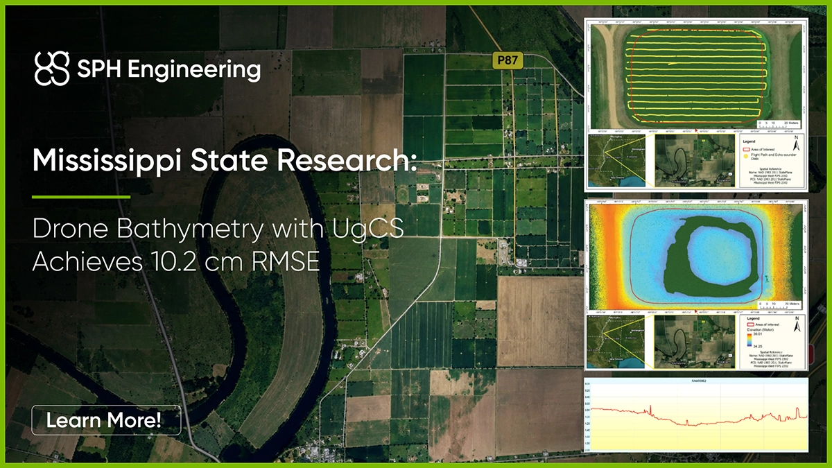
First, the team surveyed a 2.09-acre pond using a DJI Matrice 300 RTK carrying an SPH Engineering single-beam echo sounder system. Then the pond was drained and the exposed bottom was surveyed again with LiDAR.
This meant the researchers could compare thousands of sonar measurements collected through the water with independent measurements of the same pond bottom after the water was removed.
Across 11,439 comparison points, the average vertical difference represented by root mean square error (RMSE) was 10.2 cm. With the strongest tested processing approach, the resulting bathymetric surface came within approximately 6-7 cm of the reference data.
For drone surveyors, the study provides peer-reviewed evidence that drone-based single-beam bathymetry can produce a close representation of shallow underwater terrain, while also showing how survey density and data processing affect the final result.
Study at a Glance
Why Shallow-Water Bathymetric Surveys Are Hard to Do by Boat
Bathymetric surveys are used to understand the shape and depth of underwater terrain for applications such as sediment monitoring, water-volume calculations, restoration projects and infrastructure assessment.
Echo sounders are normally mounted on a boat, but small ponds, shallow margins, difficult launch access and obstacles can make boat-based surveying slow or impossible.
A drone can carry the sensor to these areas, but the operation is technically demanding. The echo sounder must remain submerged while the aircraft follows the survey route above it. The drone also needs to maintain a stable height over the water while towing the sensor.
Mississippi State used the SPH Engineering system to automate this process.
How the Drone Survey Worked
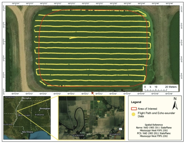
The team mounted an EchoLogger ECT D052S dual-frequency (50/200 kHz) single-beam echo sounder on a DJI Matrice 300 RTK, integrated through SkyHub onboard computer.
The survey route was planned in UgCS drone flight planning software using parallel lines spaced 5 m apart. During flight, a laser altimeter helped the aircraft maintain a constant height above the water while the echo sounder was towed below the drone.
Because Pond D1 was shallow, the researchers used the sensor's 200 kHz measurements for the accuracy analysis.
The complete 2.09-acre pond survey took approximately 60 minutes across four flights, including battery changes. The echo sounder was towed at a maximum speed of 0.7 m/s.
The result was a dense set of depth measurements covering the pond.
But collecting sonar data was only half of the experiment. The researchers still needed to know how closely those measurements represented the actual pond bottom.
Draining the Pond for an Independent LiDAR Reference Survey
After the sonar survey, Pond D1 was drained.
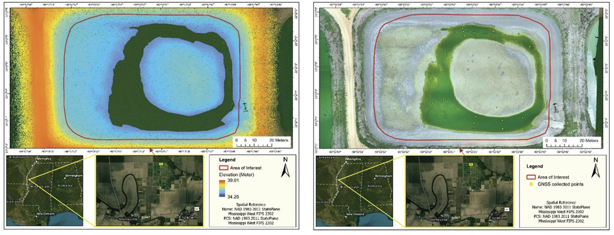
Nineteen days later, the researchers flew another uncrewed aerial system (UAS) survey over the exposed pond bed, this time using a GeoCue TrueView 515 LiDAR system.
This gave the researchers a direct survey of the exposed bottom to compare against the drone sonar data.
Small areas of standing water remained after drainage, so GNSS ground survey points were used to supplement areas the LiDAR could not capture.
The researchers also checked for changes to the pond bed between surveys. No rain was recorded during the 19-day interval, and their analysis found no systematic pattern of erosion or sedimentation that would invalidate the comparison.
Drone Echo Sounder Accuracy Against the Drained-Pond Surface
After cleaning the sonar data, the researchers compared 11,439 measurements with the independent reference survey.

In practical terms, thousands of underwater measurements collected by a sensor suspended from a flying drone were compared with the pond bottom measured after drainage, and the overall difference was around ten centimetres.
The researchers also found that some of the larger differences were concentrated in very shallow areas, where water-surface reflections, environmental conditions and sensor’s minimum operating depth can make sonar measurement more difficult.
When they tested the data after removing the strongest deviations, the error fell to 6.59 cm. The researchers treated this as a sensitivity test rather than the headline accuracy result, so 10.2 cm remains the more representative figure for the complete cleaned dataset.
Turning Sonar Tracks Into a Bathymetric Map
A single-beam echo sounder measures the bottom directly beneath the sensor. It does not scan the entire surface between survey lines.
Software therefore has to estimate the terrain between those measurements to create a continuous bathymetric map.
Mississippi State tested ten different processing methods to see how much that choice affected the result.
With survey lines spaced 5 m apart, the strongest tested method produced a bathymetric surface with 6.31 cm RMSE against the reference data.
The researchers then simulated wider survey lines. At 10 m line spacing, the strongest results remained close to the reference, at approximately 7.1 cm RMSE.
How densely the site is surveyed and how those measurements are interpolated can materially affect the accuracy of bathymetric mapping.
How Much Survey Data Is Enough?
The researchers also investigated what happens when fewer measurement points are used.
For Pond D1, configurations with measurements spaced 5–10 m apart performed better than configurations using 20–30 m intervals. One of the strongest tested combinations produced an error of approximately 6.6 cm against the reference.
Other ponds may need different spacing.
The appropriate spacing depends on the site, including the depth and complexity of the underwater terrain. A shallow site with rapidly changing bottom topography may require denser measurements than a deeper, relatively uniform water body.
Reducing the number of measurements too aggressively lowered the quality of the resulting bathymetric surface.
What This Means for Drone Bathymetry
The 2.09-acre pond was surveyed in about one hour, without putting a survey boat on the water.
The study does not establish a universal accuracy specification for every water body. Depth, bottom geometry, survey spacing, environmental conditions, and processing all affect the result, which is why it is worth reading alongside other LiDAR-validated work such as the dual-frequency echo sounder survey as Lake Conza in Italy.
It does provide direct, peer-reviewed validation that a drone-towed single-beam echo sounder can reconstruct underwater terrain that closely matches an independently surveyed reference surface.
For shallow ponds and other sites where launching or operating a survey boat is difficult, including stormwater detention ponds and industrial impoundments, drone-based echo sounding is a practical option.
Source
Bashit, M. S., Pricope, N. G., McCraine, D., Skarke, A., & Meng, Q. (2026). Optimizing interpolation methods and assessing accuracy of UAS-Echo sounder data for enhanced bathymetric mapping in inland waters. International Journal of Remote Sensing. Published online 11 August 2026. DOI: 10.1080/01431161.2026.2713782.

