

That magnetic reference is only as good as the geomagnetic model behind it. Global models provide the broad magnetic field, but local crustal geology and time-varying external fields can introduce uncertainty. For high-accuracy well placement, especially in areas with tight well spacing or challenging magnetic conditions, a local magnetic reference may help improve the geomagnetic reference used in wellbore positioning. This article explores where drone aeromagnetic surveys could provide useful site-specific data for that workflow.
Why magnetic referencing matters
A downhole magnetic measurement does not directly “know” true north (not to be confused with magnetic north). It measures the magnetic field around the tool. To convert that measurement into a usable heading, the survey workflow needs reliable values for:
- Magnetic declination: the angle between magnetic north and true north
- Magnetic dip (inclination): the angle at which the magnetic field points into or out of the Earth (also called magnetic inclination, distinct from wellbore inclination)
- Total field strength: the magnitude of the magnetic field
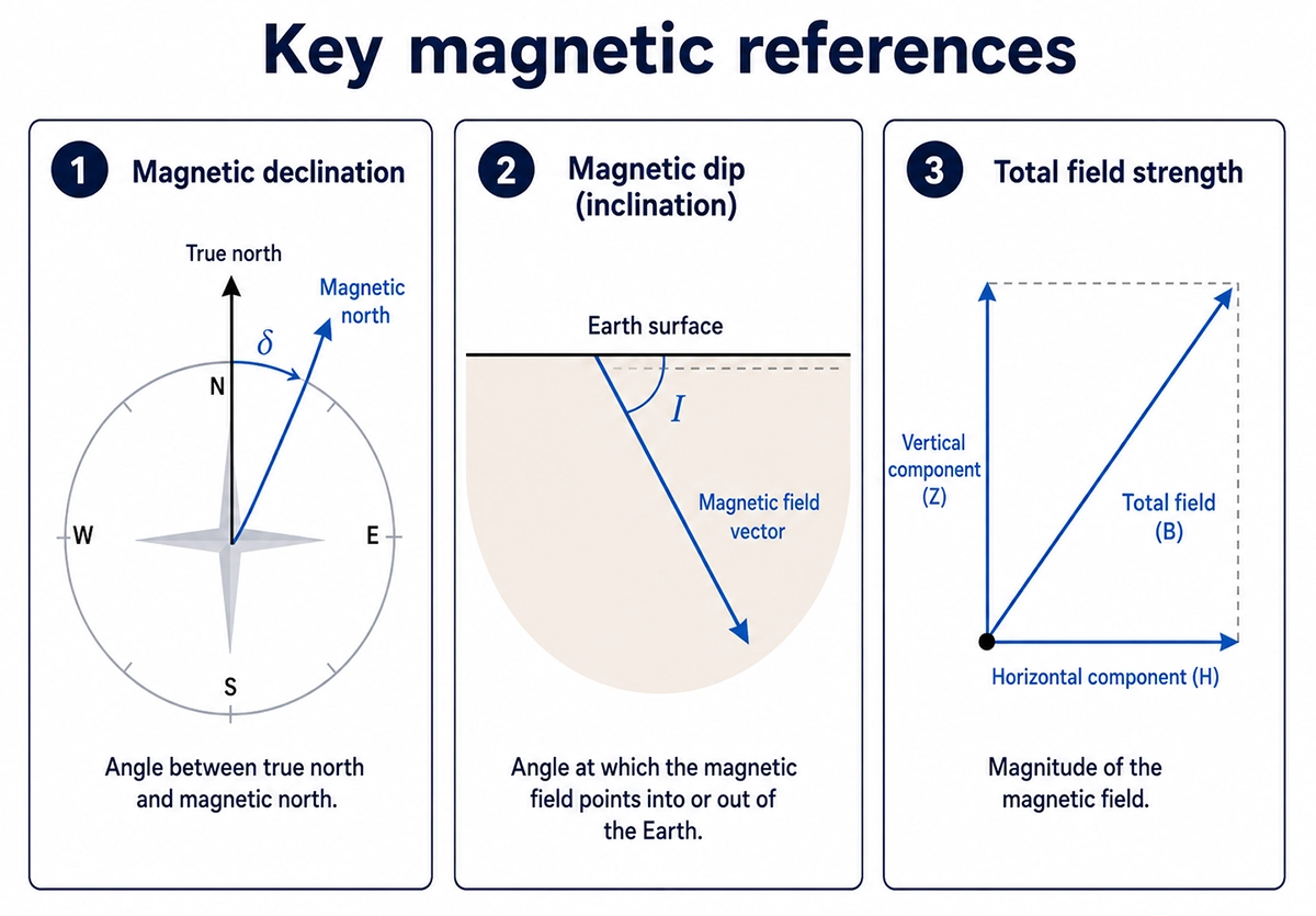
If the reference field is inaccurate, the calculated azimuth will also be inaccurate. Over a long lateral section, even a small angular error can create a meaningful positional offset. As a simplified geometric example, a 1° azimuth error over 3,000 m corresponds to about 52 m of lateral displacement.
What global geomagnetic models provide
Directional drilling workflows commonly rely on geomagnetic reference models such as the BGS Global Geomagnetic Model (BGGM). Public models such as the World Magnetic Model and IGRF are also widely known,but they are not intended to resolve every small-scale crustal magnetic feature that may affect subsurface navigation.
These models describe the large-scale structure of the Earth’s magnetic field. However, the observed field at a drill site can also be affected by local crustal magnetization, nearby steel infrastructure such as casing, wellheads, pipelines, rigs, vehicles, or fences, and external disturbances linked to ionospheric and magnetospheric activity. In some locations, these effects can be large enough to matter for wellbore placement. Higher-resolution commercial models, such as the High Definition Geomagnetic Model (HDGM), incorporate more crustal-field detail than public global models and provide drilling-relevant parameters such as declination, dip, and total field strength. However, they are still models, so site-specific magnetic data may be useful where local conditions need closer evaluation.
In-field referencing: correcting for the local geology
In-Field Referencing or IFR, improves the geomagnetic reference used for directional drilling by adding local magnetic-field information from the area around the well. The goal is to better represent the crustal field that affects the MWD magnetic reading.
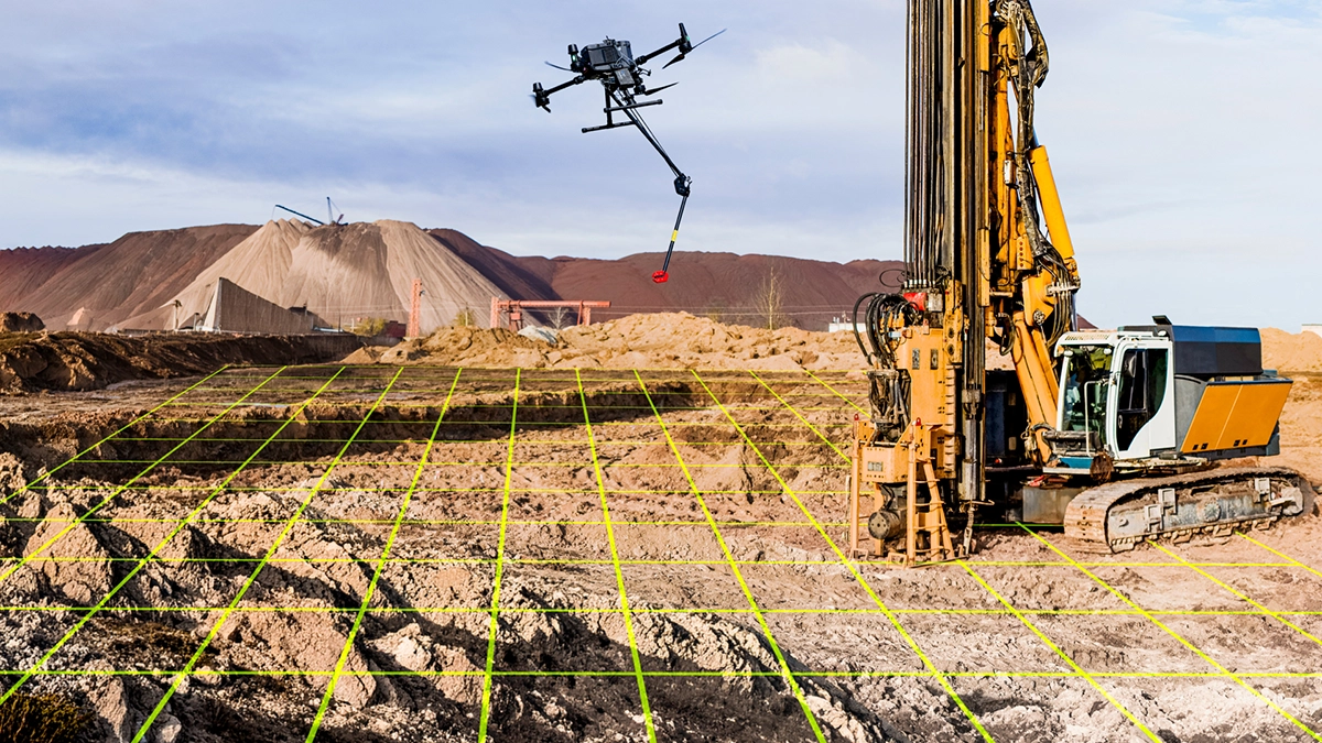
This is where aeromagnetic survey data becomes relevant. A local magnetic survey may help characterize crustal magnetic variation around the drill site. With appropriate data processing and modelling, magnetic data from an airborne, terrestrial or marine survey may help constrain the local crustal-field correction and improve the reference values used for drilling.
Interpolated In-Field Referencing, or IIFR, addresses a different source of error: time-varying external fields. It combines the local reference with real-time or near-real-time data from magnetic observations to estimate the field at the drill site during drilling. This is especially relevant at high-latitudes and during geomagnetic disturbances, including areas and regions such as Alaska, northern Canada, and the North Sea.
Why drone acquisition may be relevant
Local magnetic data for IFR can come from ground measurements, crewed airborne surveys, marine surveys, or existing datasets. A drone does not change the geophysical principle, but it may offer a practical way to collect targeted magnetic data over selected sites.
Potential advantages of drone-based magnetic acquisition include:
- Low-altitude coverage over a defined pad, corridor, or local survey area
- Dense spatial data that can help resolve near-surface magnetic variation
- Faster access than walking surveys on rough, vegetated, wet, or restricted terrain
- Lower mobilization effort than crewed aircraft for small or site-specific surveys
- Reduced exposure for field crews by keeping people away from hazardous or difficult to access areas
This may make drones especially relevant where the area of interest is too small for a crewed airborne campaign but impractical or time-consuming for ground acquisition.
Total-field data vs. vector direction
For standard aeromagnetic mapping, a total-field magnetometer is often suitable because it measures magnetic field magnitude rather than direction. This makes it practical for drone surveys where the payload may move during flight.
Directional drilling referencing ultimately needs directional field parameters, especially declination, dip (inclination) and total field strength. These values are derived from geomagnetic models constrained by local magnetic data and other reference inputs; they are not measured directly by a standard total-field drone payload alone. If the goal is to measure the magnetic vector direction directly from the air, the payload must also know its own orientation accurately.
This distinction is important. A sensor that records three-dimensional magnetic components (Bx, By, Bz) but moves freely under the drone may not provide an Earth-referenced vector unless its attitude is known and controlled. A payload with reliable orientation data could help address that gap, but it would still need to be validated against real wellbore-positioning requirements.
Applying drone magnetics to directional drilling workflows
SPH Engineering brings together drone-based magnetometer integration, flight planning, terrain following, and aeromagnetic data acquisition for geophysical applications. For directional drilling, these capabilities could be evaluated as a way to collect site-specific magnetic data for geomagnetic referencing studies.
The value depends on survey design, processing requirements, validation, and the accuracy expected from the drilling program. In this context, drone-acquired magnetic data can provide a practical site-scale input for geomagnetic evaluation and project-specific analysis.
When this approach may be worth exploring
Drone-based magnetic acquisition may be worth discussing for projects where:
- Existing magnetic reference data is limited, outdated or too coarse for the well plan
- Wells are tightly spaced and positional uncertainty has high operational cost
- The site is located in an area with known crustal magnetic variation
- Ground access is slow, unsafe, or restricted
- A pad- or corridor-scale magnetic survey is needed without mobilizing a crewed aircraft campaign
Interested in exploring this workflow together?
If magnetic uncertainty is a concern in your directional drilling program, we can discuss whether a drone-based magnetic survey could add useful site-specific data to the workflow.
FAQs
How is In-Field Referencing different from a standard MWD magnetic correction?
A standard correction relies mainly on a geomagnetic reference model. In-Field Referencing adds site-specific magnetic information to account for crustal variation that may not be fully represented in the global model.
What is the difference between IFR and IIFR?
IFR is designed to improve the geomagnetic reference. IIFR goes further by accounting for time-varying external magnetic disturbances, often using data from nearby magnetic observatories to estimate the field at the drill site during drilling.
Can a drone survey provide the data needed for In-Field Referencing?
Potentially, but this depends on the required accuracy, survey design, processing workflow, and validation method. A drone can collect dense magnetic data at low altitude, but its use for drilling reference workflows must be assessed case by case.
Do you need a vector magnetometer?
Not necessarily for every workflow, but total-field magnetic data alone is not a complete IFR correction. IFR requires local estimates of the magnetic field direction and strength used by MWD survey tools. Total-field drone magnetic data can help model local crustal-field variation when processed with reference-field models and other inputs, but producing IFR-ready declination and inclination corrections requires specialist geomagnetic modeling and validation. Directly measuring magnetic-field direction from a drone is a separate, more demanding task because it requires accurate payload orientation as well as magnetic measurements.
Does HDGM replace the need for a local magnetic survey?
Not always. The High Definition Geomagnetic Model (HDGM) includes more crustal-field detail than public global models such as WMM or IGRF and provides drilling-relevant values such as declination, dip, and total field strength. For many projects, that level of reference may be sufficient. Where crustal magnetic variation is strong, well spacing is tight, or local conditions are uncertain, site-specific magnetic data may still be worth evaluating.