
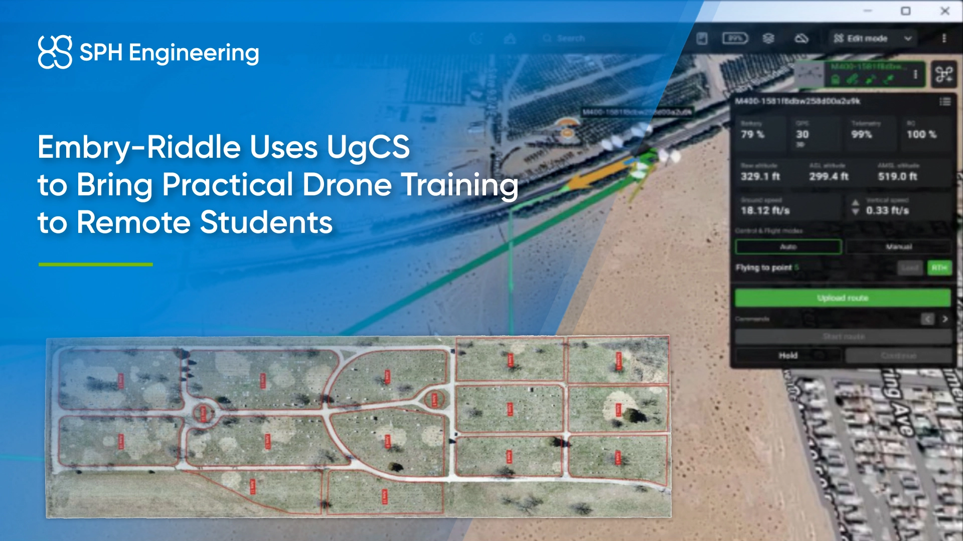
The program started with photogrammetry and later expanded to LiDAR, thermal imaging and multispectral sensing, with an emphasis on skills relevant to future beyond visual line of sight (BVLOS) operations.
Quick Facts
- Award: Jury Special Recognition, Global Drone Operations Awards 2026, Academia & Research category
- Award winner: Embry-Riddle Aeronautical University Worldwide & Online Campus
- Location: United States, with students and field crews in different states
- Application: Remote UAS education and applied geospatial analysis
- Operational model: Remote student participation with faculty-supervised field operations
- Technology: SPH Engineering’s UgCS, UgCS Companion, UgCS for DJI and DroneGIS; photogrammetry and GIS software
- Aircraft and sensors: Fixed-wing and multirotor platforms; RGB, thermal, multispectral and LiDAR sensors across the expanded curriculum
- Key result: Approximately 97% agreement with ground-truth data in the initial AI headstone detector assignment
Practical Drone Training for Remote Students
Embry-Riddle developed the Remote Split Operations concept in 2020 in response to limited student access during COVID-19. Airspace restrictions, weather, equipment costs and access to suitable flight locations could also prevent online students from conducting practical work where they lived.
The university used its resources and faculty supervision to give students access to operational missions without personal ownership of specialized aircraft, sensors or software. Faculty supported aircraft operations at field locations, while students participated from elsewhere in the United States.
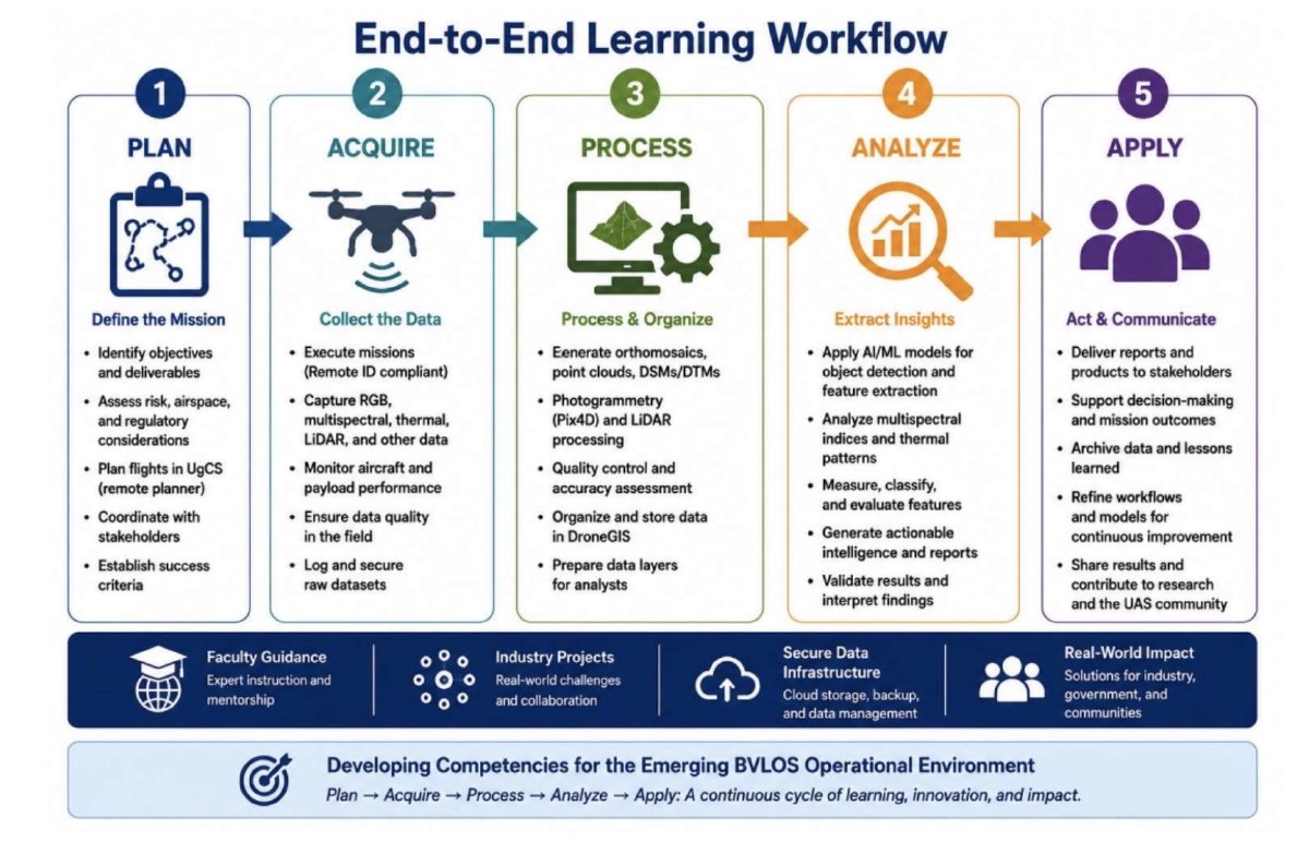
The program extended training past the FAA Part 107 Remote Pilot Certificate to mission planning, specialized sensors, risk management and data analysis. Assignments covered the complete sequence from mission definition to technical reporting, so students could assess how operational decisions affected the final results.
Remote Mission Planning and Flights with UgCS
Students planned missions for locations they had not physically visited. They researched airspace classifications, NOTAMs, temporary flight restrictions (TFRs), weather, terrain and obstacles. They also assessed launch and recovery sites, communications, aircraft performance, payload requirements and operational risks.
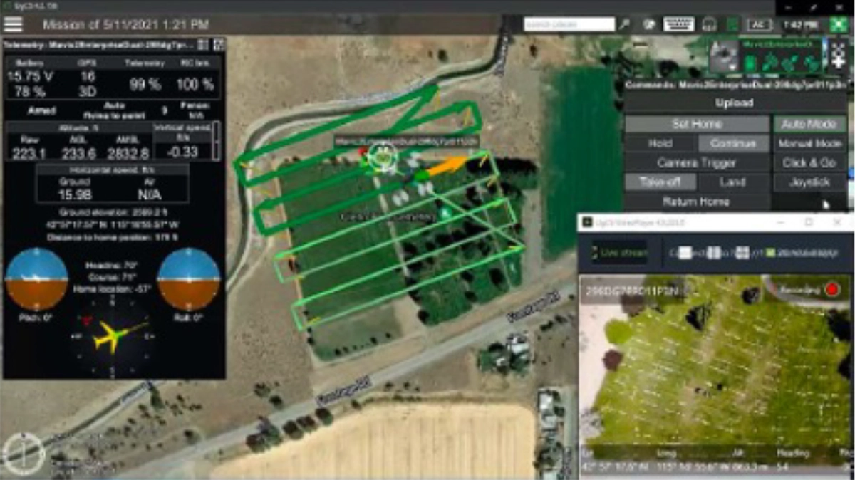
Students developed their flight plans in SPH Engineering’s UgCS and rehearsed missions with its embedded emulator before live operations. Remote participation then took place through UgCS Companion or UgCS for DJI under faculty supervision.
During a cemetery-mapping mission in Idaho, students in Florida controlled a DJI Mavic 2 Enterprise Dual remotely. This arrangement required coordination between the remote participants and the field team, with attention to crew responsibilities, communications and contingency planning.
Drone Data Processing and Validation
After acquisition, students processed imagery with photogrammetry software such as Pix4D and imported geospatial products into geographic information system (GIS) and AI tools. Depending on the assignment, outputs included orthomosaics, digital surface models, digital terrain models and point clouds.
Students examined how flight paths, image-collection requirements, environmental conditions and seasonal variability affected data quality. They then assessed whether the resulting products were suitable for the intended analysis.
The workflow continued through annotation, AI detector training, ground-truth comparison and technical reporting. Students evaluated false positives and false negatives and explained the limitations of their results.
AI Headstone Detection With About 97% Ground-Truth Agreement
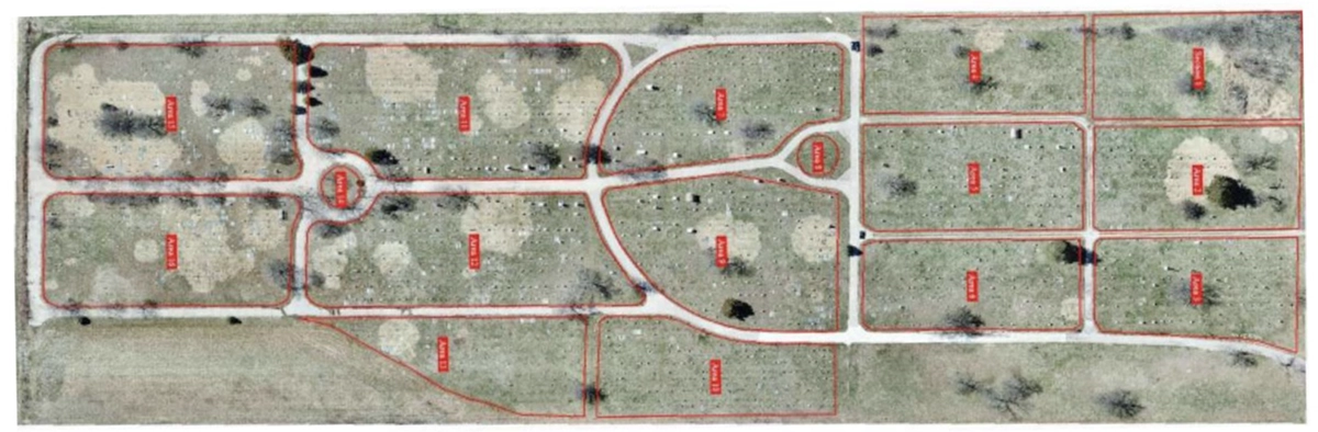
In the initial cemetery project, students processed survey imagery into orthomosaics and trained custom headstone detectors in SPH Engineering’s ATLAS, now DroneGIS.
They compared the detector outputs with independently established ground-truth data. In May 2021, the assignment achieved approximately 97% agreement with the reference data.
The exercise required students to assess the full analytical process. Image quality, annotation and detector training all influenced the outcome, while ground-truth evaluation gave students a way to measure performance and identify errors.
LiDAR, Thermal and Multispectral Training
The program expanded from the initial AI assignment into LiDAR surveys, thermal inspection, floodplain mapping, wildlife monitoring and public-safety applications. Undergraduate and graduate students encountered different aircraft and sensor technologies through coursework, simulation and faculty-supervised operations.
Fixed-wing aircraft introduced considerations such as endurance, area coverage and launch and recovery requirements. Multirotor platforms provided a context for precision positioning, constrained operating areas and inspection tasks.
The expanded curriculum connected sensor selection with specific applications:
- LiDAR: Transmission-line vegetation encroachment, terrain models, point clouds and structure measurement.
- Thermal imaging: Inspection tasks, including work related to water availability, alongside public-safety and environmental applications.
- Multispectral sensing: Vegetation analysis, environmental monitoring and spectral indices.
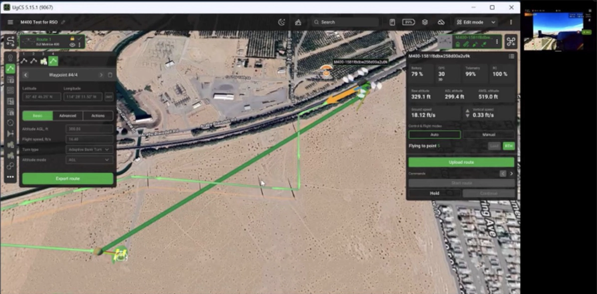
In one transmission-line mission, students in Texas participated remotely while the aircraft operated in Arizona. The setup used a DJI Matrice 400 with a DJI Zenmuse L3 LiDAR sensor, SPH Engineering’s UgCS and UgCS Companion to investigate vegetation encroachment.
UAS Workforce Preparation for Future BVLOS Operations
The model prepared students for unmanned aircraft system (UAS) roles such as mission planner, flight coordinator, payload specialist, data analyst and operations supervisor. Students practiced distributed coordination and considered how operational decisions affected both flight execution and the usefulness of the collected data.
Preparation for future BVLOS work included airspace assessment, operational supervision, communications, contingency awareness and data validation. Students also learned how teams organized responsibilities and managed missions across separate locations.
The approach also connected coursework with applied research. Students defined operational problems, selected sensors, developed missions, evaluated analytical outputs and presented their findings in technical reports.
Award Recognition
Embry-Riddle Aeronautical University Worldwide & Online Campus won in the Academia & Research category at the Global Drone Operations Awards 2026 for its Remote Split Operations educational model.