
Quick Facts
- Research institutions: Ghent University, Kiel University and the University of Vienna
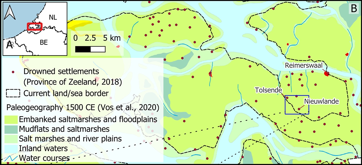
- Location: Tolsende, Eastern Scheldt, Zeeland, the Netherlands
- Application: Intertidal archaeology and drone magnetometry for non-invasive settlement mapping
- Challenge: Surveying exposed and buried remains within short tidal access windows and under difficult ground and sea conditions
- Solution: UAV photogrammetry, UAV magnetometry, terrestrial magnetic gradiometry and multichannel sediment sonar
- Coverage rate: About 4 ha of UAV magnetometry per low-tide cycle, compared with about 1.2 ha per cycle for terrestrial magnetic gradiometry
- Technology used: SENSYS MagDrone R4 magnetometer mounted on a DJI Matrice 350 RTK, SPH Engineering’s UgCS flight planning software and the SkyHub onboard computer with a Nanoradar NRA24 radar altimeter for semi-automated True Terrain Following, with a DJI Zenmuse L2 RGB camera for the photogrammetry flights
- Key result: The combined dataset mapped previously undocumented buried features across the village center and revised the plan of its medieval church, estimated at about 36 m by 11 m within an enclosure about 60 m in diameter
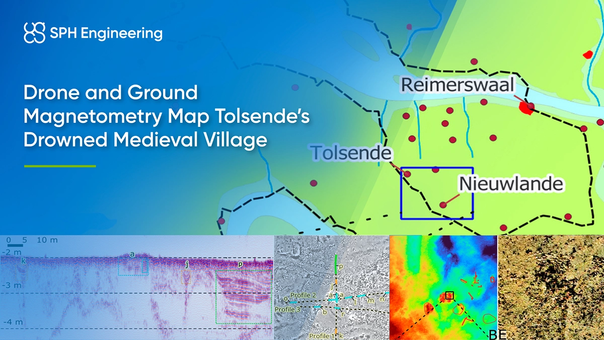
A Medieval Village Lost to the 1530 and 1532 Storm Floods
Tolsende developed within twelfth-century embankments on Zuid-Beveland, along the left bank of the Eastern Scheldt. After the sixteenth-century floods, erosion and sediment movement left parts of the village exposed on the mudflat while other remains stayed buried beneath sediment or shallow water. Because the site lies in an intertidal zone, the mudflat is exposed at low tide and covered by shallow water at high tide.
Earlier work had recorded surface finds, cores, test pits, satellite imagery and a detailed topographic survey completed in 2020 after seaweed was cleared from the site. These sources identified a concentration of brick remains interpreted as the village church, but its plan remained incomplete. The new study selected the church area as a representative test location for comparing survey methods across exposed, buried and submerged conditions.
Two-Hour Tidal Windows and a 0.70 m Sensor Clearance
Three main operational constraints shaped the survey design:
- Limited access: Teams working on foot had two to three hours around low tide, while boat-based work was limited to about one and a half hours around high tide.
- Difficult field conditions: Uneven and slippery ground, seaweed, shallow channels, high salinity, wind, waves and soft sediment affected access, electronics and instrument stability.
- Very-low-altitude flight: The five tri-axial fluxgate magnetic sensors had to remain about 0.70 m above the surface for the full duration of each line. Over steep outcrops, the team reduced flight speed from the planned 4 m/s to 2 or 3 m/s so the terrain-following system could respond more reliably.
The initial stop-and-turn maneuver also produced abrupt pitch changes. Because the radar altimeter was mounted toward the front of the aircraft, these changes could distort its ground-clearance reading and trigger sudden altitude loss. The team changed to adaptive bank turns, which improved flight stability but created gaps near the edges of adjacent survey blocks. This is an operational limitation of the tested configuration. The survey design had to balance broad coverage, sufficient detail and subsurface context within the tidal constraints.
Coordinating UAV, Ground and Waterborne Surveys Around the Tide
The researchers organized the campaign around the changing tide:
- Low tide: UAV photogrammetry, UAV magnetometry and terrestrial magnetic gradiometry surveyed the exposed mudflat.
- High tide: Multichannel sediment sonar examined the site beneath the water and seabed.
- Data alignment: RTK (real-time kinematic) corrected positioning linked the aerial, ground and waterborne measurements in a common coordinate system.
Drone magnetometer survey and photogrammetry setup
For photogrammetry, the DJI Matrice 350 RTK flew at 50 m and 6 m/s. The flight used the RGB camera in a DJI Zenmuse L2 payload, with the LiDAR outside the study scope. Images covered about 64 ha and were processed in Agisoft Metashape Professional 2.3.0. The resulting orthomosaic had a ground sampling distance (GSD) of about 1.6 cm, and the digital elevation model (DEM) had a resolution of 3.14 cm.
For the drone magnetometer survey, the same aircraft carried a SENSYS MagDrone R4 magnetometer with five tri-axial fluxgate sensors spaced 0.5 m apart and recording at 200 Hz. UgCS flight planning software planned parallel back-and-forth lines across contiguous 200 m by 200 m blocks, with a fixed heading of 138.20 degrees. The SkyHub onboard computer handled mission execution and combined telemetry with a Nanoradar NRA24 radar altimeter for semi-automated True Terrain Following. The magnetometer flew about 0.70 m above the surface at 2 to 4 m/s, depending on wind and terrain.
Magnetic data were processed in SENSYS MagDrone Data Tool, downsampled to 0.1 m and interpolated to a 0.2 m grid in QGIS 3.34.12.
Terrestrial gradiometer and sub-bottom sonar follow-up
The terrestrial magnetic survey used six Foerster FEREX CON650 vertical gradiometers mounted on a cart, with 0.5 m spacing between sensors and 3 m between profiles. The team collected these data over three low-tide days. This slower method provided finer detail over the church area and a reference for evaluating the UAV results.
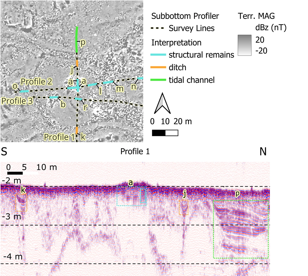
At high tide, a four-channel Innomar SES-2000 quattro sub-bottom profiler surveyed beneath the water and seabed. The 14.4 kHz system was mounted on a 7 m cabin boat. Broad profiles crossed the site in two directions, followed by a dense survey over the church plot with line spacing as close as 1 m. Processing used Innomar ISE and QGIS.
A Broader Village Map and a Revised Church Plan
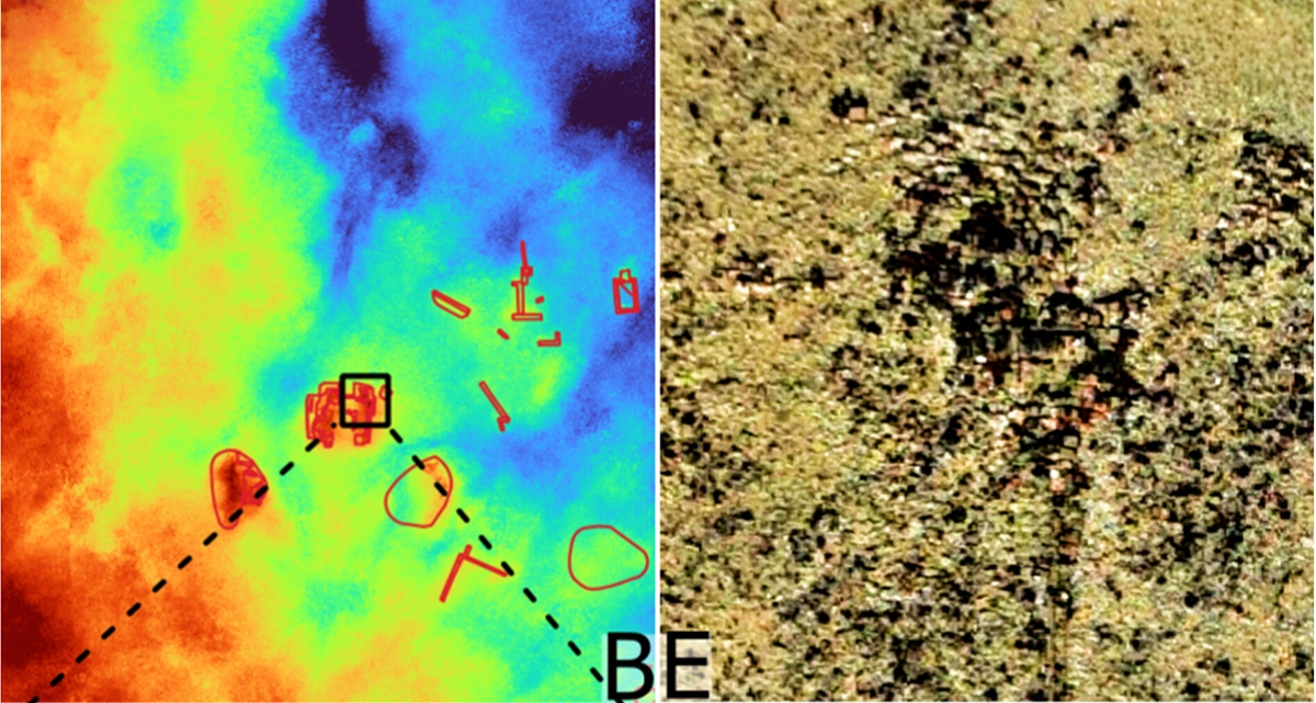
The integrated survey mapped a more complete village center, revealed previously undocumented buried features and revised the church plan.
A broader village-center map
Magnetic anomalies connected structures that had previously appeared as isolated surface remains. Rectangular anomaly patterns indicated buried structural remains, while weaker linear features were interpreted as possible roads and drainage ditches. This evidence extended the known settlement layout beyond the exposed brick concentrations.
A revised church plan measuring 36 m by 11 m
The magnetic data identified a western tower about 7 m by 7 m, a large northern transept and an eastern apse that was probably semicircular or polygonal. Features previously interpreted as the tower were reassigned to the transept. Based on the combined evidence, the researchers estimated the church at about 36 m long and 11 m wide across the nave.
A quasi-circular enclosure about 60 m in diameter surrounded the church. Its paired magnetic lines, separated by about 3 m, could represent a wall, a filled ditch or a road corridor. These alternatives require targeted coring or excavation for confirmation.
Drone magnetometry vs. terrestrial gradiometry coverage rates
UAV magnetometry covered about 4 ha during one low-tide cycle. Under similar site conditions, terrestrial magnetic gradiometry covered about 1.2 ha per low-tide cycle, about a third of the aerial rate. The aerial array detected the strongest structural anomalies across a larger area, while the ground system resolved subtler features and more internal detail.
This division of strengths supports a staged workflow, and it matches the pattern seen in wider drone and ground magnetometer comparisons. UAV magnetometry can identify priority zones across a broad site, followed by focused terrestrial measurements where architectural detail is needed. At Tolsende, using both methods produced a clearer result than either dataset could provide alone.
Photogrammetry added a rapid, repeatable record of the visible surface. It mapped almost the entire village center within one tidal cycle and created an elevation baseline for monitoring erosion. It recorded a few additional archaeological features compared with the 2020 survey, which had been completed after intensive seaweed removal. Its value in this campaign came from coverage speed and documenting the surface under normal conditions, without the seaweed clearance that the 2020 survey required.
Sediment sonar adds subsurface context
Under favorable conditions, sediment sonar penetrated at least 2.5 m beneath the seabed and detected shallow reflectors near the church that aligned with several magnetic anomalies. Comparing the datasets helped the researchers distinguish possible archaeological structures from sediment layers, although coring or excavation would be needed to confirm the interpretation.
Combining Survey Methods for Intertidal Archaeology
The Tolsende study shows how integrated non-invasive surveys can turn short tidal windows into a coherent archaeological dataset. UAV photogrammetry created a high-resolution surface record, UAV magnetometry planned in UgCS covered about 4 ha per low tide, terrestrial gradiometry supplied finer architectural detail, and sediment sonar extended the investigation beneath shallow water and sediment.
Together, the datasets revealed previously undocumented structures, possible roads and drainage ditches. They also allowed the researchers to revise the church plan and define its surrounding enclosure. The study documented limits in very-low-altitude terrain following, block-edge coverage and sonar performance. For future surveys, the authors recommend adapting flight speed to terrain, increasing overlap where bank turns create gaps, and using coring or excavation to test the geophysical interpretations.
Source: Jan Trachet et al., “Optimizing Strategies for Non-Invasive Prospection of Settlements in the Intertidal Zone: A Case Study From the Centre of the Drowned Medieval Village of Tolsende (Scheldt Estuary, the Netherlands)”, Archaeological Prospection (2026). The article is available under the Creative Commons Attribution 4.0 license. The processed research datasets are available through Zenodo.