
Quick Facts
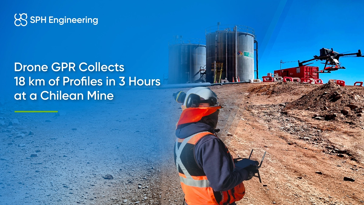
- Award: Global Drone Operations Awards 2026, Mining Operations category
- Award Winner: AB Surveying Solutions SpA (ABSS)
- Location: Near Calama, Antofagasta Region, Chile
- Client: Chilean copper producer
- Application: Buried pipeline and utility detection
- UAV flight time: Three hours across eight flights
- Survey coverage: Approximately 24.8 ha overall, including 16.8 ha surveyed with UAV-GPR
- Technology used: Radar Systems Zond Aero LF with a 300 MHz antenna mounted on a DJI Matrice 400 and with a terrestrial mono-static kit, SPH Engineering’s UgCS flight planning software and SkyHub onboard computer
- Processing: SPH Engineering’s GeoHammer and Radar Systems Prism 2
- Combined survey result: 1,051 interpreted subsurface anomalies
- Reported productivity: Approximately 10 times that of the estimated conventional method, according to ABSS
Underground Utility Mapping at an Active Mine
The engineering team needed information about buried utilities to plan excavation around existing infrastructure and reduce the risk of damaging services still in use.
Natural slopes, safety berms and operating restrictions made parts of the site difficult or unsafe to survey on foot. The high-altitude mining environment also exposed the team to strong winds, airborne dust and extreme temperatures.
Drone GPR Equipment and Flight Setup
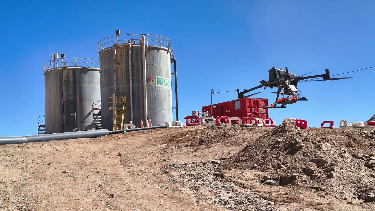
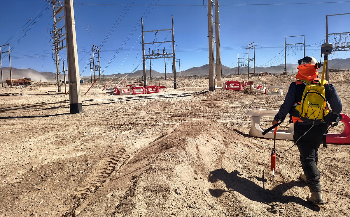
ABSS used a Radar Systems Zond Aero LF for both airborne and ground-based acquisition. The airborne setup combined a DJI Matrice 400, a 300 MHz antenna and SPH Engineering’s SkyHub onboard computer. For ground surveys, the team paired the Zond Aero LF with a Trimble R12i GNSS RTK receiver and worked around obstacles in accessible areas such as the materials yard.
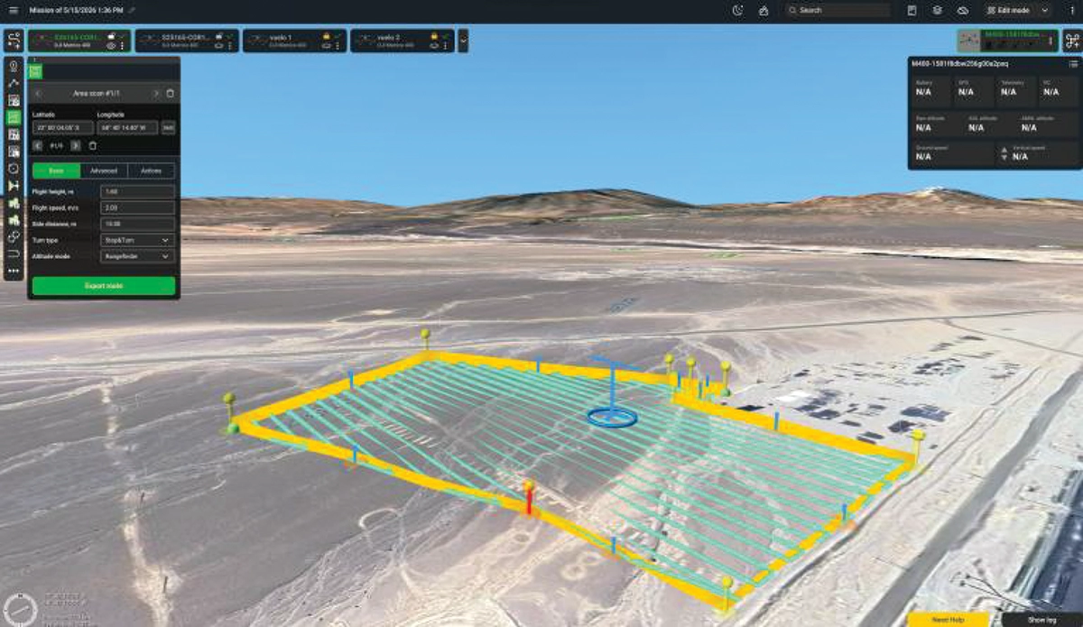
Before flight, ABSS used SPH Engineering’s GPR Calculator to assess survey parameters with a planned antenna height of 1.6 m and an estimated target depth of 4 m. The team planned a 15 × 15 m survey grid in SPH Engineering’s UgCS at a flight speed of 2 m/s.
Terrain following with UgCS and a radar altimeter maintained approximately 1.6 m of sensor clearance above the surface. ABSS completed eight flights under Chilean DGAC authorization and the facility’s operating protocols. The aircraft remained within visual line of sight.
GPR Data Processing and 3D Mapping
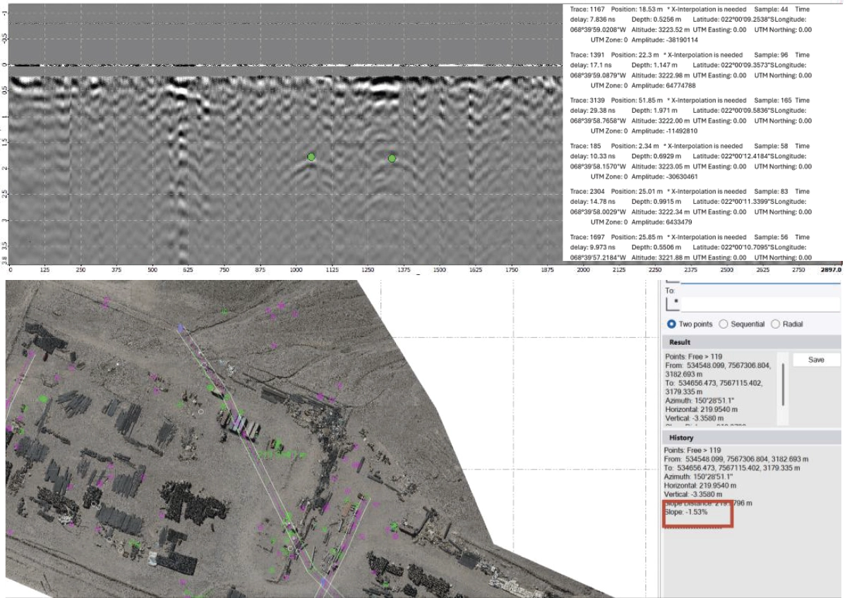
ABSS used SPH Engineering’s GeoHammer to split the recorded GPR trajectories into individual survey lines. The team then processed the profiles in Radar Systems Prism 2 and interpreted hyperbolic reflections to estimate the positions and depths of potential buried objects.
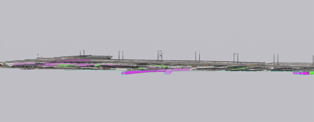
ABSS reconstructed the interpreted features and combined them with topographic and photogrammetric information in Trimble Business Center. The team then incorporated the interpretations into Trimble Connect for review alongside the site’s surface model and engineering data.
Drone GPR Survey Results
ABSS surveyed 16.8 ha with UAV-GPR without personnel walking the survey lines. Eight flights collected 18 km of profiles in three flight hours. Across the complete airborne and terrestrial investigation, the team interpreted 1,051 subsurface anomalies in six sectors:
- 910 classified as probable;
- 141 classified as tentative.
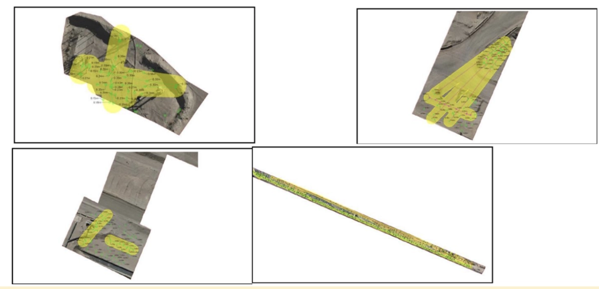
ABSS compared anomalies on consecutive profiles to interpret potential buried utility routes. The plans included ±3 m precaution buffers around features that could conflict with excavation. Areas without detected anomalies were not treated as confirmation that no buried infrastructure was present.
ABSS reported acquisition productivity approximately 10 times that of the estimated conventional method, based on three flight hours compared with approximately 30 hours for conventional acquisition.
Utility Mapping for Primary Crusher Relocation
Engineers needed to map buried services before relocating a primary crusher inside the operating facility. The 2.1 ha work area contained pipelines, electrical duct banks, utility chambers and service ducts.
ABSS surveyed the area with ground-based and drone-mounted GPR. With both methods run under the same site conditions, the team could compare them and cross-check the interpreted utility locations.
ABSS reported faster acquisition and less time spent by personnel in operational risk areas, with no disruption to plant operations. The team delivered the utility information in Civil 3D and a Trimble Connect digital twin for excavation design and service relocation.
Subsurface Mapping Deliverables for Excavation Planning
ABSS delivered:
- topographic plans in DWG and PDF formats, with interpreted utility corridors and ±3 m precaution buffers;
- an orthomosaic and a point cloud in LAS format;
- a technical report;
- a Trimble Connect digital twin with interpreted subsurface features and site context.
Engineers could see the interpreted subsurface features in relation to the site surface and check for potential utility conflicts when planning excavation.
Award Recognition
AB Surveying Solutions SpA won the Mining Operations category at the Global Drone Operations Awards 2026.