
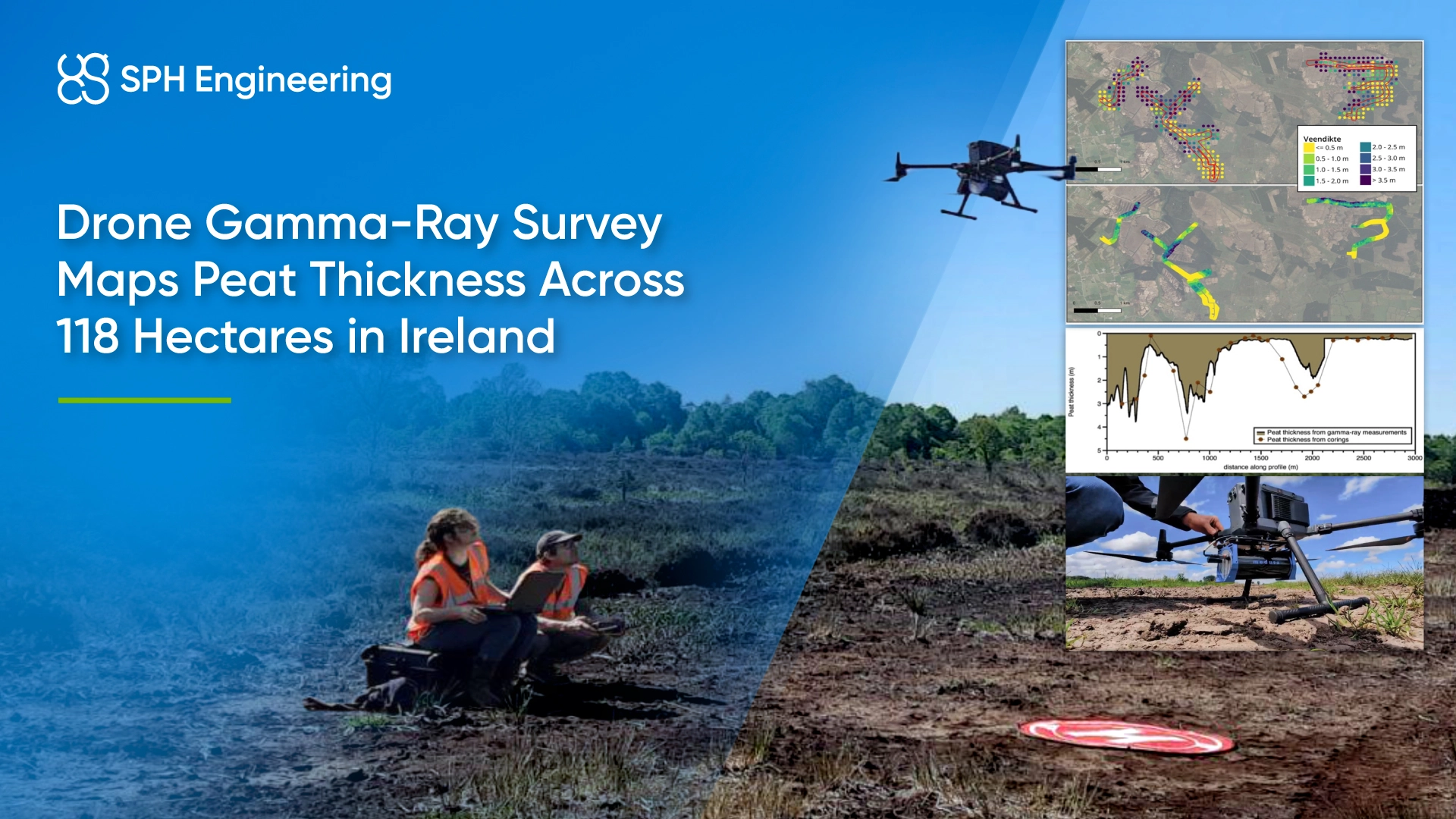
The project tested whether airborne measurements could capture spatial variations between coring locations and support more targeted ground investigations.
Quick Facts
- Award: Construction & Site Intelligence, Global Drone Operations Awards 2026
- Award Winner: Medusa Geoservices
- Location: Carrigeen Wind Farm site, Ireland
- Client: Whiteford Geoservices
- Application: Peat-thickness assessment for onshore wind farm planning
- Survey coverage: 118 hectares across approximately 40 km of flight lines
- Fieldwork: Two days, 25 flights
- Technology: DJI Matrice 350 RTK, Medusa Radiometrics MS-350 CsI gamma-ray spectrometer, SPH Engineering’s SkyHub and UgCS
- Ground reference: 110 existing corings from an earlier campaign that took approximately three weeks
- Deliverable: A continuous map of estimated peat thickness, calibrated against coring measurements
Peat Thickness Assessment for Wind Farm Planning
The proposed development included approximately 11 wind turbines across two clusters. Geotechnical site investigations required information about peat distribution and thickness to support planning for turbine foundations, access roads and a connection to a local substation.
An earlier coring campaign had measured peat thickness at 110 locations. These measurements provided essential ground information, but each represented an individual point. Wet peatland terrain and difficult access made extensive ground investigations labor-intensive, while changes between coring locations remained less clearly defined.
Medusa tested an airborne approach that could cover the survey area efficiently and add spatial detail between those measurements.
Drone Gamma-Ray Equipment and Flight Planning
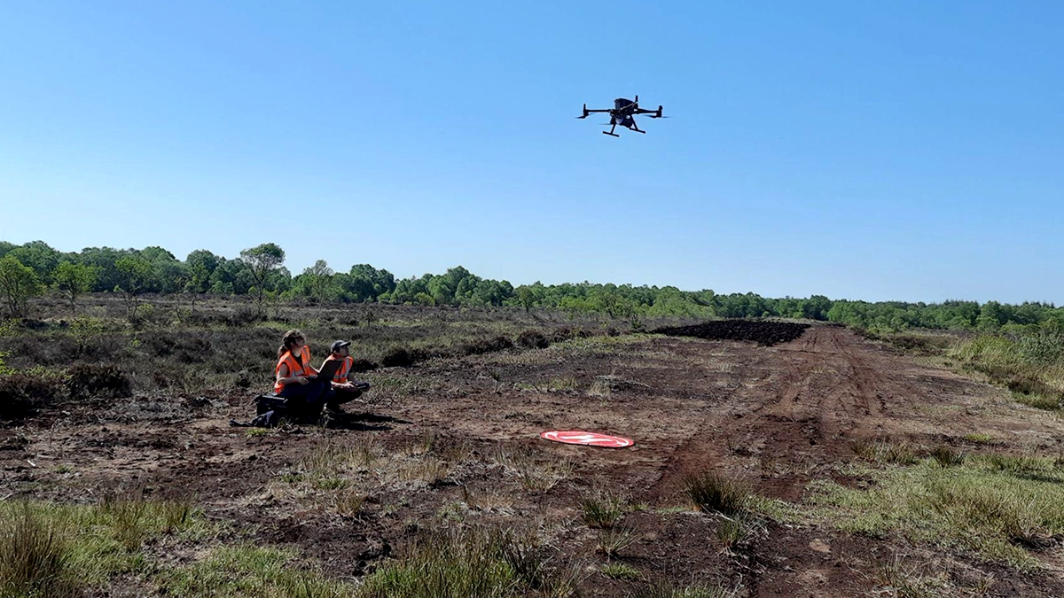
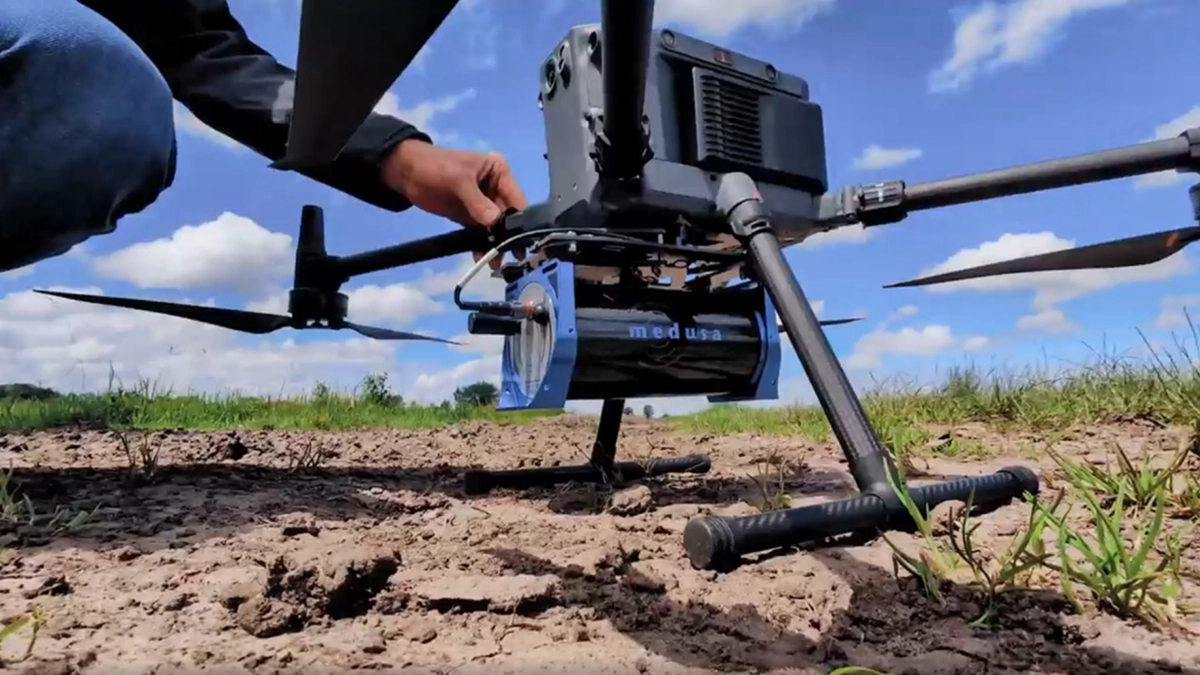
The team mounted a 2.7 kg Medusa Radiometrics MS-350 cesium iodide (CsI) gamma-ray spectrometer beneath a DJI Matrice 350. SPH Engineering’s SkyHub onboard computer linked the detector to the drone’s differential GNSS positioning stream and supported live monitoring of the measurements.
Medusa planned the flights in SPH Engineering’s UgCS mission planning software. The aircraft followed approximately 40 km of survey lines at 20–30 m above ground level. At this height, the detector’s measurement footprint supported continuous coverage across the surveyed corridors.
The conditions were sunny and warm. The drone also flew over tree-covered areas that would have slowed ground-based data collection.
Converting Gamma-Ray Measurements into Peat Thickness
The method relied on natural gamma radiation emitted by potassium, uranium and thorium in mineral soils and bedrock. Overlying peat absorbed part of that radiation, so changes in the measured signal could help estimate peat thickness.
After the flights, Medusa processed the measurements into a continuous grid of gamma-ray count rates. The team then extracted values at the 110 coring locations and compared them with the measured peat depths.
The eastern and western parts of the site had different radiometric backgrounds. Medusa therefore fitted a separate exponential attenuation model for each area. These models described the relationship between count rate and peat thickness and converted the airborne measurements into a continuous thickness map.
The corings established the local relationships needed to interpret the gamma-ray signal.
Peat Mapping Results Compared with Ground Corings
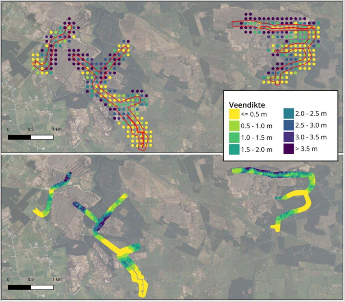
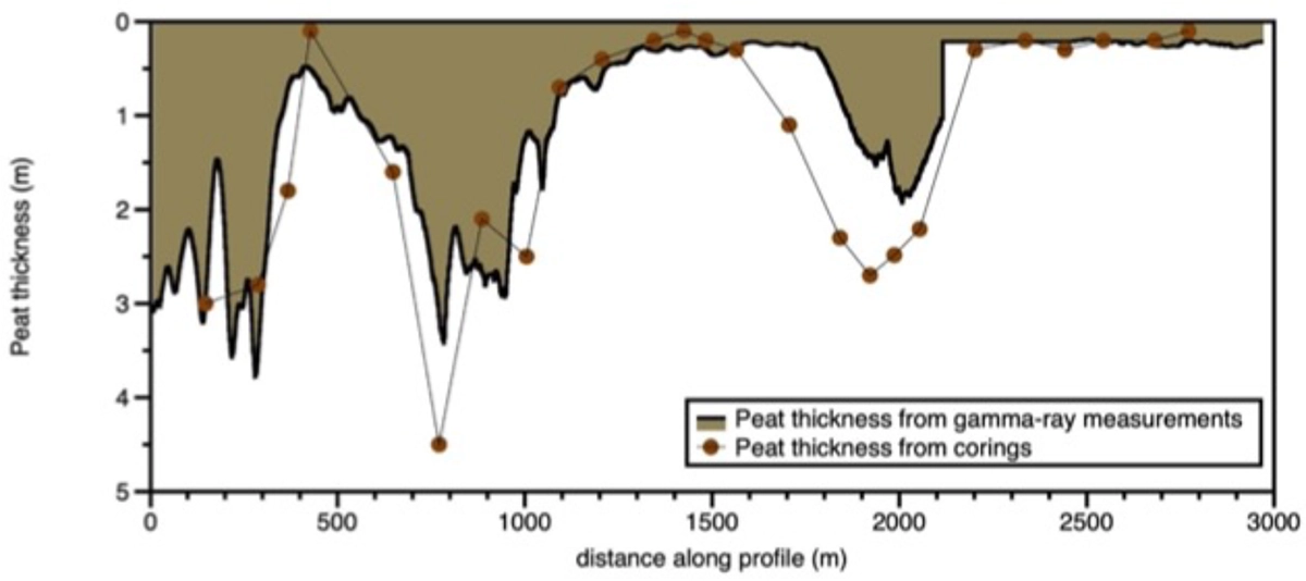
The drone-derived map reproduced the main spatial patterns in the coring data. Thicker peat occurred mainly in low-lying, river-related areas, with shallower deposits towards their margins. The airborne measurements also added information between individual coring locations.
Medusa compared the estimated thickness along a 3 km cross-section with corings within 50 m of the profile. The comparison captured the main changes between thicker and thinner peat, including sharp transitions over short distances.
However, the airborne estimate underestimated peat thickness in a zone near the 2,000 m position along the profile. Variations in peat moisture were considered a likely explanation. Differences between individual coring measurements and the detector’s broader measurement footprint also affected the comparison.
Faster Site Screening with Targeted Follow-Up Coring
The airborne survey covered 118 hectares in two days through 25 flights. The earlier campaign of 110 corings had required approximately three weeks. These figures describe the respective field campaigns. The drone-derived map still depended on ground measurements for calibration.
The resulting map offered a practical basis for identifying broad peat-depth patterns and selecting locations for further coring. It also reduced the amount of ground traversal needed to collect spatial survey data.
Moisture content and peat density remained sources of uncertainty. Further work was needed to refine the method, particularly in thicker peat. Ground corings remained essential for calibration and detailed investigation, while airborne gamma-ray mapping provided wider coverage for the screening stage.
Award Recognition
Medusa Geoservices won the Construction & Site Intelligence category at the Global Drone Operations Awards 2026 for its drone-based peat-thickness mapping project in Ireland.