
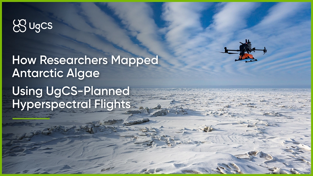
Key Results
- Held a consistent 6.5 cm/px ground sampling distance (GSD) at 80 m above an uneven glacier surface
- Georeferencing accuracy of ±0.02 m vertical and ±0.05 m horizontal
- Two hyperspectral cubes produced a 214-pixel spectral library of confirmed red snow algae
- That library trained a satellite classifier applied to 45 cloud-free Sentinel-2 scenes across seven years
- Red snow algae detected on up to 12% of a single island's surface, about 176 km², at an F1 score of 0.757 and AUC of 0.935
Why red snow algae accelerate Antarctic snowmelt
Patches of red and pink snow show up on Antarctic coastal snowfields every summer. The color comes from algae, mostly Sanguina nivaloides, which pack their cells with a red pigment called astaxanthin to survive high sunlight.
The color is the problem. Darker snow absorbs more sunlight. These blooms lower surface albedo by as much as 20%, which warms the surface and melts the snow and ice underneath faster. As Antarctica keeps warming, climate models need to know where these blooms are and how much ground they cover. Nobody had a reliable map of them at scale. Single blooms had been measured before, covering anywhere from tens to hundreds of square meters. The science lacked an archipelago-wide coverage tracked over multiple years.
Sentinel-2 alone cannot detect red snow algae
Mapping blooms across an entire island group means satellite imagery. The team used the European Space Agency's (ESA) Sentinel-2 constellation, which offers open data and revisits the same ground regularly.
Two things make this hard. Persistent cloud cover wipes out most scenes, which is why only 45 of 109 downloaded scenes were usable. And Sentinel-2 resolves ground at 10 to 20 meters per pixel, so a single pixel mixes algae, clean snow, bare rock, and mineral dust together. Mineral dust on snow can look a lot like red algae to a coarse sensor, which produces false positives.
To tell real algae apart from dust and rock, the classifier needed to know exactly what red snow algae look like across the spectrum. That reference could not come from the satellite itself. It had to come from the ground, at much higher resolution, from confirmed algae patches.
Flying a pushbroom hyperspectral sensor over a moving glacier surface
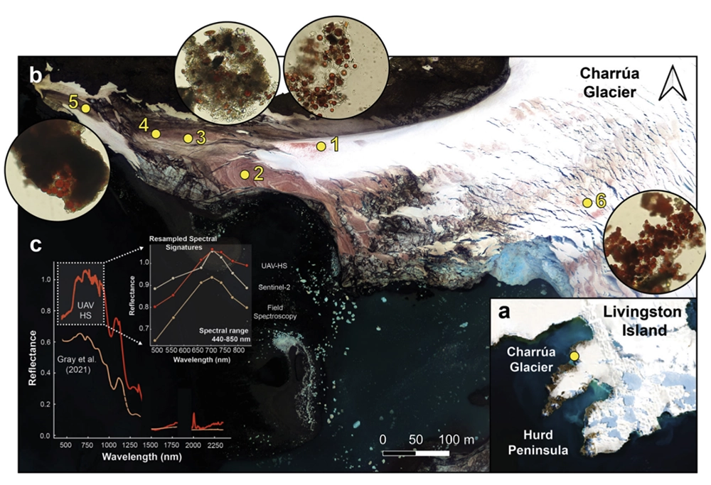
The reference spectra came from a hyperspectral drone sensor flown over Charrúa Glacier and Shelter Point on Livingston Island in March 2022. The UAV payload was a DJI Matrice 600 Pro carrying a Headwall Photonics VNIR-SWIR pushbroom sensor recording 546 bands from 400 to 2500 nm.
A UAV pushbroom hyperspectral survey is unforgiving about flight altitude. The ground sampling distance depends directly on height above the surface. The target here was 6.5 cm/px, fine enough to isolate pure algae pixels for the spectral library. Drift up or down and the resolution changes, the overlap between passes breaks, and the spectral data gets noisier.
Now put that over a glacier. Glacier surfaces slope and undulate. If you fly at a fixed altitude above sea level, your height above the ice changes constantly as the surface rises and falls beneath you, and your GSD drifts with it. Add predominantly cloudy Antarctic weather, a remote site reached by ship, and a narrow window to fly, and there is no room for a second attempt.
The UgCS solution: hold height above the surface
The team planned the missions in the UgCS desktop flight planner. Rather than fixing altitude above sea level, using terrain following, they flew at a constant 80 m above the surface, so the drone tracked the shape of the glacier as it moved.
Terrain following helped a steady height above uneven ice, which kept the ground sampling distance locked at 6.5 cm/px across the whole survey. With a planned 40% lateral overlap, the passes lined up cleanly. Pairing the M600's onboard GPS with an APX-15 GNSS-inertial unit brought final georeferencing to ±0.02 m vertically and ±0.05 m horizontally, so every pixel in the reference library sat where it belonged.
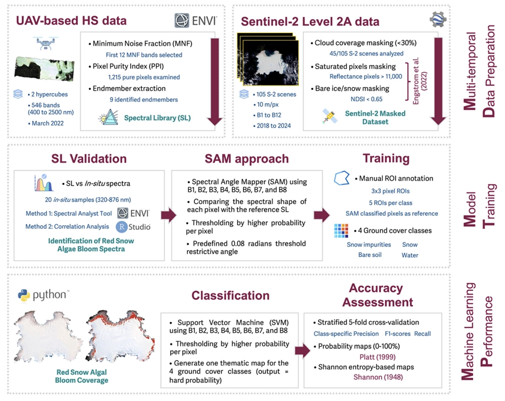
The result of the flight itself was not a map of Antarctica. It was two clean hyperspectral cubes. From those, the team extracted 1,215 spectrally pure pixels, narrowed them to nine endmembers, and pulled out 214 pixels that represented red snow algae. That set became the spectral library.
From two drone flights to a seven-year satellite map
The spectral library is the link between one glacier and the whole archipelago.
The team resampled the drone-derived library to match Sentinel-2's bands, then used it to train a supervised classification chain (Spectral Angle Mapper (SAM) followed by a Support Vector Machine(SVM)) across 45 cloud-free scenes spanning 2018 to 2024. They validated the classifier against 20 field spectra collected on site and six bloom locations already documented in the literature.
The classification held up. At the chosen spectral angle threshold, it reached an F1 score of 0.757, an AUC of 0.935, precision of 0.868, and recall of 0.672.
The classifier's output across the archipelago:
- During the growth season, red snow algae covered up to 12% of a single island's surface, roughly 176 km².
- On King George Island, blooms reached 53 km², about 4.2% of its 1,259 km² area.
- On smaller Robert Island, blooms covered up to 10 km², about 7.23% of the island.
None of these numbers came off the drone directly. The satellite classification needed a trustworthy spectral fingerprint of real Antarctic red snow algae, and the drone flight, planned to hold a precise height over moving terrain, produced that. Everything downstream rests on that reference.
What the drone survey made possible
Detecting red snow algae across the South Shetland Islands came down to one requirement: a reliable spectral fingerprint that a satellite classifier could trust. Sentinel-2 alone could not provide it, because a single 10m pixel blends algae with mineral dust, rock, and clean snow.
The drone survey supplied that fingerprint. Flying at a fixed 80 m above the glacier surface, planned in UgCS with terrain following, kept the hyperspectral resolution steady at 6.5 cm/px over sloping ice, which is what made the spectral library clean enough to use. That library then trained a classification chain applied to 45 Sentinel-2 scenes over seven years.
Red snow algae mapped on up to 12% of a single island's surface (about 176 km²), at an F1 score of 0.757 and AUC of 0.935. Two flights over one glacier scaled into an archipelago-wide, multi-year record of a phenomenon that is accelerating Antarctic snowmelt.
Any survey where data quality depends on holding a set height over terrain that will not stay flat, glaciers, coastlines, or mountains, runs into the same problem this team solved with UgCS terrain following.
Reference
Román, A., Navarro, G., Barbero, L., Fernández-Marín, B., García-Plazaola, J.I., González-Ortegón, E., Caballero, I., & Tovar-Sánchez, A. (2026). Unveiling the large coverage of red snow algae blooms in antarctic coastal snowfields. Communications Earth & Environment, 7, 53. https://doi.org/10.1038/s43247-025-03156-6
Licensed under CC BY-NC-ND 4.0.
Technical Specifications