UgCS - Drone Flight Planning Software for Professional UAV Missions
UgCS (Universal Ground Control Software) is the desktop drone flight-planning software for research-grade applications. Trusted by 5,000+ drone teams worldwide.
- Get survey-grade data on the first flight. Stop re-flying, re-training, re-planning.
- LiDAR surveys. Magnetometry. 3D Mapping and Photogrammetry.
- Built for surveyors, geophysicists, energy companies, and research institutions.


Trusted by


%202.svg)
_black%201.svg)


One platform for every drone, every sensor, and every application.


Who UgCS Is Built For
Surveyors & Engineers

Geophysicists
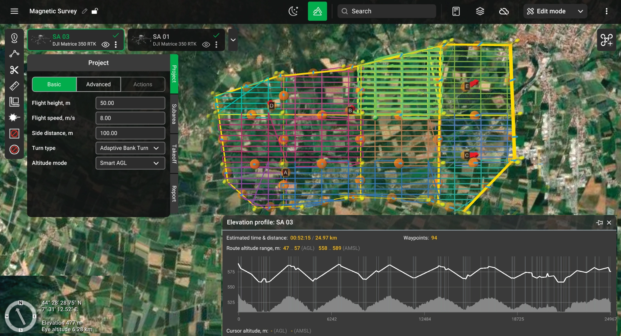
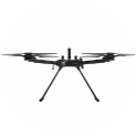
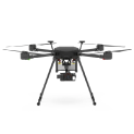
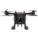
Magnetometer, GPR, and gamma-ray spectrometer missions with true terrain following through SkyHub. The only drone flight planner with dedicated geophysical survey tools.

Upcoming Webinar
Why Drone Surveyors and Geophysicists Choose UgCS


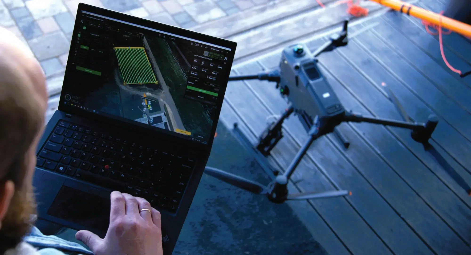
Desktop Mission Planning With Full 3D Preview. No More Re-flights.
UgCS runs on your desktop. Build complex missions with 3D preview, elevation profiles, and multi-segment routes. Industry-leading terrain following algorithms and large DEM import support go even further.
You can't catch overlap gaps, altitude drift, or missed strips on a 7-inch controller screen. UgCS runs on your desktop, with full-screen 3D mission preview, elevation profiles, and multi-segment routes. See the problem before you fly, not after you process.
KML/CSV import. Drop in client coordinates, auto-generate terrain-following corridors with battery swap points. 180km mission, flight-ready in 30 minutes.

One Software for DJI, Blue UAS, and 100+ Drone Platforms.
You trained pilots on DJI. Now the contract requires Blue UAS. New platform, new flight planner, new workflows. UgCS secures your future; you won’t ever need anything else. We support DJI and +100 other drone platforms.
UgCS supports DJI, Freefly, Autel, ArduPilot, and PX4 drones. Same workflows, same interface.
NDAA-compliant operations. When your contract requires Blue sUAS platforms, switch airframes without switching mission planning software or retraining pilots. Push missions to DJI controllers through UgCS Cloud sync with DJI Pilot 2.

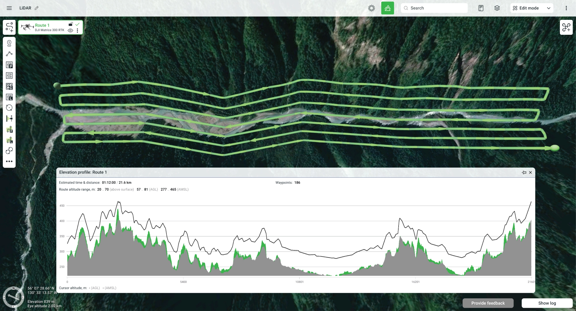
The Only Dedicated LiDAR Mission Planning Toolset.
Figure-8 IMU calibration, automated loop turns, scan pattern control, DEM and DSM import. Smart AGL.
Fly as low as 8m AGL using your own DEM data. DJI Pilot 2 stops at 12m. Those 4 meters decide whether you hit 1mm/px or miss your project spec. Import custom elevation models and hold exact AGL across elevation changes.
Plan scan patterns with built-in IMU calibration legs, automated loop turns, and cross-flight lines. Compatible with YellowScan, DJI L-series, Rock Robotics & more.
Custom DEM Import, Terrain Following, Fully Offline.
Don’t crash because of bad terrain data. No internet? No problem. Basic DEMs are not enough. One bad waypoint means one crashed aircraft. Not with UgCS. Import your own high-resolution DEM and DSM data. Smart AGL holds your exact altitude above ground, even when the ground changes fast.
Import elevation models and cache maps before you leave the office. Fly full missions offline in remote sites with zero connectivity.
While UgCS works offline, it also includes leading Cloud capabilities - push routes directly from your desktop to DJI remote controllers through DJI Pilot 2. Desktop precision, DJI field execution.
For mining and remote sites, upload fresh GeoTIFF elevation models daily. Plan stockpile volumetrics, pit wall scans, and site-wide surveys with full offline capability. No cellular service required.

One tool, every mission type. Area scans, 3D mapping, and large area splitting.
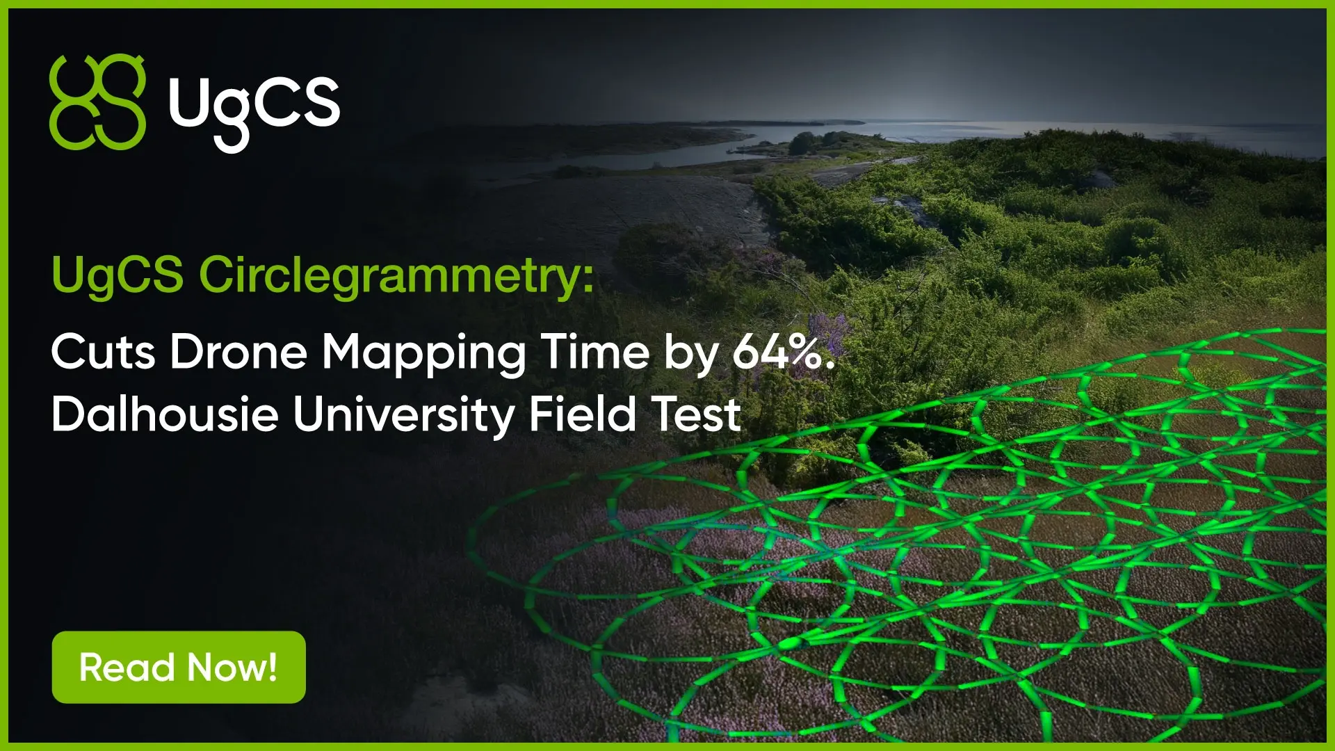
Area scans, LiDAR, photogrammetry or circlegrammetry, 3D mapping, corridor scans, vertical scanning, façade inspections. All planned from the same interface.
What else makes UgCS special? Full automation and customization. Fine-tune gimbal pitch, speed profiles, camera triggers, turning behavior, and lost-link actions. Automate what other tools force you to do manually. Use auto trajectory smoothing.
Automatic battery resume UgCS segments long missions by battery life, pauses at the swap point, picks up exactly where you stopped. No gaps, no re-alignment.
Direct Support From the UgCS Product Team
Direct access to our product and support teams. No chatbots, no ticket queue. Need to speak to the people creating UgCS?
Testimonials


Supported Drones & Sensors
DJI
Matrice 400


Discover »»»

DJI
M350 RTK
Discover »»»
DJI
M300 RTK
Discover »»»
DJI
Matrice 4 Series
Discover »»»
DJI
Mini 4 Pro
Discover »»»
DJI
Mavic 3 Enterprise Series
Discover »»»

DJI
Matrice 30 Series
Discover »»»
Autel
EVO Max 4T/4N
Discover »»»

DJI
M200 / M210 Series
Discover »»»

DJI
Phantom 4 / PRO / PRO v2 / RTK with SDK controller only!
Discover »»»

DJI
M600, 600 Pro
Discover »»»
DJI
Mavic 2 Zoom/ Pro / Enterprise / Enterprise Dual / Enterprise Advanced
Discover »»»

Freefly
Alta X
Discover »»»
Freefly
Astro
Discover »»»
Inspired Flight
IF800
Discover »»»

Inspired Flight
IF1200
Discover »»»
Inspired Flight
IF750
Discover »»»

CubePilot
Cube Orange
Discover »»»

DJI
N3
Discover »»»

DJI
A3
Discover »»»
Hexadrone
Tundra
Discover »»»
DroneBase
X1000 Pro RTK
Discover »»»

Acecore
Zoe
Discover »»»

Acecore
Noa
Discover »»»

Aurelia
X4 Series
Discover »»»

Aurelia
X6 Series
Discover »»»

Aurelia
X8 Series
Discover »»»
Autel
EVO II series
Discover »»»

Watts Innovations
PRISM
Discover »»»
Inspired Flight
IF1200A
Discover »»»

Wispr
Ranger Pro
Discover »»»

Other Ardupilot / PX4
Ardupilot/PX4 Multicopters
Discover »»»

Other Ardupilot / PX4
Ardupilot/PX4 Helicopter
Discover »»»

Other Ardupilot / PX4
APM Airplane
Discover »»»

DJI
M100
Discover »»»

DJI
Inspire 2
Discover »»»

DJI
Inspire 1 / Pro / Raw
Discover »»»

DJI
Mavic Pro
Discover »»»

DJI
Phantom 3
Discover »»»

Yuneec
H850 RTK
Discover »»»

Arcsky
X55
Discover »»»
Xer Technologies
X8
Discover »»»

Radar System
Zond Aero 500
Discover »»»
Radar System
Zond Aero 600
Discover »»»
Radar System
Zond Aero 1000
Discover »»»
Radar System
Zond Aero LF & NG
Discover »»»

SPH Engineering
EchoNIMBUS MBES, with Cerulean Surveyor 240-16 sensor
Discover »»»
Echologger
ECT 400S
Discover »»»
Echologger
ETF 400S
Discover »»»
Echologger
ECT D052S
Discover »»»
Echologger
ECT D032S
Discover »»»
Echologger
ECT D24S
Discover »»»
SPH Engineering
EchoNIMBUS SSS (with 2 * Cerulean Omniscan 450SS sensors)
Discover »»»

Ebinger
VEMOS AIR
Discover »»»

Geometrics
MagArrow Mk2 magnetometer
Discover »»»
SENSYS
MagDrone R3 / R4
Discover »»»
SENSYS
MagDrone R1
Discover »»»
SPH Engineering
MagNIMBUS (with QuSpin Gen-2 magnetometer sensor)
Discover »»»

Axetris
FluX Aero Methane Sniffer
Discover »»»
Pergam
Laser Falcon
Discover »»»
Pergam
Laser Falcon 2
Discover »»»
Pergam
Laser Falcon Plus
Discover »»»

Geolux
RSS2-300W
Discover »»»
Geolux
LX-80
Discover »»»
SPH Engineering
Water sampler messenger release device
Discover »»»
FT Technologies
FT742 anemometer
Discover »»»
FT Technologies
FT602 anemometer
Discover »»»

Ainstein AI
US-D1
Discover »»»
LightWare Lidar
SF30/D
Discover »»»
Nanoradar
NRA24
Discover »»»

Nanoradar
MR72 obstacles detector
Discover »»»
Emlid
Reach M2
Discover »»»
.webp)


.webp)
.webp)
Plan it right. Fly it once.


FAQs
How much does UgCS cost, and what license options are there?
UgCS has a free tier plus paid licenses, available either as a subscription or as a perpetual one-time license. UgCS Open is free, a higher tier adds the full LiDAR toolset, and an Enterprise license covers custom sensor integration, larger fleets, and proprietary workflows. Every paid license includes long-term software updates and direct support. Current pricing is on the pricing page.
Is there a free version of UgCS, and what are its limits?
Yes, UgCS Open is free and runs the same desktop planning workflow so you can evaluate the software properly. It caps you at two saved missions per day and 250 meters between the two furthest points of a route, while still including offline planning and a DJI Pilot 2 connection. Once you need to survey larger areas, run more missions, or use tools like corridor mapping and façade scanning, you move to a paid license.
Is UgCS a subscription, or can I buy it once?
Both options exist. You can pay as a subscription or buy a perpetual license that you own outright. Perpetual licenses include a first year of updates and support, and subscriptions include updates for as long as they stay active.
What operating system and computer does UgCS need?
UgCS is desktop software that installs on Windows, macOS, and Linux (Ubuntu). All planning happens on the computer rather than a tablet or phone, and it runs fully offline once installed. A standard modern laptop handles most work, though large DEMs and heavy 3D scenes benefit from more RAM and a dedicated graphics card.
Can I move my license to another computer?
Yes. A UgCS license activates on one computer by default, and you can buy additional activations if you work across machines or have several pilots. For larger teams, Enterprise licensing handles multi-user deployments.
Can UgCS work with custom or proprietary sensors and drones?
Yes. You can add a custom profile for Pixhawk-based aircraft, and the Enterprise license supports integrating proprietary sensors, connecting to enterprise software, and automating custom workflows. Common payloads from YellowScan, Riegl, RockRobotic, and the DJI L-series are supported out of the box.
Does UgCS process the survey data, or only plan and fly the mission?
UgCS handles flight planning and control, not data processing. It plans the mission, follows the terrain, and flies the drone, and you then process the collected LiDAR, imagery, or geophysical data in your usual software. SPH Engineering also offers DroneGIS for sharing flight plans and viewing results on an interactive map.
Can I see a demo or talk to someone before buying?
Yes. You can request a demo or talk to the UgCS team directly, and you can download UgCS Open to test the workflow yourself at no cost. There are no chatbots or ticket queues, so you reach the people who build and support the software, which makes it straightforward to confirm UgCS fits your drones, sensors, and project specs before choosing a license.