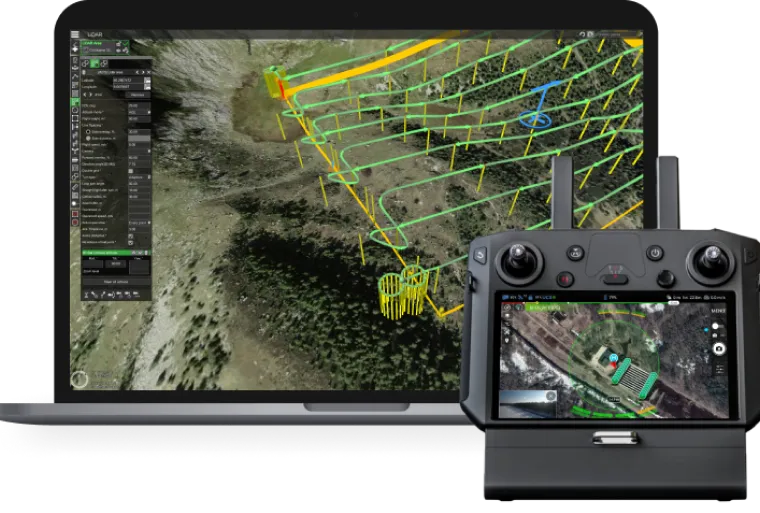
Professional desktop drone flight planning software
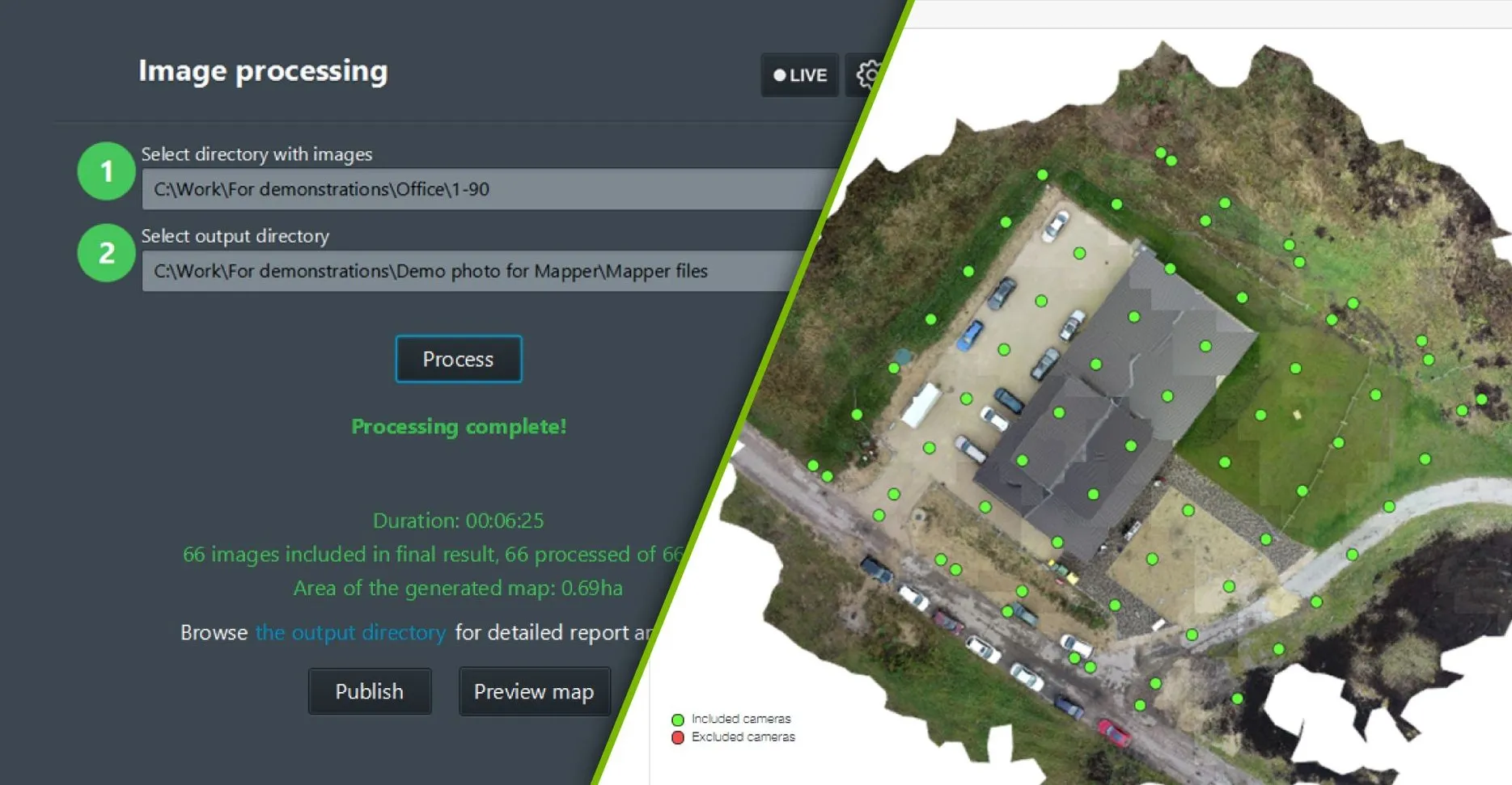
UgCS is the tool of choice to create and execute automated drone flights even in areas with complex terrain. It supports data import from KML/CSV and the use of custom digital elevation models (DEM)
Introducing
Experience the powerful capabilities of UgCS Open - the free flight planning version with just a few limitations.
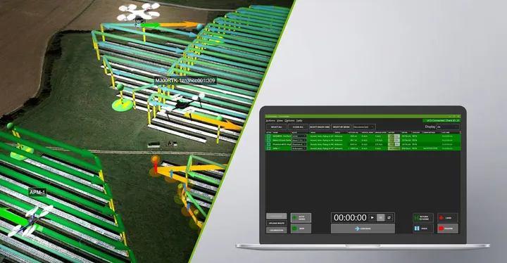
Simple yet powerful tool designed to allow simultaneous control and monitoring of multiple drones.
Features
Testing Anti-drone systems protecting airports, industrial objects, and other critical infrastructure by simultaneously sending drones from different directions toward the protected object.
Simultaneously spraying the crops in parallel using multiple drones.
Mapping large areas using multiple drones simultaneously.