Background & Challenge
The survey was conducted in response to the increasing need for precise magnetic data acquisition in coastal regions due to activities such as offshore wind farm construction. The primary goal was to precisely locate cables and pipelines, along with identifying all potential point targets for further inspection.
The survey needed to cover an area starting from the shoreline, which posed a challenge due to the limitations of existing solutions. Towed magnetometer systems are not suitable for shallow waters because they require deep enough water for boats to safely navigate and maintain the correct elevation of the sensors, which can be disturbed by surface waves.
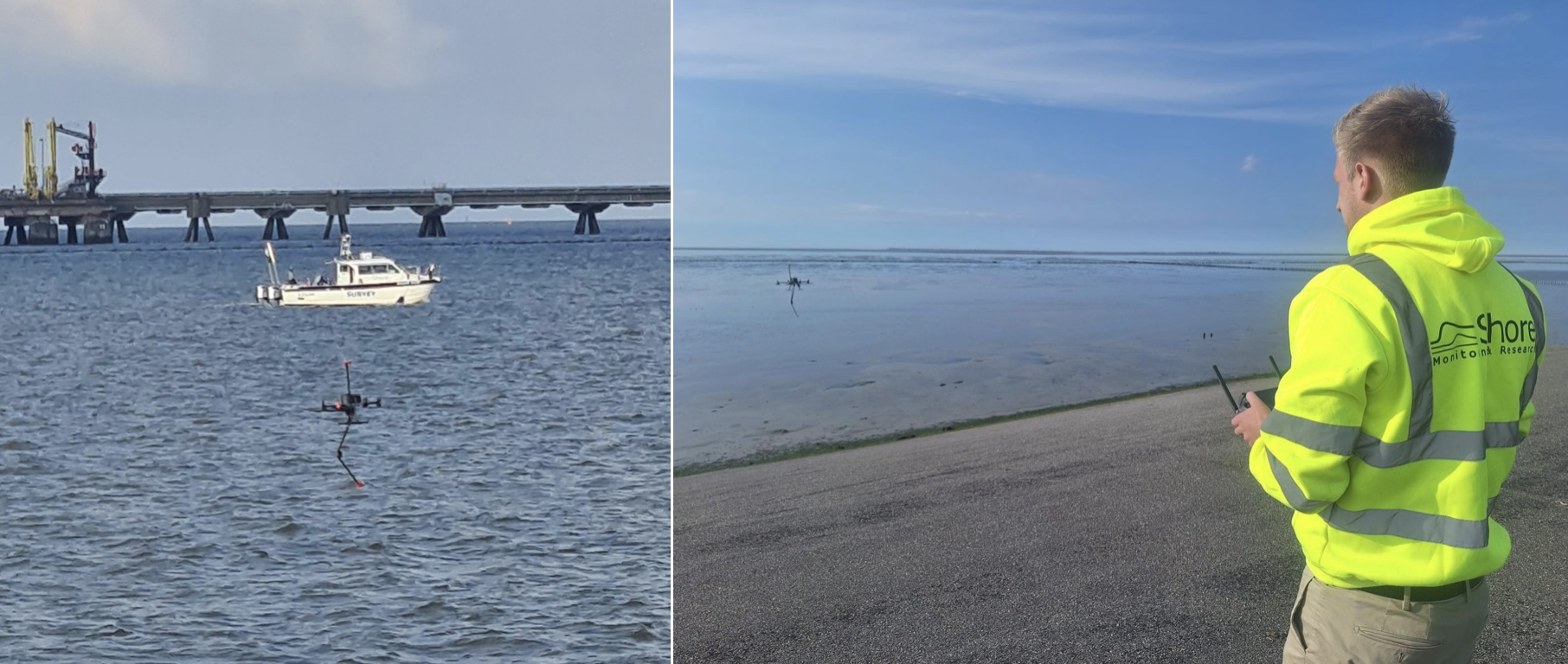
While the towed system (2x Geometrics G-882 marine magnetometers mounted on a TVG frame) was ideal for deeper waters, it was not effective for shallow waters near the shore. Therefore, the challenge was to find a solution that could survey the gap between the shoreline and the area accessible to the towed magnetometer system.
Solution
A dual-system approach was implemented to ensure full coverage of the survey area. A towed submersible magnetometer system (Geometrics G-882) was used to survey deeper waters where it could safely navigate. For the shallow waters and shoreline areas, SPH Engineering’s MagNIMBUS magnetometer was proposed as an emerging solution.
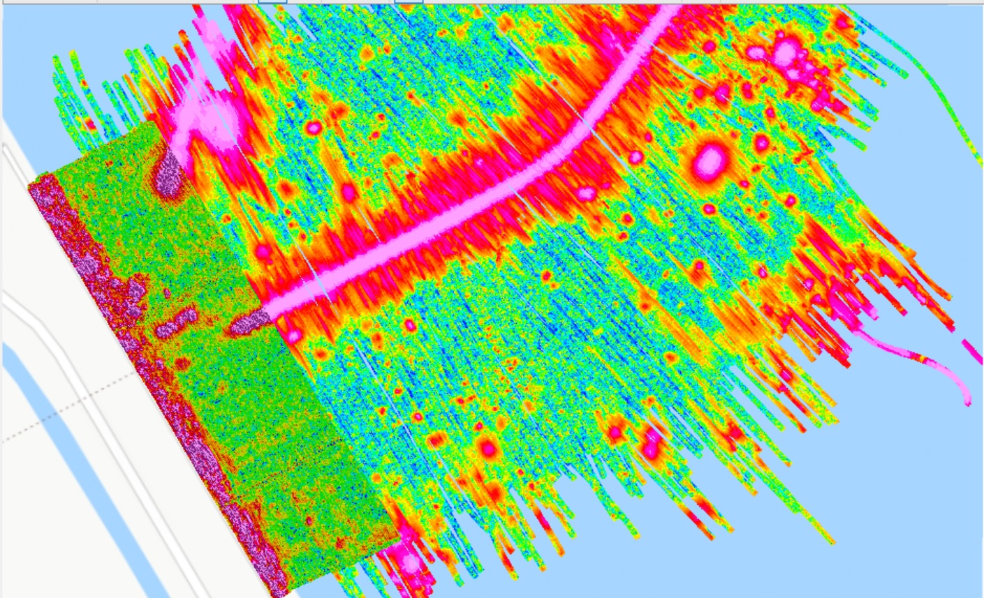
This combination allowed for seamless data collection from the shoreline to deeper waters, with the datasets overlapping for improved confidence and cross-validation. The solution provided comprehensive coverage and higher positional precision, especially in the challenging nearshore areas.

Outcome
The drone flights were planned till the distance of approximately 100 meters from the shore, allowing data from both the drone and the towed systems to overlap. This overlap enabled the comparison and cross-checking of the two datasets, ensuring a high degree of confidence in the data collected using both systems.
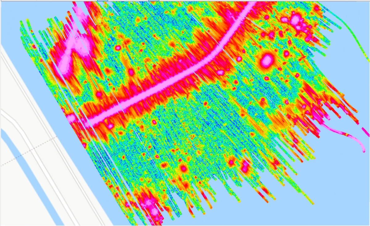
The survey successfully mapped a long linear anomaly — the export cable from an offshore wind farm, which was the primary target. It also revealed additional findings, including an AC cable and multiple point anomalies in both deep and shallow waters. A strong magnetic anomaly was also detected over the dike, caused by reinforcement in the concrete.


Sean Zandbergen from Shore Monitoring & Research commented: “We were happy with the results based on the overlap of the two datasets. Using a UAV magnetometer in this industry is a bit new, so we and our client were also curious about the result. It’s easier to process the drone data since the positioning is so much better/more accurate. The line keeping while towing the submersible magnetometer system is challenging, while the drone autonomously flies an accurate line plan based on RTK-GNSS. Therefore, it’s easier to line up consecutive lines of the survey. The position accuracy of towed equipment is a bit lower since it is all based on the position of the vessel. Either by calculating the lay-back position (in the shallow) or acoustic/USBL (in >5m water depth), the position of the sensor is determined.”
Conclusion
By utilizing both a towed submersible magnetometer system and a UAV-borne magnetometer, the team was able to achieve comprehensive coverage from the shoreline to deeper waters. This dual approach not only allowed for the precise location of the cable but also identified additional anomalies in the surveyed area.
The overlap of data from the two systems ensured a high level of confidence, demonstrating the effectiveness of integrating UAV technology into marine magnetic surveys, particularly in shallow-water environments where traditional methods fall short. The success of this survey underscores the potential for UAV systems in the field of coastal and marine UXO detection.
Read the full article on drone-borne marine magnetic surveys for UXO detection and cable/pipeline tracing in the EAGE First Break Journal.


