Through the experiences and feedback of Adam Caratini, General Manager of CrossFit Exalted, the case study highlights the effectiveness, precision, and professional excellence of Skyland Pixels in drone-based property inspections.
Skyland Pixels, LLC has received approval from CrossFit Exalted in Sanford, FL, to conduct a state-of-the-art aerial inspection of their property at 118 Central Park Place, Sanford, FL 32771. This project will involve a detailed analysis of the roofing and its various components, leveraging advanced drone technology to assess the structure's condition thoroughly.
This multi-faceted report empowered CrossFit Exalted with actionable insights for proactive maintenance. It also served as a reliable record to refer to in case of any future disagreements and helped in carefully managing their property's inventory and regular monitoring.
Key insights from the roof condition report
The aerial survey indicated descent roof conditions with some recommendations for further monitoring and maintenance, such as:
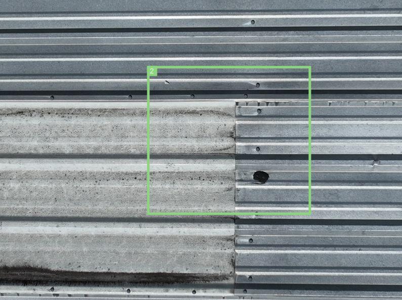
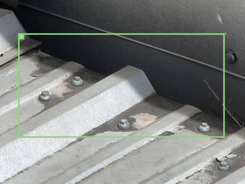
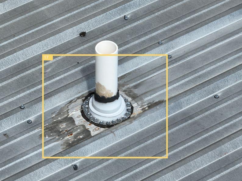
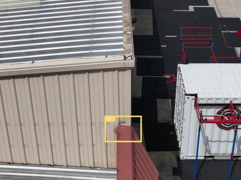
Please read the full roof condition report here: Imaging Report
“I couldn't be happier with the outstanding service I received from Skyland Pixels! They are true professionals in the field of drone services and mapping assessments.
Skyland Pixels inspected the roof of our gym, and the results were nothing short of impressive. From the moment they arrived, it was clear that they take their work seriously and are dedicated to providing the highest quality service.
The attention to detail in their roof inspection was remarkable. They used their drones to capture every angle and aspect of our roof, providing us with a comprehensive report that highlighted any issues or areas of concern. This level of detail gave us peace of mind, knowing that we had a thorough understanding of our roof's condition.
Not only was their work thorough, but the team at Skyland Pixels was also incredibly professional and courteous throughout the entire process. They answered all of our questions, explained their findings in a way that was easy to understand and went above and beyond to ensure our satisfaction.
In addition to their exceptional work, the turnaround time for the inspection report was surprisingly quick, which allowed us to take prompt action where needed.
I highly recommend Skyland Pixels. Their dedication to excellence, attention to detail, and overall professionalism make them stand out in their field. They've certainly earned our trust and future business. Thank you, Skyland Pixels, for a job well done, ” said Adam Caratini, CrossFit Exalted General Manager
Methodology of drone roof survey
The approach involved a Mavic 3 Enterprise drone equipped with high-resolution cameras. Flying at an altitude of 80 feet, the drone captured top-down oblique shots with its camera precisely angled at 75 degrees. To guarantee a thorough inspection, automated flight planning software was utilized. You can use any automated software for drone flight planning, just make sure to ensure complete coverage of the area.
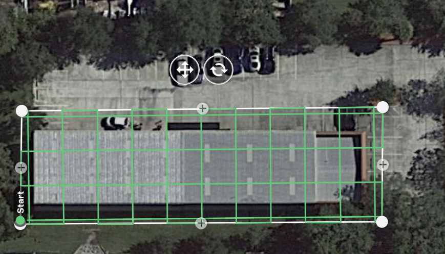
For facade mapping, the drone was manually navigated around the property, capturing images every two seconds. There were additional manual shots taken for the front section of the roof to eliminate any shadow interference.
Then, collected images have been annotated in the ImageInspector software by SPH Engineering and a resulting MS Word (DOCX) report has been generated. The report contains only pictures of found issues, severity levels, and text comments for better understanding and decision-making.
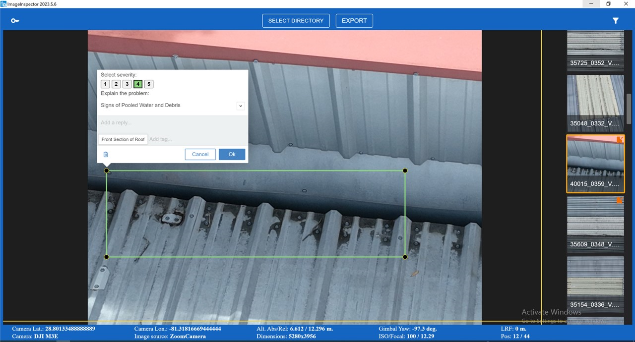
Presented below are insights from Chad Hammond, the Chief Executive Officer and Chief Pilot of SkyLand Pixels:
Q: What were the building's approximate dimensions?
A: Our inspection was comprehensive, covering the entire roofing area, which is a flat metal surface of 8,373 square feet with dimensions of 194 feet 3 inches by 43 feet. A separate section at the front of the building, suspected to house offices, was also given due attention. Both automated and manual image captures were employed to ensure a thorough inspection.
Q: How long did it take to acquire images to capture images?
A: The flight plan with the Mavic 3E took approximately 20 minutes.
Q: What were alternative methods besides ImageInspector, that you considered for this job?
A: Alternative methods for conducting this inspection would involve manually going through each image, obtaining the coordinates, and documenting each image in a table to be inserted into the report. Other alternatives could be third-party software that handles flight planning and reporting, but those options were not within our budget for this project.
Q: How long did it take to prepare a report, and how does it compare to alternative methods?
A: Compiling the report took about one hour, whereas doing it manually without ImageInspector would take an undetermined amount of time to create a well-formatted report that would meet customer expectations.
Q: Were there any limitations?
A: Our inspection was conducted without the use of a thermal sensor drone. While our high-resolution cameras provide detailed visual data, they cannot detect thermal variations indicative of moisture or heat loss issues. We are actively considering adding thermal sensor drones to our technology suite for future inspections.
The use of ImageInspector software, together with the DJI Mavic 3 Enterprise drone, represents an innovative approach to property inspection, offering a solution that significantly enhances crew safety and minimizes costs. This method eliminates the need for cloud uploads, streamlining the process and ensuring data security. By integrating this technology, Skyland Pixels is exploring the industry and discovering efficient, precise, and cost-effective solutions for property management and maintenance. The success of this project at CrossFit Exalted's facility in Sanford, FL, as highlighted by Adam Caratini, General Manager, is a testament to the effectiveness of this innovative approach.
You can test Image Inspector by downloading it from the following link.


