

This is a real-world story of how UgCS enabled fast, safe, and complete aerial coverage of a complex mountainous search area in a single day, without internet, and without compromise.
The Challenge
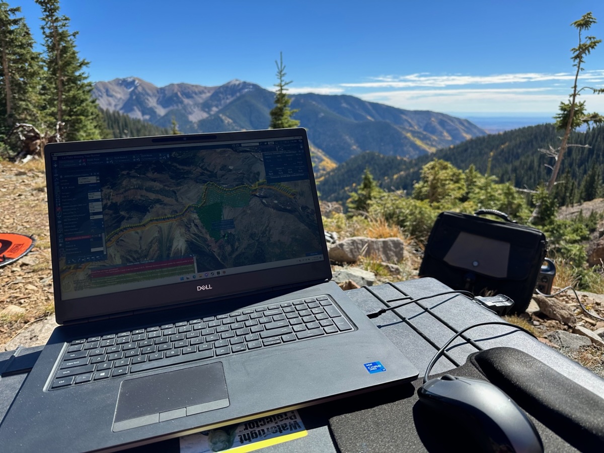
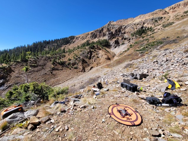
SAR teams often work against the clock, in remote locations, with limited resources. This mission was no different. The terrain ranged from 11,200 to 13,100 feet in elevation, with sharp inclines and unpredictable obstacles. Each flight consumed 20% of the drone’s battery just getting to the search area, and another 20% returning.
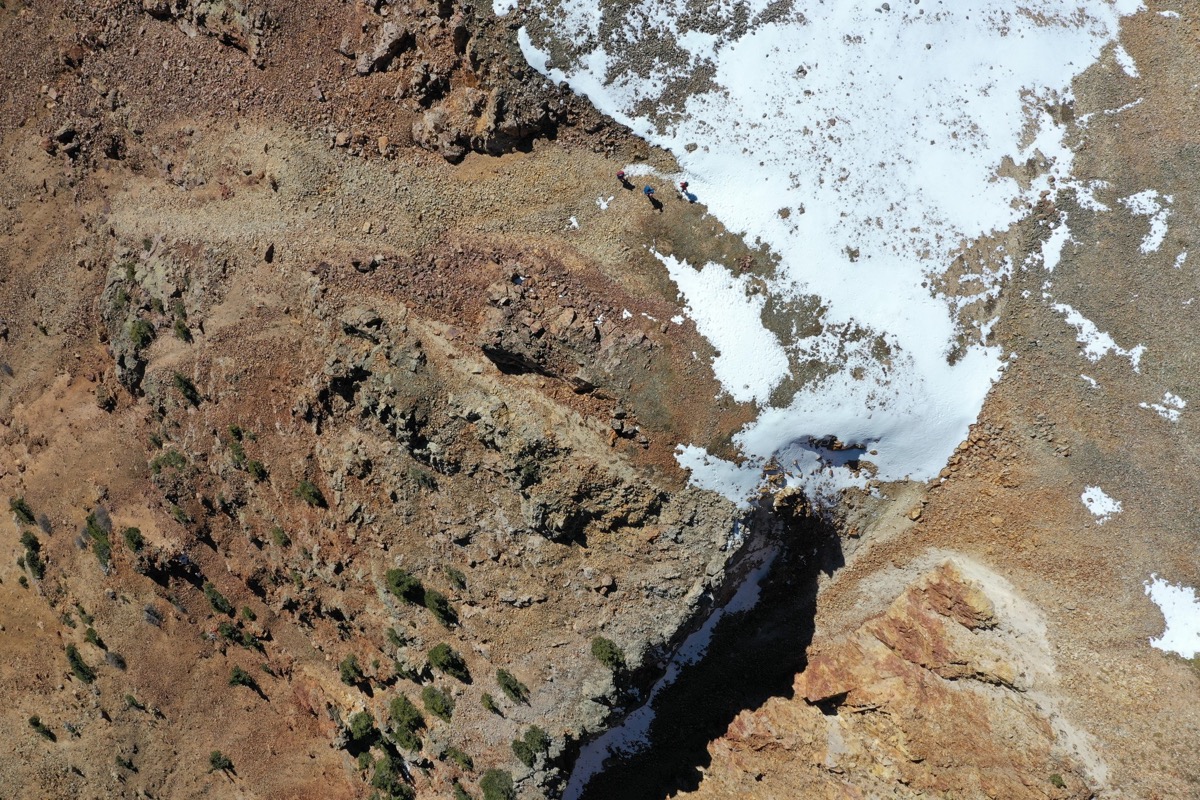
The mission's goal was not real-time observation, but complete image capture for post-mission analysis using Loc8, a visual search tool. Accuracy and coverage were paramount: every slope, shadow, and tree line mattered.
Key obstacles:
- High elevation caused reduced battery life and increased risk
- Steep, uneven terrain made altitude control critical
- No margin for missing areas or repeating flights
- Connectivity in the area was limited or non-existent
- Time pressure to cover four separate zones in a single day
The UgCS Advantage
UgCS offered the terrain awareness, planning flexibility, and multi-drone coordination that made this operation possible.
Key Features Used
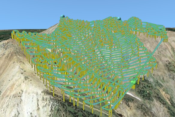
- Digital Terrain Model import from USGS (1m LiDAR DEM)
- Offline flight planning using pre-loaded terrain data
- Terrain-following automation to maintain consistent AGL
- Simultaneous multi-drone mission control
- Custom flight area creation in the field for on-the-fly changes
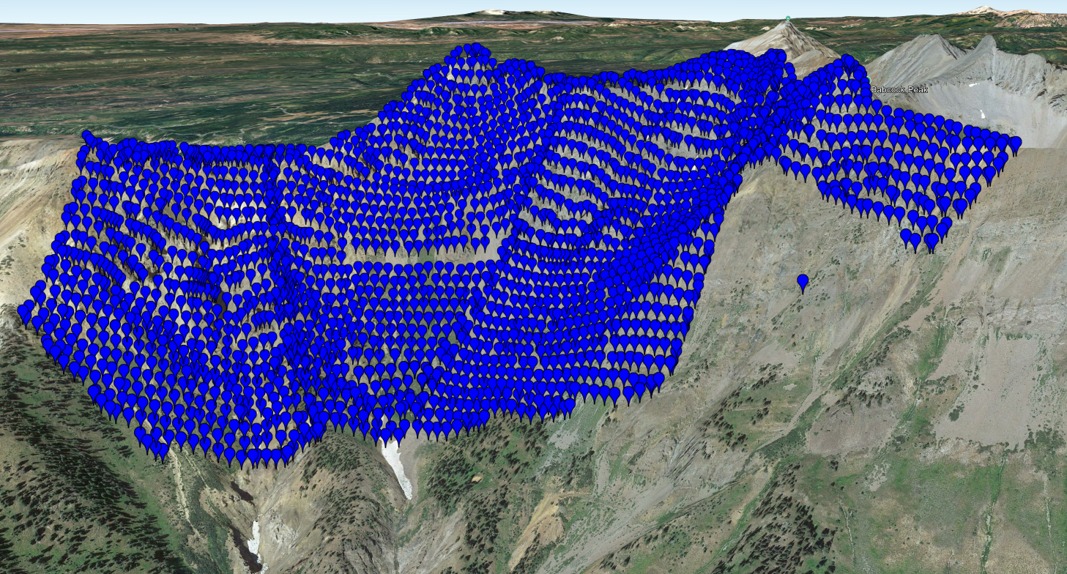
- Route coverage confidence with visible overlaps and gaps
- KML export & flexible waypoint generation for precision control
“UgCS performed flawlessly. With the high-res terrain model, we had total confidence flying steep and rugged terrain.”
The team used two DJI Mavic 2 Pro drones flying in parallel. Routes were split in UgCS and assigned to each pilot, avoiding overlaps and gaps and ensuring the entire 250+ acre area was imaged with 20MP resolution for post-flight object recognition.
Quantifiable Results
- Complete aerial coverage of 4 large mountain-side zones in ~6 hours
- 4 flight zones covered: 27, 63, 84, and 83 acres
- Elevation range: 11,200’ to 13,100’
- Zero re-flights due to missed coverage
- Over 200GB of data collected for later analysis
- 10-20 minutes saved per flight due to automated terrain planning
- No internet required during execution
Even after search teams leave the field, the imagery allows ongoing digital analysis, a critical benefit in SAR where victims may be hard to locate on foot.
Strategic Impact
Safer Flights
UgCS terrain-following and high-resolution DEM input meant no second-guessing elevation. Flights stayed low but safe, hugging terrain with precision.
More Coverage, Less Time
By planning centrally and assigning routes per drone, the team doubled their area coverage and finished within one working day, something not possible with basic drone apps.
Field-Proven Reliability
Battery limitations and lack of connectivity weren’t deal-breakers. UgCS handled offline workflows and allowed ad-hoc plan adjustments from the field.
“The ability to control flights across multiple pilots has proven efficient. We covered more terrain in the same amount of time - and with far more confidence.”
Why UgCS?
This SAR operator had used other tools before, but for high-risk missions, UgCS became the go-to.
- Autonomy in extreme terrain
- Ability to import and follow high-res terrain data
- Efficient route distribution across multiple pilots
- Flexibility to create or change missions in the field
- Works offline, no live connection required
- Centralized control instead of fragmented apps
“Others have commented how effective and efficient UgCS is over other flight control applications. Many pilots still don’t know what’s possible.”
Onboarding & Learning Curve
The team spent a few weeks getting up to speed, running smaller missions in easier terrain to build trust in the software. As the UgCS ecosystem matured, learning resources (videos, groups, webinars) made future training easier.
Today, the operator also uses Mavic 3 Enterprise, and has started testing UgCS Companion App with plans to explore UgCS Cloud sync next.
Conclusion
In extreme search and rescue environments, the margin for error is zero. This mission proved that with UgCS, drone teams can fly smarter, cover more, and do it all under pressure, even without live network access.
No other drone mission planner provided the same confidence, terrain precision, and multi-drone coordination that UgCS delivered when it mattered most.
Explore UgCS for your SAR and terrain-aware missions
Solution Used, UgCS: