
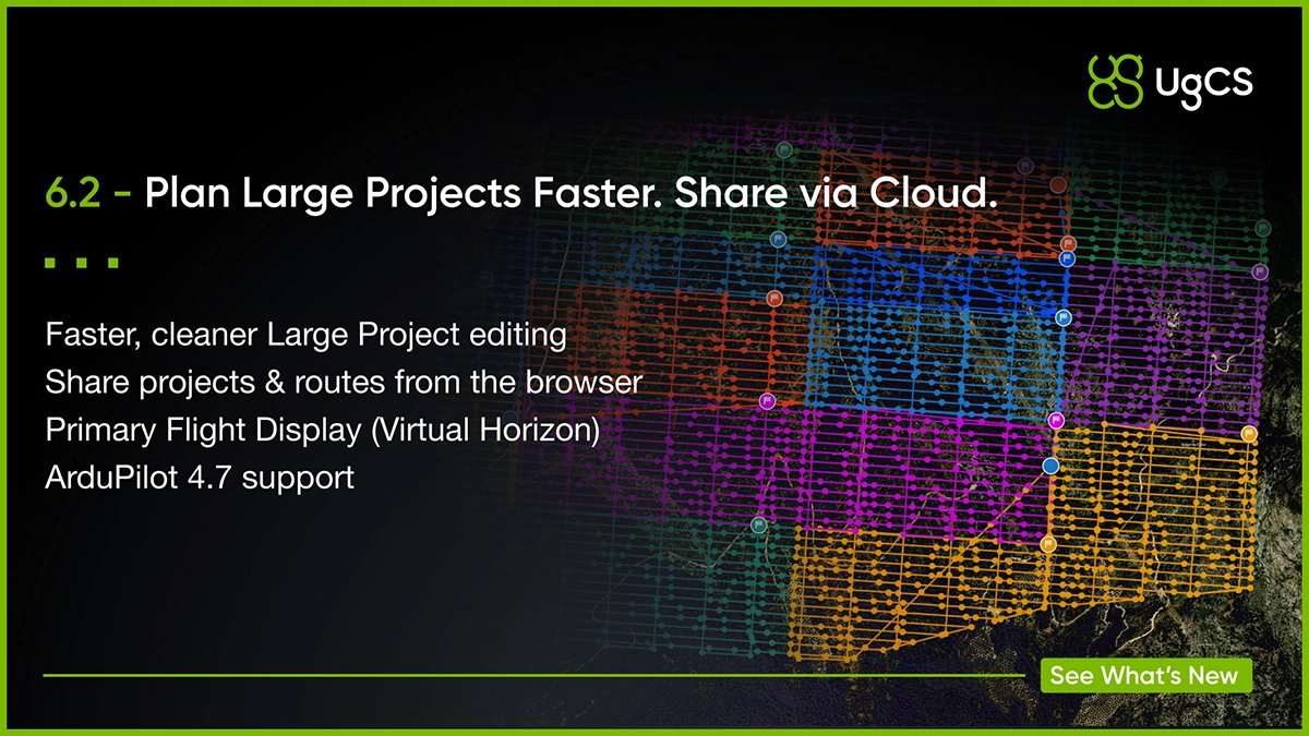
The release also adds a Primary Flight Display, UgCS Cloud in the browser, ArduPilot 4.7 support, and several workflow fixes.
Large Projects are easier to build
When a survey covers dozens of flights, small planning annoyances rise quickly.
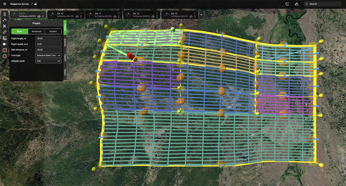
UgCS 6.2 adds snapping for cut lines and subarea border points.
Hold Shift while placing a cut line, and it snaps either parallel or perpendicular to the survey grid. The same works when adjusting subarea borders.
That means less time manually lining up survey blocks and a cleaner project structure.
Cut lines are also more visible, and subarea previews have been improved.
Why this matters
Large Projects are designed to let you treat a multi-flight survey as one project, instead of a collection of disconnected routes.
For magnetic surveys, that means you can:
- plan the full survey area once
- split it into manageable flight blocks
- keep survey lines aligned across subareas
- apply tie lines across the project
- plan repeat or infill surveys against an existing grid
- use terrain following with imported DTM/DSM data
- manage a multi-day campaign from the same project
The 6.2 changes make that workflow quicker to edit and easier to control.
Primary Flight Display is back (BVLOS flights)
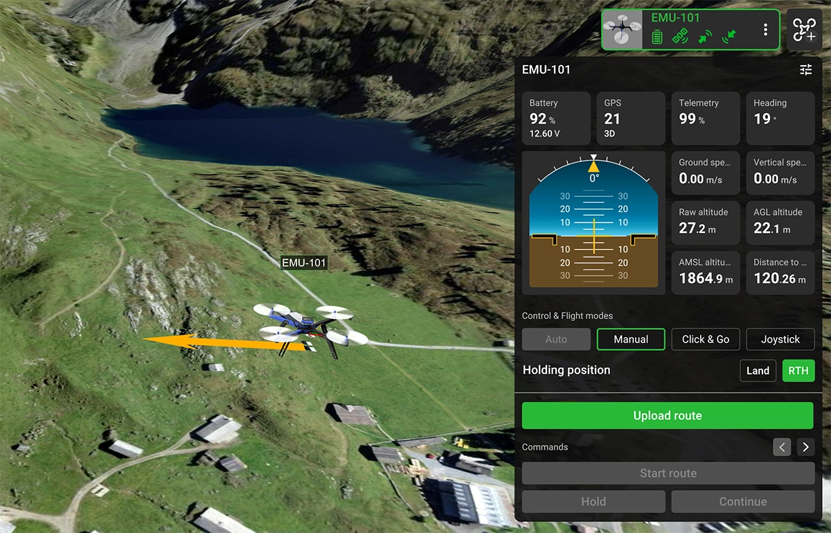
UgCS telemetry now includes a Primary Flight Display (PFD) with a virtual horizon and live aircraft pitch and roll angles, as well as distance to home location.
Some long-time users may remember a similar display in UgCS 4. It is now back in UgCS 6.2.
UgCS Cloud now works in the browser
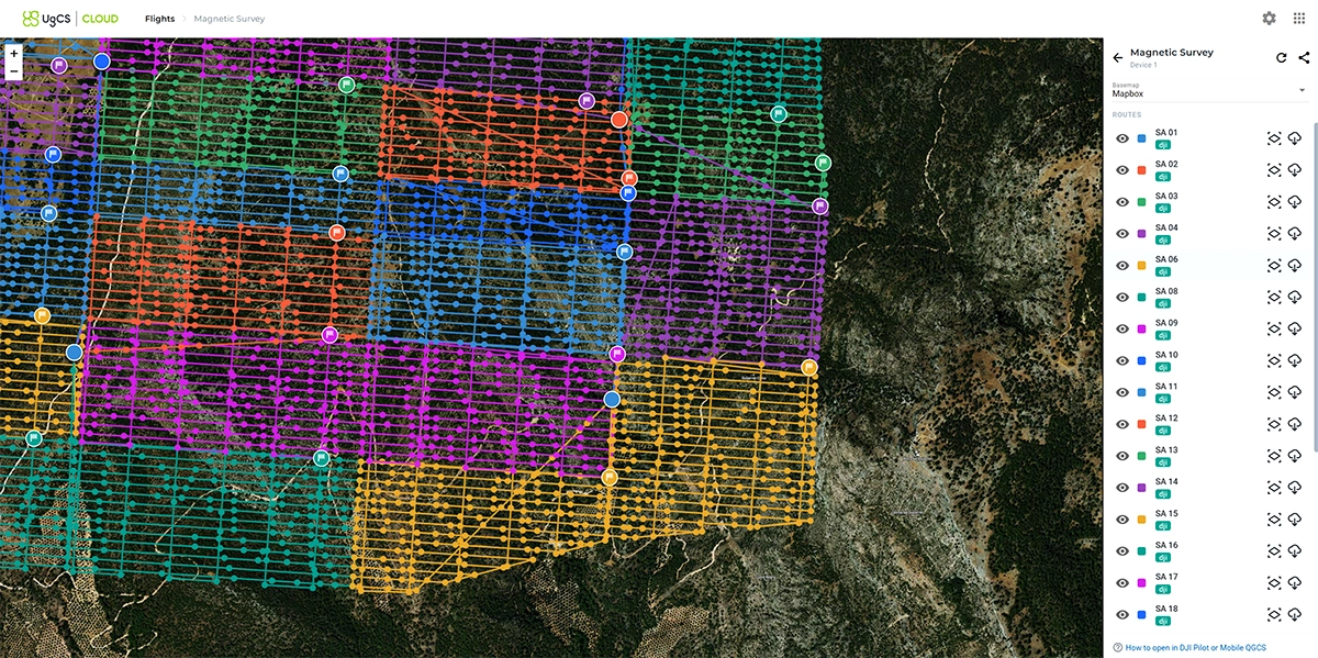
UgCS Cloud can now be opened directly from Main Menu → Cloud.
From the web interface, you can preview synced projects and routes from your devices, download them, delete or share them with other team members.
Editing in the browser is not available yet.
ArduPilot 4.7 and other improvements
UgCS 6.2 adds support for ArduPilot 4.7.0.
It also adds control over update notifications for teams that need to keep UgCS aligned with specific SkyHub firmware or CPM versions.
For DJI users, routes containing waypoint segments longer than 2,000 m will now get an intermediate waypoint automatically, preventing the upload failure that could occur before.
Several smaller telemetry, installer and interface issues have also been fixed.
Try Large Projects in UgCS 6.2
If you are planning magnetic surveys that require multiple flights, this is a good release to try Large Projects on a real job.
Plan the full survey once. Split it into flyable blocks. Keep the grid consistent across the whole site.