
Paladin Canada required high-resolution radiometric data to refine geological models and guide future drilling at its remote Michelin uranium deposit. Altomaxx deployed a drone-based radiometric workflow centered on the Medusa MS350 gamma-ray spectrometer integrated with the SkyHub onboard computer. The resulting dataset surpassed helicopter survey resolution, improved anomaly delineation, and enabled Paladin to establish its own drone survey program for future exploration seasons.
Quick Facts
- Company: Paladin Canada (Paladin Energy)
- Partner: Altomaxx Technologies
- Site: Michelin Project, Labrador, Canada
- Challenge: Acquire high-resolution radiometric data in rugged terrain where helicopter surveys lacked detail and ground surveys were slow and risky
- Radiometric Solution: Deployment of a drone-based radiometric solution using the Medusa MS350 gamma-ray spectrometer integrated with the SkyHub onboard computer
- Applications: Drone-based radiometric surveying, uranium exploration, anomaly detection
- Key Result: Drone radiometric data exceeded helicopter-based resolution, revealed new anomalies, and allowed Paladin to continue surveys independently
Background: The Logistical Challenge of Remote Exploration
The Michelin Project (Uranium Deposit) is located approximately 140 km north of Happy Valley-Goose Bay, Labrador province, Canada, and is accessible only by charter aircraft and helicopter. The site’s hilly terrain, dense vegetation, boggy ground, wildlife presence, and complete lack of cellular connectivity make traditional on-foot radiometric surveys slow, hazardous, and resource-intensive.
Previous helicopter-based surveys covered wide areas but lacked the spatial resolution required for modern uranium exploration. Paladin required a solution that could deliver high-resolution radiometric measurements, operate safely in remote conditions, and reduce the cost and time burden associated with traditional methods.
The Challenge: Acquiring High-Resolution Radiometric Data in Remote Northern Terrain
Paladin’s goal was to obtain radiometric data that exceeded helicopter-derived resolution while minimizing field risk and logistical complexity. The operational challenges included:
- Maintaining a stable low altitude (Terrain Following) over uneven, forested landscapes
- Completing surveys safely with wildlife and environmental risks
- Operating with no communication infrastructure
- Training a team with no previous drone experience
- Demonstrating whether drone-based gamma-ray spectroscopy could reliably guide future drilling decisions
A robust, repeatable process was essential to validate the approach.
The Solution: Deploying an Integrated Drone Radiometric Workflow
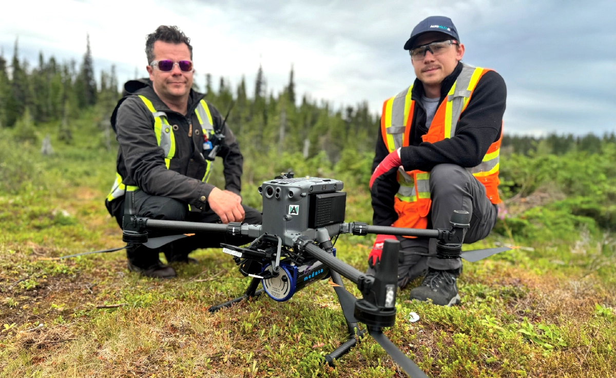
Altomaxx deployed a custom UAV solution, integrating the Medusa MS350 gamma-ray spectrometer, with the SkyHub onboard computer, enabling automated radiometric data collection over rugged ground conditions.
Technical Workflow
- Precision flight planning: SkyHub controlled flight paths to maintain a slow ~2 m/s speed, generating one radiometric data point every ~2 meters.
- Terrain Awareness: Radar altimeters adjusted drone height in real-time, ensuring consistent sensor proximity to the ground source.
- Capacity Building: Beyond data collection, Altomaxx trained Paladin’s team to operate the drone systems, enabling independent future surveys
Automated Mission Execution
- Survey lines, flight speeds, and elevations were pre-programmed in UgCS and executed under the control of SkyHub.
- Flights were executed at ~2 m/s, producing one radiometric data point every ~2 meters.
- SkyHub synchronized sensor data and flight parameters for clean, consistent acquisition.
Altitude Optimization Across Uneven Terrain
- Radar altimeters, combined with digital elevation inputs, maintained safe and consistent sensor height.
- Ensured measurement accuracy despite dense forest and uneven ground.
Training & Capacity Building
- Altomaxx provided pre-mobilization and on-site training.
- Topics included drone operations, payload workflows, SkyHub procedures, and radiometric survey techniques.
- Enabled Paladin’s team to participate directly in survey operations.
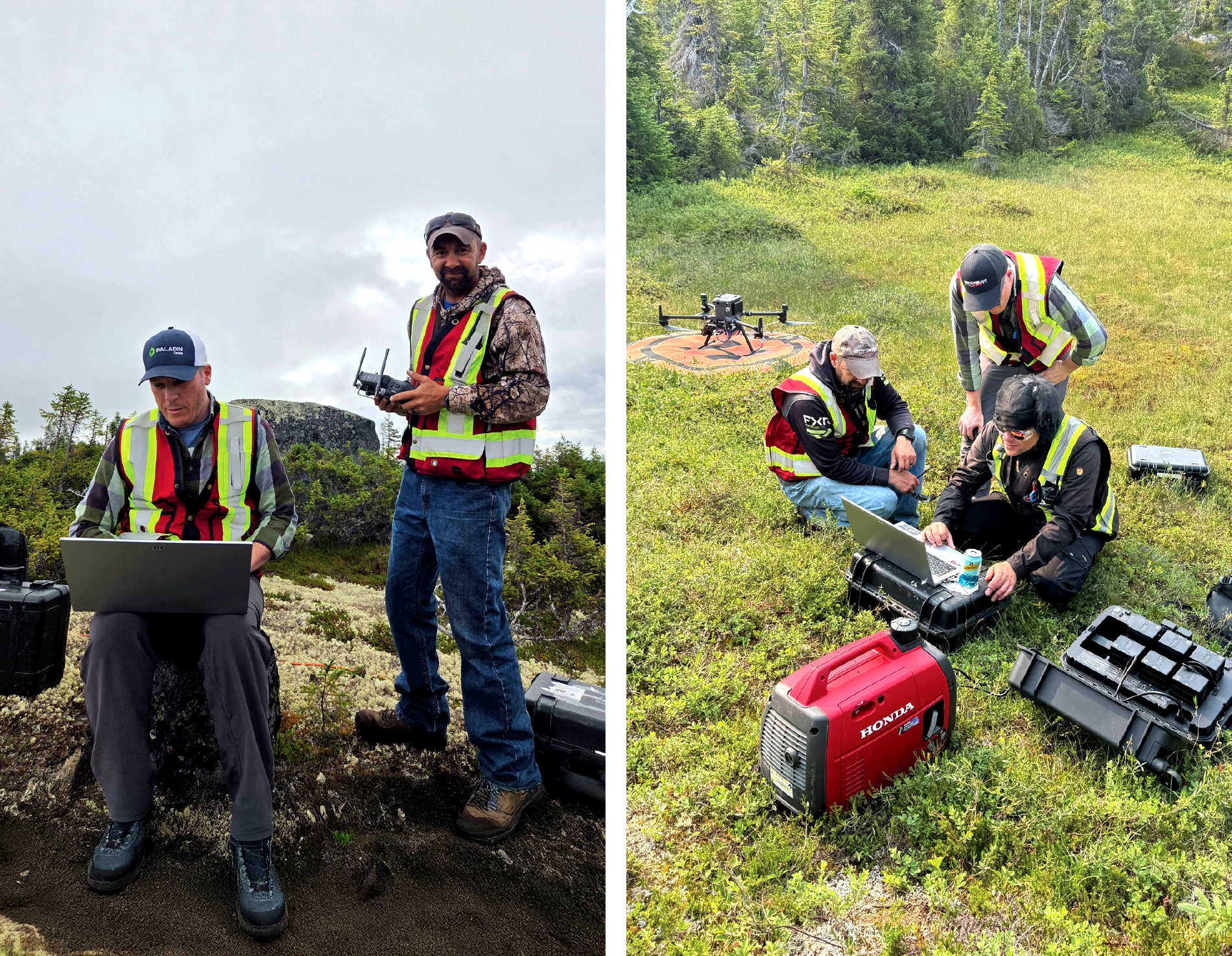
Operational Execution Under Remote Conditions
- A five-person crew (pilot, two trainees, two visual observers) supported the missions.
- Surveys were completed reliably despite insects, vegetation, slopes, and communication isolation.
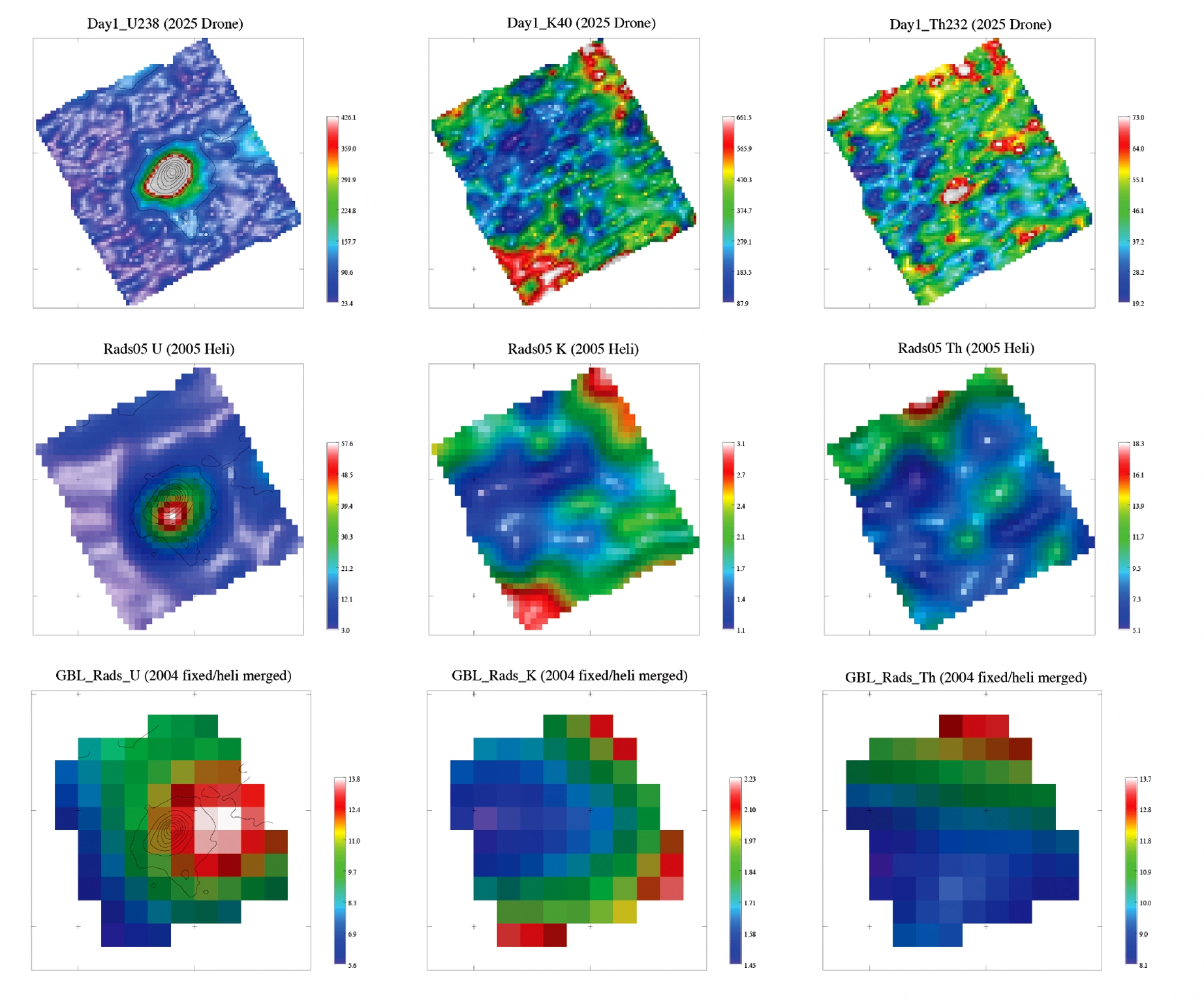
The Results: Higher Resolution, New Geological Insights, and Increased Efficiency Over Helicopter Surveys
The drone-based radiometric survey produced a dataset that significantly exceeded the resolution of previous helicopter surveys. The improved clarity and density of the measurements enabled:
- More precise anomaly delineation than airborne helicopter datasets
- Discovery of new radiometric anomalies, validated through geological follow-up
- Faster data acquisition compared to ground-based surveys while maintaining high accuracy
- Reduced field risk due to minimized ground exposure
- Long-term capability growth, enabling Paladin to conduct future surveys independently
- Plans to expand the workflow to thousands of line-kilometers in the upcoming seasons
The results confirm drone-based radiometrics as a powerful addition to Paladin’s exploration toolkit.
Conclusion
The Michelin Project demonstrates how a modern drone-based radiometric approach can deliver high-resolution data, operate reliably in remote northern environments, and accelerate mineral exploration decision-making. Altomaxx’s deployment enabled Paladin to identify new anomalies, refine existing targets, and build the internal capability needed for future autonomous survey campaigns. The success of this operation highlights the growing value of drone-enabled geophysical methods in challenging exploration settings.